
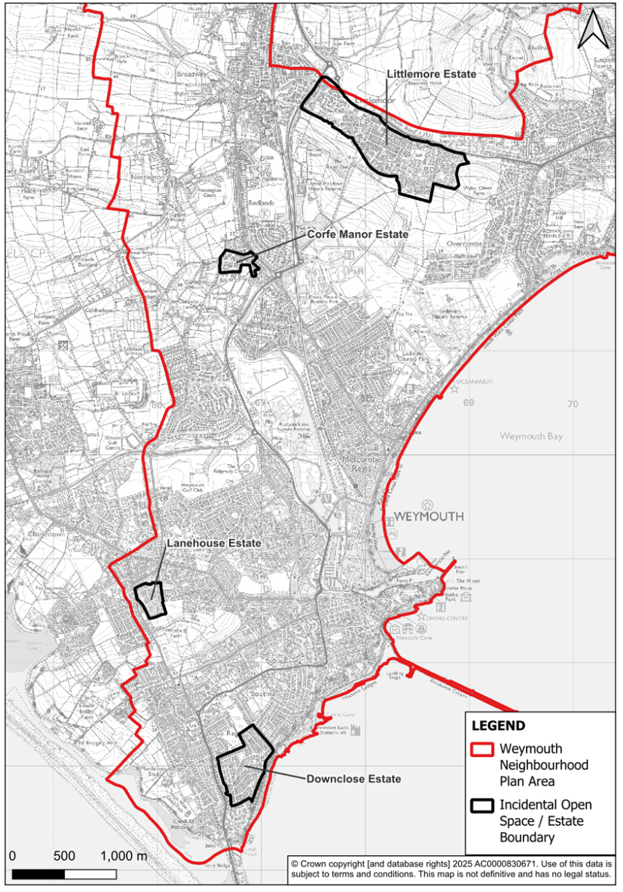
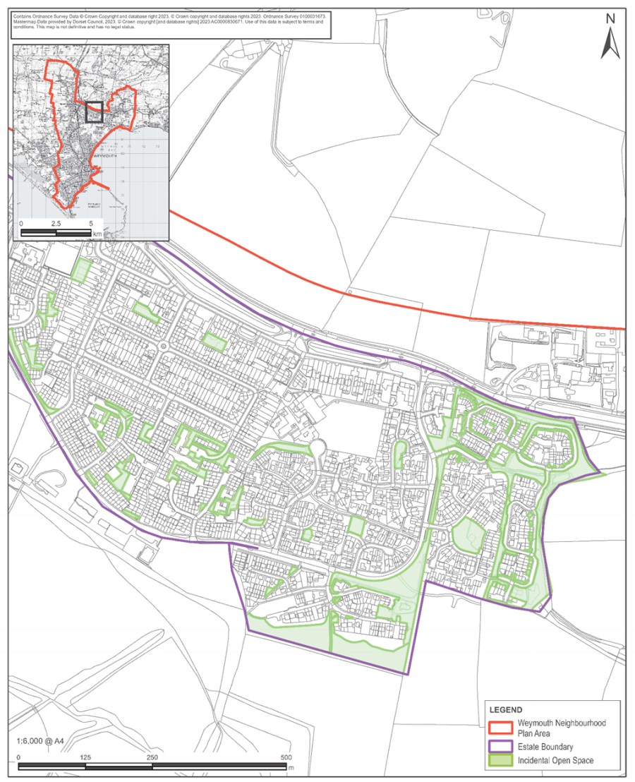
This appendix contains details of the 4 Estates with protected incidental open spaces as defined by policy W11: Incidental Open Spaces. The map showing the location of the 4 estates is repeated below:
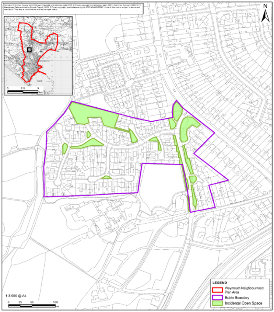
Map C1: Corfe Manor Estate
| Map Ref. No. | Location | Description |
|---|---|---|
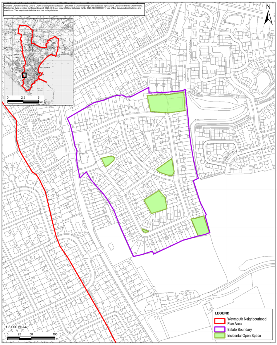
| C1 | Corfe Manor Estate | Corfe Manor Estate is situated at the northern end of Radipole Lane and is defined by Corfe Road, Tyneham Close, Studland Way, Kimmeridge Close, Home Close, Steeple Close and Creech Way. The registered public playing field off Corfe Road and Tyneham Close provides a community focal point for safe recreational activity in close proximity to homes. The estate is a well laid out, giving a sense of space and light as is evidenced by the original site plan below. The cut-throughs, pavements and public rights-of-way to the main road, local facilities and schools create a walkable area. It is intersected by numerous green open spaces and trees which front junctions and estate streets making walking and wheeling a safe and attractive option. |
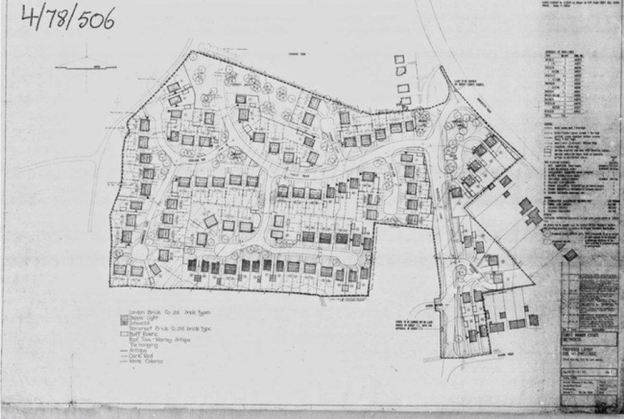
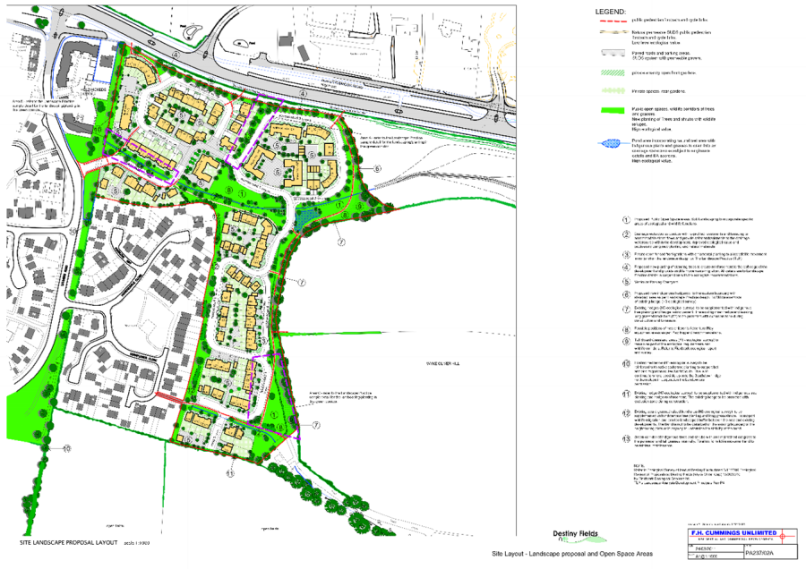
Original Planning Layout for Corfe Manor Estate
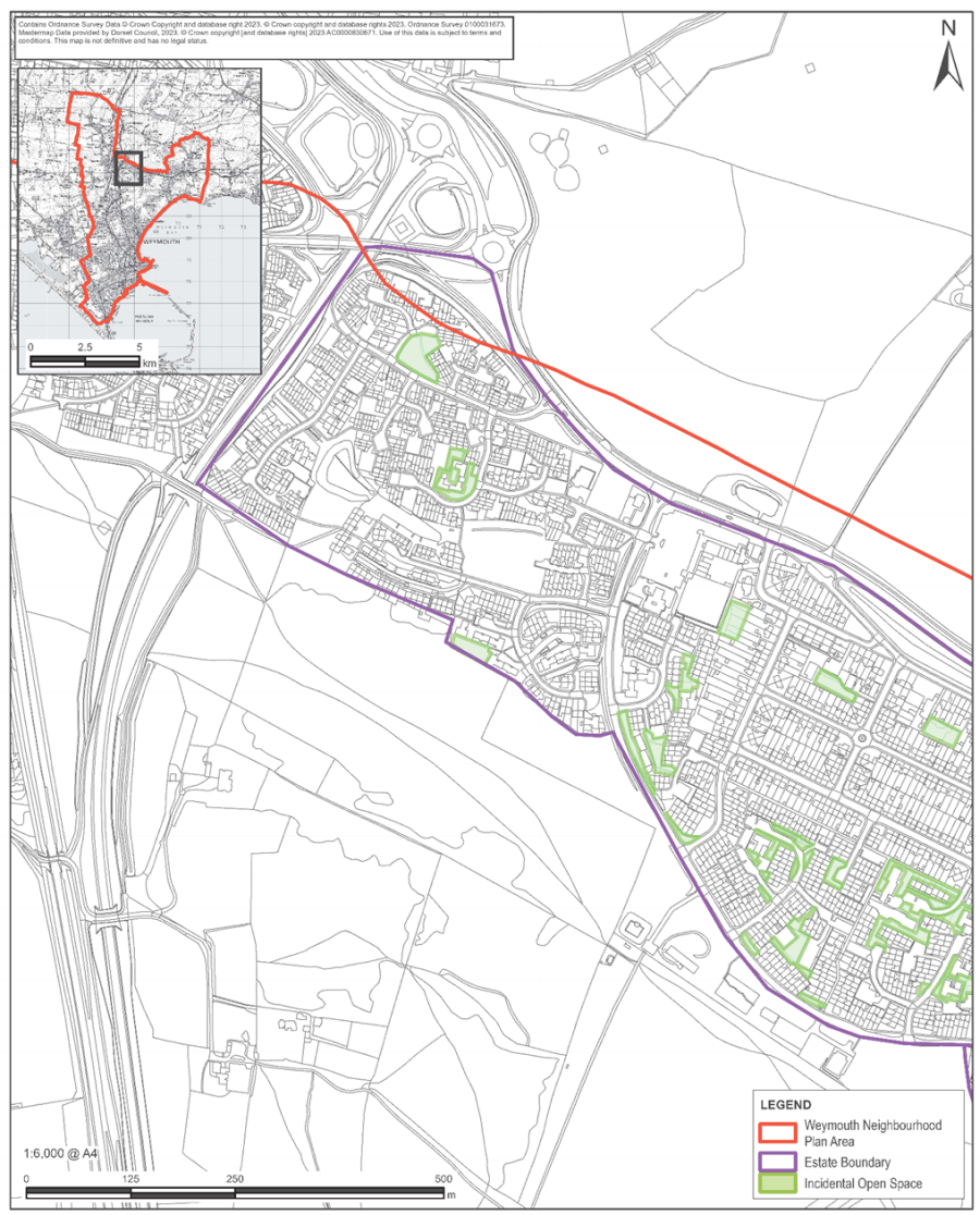
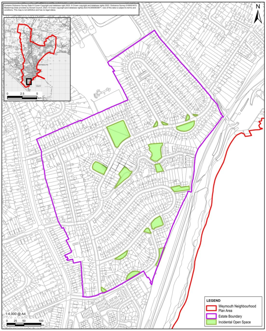
Map C2: Littlemoor Estate West
Map C3: Littlemoor Estate East
| Map Ref. No. | Location | Description |
|---|---|---|
| C2C3 | Littlemoor Estates |
Littlemoor estate has had at least 7 phases of development and is shown on Map C2 and C3. The early phases had large gardens with houses. The later phases had smaller gardens with incidental open spaces to open up the housing and provide green infrastructure and accessible communal and play areas. Starting in the west the estates with incidental open spaces are on Map C2 Littlemoor West.
|
Destiny Fields
Lodmoor Sands
Map C4: Downclose Estate
| Map Ref. No. | Location | Description |
|---|---|---|
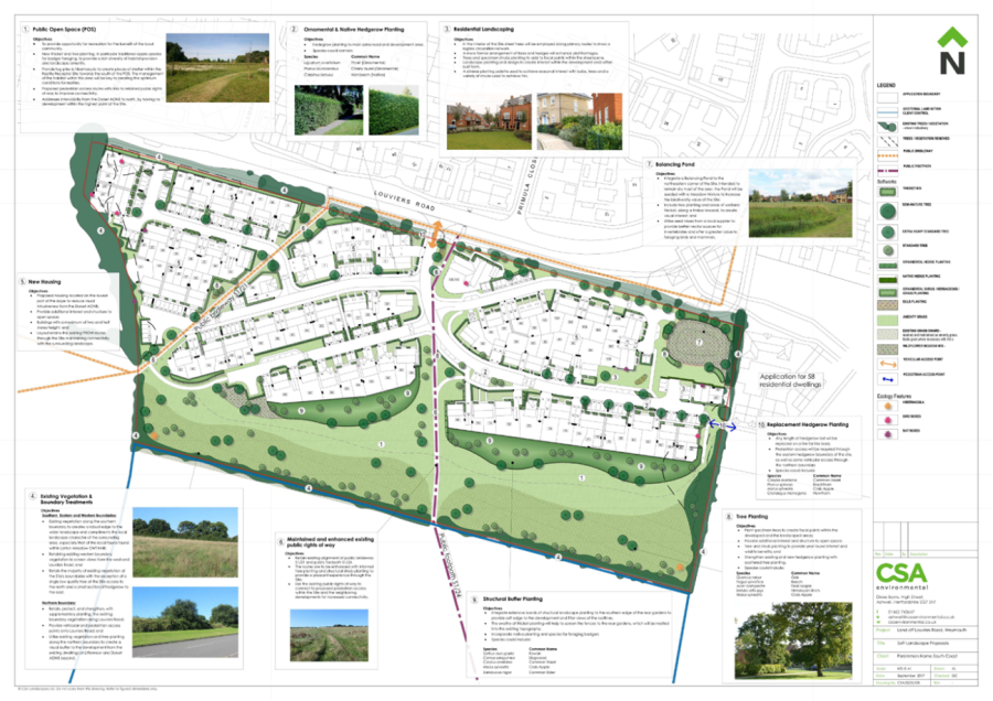
| C4 | Downclose Estate | Downclose Estate accessed off Portland Road via Merley Road, links to Derwent Road, Dundee Road, Dumbarton Road, Down Close, Douglas Road and Hillborne Road. This large estate includes a number of well-sized largely grassed public open spaces as well as the Douglas Road play area which create green buffer zones between the large number of houses and provide important community focal points and a sense of space and light. This original design concept is evident in the site plan above. |
Map C5: Lanehouse Estate
| Map Ref. No. | Location | Description |
|---|---|---|
| C5 | Lanehouse Estate | This estate is sited off Lanehouse Rocks Road and is defined by Leamington Road, Ludlow Road, Lichfield Road and containing Lincoln Road, Leeds Crescent and Liverpool Road. It is well laid out with groups of housing interspersed with and bordered by open green space. The layout provides walkable access to community services and facilities including Lanehouse Surgery, Ludlow Road Play Area, and St Edmunds Church. The open areas are added to by an allotment area complemented by numerous large green open spaces, such as those between Lanehouse Surgery and Ludlow Road Play Area, corner of Lichfield Road and Leeds Crescent, entrance to Lincoln Road, central to Leamington Road, Liverpool Road and Leeds Crescent. Scattered trees and shrubs further add to this green infrastructure. |
< Previous | ^ Top | Next >