
Figure 1: Land at Castle Cove
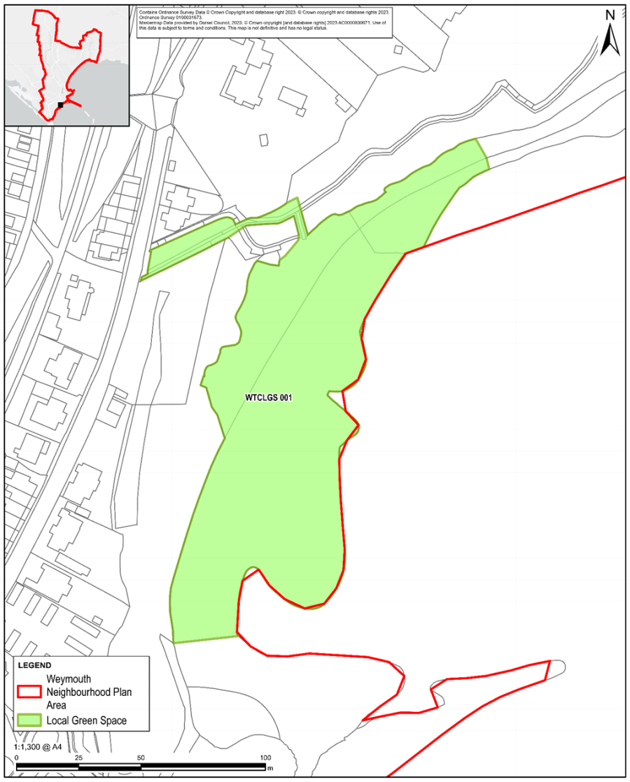
Figure 2: Hurdlemead off Elwell Street
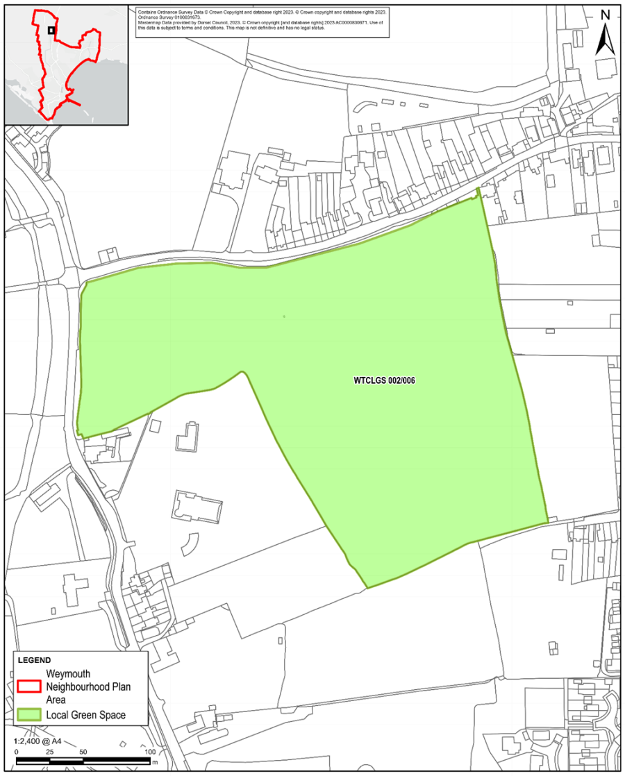
Figure 3: Woodland between Beaumont & Grove Avenue
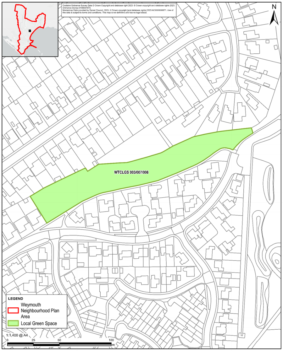
Figure 4: Adjoining Fields Adjacent Hurdlemead
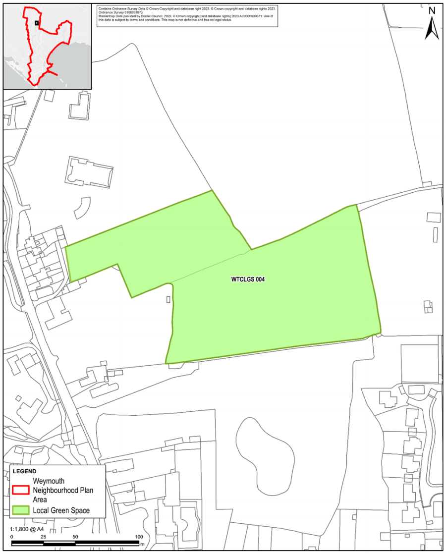
Figure 5: Wey Valley Watermeadows – Part A
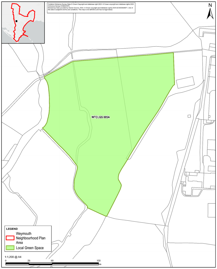
Figure 6: Wey Valley Watermeadows – Part B
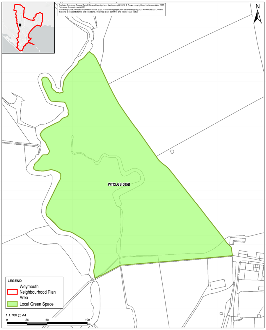
Figure 7: Area of Recreational Land South of Elm Close
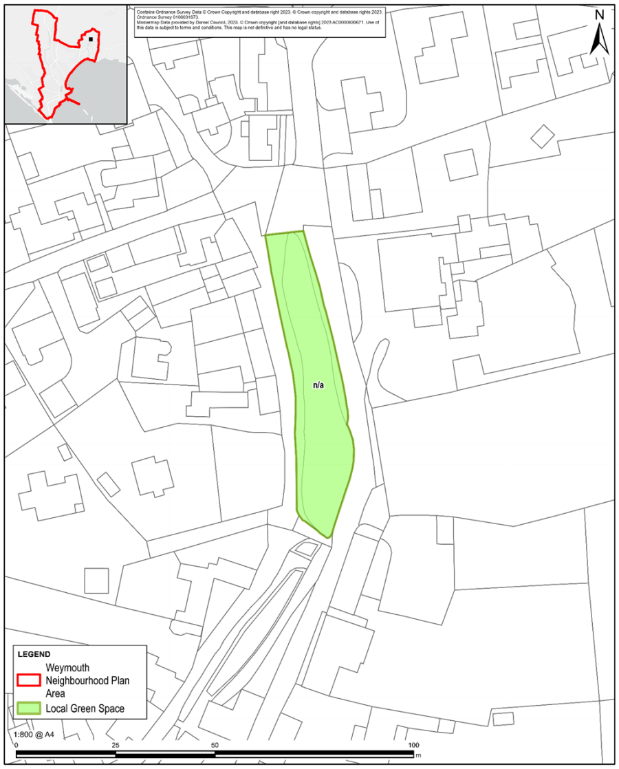
Figure 8: Interconnecting Strip of grass verge between street at Southill Garden Village
Figure 9: Field adjacent to top of Southill Garden Drive & adjacent to School Playing Field
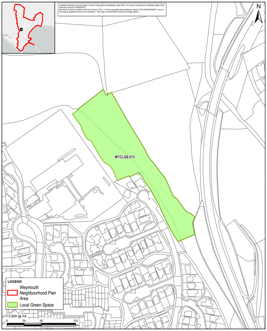
Figure 10: Recreation Area off Telford Close
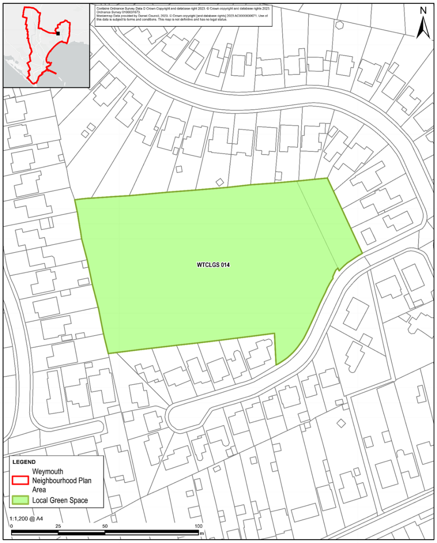
Figure 11: Remembrance / Memory Garden at Littlemoor
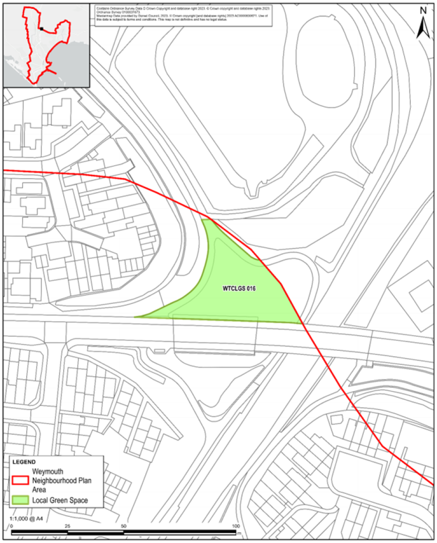
Figure 12: Community Orchard & Pond area adjacent to Littlemoor Road
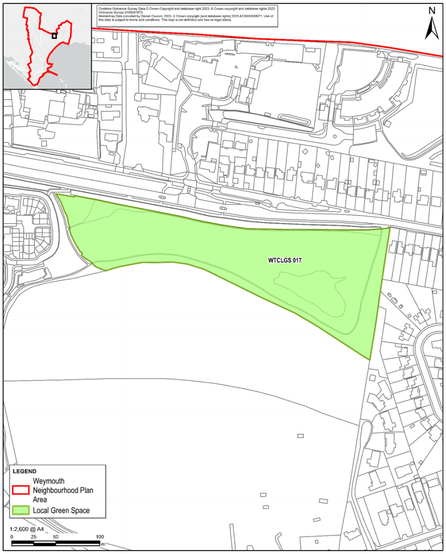
Figure 13: Radipole Park & Gardens
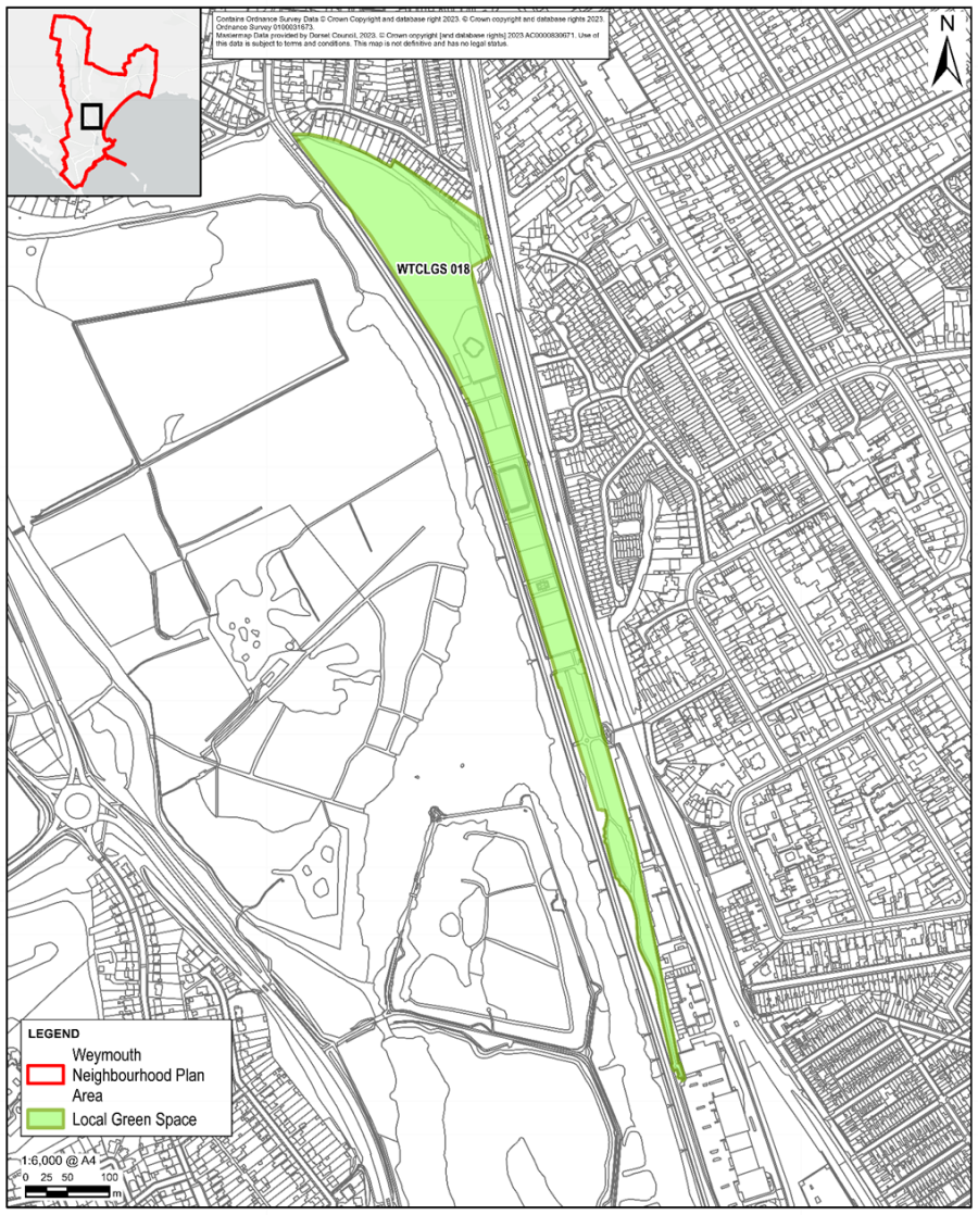
Figure 14: Links Road Open Space
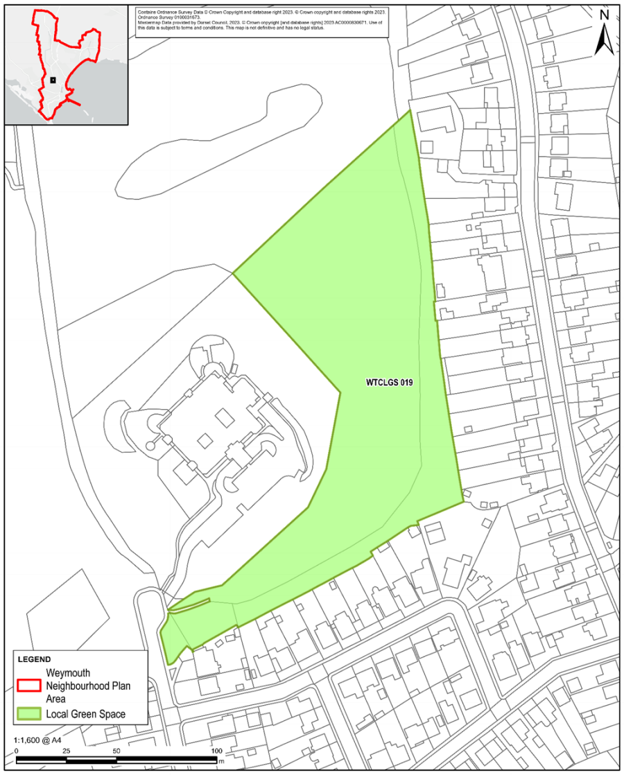
Figure 15: Open Space at Bowleaze Coveway
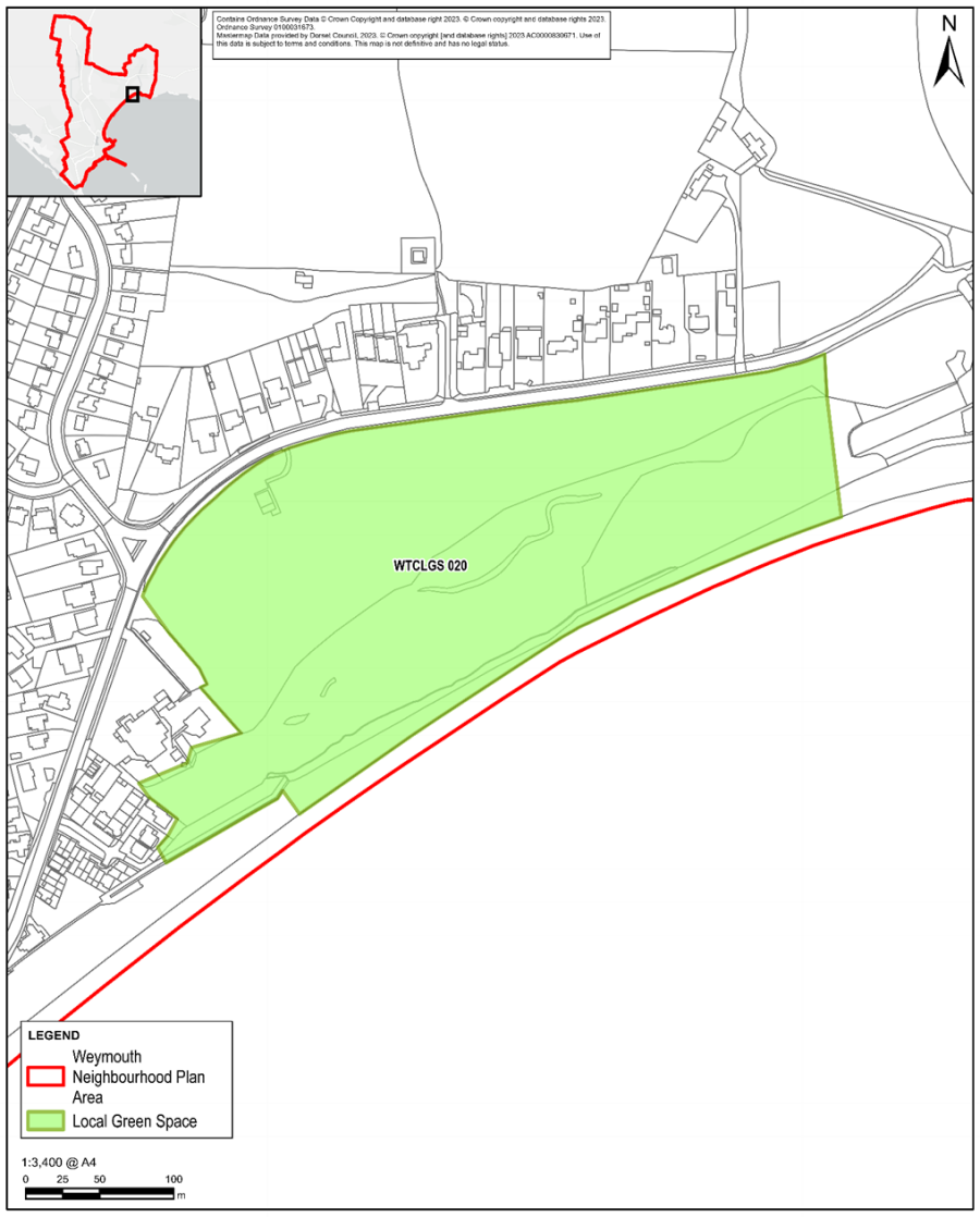
Figure 16: Green Strip btwn Finches & A354 to Southdown Ridge Bridge
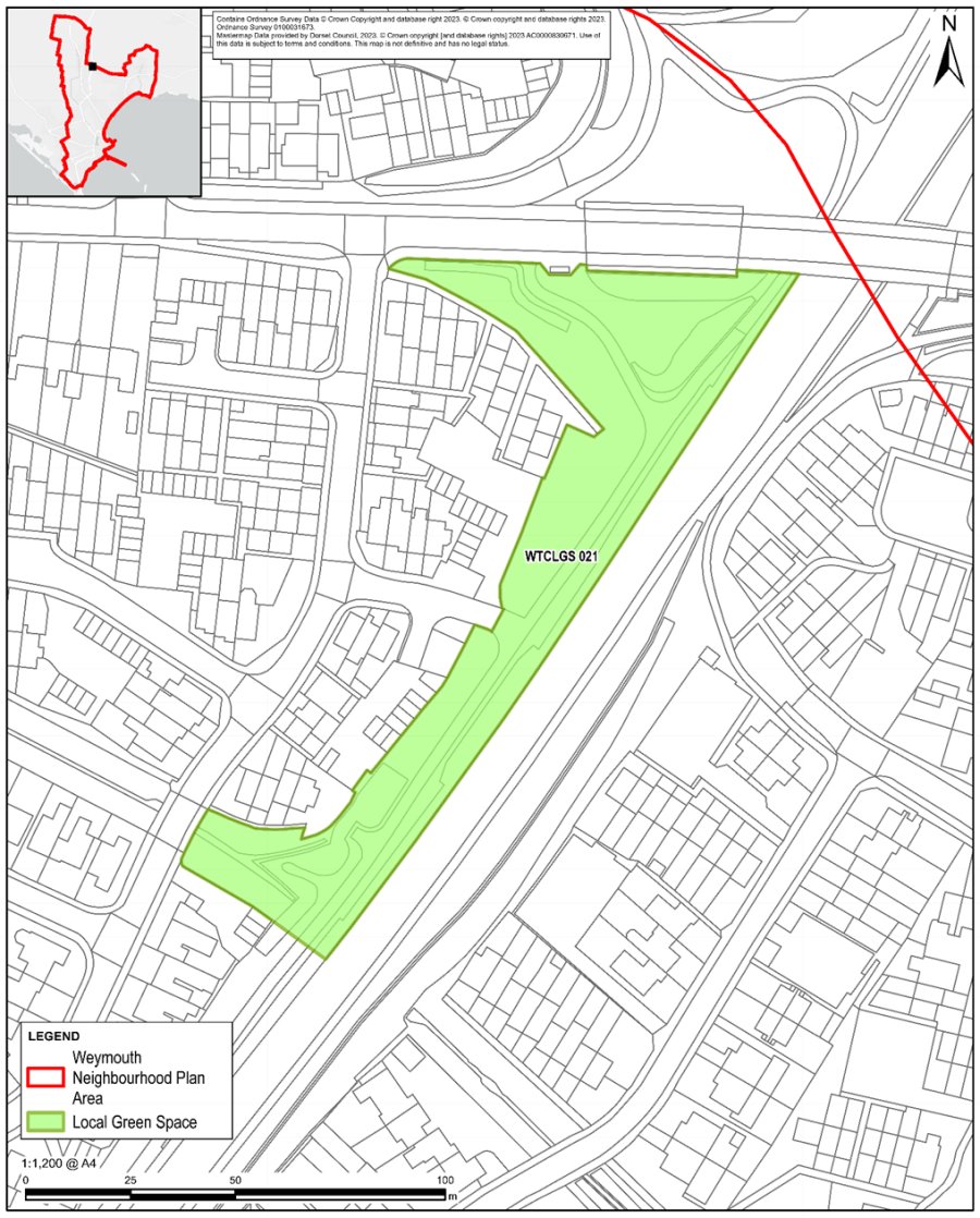
Figure 17: Green Space btwn Sanderling Close & Reedling Close
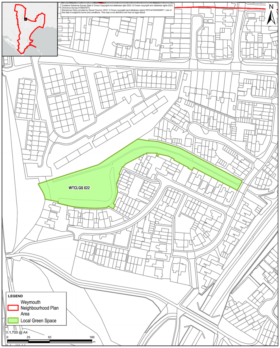
Figure 18 –Green Space btwn Kestrel View, Beverley Road and Fieldfare Close
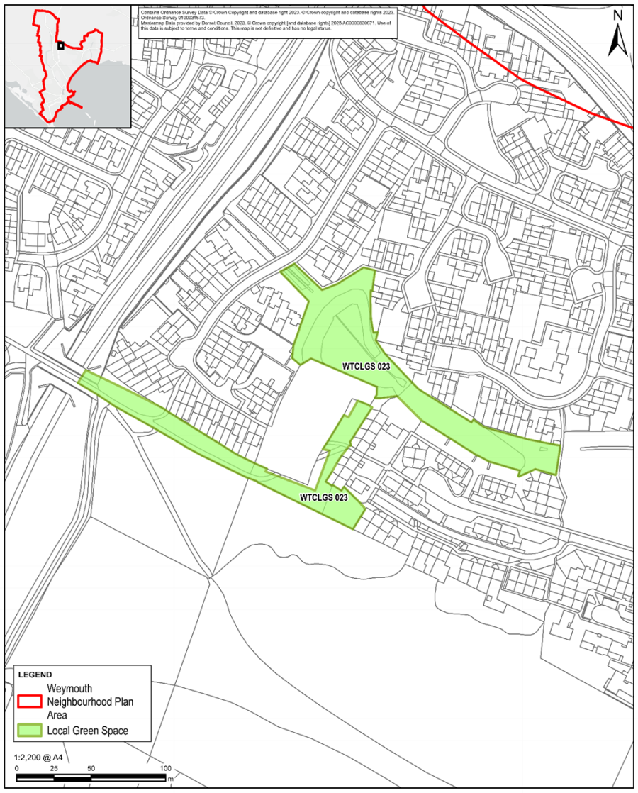
Figure 19: Nothe Gardens / Peace Gardens
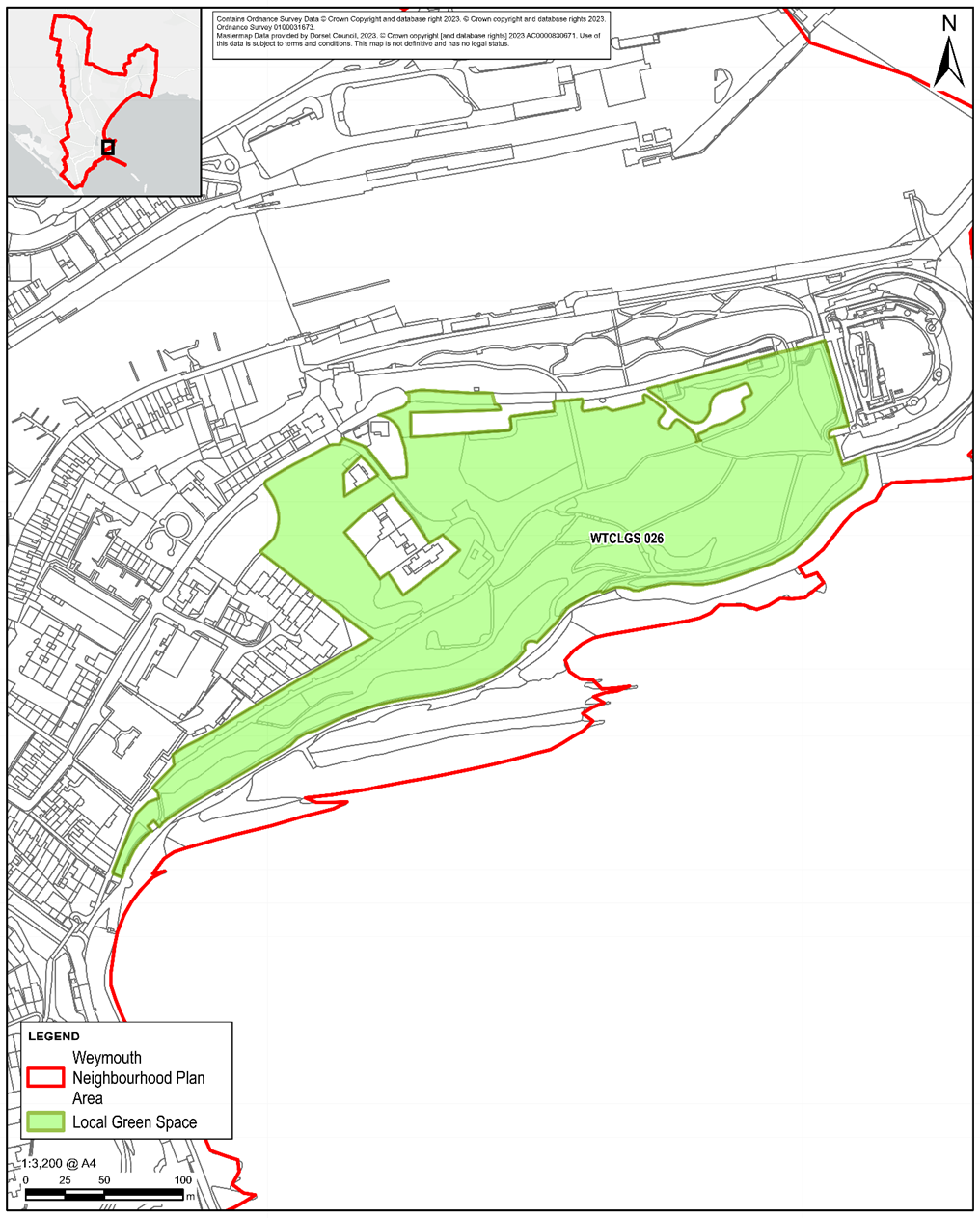
Figure 20: Bincleaves Open Space
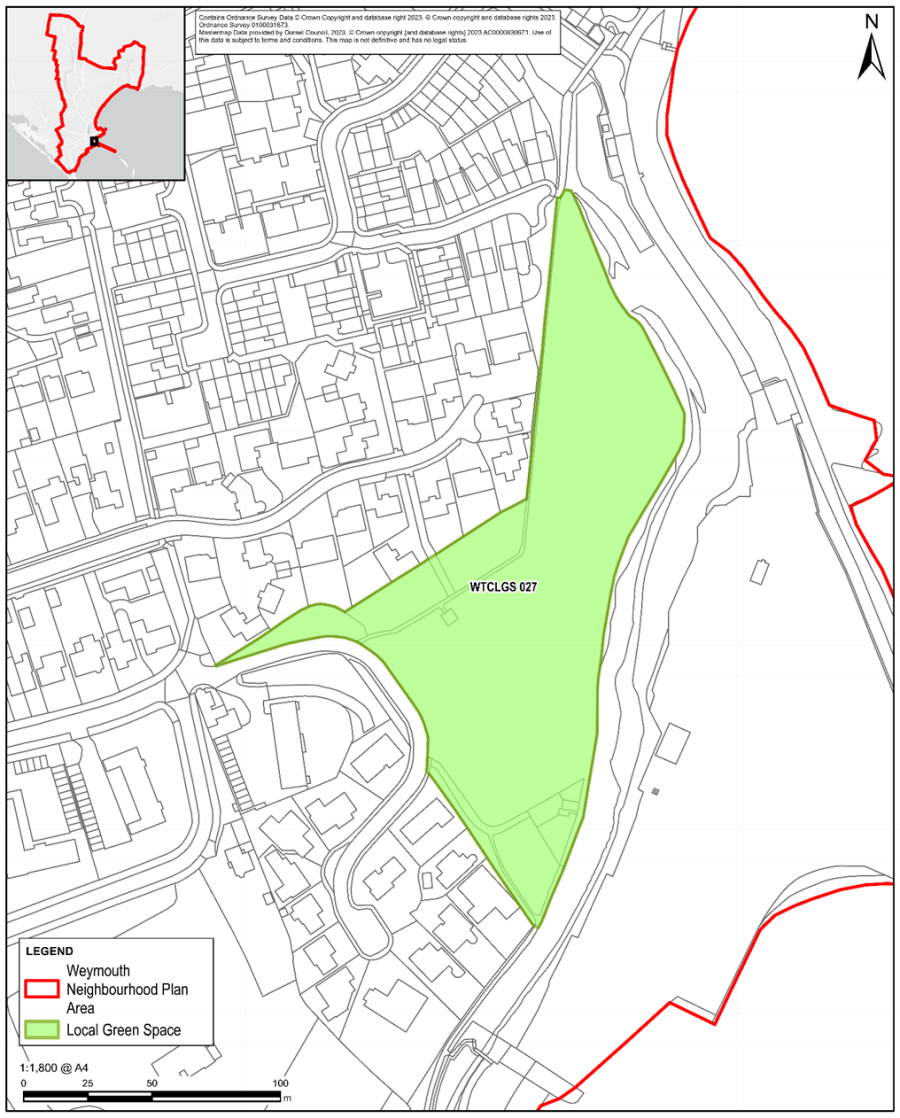
Figure 21: Chapelhay Open Space
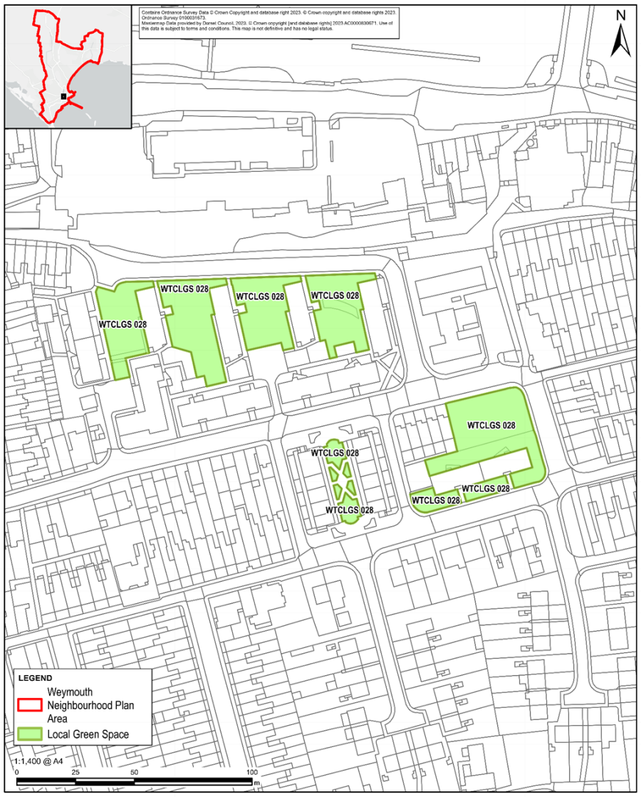
Figure 22: Larkspur Close Green Space
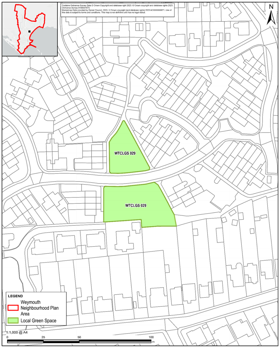
Figure 23: Westmacott Estate Green Space
Figure 24: Corfe Road / Tyneham Close Green Space
Figure 25: St Johns Gardens, Park District
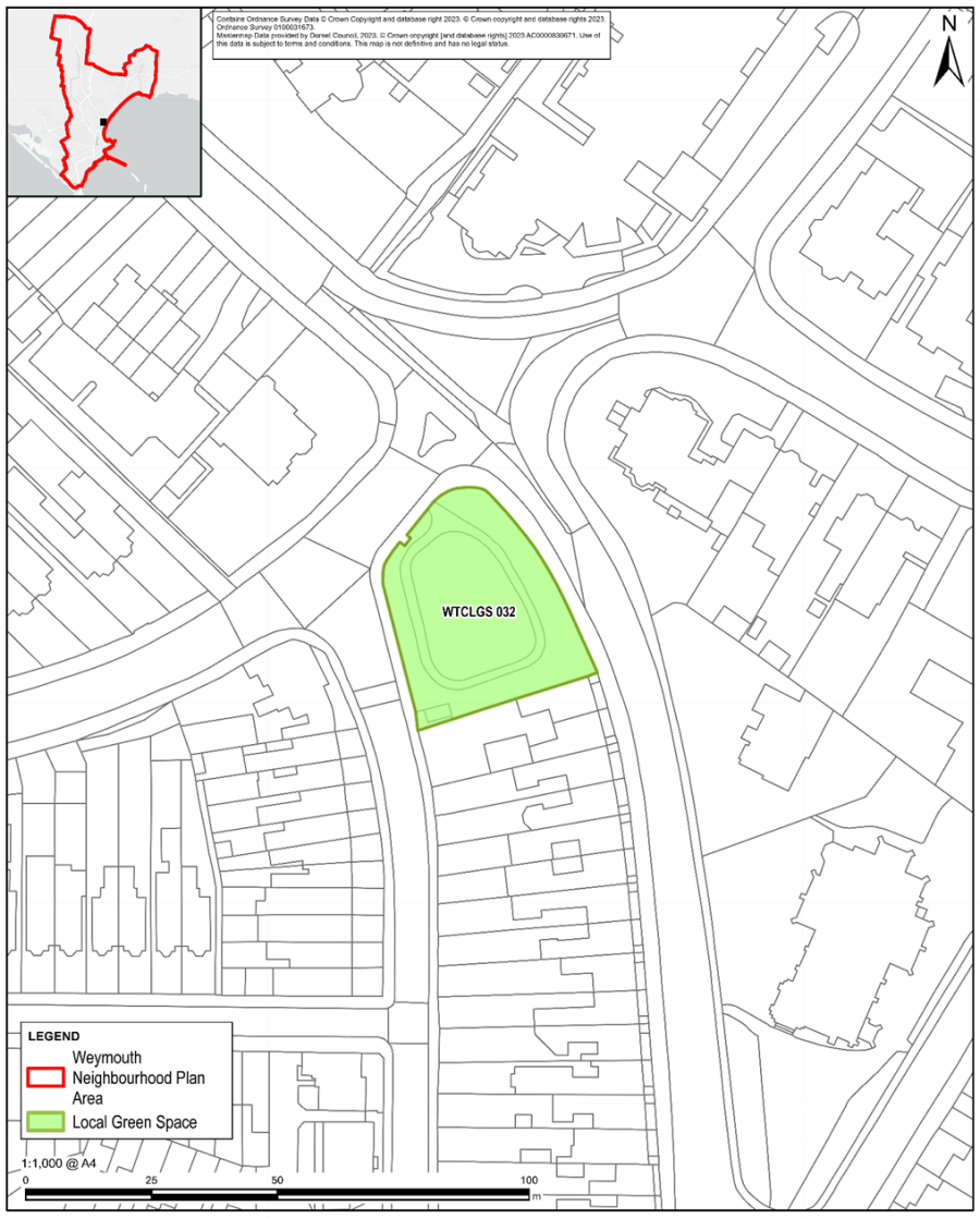
Figure 26: Green area btwn Enkworth Road & Oakbury Drive
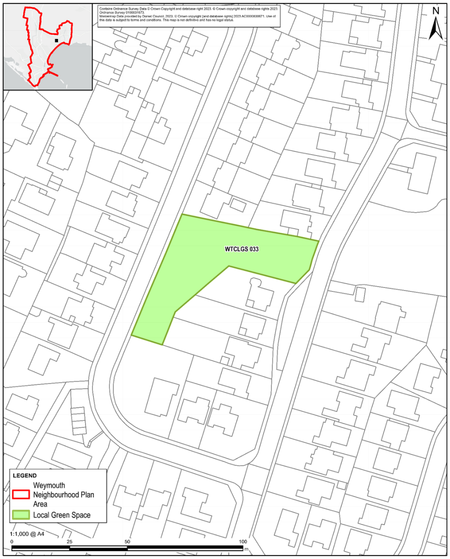
Figure 27: Woodland area off Oakbury Drive
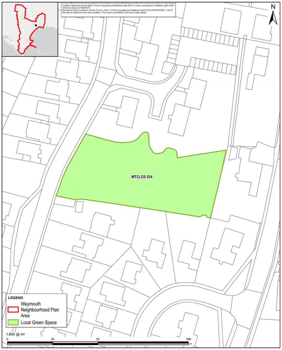
Figure 28: Bradford Road Green
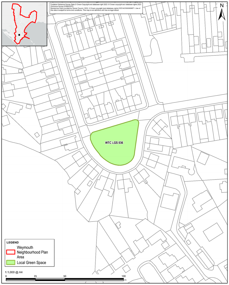
Figure 29: Bradford Road Woodland Area
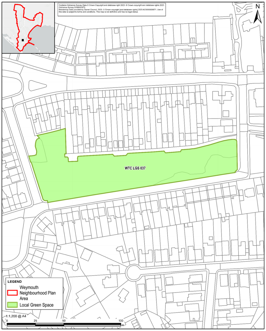
Figure 30: Tennyson Road Green
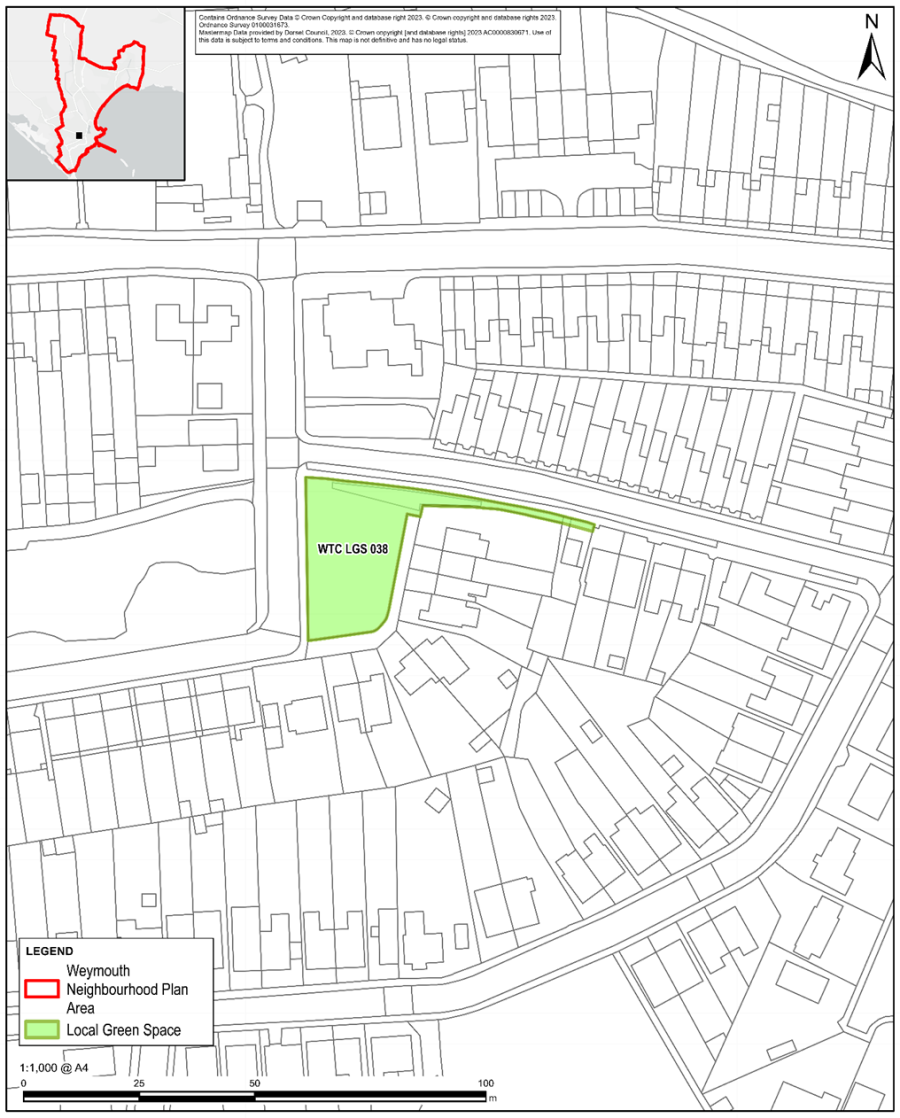
Figure 31: Wyke Playing Fields
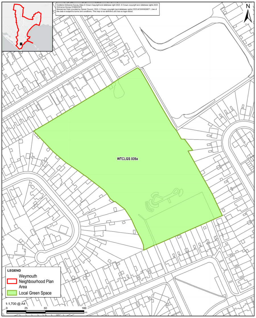
Figure 32: Ryemead Open Space
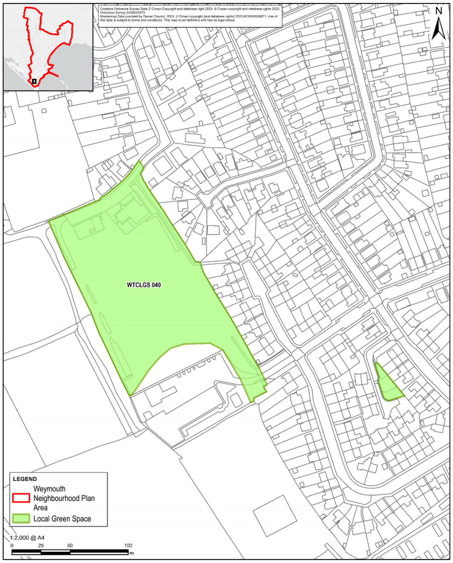
Figure 33: Douglas Road Play Area & Open Space
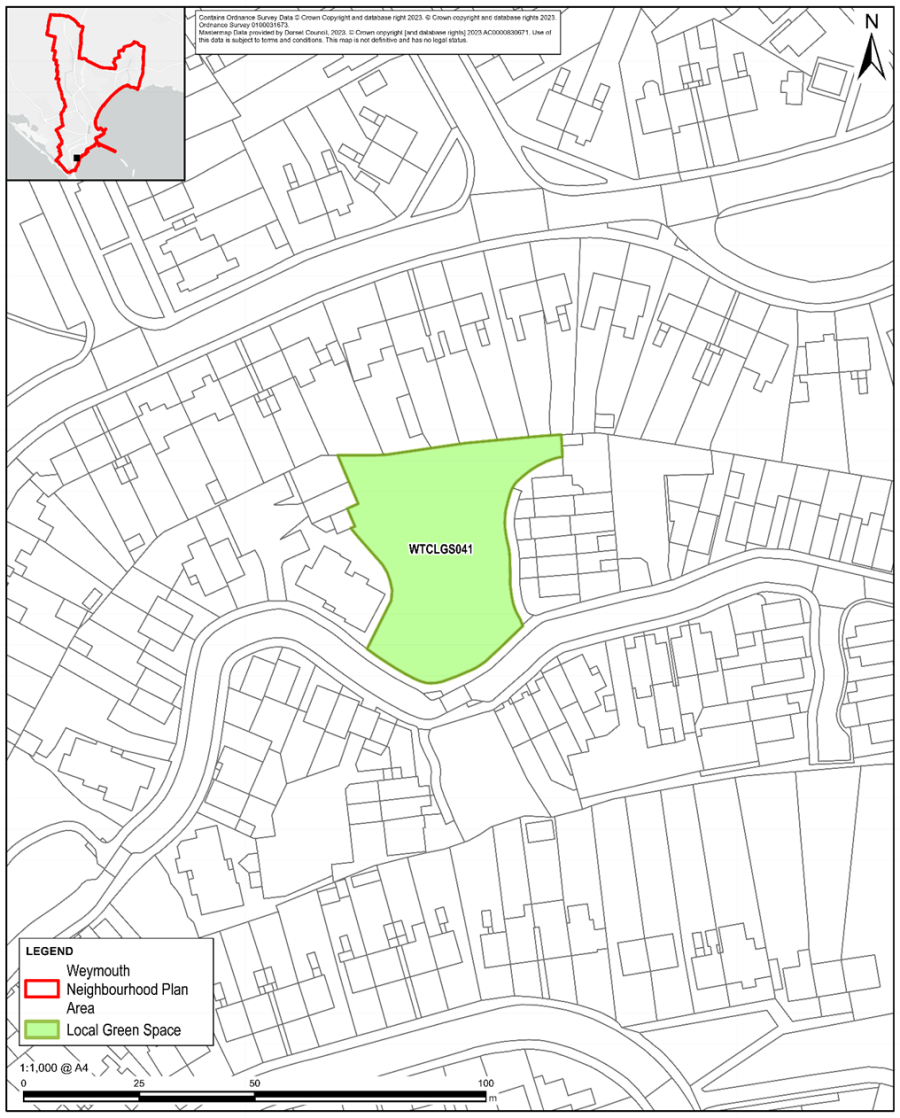
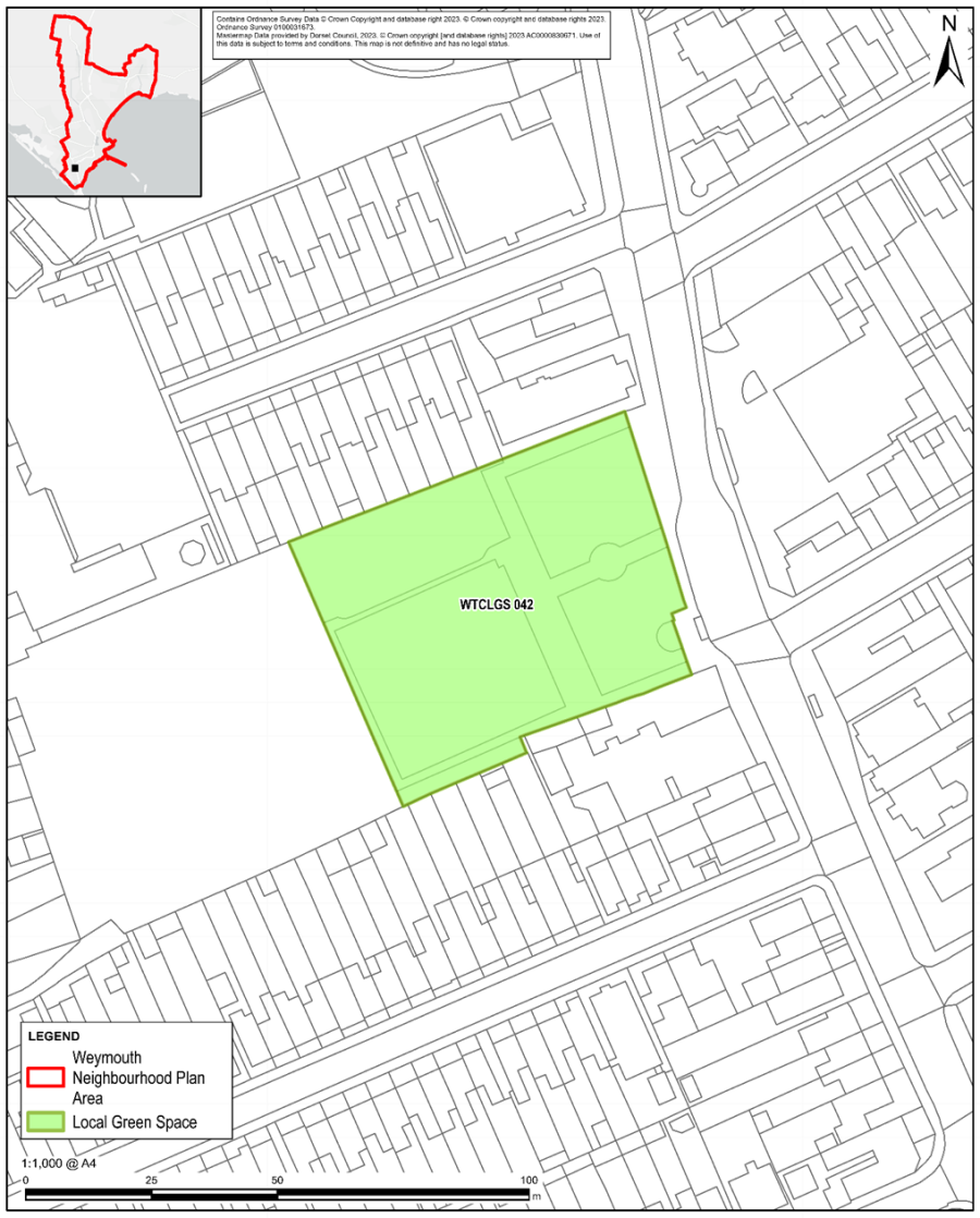
Figure 35: Purbeck Close Green
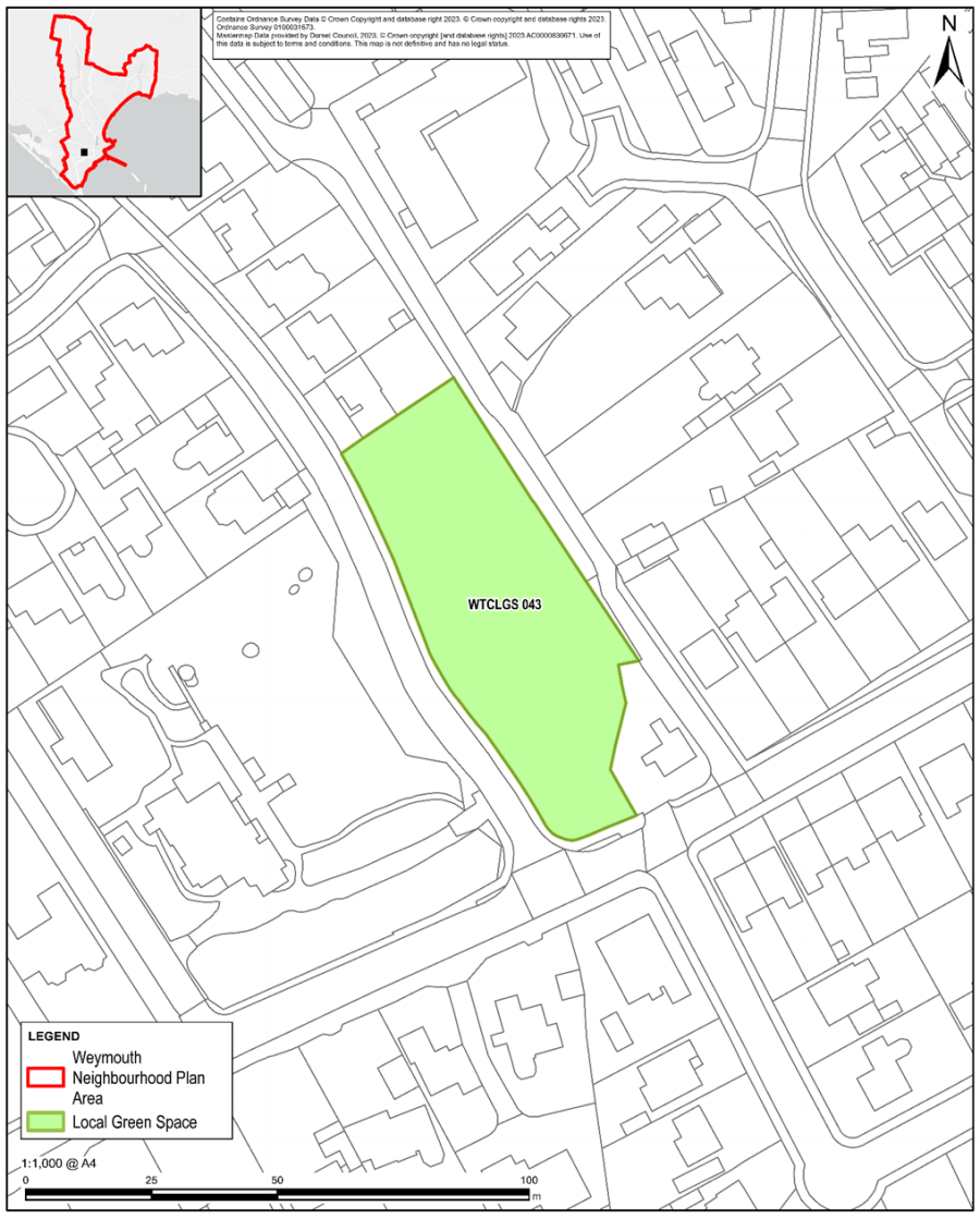
Figure 36: Hillbourne Road Green
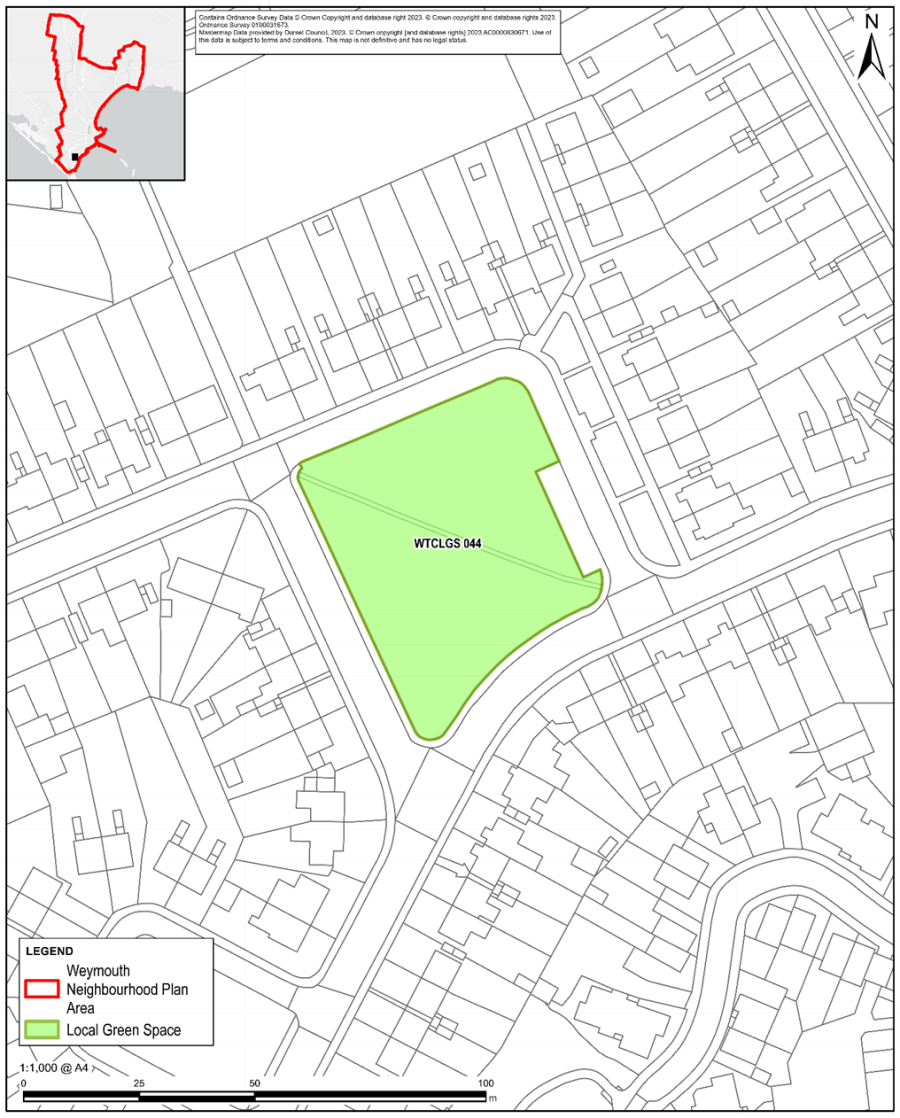
Figure 37: Down Close Green
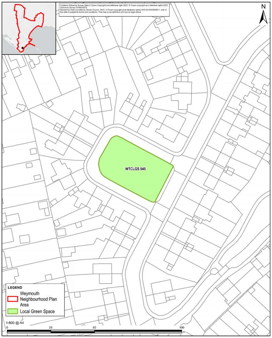
Figure 38: Forehill Maple Close Green Space
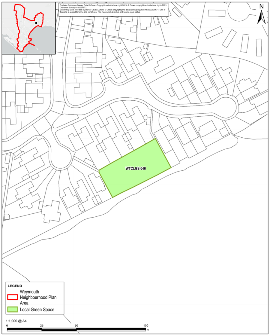
Figure 39: Verge & Copse at Springfield/Dorchester Road
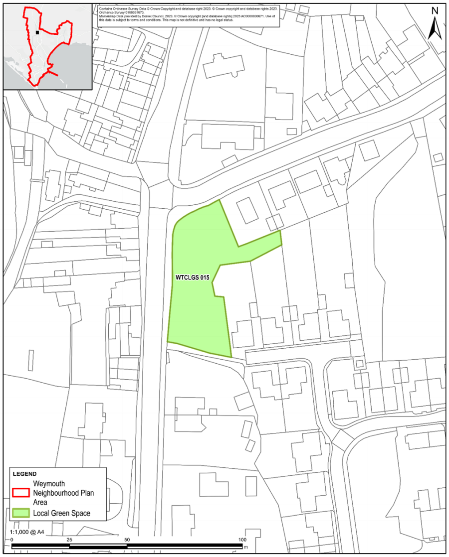
Figure 40: Traditional Orchard west of Southdown Avenue
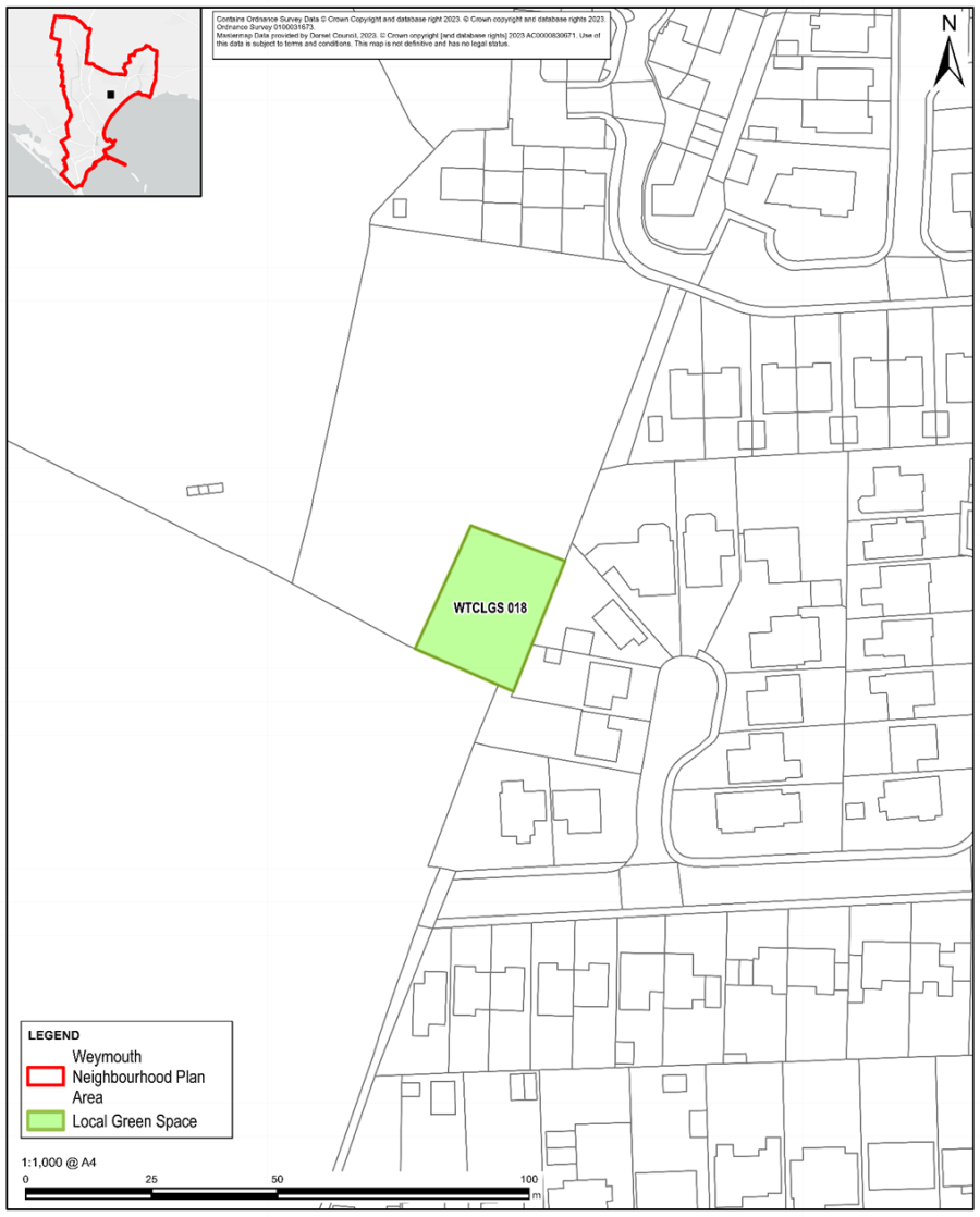
Figure 41 –Community Orchard near Southdown Avenue
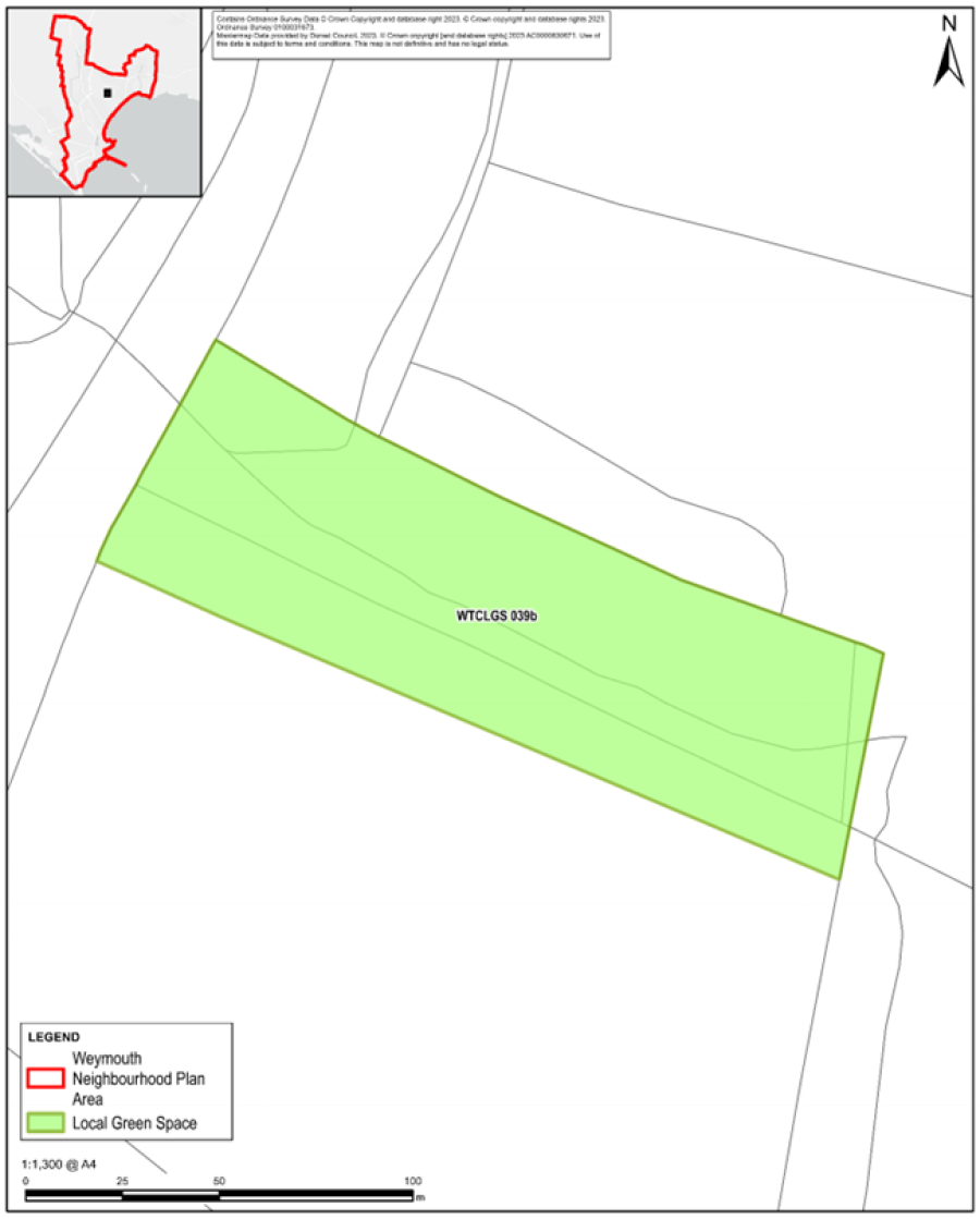
Figure 42: Chapelhay Community Growing Space
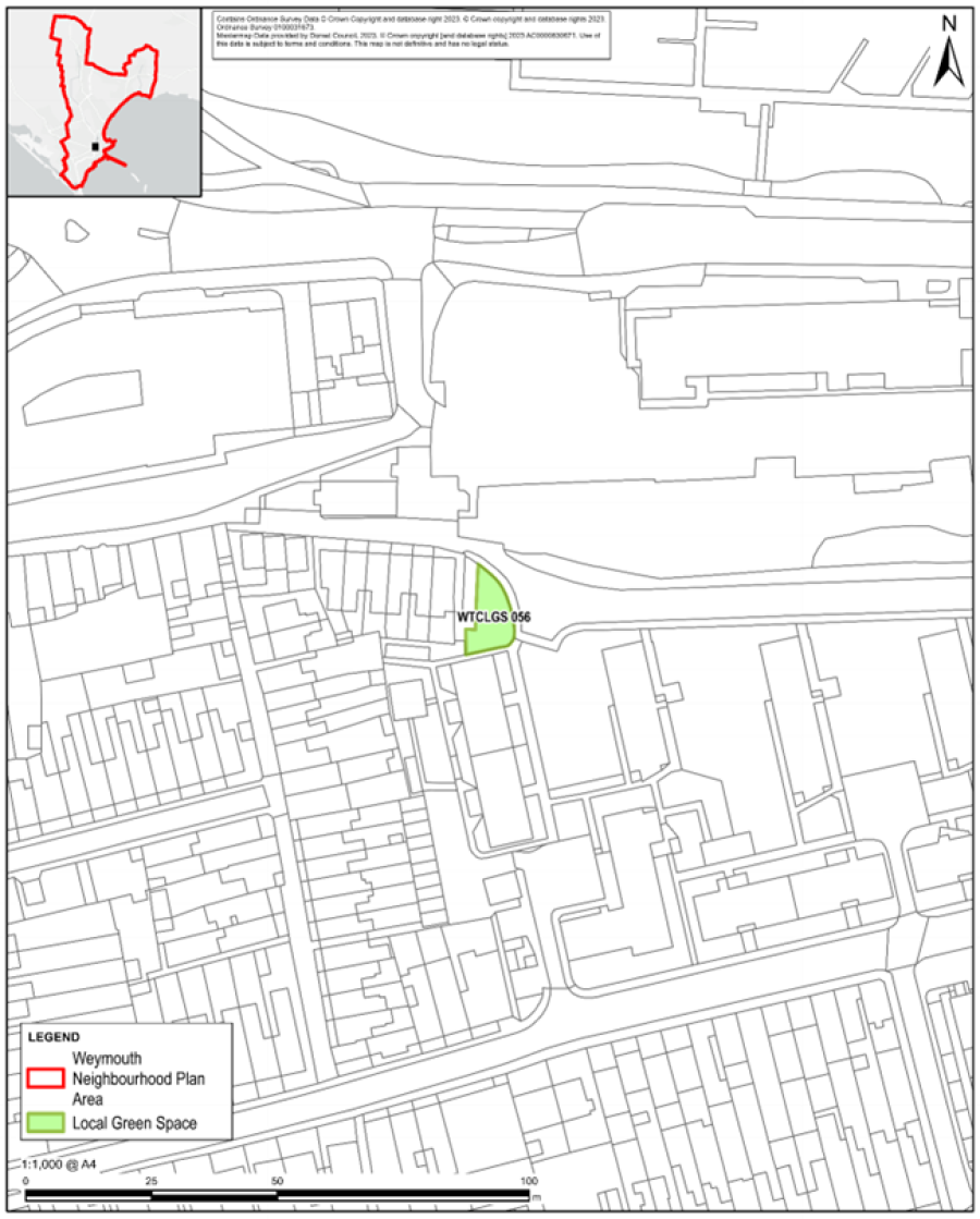
Figure 43: Wet Woodland (SPNP)
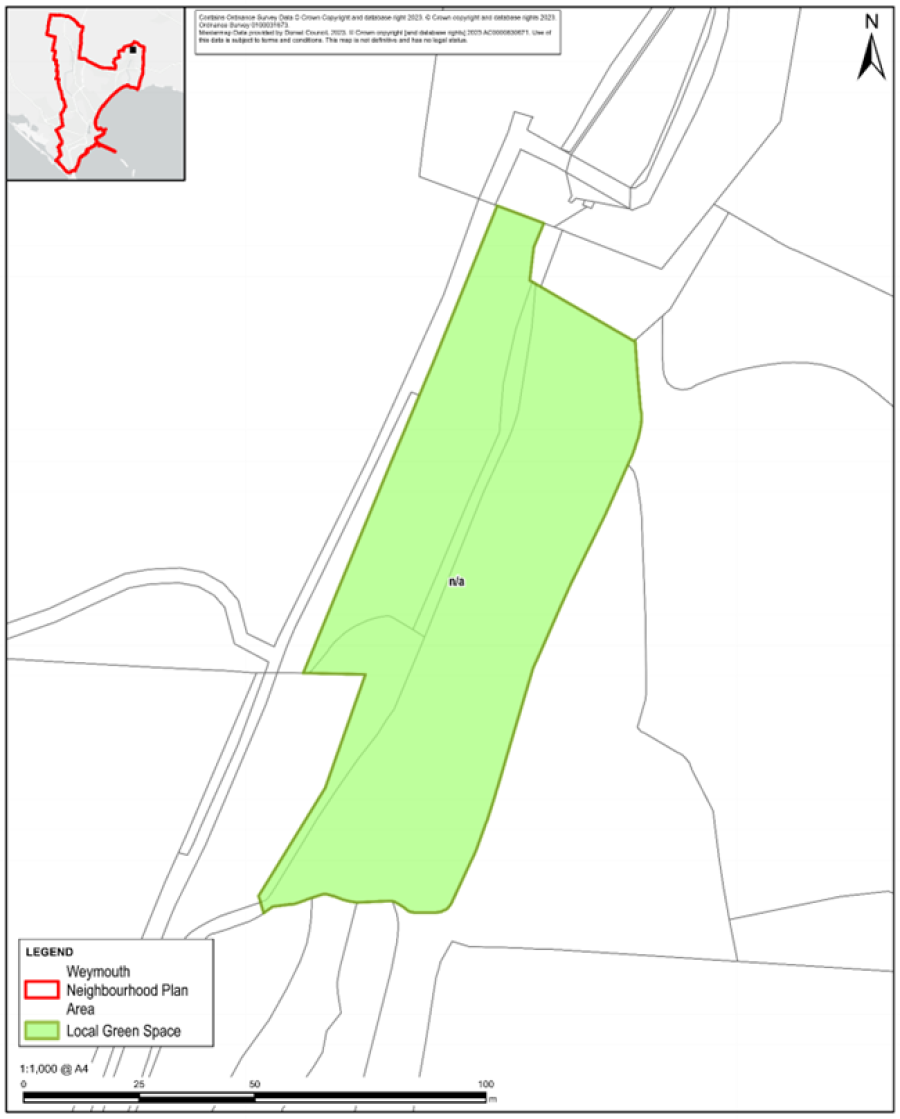
Figure 44: Area of Fen (SPNP)
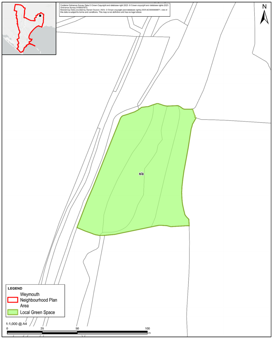
Figure 45: Veterans Wood (SPNP)
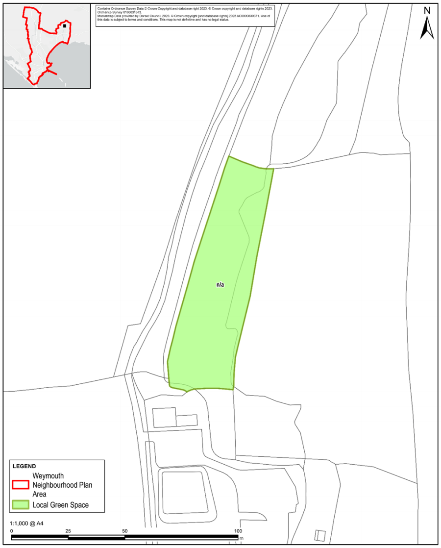
Figure 46: Water Meadows (SPNP)
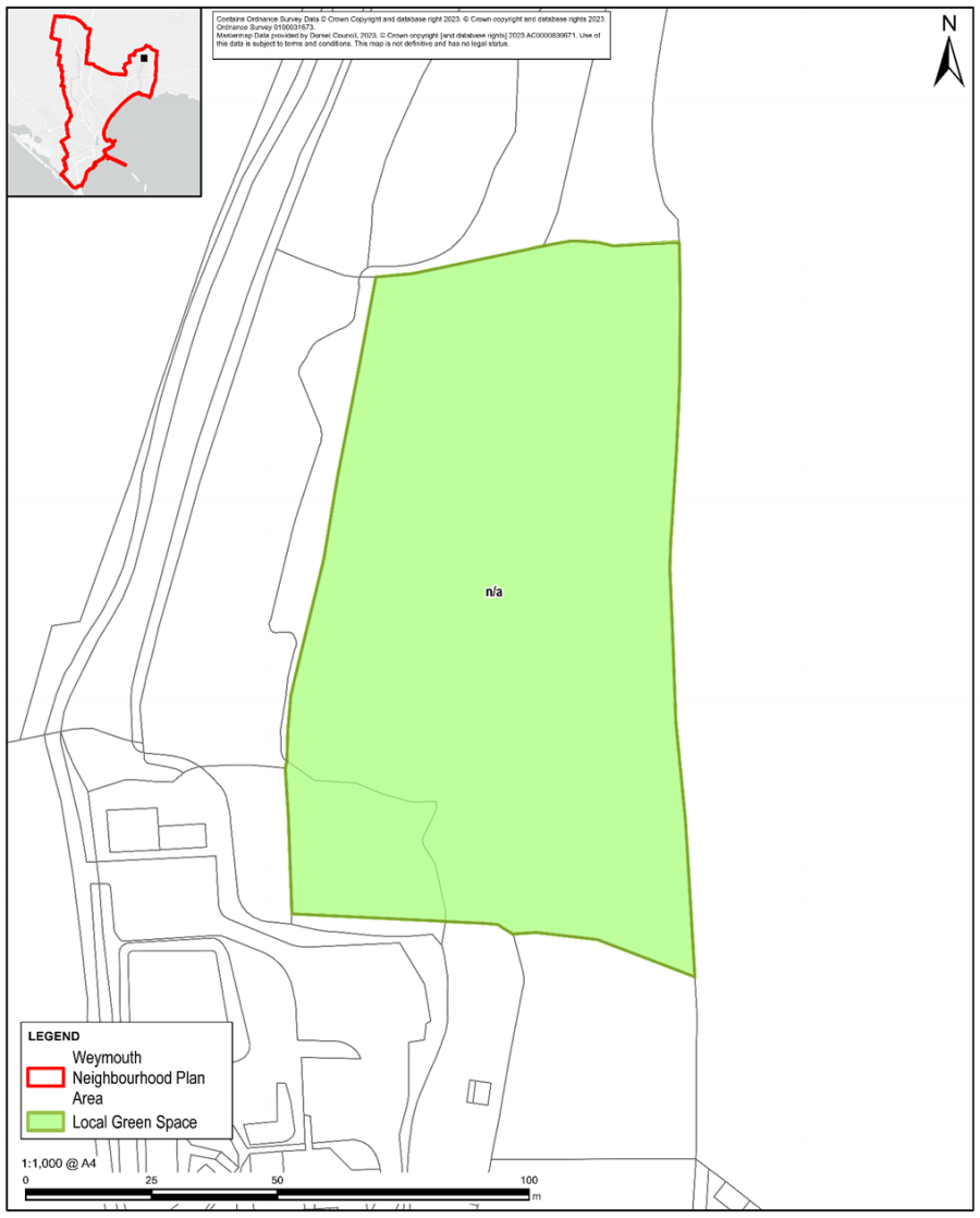
Figure 47: Mission Hall Orchard (SPNP)
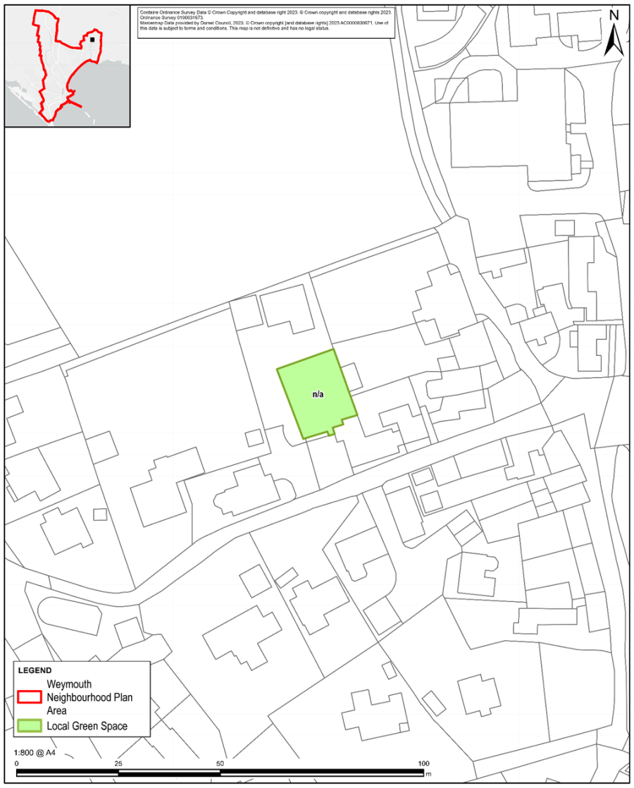
Figure 48: Village Green (SPNP)
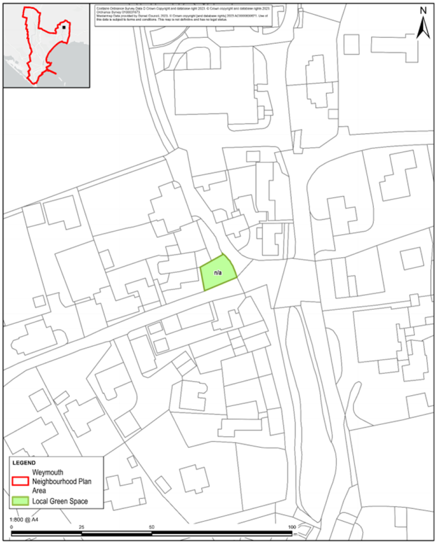
Figure 49: Mill Pond (SPNP)
< Previous | ^ Top | Next >