
Puddletown will retain the character of the village and surrounding countryside, maintaining our much-loved green spaces and views within and out of the village, archaeological sites, historic buildings and the links to Thomas Hardy, with any new development being well-designed and environmentally-friendly. There should be no inappropriate infilling or unplanned sprawl. |
2.1.1 During the consultation phase of the Plan, one overwhelming message was the value people put upon the exceptional landscapes within which they live. There is much affection and appreciation of the local green areas and spaces around the village, including the surrounding hills, meadows and woodlands.
2.1.2 Puddletown residents are also rightly proud of their heritage, including the character of the conservation area and the many surviving historic buildings. Puddletown provided the inspiration for the fictional settlement of Weatherbury in Thomas Hardy‘s novel ‘Far from the Madding Crowd‘. Weatherbury Farm, the home of principal character Bathsheba Everdene, is based on Waterston Manor within the parish.
2.2.1 National planning policy allows for green spaces that are well related to existing settlements and hold a particular local value to be designated as “Local Green Spaces”. This designation provides strong protection against development, that should last well beyond the Neighbourhood Plan period. So it is not appropriate to extensive tracts of countryside, or land which may have planning permission to be developed or may need to be released for housing, employment or community buildings / infrastructure in the longer term.
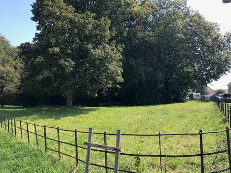
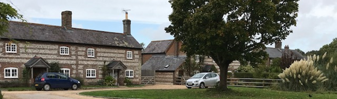
Figure 1. The Green
An example of one of the many much-loved spaces in and around the village
2.2.2 Many of these spaces may be in public ownership, but the designation can be applied to privately owned land provided that it is clearly valued by the community and of obvious importance for its recreational, landscape, historic, cultural or wildlife value.
2.2.3 The areas identified for designated as Local Green Spaces are:
Table 1. Local Green Spaces
| Local Green Space | Reason for designation | |
|---|---|---|
| 1 | The Green (private land) |
The Green is central to the village, both in terms of location and heritage, equivalent to many villages’ central ‘green‘. It has old and much loved trees, which support wildlife. The Conservation Area Appraisal notes that space as visually important. |
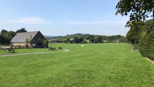
| 2 | Recreation Park (public land) |
The park is the main recreation area for the village with Pavilion and changing rooms, as well as a children‘s play area. It hosts cricket, football, 5 aside football and tennis matches. |
| 3 | Butt Close Recreation Park (public land) |
This recreation area was built to serve children who live in the Butt Close / Whitehill / Brymer Road following significant housing construction there. It is dedicated to younger children who cannot easily get to the main recreation area. |
| 4 | Catmead green space (private land / highway verge / public footpaths) |
These green spaces provide a landscaped setting to houses within this part of the Conservation Area, creating an attractive sense of openness close to the River Piddle, a pleasant space to wait at the bus stop and to enhances the public footpaths that connect through the area. |
| 5 | Brymer Road green spaces (public land) |
The green spaces are divided into 2 main areas, one at the connection of Brymer Road and Whitehill, the other towards Butt Close. They provide a green ‘lung‘ for the residents of this area, which is characterised by otherwise intensive c20 housing. |
| 6 | The Coombe (including path alongside the Middle School) (public land / unregistered) |
The Coombe as a piece of land is one of the best ‘holloways‘ in the area, with the trees creating a tunnel of vegetation (and subject to a group Tree Preservation Order). This collection of green spaces (up Coombe Road and White Hill) is held in high regard by residents, who walk in this direction to access the school and Puddletown Forest. |
| 7 | St Mary‘s church yard (church land / public footpath) |
St Mary‘s church yard is another ‘green lung‘ for the village, also providing peace and a place for quiet contemplation for many residents. It forms the setting of the Grade I Listed church and many of the separately listed tombs and monuments. |
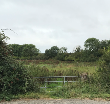
| 8 | Riverside land (private land / public footpath) |
The Riverside area, off Little Lane (track) to the east of the Blandford Road, provides a verdant, tranquil landscape next to an important walking route for residents, and supports wildlife. |
| 9 | The Moor (private land) |
The Moor provides an important green area rich in vegetation and protects the houses on the Moor from the vehicle traffic on the Blandford Road, providing an appropriate setting to No.s 3-8 The Moor which are Grade II Listed. |
| 10 | Land adjoining Greenacres (private land) |
The area of natural land to the west of the Greenacres estate is protected by a S106 agreement (ref 1/E/2000/0329). It provides habitat for bats, nesting birds and other wildlife, and acts as a natural setting for the houses of Greenacres. |
Local Green Spaces are not necessarily public open space, and their designation should not be regarded as conveying any additional public rights of access to these areas. For this reason, we have made clear on the map those areas which are publicly owned and accessible. We have also indicated public rights of way, where these are known to exist. |
Map 2. Local Green Spaces (Private and Public)
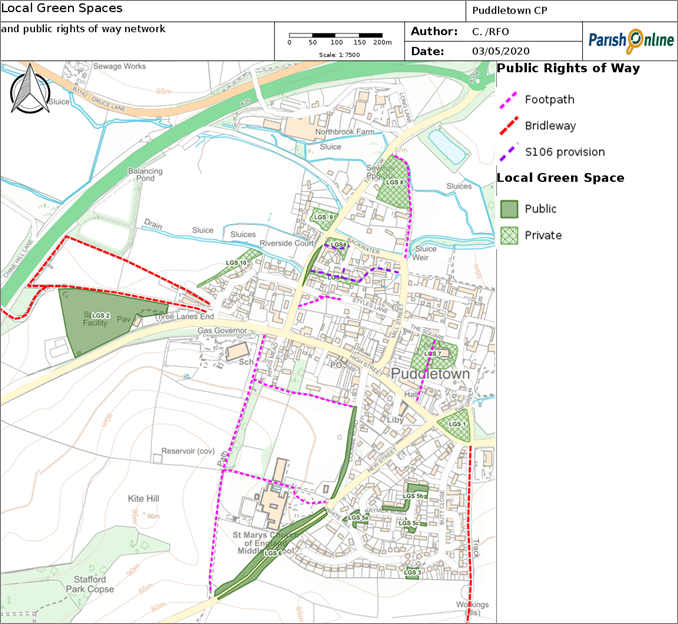
© Contains Ordnance Survey Data : Crown copyright and database right 2020,
© Crown copyright and database right. All rights reserved (100050773) 2020
2.2.4 The only form of development that would be appropriate in such locations, would be ancillary development to support their on-going function (such as outdoor sports and recreation facilities within the Recreation Park). Development proposals adjoining such sites should also be considered, to ensure that the development would not have an adverse impact on the Local Green Space. For example, the approval of a noisy industrial unit adjoining a space noted for its tranquillity would be inappropriate, as would a large, ugly building or a large area of blank wall adjoining an area noted for its landscape contribution.
Figure 2. Puddletown’s Recreation Park
2.2.5 Puddletown Forest is also highly valued by residents but does not readily meet the criteria for Local Green Space designation. Its protection is covered under policy 2.
Policy 1. Local Green Spaces
The sites listed in Table 1 (and as shown on the Policies Map) are designated as Local Green Spaces, and no development will be permitted within or immediately adjoining them that would undermine their reason for designation.
2.3.1 Puddletown lies within an area of chalk valley and downland associated with the River Piddle, with a distinctive area of heath / forest mosaic to the south (around Puddletown Forest), and valley pasture associated with the River Frome to the south4. The change in landscape character very much reflects the underlying geology, from Spetisbury chalk to West Park Farm Member sand then clay5. The Dorset Area of Outstanding Natural Beauty (a nationally important landscape) skirts around the northern edge of the parish, and the higher ground to the south of the parish boasts uninterrupted views of the surrounding landscape.
Figure 3. The historic water meadows
2.3.2 The area immediately surrounding the village is part of the Cerne and Piddle Valleys and Chalk Downland and is described in the West Dorset Design Guidelines - Landscape Character Assessment6. The assessment identifies a number of characteristics, including:
2.3.3 The trees of the village are dominant features of the landscape and contribute to the overall beauty of the area. The latest Conservation Area Appraisal7 notes that the village edges “are blessed with a number of fine, mature trees, at Ilsington House (seen to particular advantage along Athelhampton Road and The Green); on The Green itself; in the churchyard; between Styles Lane and the south side of High Street; and along The Backwater. Large yew hedges bound the drive to The Stables. There is a solitary yew, on the pavement edge between Puddletown House and no. 8 High Street that is of visual value. ” The Conservation Area designation gives protection to these and the many other trees within it.
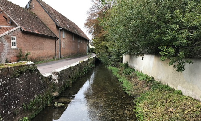
Figure 4. The Backwater
2.3.4 The area around Puddletown Forest has its own landscape character description. The area has much more extensive tree cover and is scattered with swallets and dolines, geological hollows, formed by the erosion of the soluble chalk by water. The assessment notes the intricate network of public rights of way and private access tracks that provide access throughout the area. The majority of the Forest is managed by the Forestry Commission and covers a total area of 301 Ha (extending either side of the A35 and westwards beyond the parish boundary). Douglas Fir and Corsican Pine predominate, with a small proportion (less than 10%) of broadleaved tree species. Open space is increasing as a result of felling for heathland restoration, but the retention of sporting rights by the leaser limits the formal provision of recreation facilities in the forest8. Of particular concern to residents in recent years has been the instances of anti-social behaviour in Puddletown Forest.
Figure 5. Puddletown Forest
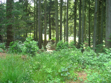
Project P1. The Puddletown Area Parish Council and Dorset Council will continue to liaise with the Forestry Commission and local police to ensure good, clear access to and public safety in the environs of Forest.
2.3.5 The history of the area is clearly evident in the landscape. The lanes have a rural character with small humped bridges, and traditional fingerpost signs. There is a straight Roman road that radiates out from nearby Dorchester and passes through Puddletown Forest and the area south of the village. Surviving prehistoric monuments such as round barrows and prehistoric field systems are also visible as humps along the skyline (a number are noted as being at risk due to arable ploughing). The remains of strip lynchets of ‘Celtic‘ fields have also been found near a few of the barrows. There are also earthworks and channels relating to water meadow management.
2.3.6 The A35 road corridor is a major feature in this open landscape, with its associated noise and lighting. Other than that, the area is relatively tranquil and away from the village and trunk road, the dark night skies can be enjoyed.
Policy 2. Local Landscape Features
Development will respect and where possible enhance the character of the local landscape, including the retention and reinforcement of the following key characteristics:
2.4.1 Puddletown has the characteristics of a Dorset village with its clear connections to the countryside and rural way of life. Many residents who moved here specifically chose to live in a village, and made it clear that they would not wish it to become a small town. So this policy attempts to ensure that the village retains its links with the countryside and inherent feel as a rural-based community.
2.4.2 In attempting to understand what underpins the village character, four key factors
have been identified:
The ‘village’ characteristics of Puddletown should be respected, in particular through:
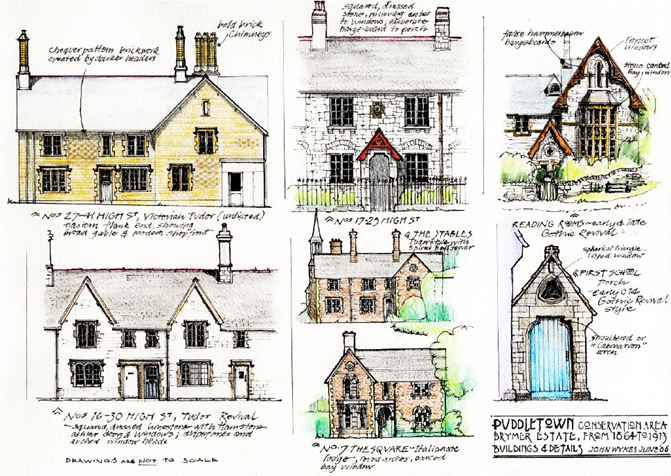
2.5.1 Puddletown has a long and complex history. There is evidence of prehistoric human occupation in the parish (from the many round barrows and the remains of strip lynchets). It was recorded in the Domesday book, and the parish church of St Mary has Norman origins. The village has been shaped by the environmental constraints and availability of local building materials, and also influenced by the main landowners in the C18 and C19. In particular, John Brymer bought the estate of the 4th Earl of Orford in 1864, which by that time included Ilsington House, and commissioned a new school, reading room and a Home Farm as well as decent terraced cottages for his workers - the estate was eventually split up and sold to a multiplicity of private owners in 1921.
2.5.2 Planning and other legislation places great emphasis on the need to protect the special architectural or historic interest of Listed Buildings, Conservation Areas, Scheduled Monuments, Registered Parks and Gardens and even undesignated heritage assets, all of which are present in this area. This does not mean that further development cannot take place, but that any development should be carefully considered, taking into account factors such as the historic and cultural significance of the historic features, and their setting. As a result opportunities may be identified to enhance historic features, and obvious harm will be avoided. Indeed, the Conservation Area appraisal notes that there has been some good quality modern infill and building conversions that have added to the sense of place.
2.5.3 In recognition of its historic interest and character, the Puddletown Conservation Area was designated in July 1975 and extended January 1994. The latest appraisal9 identifies a number of key characteristics and features.
Table 2. Puddletown Conservation Area key characteristics and features
| ✔Well defined entry points into the village, particularly from the west and east, on the former A35, with notable views along the High Street; |
| ✔A mixture of vernacular cottages, larger C18 and early C19 gentry houses and Victorian estate houses throughout the village, and consistent use of South Dorset limestone, cob, local brick clays, thatch and vernacular building details that give an overall unity to the village; |
| ✔Some good details, including shop fronts, doorways, boundary walls, railings and other ironwork, most notably on the western part of High Street, Mill Street, The Square, the ancillary buildings of Ilsington House and The Green; |
| ✔Many of the smaller cottages and substantial buildings relate to a major mid-Victorian development of a model farming estate (commissioned by John Brymer); |
| ✔Obvious landmarks include the (old) primary school and the Reading Room on High Street; the end elevation of no. 3 The Square; and the church tower (limited to intimate, local views and two longer views). The spired tower to The Stables is also seen from The Square and The Green. Ilsington House is a key Listed Building (Grade II*) and has many associated estate buildings, but is not particularly visible from the village core. |
2.5.4 The parish boasts over fifty Listed buildings. These include the Grade I St Mary‘s Church and Waterston Manor, and the Grade II* Ilsington House, the Old Vicarage adjoining it, and No.8, The Square10. A full list is provided in Appendix 4. All of these Listed buildings are nationally important heritage assets. These are protected by legislation, which means that both the buildings and their setting (the surroundings in which a heritage asset is experienced) should not be harmed by development. Whilst the setting of Listed Buildings is not often described in their Listing, of particular note are the gardens of Waterston Manor (the house is surrounded by a fine example of formal Edwardian gardens that are Registered as an Historic Park / Garden in their own right), and the grounds of Athelhampton House (which is also Registered and extends into the
parish).
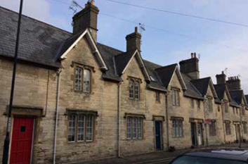
Figure 6.
16 - 30 High Street (Grade II Listed)
2.5.5 There are also a number of Locally Important Buildings identified through the Conservation Area Appraisal in 2007, which are included in Table 3. Whilst these are not designated, they are nevertheless important heritage assets and development should be carefully assessed to see if any harm is justified (having regard to the benefits of the
development and the contribution the asset makes to the historic and architectural character of the area) and if changes could be made to reduce or avoid such harm. The Old Chapel, 1 -3 Athelhampton Road, the Blue Vinney, and Druce House, which are outside the Conservation Area, have been identified through more recent research.
| 3 High Street | a brick, Victorian Tudor building (possibly an estate building) with stone dressings, very prominent in the approach from the west (and enhanced by the brick gate piers to yard entrance, capped with stone birds of prey) |
| Puddletown House, High St | a dignified early C19 brick cube, with good brickwork and a central chimney stack |
| 27 - 41 High Street |
large brick and slate estate buildings, with strong end and mid-façade gables, cartouche and octagonal chimney stacks |
| 38a - 46b High Street |
later estate houses, of brick, stone and mock half-timber; an important group in the eastern end of High Street, grouping with the school and stone estate buildings west |
| 4 - 8 The Green | simple rendered and painted brick row, of townscape & group value |
| Old Chapel, 1 -3 Athelhampton Road | clearly identifiable as the congregational chapel on the 1888 OS map, the old chapel (also used as a schoolhouse) retains much of its former character through the decorative arched windows and soffits |
| 1 The Square | handsome double bayed Victorian house on the corner with Mill St |
| 3 - 13 Mill Street |
brick and mock half-timber estate houses, of group value and a key feature in the view down Mill Street from the High Street junction |
| 16 Mill Street | early C19 painted brick corner building, of group & townscape value |
| 18 and 20 Mill Street |
a semi-detached pair of estate houses, dated 1878, unspoilt, on an important corner site |
| 1 and 2 Styles Lane and the wall adjacent to 3 Styles Lane | pair of flint and stone Tudor Revival estate cottages, with a date lozenge of 1911 and John Brymer’s initials, attractive and unspoilt. The cob and pantiled boundary wall at the end of Styles Lane, by Sherrings Green Close and the footpath, is also of historic interest |
| Home Farm’s outbuildings | barns, sheds and grist and sawmill, an important example of farming technology, attractive materials and details (now converted) |
| The Myrtles, Little Lane | with its thatched cob boundary wall; the house has a good eastern elevation to the lane |
| The Blue Vinney, The Moor | distinctive Village pub with gabled roof form, decorative wooden beams and central red brick chimney, recorded in the Kelly Directory of 1911 managed by Eliza Hardy), identifiable on 1950s OS maps |
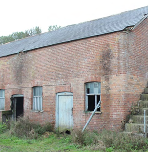
| Stables block, Northbrook Farm | L- shaped stable block/haybarn, believed to be constructed in the late C19, associated with the Grade II Listed Stafford Park Farm, the eastern range being accessed from their grounds. |
| Threshing Barn, Northbrook Farm | brick built threshing barn, forming the northern perimeter of a block of historic farm buildings associated with the Grade II Listed Stafford Park Farm. The several modern additions are of no merit. |
| Druce House, Birch Lane, Druce | farmhouse and associated outbuildings dating back to the 19th century (on the 1888 OS map) and potentially linked to Thomas Hardy’s Little Weatherbury Farm in "Far from the Madding Crowd" |
Locally Important Buildings are not Listed – so owners are able to make internal changes to them, and also changes that are possible under permitted development rights, subject to any restrictions arising within the Conservation Area or areas subject to current or future Article 4 Directions. However any external alterations that would require planning permission would be more carefully considered due to their local importance. |
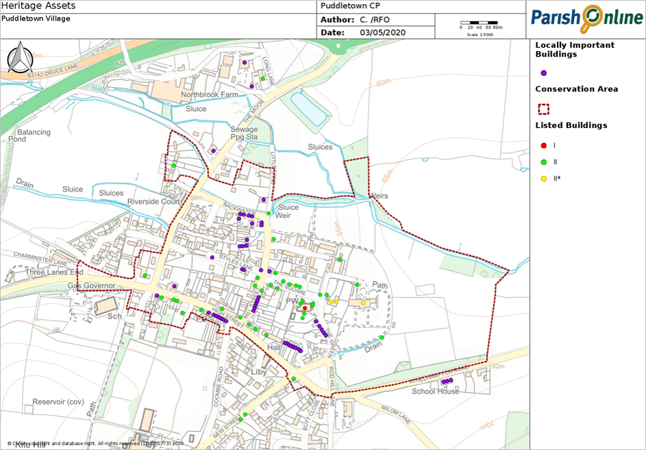
Map 3. Puddletown Conservation Area, Listed and Locally Important Buildings
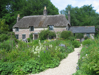
2.5.6 Thomas Hardy, the author of novels such as Far From the Madding Crowd and Tess of the D’Urbervilles, was closely associated with Puddletown. His maternal aunts Mary and Maria, and their thr ee elder brothers, Christopher, Henry and William, lived in the village, and when his own parents married they lived in Higher Bockhampton, on the western edge of Puddletown Forest just outside the Neighbourhood Plan area. Hardy himself was born there (in 1840), and the cottage is now owned by the National Trust and attracts many visitors, who are keen to see not only the author‘s first home but also a typical 19th century skilled working man‘s cottage.
Figure 7. Hardy’s Cottage
2.5.7 Far From the Madding Crowd, Hardy‘s fourth book and the one that brought him acclaim, was set in the fictional village of Weatherbury, closely modelled on Puddletown. Bathsheba, the main character in that novel, inherits Weatherbury Farm, which itself is based on Waterston Manor. St Mary‘s church is the site for Fanny Robins‘ grave that Sergeant Troy visits, and there are many other references to places and people that Hardy knew well in Puddletown.
Hardy wrote to his editor that his home was "within a walk of the district in which the incidents are supposed to occur" and that it was "a great advantage to be actually among the people described at the time of describing them".
2.5.8 There are also references to places and characters in Puddletown in some of his other books and poems. For example, St Mary‘s church also features in Under the Greenwood Tree, and his uncle John Antell (a shoemaker married to his Aunt Mary) is thought to have provided inspiration for Jude the Obscure. Hardy‘s cousin, Tryphena Sparks, also lived in Puddletown (working at the school), and was the inspiration for Hardy‘s poem "Thoughts of Phena at her Death". In one of his poem’s he recalls walking with his mother along the Roman Road that crosses through the Forest.
Table 4. Thomas Hardy fictional places and Puddletown associations11
| Coomb-Barn | Barn south of Puddletown |
| Coomb-Ewelease | Sheep pasture on White Hill |
| Elsenford | Ilsington (on the Tincleton boundary and not to be confused with Ilsington House in Puddletown village) |
| Icen Way | The Roman road across Puddletown Heath |
| Little Weatherbury Farm | Druce Farm, half a mile north-west of Puddletown |
| Mistover | Scattering of cob and thatch cottages on Puddletown Heath |
| Mistover Knap | House (demolished) on Puddletown Heath |
| Nest Cottage | Chine Hill Cottage, Druce (demolished) |
| Pydel Vale | Valley of the River Piddle upstream of Puddletown |
| Quiet Woman Inn | Former Wild Duck Inn, at Duck Dairy House, Duddle Heath |
| Roy-town | Troy Town (the hamlet below Yellowham Hill; its real name usually means slums, but there may be other derivations) |
| Rushy Pond | Rushy Pond, Duddle Heath |
| Waterstone Ridge | Waterston Ridge is half a mile south of Laycock Dairy Farm (along which the Ridge Way runs) |
| Weatherbury | Puddletown (Piddletown in Hardy‘s time). "Weatherbury" is from Weatherby Castle hill-fort, Milborne St Andrew |
| Weatherbury Farm | Waterston Manor, in Lower Waterston |
| Yalbury Hill | Yellowham Hill |
2.5.9 Just prior to Hardy’s birth another key event happened in this part of the world – the story of the Tolpuddle Martyrs. This led to working people having the right to organise themselves into trade unions as part of a free society. Whilst the Martyrs are most associated with Tolpuddle (to the east of Puddletown) and were tried in the Crown Courts in Dorchester (to the west) before being transported to Australia, they would have passed through Puddletown on many occasions. Similarly, visitors to the area, looking to retrace the Martyr’s steps, will come through Puddletown.
Project P2. The Parish Council will work with the National Trust and other interested parties to promote greater understanding of the Thomas Hardy and Tolpuddle Martyr connections to the area, for example through the production of a visitor information brochure and negotiating and waymarking a Martyr’s Trail from Tolpuddle to Shire Hall.
Policy 4. Respecting the history of Puddletown
Development within and forming the setting of the Conservation Area should respect its key characteristics and features of special interest (as described in detail in the Conservation Area Appraisal and summarised in Table 2).
In addition to the protection given to the many designated Listed buildings, support will also be given wherever practicable to the protection and, where appropriate, restoration / enhancement of the Locally Important Buildings as listed in Table 3 (and as shown on the Policies Map).
Proposals that raise awareness of the area’s links with Thomas Hardy and the Tolpuddle Martyrs should receive favourable consideration, provided that these would not cause substantial harm to the environment or character of the area.
2.6.1 National planning policy guidance recognises that a neighbourhood plan can play an important role in understanding and appreciating the context of an area, so that applicants have as much certainty as possible about what is likely to be acceptable and in line with local aspirations.
2.6.2 The design forum workshops, a review of the character of the area undertaken as part of the Conservation Area Appraisal produced in 2007 and the more recent (2017) Settlement & Character Analysis by Feria Urbanism have all informed the following design guidelines:
Table 5. Puddletown Planning Design Guidelines
| Element | What works well (ü) and what doesn’t (I) |
|---|---|
| Street frontages | ✔ Front door canopies are a common architectural feature used and help distinguish entrances. ✔ Curving building lines follow the gentle meanders of the back lanes. ✔ Low walls and wrought iron fences help define public and private spaces. ✔ Details such as ridged finishes to brick work walls, and traditional street lighting, have positively contributed to the village character. ✔ Gaps have allowed views of local landmarks such as the church tower, sometimes unexpected, sometimes framed. What to avoid… ❌High boundary walls, fences, and blank building facades create unpleasant streets that feel unsafe. Stepped walls and “eyes on the street” from the ground and first floor windows can help keep pathways feeling safe, but would be further improved with room for planting and some low-level lighting.   |
| Ground details and surfacing | ✔Opportunities for simple planting within the street, such as in front of houses and alongside footways, helps to add interest and personalise the space as well as creating a more attractive semi-rural character. ✔Larger trees (with spaces for these to mature) within the built-up area provide multiple benefits. ✔Use of materials, such as brick paving, helps to differentiate private paths. ✔Use of permeable ground materials softens appearances and assists with the control of rainwater run-off. ✔Lack of raised footway with concrete kerbs, and absence of painted lines, helps preserve a village character. What to avoid… ❌Poor definition of public and private spaces can lead to the under-used grassed areas and maintenance problems. ❌Large expanses of tarmac can give an overly urban impression – for example at the Blandford Road / High Street junction. ❌Parked cars, either planned or unplanned, can dominate the street scene. Sufficient parking needs to be provided, and where parking is likely to take place on the street the design should look to create breaks (eg through planting schemes) and discourage parking close to junctions. ❌Poorly thought through pavements that don’t obviously connect places can cause frustration. Providing a choice of connections from new development to adjoining areas should be one of first considerations in good design.  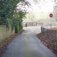 |
| Building styles and materials | ✔A mix of building types and styles that are reflective of the different periods of development and long evolution of the settlement has worked very well in recent developments. For example, collections of working and renovated farm buildings have been cleverly converted to alternatives uses. The old school house and other key buildings provide an important link to the Victorian estate heritage and the grandeur of their past use. ✔Architectural compositions with a vertical emphasis tend to work well, particularly when balanced – eg vertical window details and tall chimney stacks. ✔Side or rear wings and humbler lean-tos provide useful extensions and add character without diminishing the design of the original building, although greater care is needed in the case of semi-detached and terraced designs. ✔Quirky features add to the visual richness of the village. ✔There is a consistent use of South Dorset limestone (typically dressed Lower Purbeck for walling and Portland Freestone ashlar), some cob, local brick clays (pale sandy yellow, mid-brown and a bright orange), and more occasionally use of orange-brown hamstone, flint and timber, and on roofs there is slate (and some stone slates), clay tiles and pantiles as well as traditional thatch, that give an overall unity to the village, particularly within the Conservation Area. A mix of render, brick and timber have provided a rural feel to more recent developments. ✔Small courtyard and mews layouts, for example on the sites of the sawmill and coal yard and off The Square, have worked well. What to avoid… ❌Large estates of repeated house types and designs that give a suburban feel and could be anywhere. ❌Undersized features, such as limited overhang at the eaves, small chimneys and dormers, suggest a meanness and lack of pride in the architecture. ❌Communal garage blocks can be poorly used, creating empty uninteresting spaces. ❌Some materials have not weathered well – such as some of the painted brickwork and timber. ❌PVC-u used as an external material on buildings in historic areas, where feasible and practicable. ❌Meter boxes on the front walls appear as thoughtless additions. 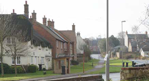 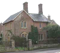
|
| Building scale and roof lines | ✔Village dwellings are typically two storeys in height (with 1½ storey cottages) and finished with pitched roofs. ✔The sub-division of some of the larger, historic buildings into apartments provides a possible precedent for the provision of flats / apartments. ✔There is a lot of variation in roof pitches (also reflecting the use of different materials), decorative ridge tiles (eg scalloping or crockets), and chimneystacks and flue-pots (a special feature of Puddletown, with many tall, prominent brick and stone stacks populating the village skyline), providing character. ✔Traditional rows of planned terraces can form a strong singular roofline punctuated by characterful chimneys and a clear repeated rhythm. What to avoid… ❌The absence, removal or diminishment of chimney stacks and pots on old and new buildings. ❌Solar panels on roofs that face directly onto the street or key vistas can detract from the street scene - care is needed in the choice of materials and to make these flush-fitting. ❌The white roof of the gym on the school playing field is far too prominent. ❌Some of the building that has taken place on higher ground has reduced the visual link between the village and surrounding countryside. 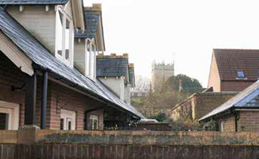 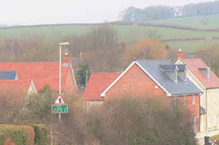 |
2.6.3 Like many communities, in Puddletown there is an increasing awareness and ‘push’ to ensure that the homes that we build now are as environmentally-friendly and energy efficient as possible. In particular, there was a lot of local support for small-scale renewables (particularly solar and ground source heat pumps on buildings). Improved energy efficiency is not only good for the environment, but should also help keep down household running costs in the long term.
2.6.4 The Government has recently launched a consultation (October 2019) suggesting further changes to Building Regulations as the best way to ensure that the homes built now put us on track to meet the national target of net zero greenhouse gas emissions by 2050. The Future Homes Standard would apply to all homes completed after 2025, making these much more efficient than those built under the current 2013 standards (achieving about 75 - 80% less emissions as a result), and putting significant reliance on clean technologies such as solar panels and air / ground source heat pumps and the use of triple glazing and insulation. Because of this, the Government is making clear that planners (and this would include Neighbourhood Plans) should not insist on higher energy efficient targets.
2.6.5 But we won’t need to wait until 2025 for all these changes to happen – the Government is also proposing that an interim standard is introduced as soon as 2020, requiring a 20 - 31% reduction in the short term. Further standards will be introduced to cover changes to existing buildings and non-residential buildings.
2.6.6 Whilst there is no reason to suggest that energy efficient designs would be incompatible with the more traditional character of the village (some traditional material such as cob and stone can achieve very high levels of thermal insulation), the design of zero carbon homes (including the consideration of water as well as energy efficiency) may require a new approach and such innovation is encouraged. Innovative designs can still reflect the character of the village, but go further than traditional designs in helping to tackle climate change.
Anyone considering the installation of a ground source heating system should contact the Environment Agency at an early stage to discuss the intended location, proposed design, and operation. This is because of the potential risks to groundwater that could otherwise get polluted. |
Policy 5. Design
New development, and alterations to existing buildings, should integrate well with the surrounding area and reinforce local distinctiveness. The design of development at all scales should reflect the principles of good design as set out in Table 5, and avoid replicating those features that are cited as inappropriate for the Puddletown area.
The design of new buildings to achieve zero-carbon homes will be strongly supported, and may justify taking a different approach to the traditional vernacular due to (for example) the methods for optimising passive solar gain and cooling, the use of high quality, thermally efficient building materials, and the installation of water and/or energy efficiency measures such as greywater systems and triple glazing, provided that overall they still reflect the character of the village.
4 https://explorer.geowessex.com/ Dorset Landscape Types layer
5 http://mapapps.bgs.ac.uk/geologyofbritain/home.html?location=puddletown
7 Produced in 2007 by West Dorset District Council and adopted as supplementary guidance - https://www.dorsetcouncil.gov.uk/planning-buildings-land/planning/planning-constraints/conservation-areas/west-dorset/pdfs/puddletown-stinsford-and-lower-bockhampton-and-tolpuddle-conservation-area-appraisal.pdf
8 Information on the Forest, including felling, restocking and habitat management, is available in the Forest Design Plan prepared in 2013 https://www.forestryengland.uk/sites/default/files/documents/Purbeck%20Forest%20Plan%20Puddletown.pdf
9 Produced in 2007 by West Dorset District Council and adopted as supplementary guidance - https://www.dorsetcouncil.gov.uk/planning-buildings-land/planning/planning-constraints/conservation-areas/west-dorset/pdfs/puddletown-stinsford-and-lower-bockhampton-and-tolpuddle-conservation-area-appraisal.pdf
10 https://historicengland.org.uk/listing/the-list/advanced-search
11 Information derived with thanks from http://www.eugenebirchall.co.uk
< Previous | ^ Top | Next >