
8.1.1 Chesil Bank has a diverse range of landscapes, coastal areas and habitats, buildings and other historic features that are important from an environmental, social and economic perspective. Not only is much of the landscape of national importance, and the coastline of international geological importance, it is also rich in terms of its historic features – the South Dorset Ridgeway is known by archaeologists as an internationally-important “prehistoric ceremonial landscape” for its concentration of archaeology, particularly from the Neolithic and Bronze Age (6,000-2,300 years ago)9.
8.1.2 These fantastic environments provide social and economic benefits. From a social perspective, contact with nature is good for our physical and mental wellbeing - outdoor activities are shown to benefit patients suffering from debilitating mental health illnesses. Across the whole of the Dorset AONB, Tourism supports nearly 13,000 full time equivalent jobs and visitor spend contributes £860 million to the local economy (2016 figures)10 .
8.1.3 Much of the attributes of our natural and historic environment have been very well-protected by current national and Local Plan policies. This Neighbourhood Plan assumes that such protections will continue, and that this Plan does not need to duplicate these policies. This Plan has therefore focused on highlighting particularly local characteristics that may be overlooked by those not familiar with our area.
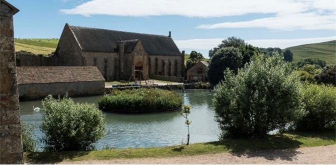
Figure 18: The Tithe Barn, Abbotsbury
8.2.1 National planning policy allows communities to identify those places which are well related to existing settlements and hold a particular local value to be designated as “Local Green Spaces”. This designation provides strong protection against development, that should last well beyond the Neighbourhood Plan period. Many of these spaces may be in public ownership, but the designation can be applied to privately owned land provided that it is clearly valued by the community and of obvious importance for its recreational, landscape, historic, cultural or wildlife value.
8.2.2 The areas identified for designation as Local Green Spaces in the various settlements are listed and described in Table 3, and locations maps are shown in the Appendix.
Table 3
| Local Green Space | Size | Local Value (Landscape, History, Recreation, Wildlife etc) |
|---|---|---|
| Abbey Remains,Abbotsbury | 0.7ha | Historic value dating back to the 13th century. Publicly accessible part of the landscape of the Benedictine Abbey/Church and Tithe Barn. |
| Abbotsbury Allotments, Back Street | 0.2ha | Allotment plots available to rent, with views to St Catherine’s Chapel and also providing wildlife and ecological value. |
| Abbotsbury Play Area and Recreation Ground | 1.1ha | A large, well equipped gated facility, popular with villagers and tourists. Initially a local village initiative, now managed by the Parish Council. |
| Abbotsbury Village Green | 0.1ha | The Village Green is a small triangle of land surrounded by railings, a place where walkers, cyclists and villagers stop and rest to have their lunch at times.It is owned by Ilchester Estates and the Parish Council maintains the grass. |
| Cricket Ground, Abbotsbury | 2.0ha | Owned and managed by Ilchester Estates, but important to local residents for its recreational value, regularly used for cricket matches, dog walking and with local landscape views. |
| St Nicholas Churchyard, Abbotsbury | 0.3ha | Publicly accessible heritage amenity site, historic gravestones, sarcophagi and memorials, also with local wildlife and ecological value. Remains of parts of the old Abbey, and landscape views of Tithe Barn and Abbey ruin. |
| Old Railway Track, Abbotsbury / Portesham | 3.6ha | Heritage amenity on the historic Abbotsbury line, publicly accessible bridleway, used for recreation, part of established cycling routes and walks, but also valuable for wildlife and level access to view the ridgeway and local landscape. |
| Holy Trinity Church grounds, Fleet | 0.4ha | Publicly accessible heritage site and burial ground historic gravestones and memorials with ecological and wildlife value. Historic association with Moonfleet novel. |
| Old Fleet Church grounds Fleet | 0.1ha | Publicly accessible heritage amenity site and listed building, historic gravestones and memorials, associated with the great storm and floods of 1824. |
| The Graveyard Langton Herring | 0.1ha | A special place with seating for quiet reflection and contemplation forming an important green space in the centre of the village opposite the Elm Tree Inn.. It serves as an historical record of some of the long serving inhabitants of the village over the years, is publicly accessible, contains historic gravestones and memorials and also mature trees and grassland of some wildlife value. |
| The Graveyard Langton Herring | 0.1ha | A special place with seating for quiet reflection and contemplation forming an important green space in the centre of the village opposite the Elm Tree Inn.. It serves as an historical record of some of the long serving inhabitants of the village over the years, is publicly accessible, contains historic gravestones and memorials and also mature trees and grassland of some wildlife value. |
| Children’s Play Area Langton Herring | 0.1ha | A publicly accessible grassed amenity area on the southern edge of the village with drystone wall and established trees, and includes a play area that is a valued amenity for local and visiting children. |
| St Peters Churchyard Langton Herring | 0.1ha | Listed heritage amenity in the centre of the Conservation Area which is publicly accessible, with historic gravestones and memorials but also has mature trees and grassland of some wildlife value, including house martins and swallows. |
| The Pound,Langton Herring | 0.0ha | The Pound with its old Stone Walls is of historic interest (it is a Grade II Listed Building). Such structures were used to house stray livestock when they were impounded until claimed by their owners. The term “Pound” is Saxon in origin meaning an enclosure. This amenity was gifted to the Parish, and is publicly accessible, adjacent to the graveyard with important gateway views into the Conservation Area. |
| Village Green,Langton Herring | 0.2ha | The Village Green is used as a recreational area for the village and historically has been used for the Annual Village Fete and for other village events and activities. It provides a welcome green space for villagers to use. It forms an important space on the edge of the village, with mature trees, and is of some wildlife value. It is owned by the Parish Council. |
| Duck Pond,Portesham | 0.1ha | A spring fed pond which feeds an enclosed stream that runs down Front Street. Local landscape feature of historic and wildlife interest, owner by Ilchester Estate. |
| Portesham Playing Field and allotments, West Elworth | 1.8ha | This publicly accessible open area alongside the main road was gifted to the Parish Council in 1938, there is a pavilion, tennis court and area that can be used for football, fetes and open-air events. The adjacent allotments were set up in 2009. |
| St Peters Churchyard,Portesham | 0.2ha | The immediate setting of St Peter’s Church (Grade II Listed), with sarsen stones and historic gravestones and memorials, this green space is publicly accessible, but also has mature trees and adjacent stream and is of some wildlife value. |
| Village Green,Portesham | 0.0ha | A well-used meeting and resting place, particularly in the summer months. It includes an old Telephone Box, painted green, now used as a book exchange, and a map of the village Map on a stone plinth, and a stream running through. |
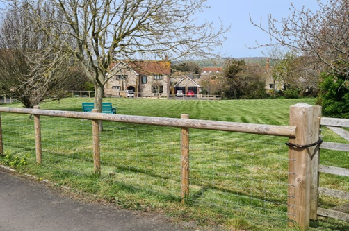
Figure 19: Village Green, Langton Herring
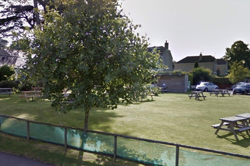
Figure 20: Kings Arms Garden, Portesham
8.2.3 Other areas also frequently mentioned, but which did not meet the “local” requirements for designation of a local green space, included:
CBNP14. Local Green Spaces
Spaces, and, other than in very special circumstances, no inappropriate development will be permitted that would harm their reason for designation.
8.3.1 The Landscape Character Area appraisals for the area include detailed descriptions of the key characteristics of the area. These features can come under threat from both natural and human causes.
8.3.2 The following policy does not seek to prevent development but to ensure that it integrates successfully within the area. In some cases, this may mean that alternative locations for development should be considered, particularly where the degree of harm to features of local landscape character would be substantial and cannot be avoided through sensitive design or mitigation
8.3.3 The potential impact of Ash Dieback is an example of a natural cause, and rather than seeking the replacement with a younger Ash tree, the potential use of suitable native broadleaf species that will be resilient and appropriate to the soil type and weather conditions should be favoured.
CBNP15. Local Landscape Features
Development, including associated hard and soft landscaping, should reinforce the local landscape character and its typical features, as listed below. Development that would result in the removal or degradation of these features without mitigation, will be resisted.
8.4.1 We took the opportunity to ask local residents what they felt were the most iconic or important views within the area. Whilst there was some variation depending on where people lived (for example, those living in Portesham were more likely to identify the views from Portesham Hill and Winters Lane, and those in Langton Herring suggested views from Rodden Ridge and the Coastguard’s Track), there was almost universal endorsement of the following views:
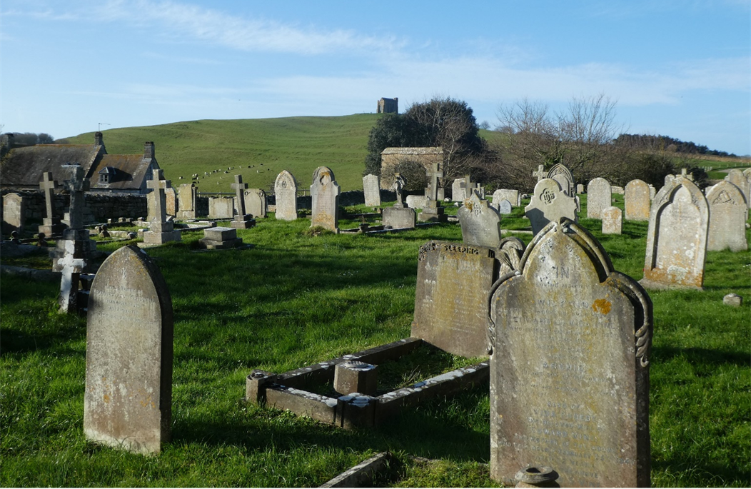
Figure 21: Graveyard at St Nicholas Church Abbotsbury with St Catherine’s Chapel in the background
8.4.2 A full description of these views and the landmarks that can be seen from them is included in the Appendix.
CBNP16. Local Views
The design and layout of development should minimise adverse impacts on the significant views over open countryside and coast identified on the Policies Map and the Appendix, particularly towards local landmarks, and enhance such views where possible.
8.5.1 The ‘dark skies’ character of the countryside should be protected. The majority of those responding to our third household survey considered the lack of light pollution to be ‘very important’, with less than 10% saying it was not important to them. There is no street lighting in Abbotsbury, Fleet or Langton Herring or any of the outlying hamlets
8.5.2 Dark skies are a key characteristic of the area, allowing people to see the stars at night and also helping nocturnal and migrating wildlife such as bats, migrating birds and owls.
8.5.3 Any new development should minimise light pollution that disrupts the natural habitat and human health and would be clearly visible in the wider landscape. This may mean including conditions to ensure lighting is directed downwards, movement / time-sensitive controls are used, and shutters or other means of reducing light spillage are included on Velux and large windows.
CBNP17. Dark Skies and Lighting Schemes
Consideration should be given to minimising light pollution
New external lighting should be avoided unless there is a significant safety issue, and any lighting schemes kept to the minimum necessary for safety and security reasons. Low level footpath lighting may be introduced within the villages and tourism sites if considered necessary for pedestrian safety.
Where lighting schemes are necessary, they should be designed to project downwards and be turned off or dimmed when not actively needed. Light fittings such as solar cat’s-eye lighting, reflective paint and ground-based lighting are preferred; full-height lighting should be avoided.
The design of new buildings in the countryside should take into account the need to minimise light projected from windows and doors, particularly from skylights and large, unshielded expanses of windows.
8.6.1 Whilst we are fortunate to have designated wildlife areas in Chesil Bank, we should not overlook the fact that our villages have become increasingly important for wildlife. Gardens in our villages make up a significant area, and there is much interest these days in wildlife gardening and there are many books and articles as well as nature conservation organisations giving tips on how best to do this.
8.6.2 Climate change is likely to have an increasing influence on our wildlife. For example we are now seeing increasing numbers of Little and Cattle Egrets in our area. These birds are now colonising our countryside and this has only been happening within the last few years. Our south coast location means that we do see migrant birds and insects in our gardens. Over the next decade and thereafter we may well see other colonists.
8.6.3 Roadside verges present an opportunity for the planting of wildflowers. This is an area where an increasing effort could well prove fruitful if continued over several years. Hedgerows, particularly older hedgerows which have a variety of native species, and area of unimproved grassland, may not be specifically designated for conservation but nonetheless provide important habitats and foraging areas. It is important that these wildlife corridors are maintained and enhanced.
8.6.4 New houses can incorporate features to encourage wildlife. For example at the Malthouse Meadow estate extension developed in 2016 or thereabouts each house incorporated a swift brick at the eaves which enables swifts to nest. This sort of initiative needs to be encouraged.
8.6.5 A further consideration for development is the potential impacts on Chesil Beach and the Fleet, and area which is designated as a Special Area of Conservation (SAC), Special Protection Area (SPA) and a Ramsar site in recognition of its exceptional ecological importance.
8.6.6 Natural England have provided evidence which suggests that recreational pressures in the surrounding area is adversely affecting the internationally important habitats and species at the site.
8.6.7 Whilst at the time of drafting this plan there was no agreed long-term strategy in place to address these impacts, such a strategy is being prepared by Dorset Council to ensure that future development will not affect the integrity of this important wildlife area. In the interim, a mitigation strategy has been prepared to address the recreational impacts, so that new development will contribute to the mitigation in a fair, transparent and proportionate manner. This allows an estimate of the developer contribution per dwelling to be calculated to deliver the necessary mitigation for new residential developments. Other types of development which may result in an increase in recreation pressure upon Chesil Beach and the Fleet within 5km of the designation will be considered on a case by case basis in consultation with Natural England.
CBNP18. Local Wildlife and Habitats
Development must protect and, where practicable, enhance biodiversity to secure an overall biodiversity gain, taking into account the existing wildlife interest and habitats in the local area, and how these are under threat (for example through recreational pressures and climate change).
Measures to support the ecological improvement of wildlife habitats, including their climate change resilience, will be supported. This could include:
To ensure resilience and increase visual interest, a variety of tree species should be incorporated into new developments. Tree species should be chosen to reflect the prevailing character of the landscape, soil conditions and the associated mix of native species, but should also have regard to climate change.
Existing hedges, hedgerows and trees should be retained as far as possible. Additional or replacement hedges, hedgerows and trees should be planted to enhance the coverage and connectivity of these habitats. Native species are to be preferred.
Net new residential dwellings within the Neighbourhood Area will make a financial contribution to delivery of the Chesil & Fleet Interim Recreation Mitigation Strategy, in line with Dorset Council guidance.
8.7.1 The statutory designation of Listed Buildings and Scheduled Monuments means that these features are clearly recognised and protected through planning, with great weight given to their preservation. Conservation Areas cover much of Abbotsbury, Portesham and Langton Herring, and these too have statutory protection as areas of special architectural and historic interest. Their important and contributing features are described in detail in the 2007 Long Bredy, Portesham, Chickerell, Abbotsbury & Langton Herring Conservation Area Appraisal.
8.7.2 The following therefore focuses on those heritage features that have been identified as part of the work on this Neighbourhood Plan, but may not be obvious at first glance because they are not designated in their own right. As these are considered to make an important contribution to the unique character and history of our area, they are likely to be considered as non-designated heritage assets in any planning applications affecting them or their settings. This list is not intended to be exhaustive and other non-designated heritage assets could be identified, or more information on their significance discovered, through further research.
Abbotsbury
8.7.3 The village has a significant range of heritage assets reflecting its rich and complex history. It has seen some very prosperous times, including the establishment of the monastery of Saint Peter, with the Swannery and the Abbey Great Tithe Barn obvious symbols of its wealth. It has also seen some very turbulent times: the dissolution and destruction of the Abbey and dispersal of its monastery lands; its association with Royalists at the time of the Civil War in the mid 1600’s; and a great fire in the early 1700’s. Its location on the main road between Bridport and Weymouth (turned into a turnpike) helped reinforce its importance as a local market place. The opening of the railway line from Portesham in 1885 contributed further to its importance, although the iron-ore deposits in Red Lane were not of good enough quality to change the character of the village away from its eclectic mix of cottage industries.
8.7.4 Examples of heritage features that are not always clearly identified through statutory designation include:
8.7.5 Table 4 includes a list of important local buildings listed within the 2007 Conservation Area Appraisal. In addition to these, the four 18th century Coastguard Cottages on the edge of the parish are also of local interest, named after the four apostles, Matthew, Mark, Luke and John.
Fleet
8.7.6 In Fleet, both the Coastguard and Butter Street Cottages in East Fleet have been identified of local historic importance – neither are Listed but are of some interest, both being shown on the 1860s Ordnance Survey maps.
8.7.7 The Coastguard Cottages are a row of white-washed cottages in an elevated location overlooking the Fleet, and their presence on the landscape is important, as well as being an indicator to Fleet’s maritime past.
8.7.8 The origins of the Butter Street Cottages date back hundreds of years, were subject to a fire in the 1700s after which they were rebuilt, and one of the cottages is known to have been destroyed by the great storm of 1824. They have also been linked to the history of smuggling in this area. The majority of the terrace retains its authenticity and is important in the local street scene.
Langton Herring
8.7.9 Traditional dry stone walls are a particularly significant feature of the area around Langton Herring, both within and well beyond the Conservation Area.
There is a WW2 Pill Box at Ivy Farm, on which there is a WW1 Soldier sculpture, that is of local historic interest, and another at Langton Hive Point. There is also a traditional (but now redundant) old telephone box in Rodden Lane (K6) just outside the Conservation Area.
8.7.11 Table 4 includes a list of important local buildings listed within the 2007 Conservation Area Appraisal. Outside of the Conservation Area four more buildings have been identified as of local historic interest:
Figure 22: Coastguard Cottages, Langton Hive
Figure 23: Old Telephone Box, Langton Herring
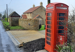
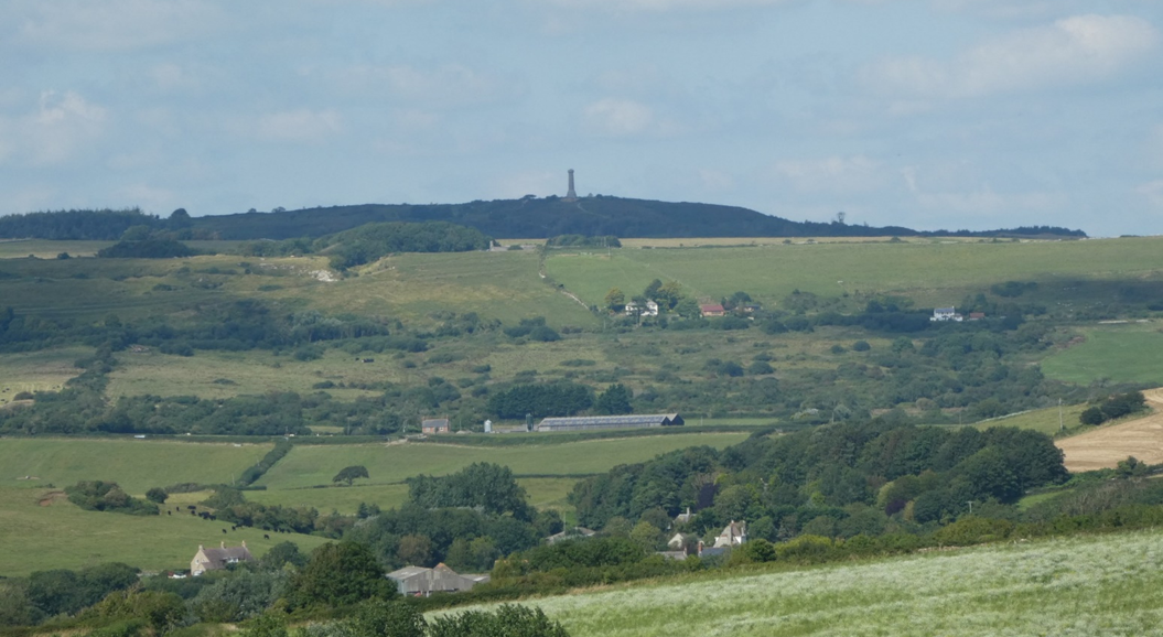
Figure 24: Hardy’s Monument and Ridgeway from Coastguard Road, Langton Herring
Portesham
8.7.12 Whilst the days of milk churns are long gone, there would have been various milk churn stands around the village. The remains of one can be seen on the wall close to Yard House in Winters Lane, Portesham.
8.7.13 The roadside stream in Portesham is a particularly noted local feature, and includes Sarsen Stones in the section alongside the Church boundary wall. Another location where these remnants from the Ice Age can be seen is at the cottage Old Shep in Portesham Hill.
8.7.14 There are several old telephone and letter boxes around the villages. These include the telephone box on the Village Green in Portesham, an old letter box dating from the reign of Queen Victoria in stone wall running westwards from the vicinity of Portesham House, and close to this is a recess at the base of the wall which is thought to have once been the site of a communal village tap.
8.7.15 Table 4 includes a list of important local buildings listed within the 2007 Conservation Area Appraisal.
CBNP19. Local Heritage Assets
Development should make a positive contribution to the conservation of heritage assets in the Neighbourhood Plan area, and pay particular regard to understanding and preserving their settings.
Development should conserve non-designated heritage assets in the Neighbourhood Plan area, including those identified below and in Table 4, in a manner appropriate to their significance. Development affecting such non-designated heritage assets should be accompanied by a Heritage Statement, which assesses their significance and any contribution made by their setting and demonstrates that harmful impacts have been avoided or minimised. These include:
Table 4
| Important Local Buildings | Description |
|---|---|
| Abbotsbury | |
| No. 3 Back St | Large areas of white limestone, slate, symmetrical front, casements, early C19 |
| Former Congregational Church, Back St | Large areas of white limestone, slate, symmetrical front, casements, early C19 Late Victorian, lancet style, simple but impressive |
| No. 1 Rosemary Lane | Slate, mid-C19, former bakery, casements, although it has lost its loading door; |
| Barn on Rosemary Lane | Barn at corner of Rodden Row and Rosemary Lane (east side), double hipped slate roof, single storey, unspoilt |
| No. 2 (East Farm) and attached barn | Slate, casements, porch, regular pattern of openings, looks to be early C19 but could be older in view of its possible origin as a longhouse |
| Swan Inn, Rodden Row | Late C19 Tudor, attractive and a real entry feature from the east |
| Nos. 3 & 5 Rosemary Lane | Thatch, casements, late C18 |
| Nos. 3 & 5 Rodden Row | Semi-detached c.1850 Tudor Revival, gablets and diamond paned iron casements; attractive entry feature |
| Former Surgery, Market St | Single storey, at right angles to the road, loading door in gable, sashes, seen at end of vista from Rodden Row |
| No. 2 Market St | Set-back from the road and attached to the butcher’s shop, mid-C19, slate, central porch |
| Building next to No. 19 Market St | Currently Artisan Flowers and Gardens - slate, single storey, at right angles to road, although much altered |
| Nos. 7-11 Rodden Row | Including the former Reading Room, 1890 Tudor, picturesque, telling contrast to the organic thatched cottages opposite |
| West Farm Barn | Thatch, half-hip at west end, a clever conversion to a house in 1980 |
| Barn at No. 9 West St | C19 slate with hipped end, plain but contains VR wall post box |
| No. 10a West St | Middle Farm Barn - single storey stone and brick trim, slate, C19 |
| Nos. 14 & 15 West St | Slate and render, attached lean-to end unit, fairly plain |
| No. 17 West St | Detached early C19 house, slate, casements and porch, set back behind a garden; attractive and an entry feature from the west |
| Stone building at south side of West Yard | Slate, two storey, converted to office use and meeting room; mid-C19, encloses yard |
| No. 18 West St | Simple symmetrical front, thatched, part of a Listed row but not, apparently, Listed |
| Nos. 38-42 West St | Three blocks of late Victorian semis, Tudor revival with bold gables, porches and tall chimneys; could be viewed as rather tall and insensitive but characterful and an example of late Victorian Estate housing |
| Nos. 1, 2, 4 - 7 Grove Lane | All mid-C19, slate and casements; part of a minor group around the Mill |
| No. 3 Grove Lane | Adjacent to the former Abbotsbury Mill, three storey render and slate, a barn with two added floors, possible C17 origins; part of a group around the Mill |
| Farm buildings north of Tithe Barn | Fronting the village pond, slate, single storey, possibly late-C18; |
| The former Piggery opposite Abbey Dairy | Slate, late-C18/early-C19, one-and-a-half storeys, with pig pens at base |
| Langton Herring | |
| The Elm Tree | Large late Victorian detached public house, render and slate, with smaller stone buildings at either side. |
| Cobblers and Bakehouse Cottage (3 & 6 Shop Lane) | A good group, with No. 3 thatched and of stone rubble, and No. 6 rubble with a slate roof, set back behind a particularly good stone boundary wall. |
| Foxbarrow House, The Square | Striking Victorian house, stone rubble and brick quoins, clay tile roofs. Rubble with brick quoins late C19 houses, with No. 3 a very simple stone and slate cottage with casements and a wooden trellised porch, of group value; |
| Nos. 1-3 Rose’s Lane | Rubble with brick quoins late C19 houses, with No. 3 a very simple stone and slate cottage with casements and a wooden trellised porch, of group value; |
| East and West Cottages, at the Church Hill/Angel Lane junction | A pair of large stone and brick semidetached Mid-Victorian estate cottages (the WS monogram in the twin gables refers to William Sparks, owner until, at least, 1867), and a good stone boundary wall with twin steps at front entrance. |
| Portesham | |
| Kings Arms public house, Front St | Late C19, stone, tile hanging, false half timber and concrete pantiles; a strong entry feature. |
| The former School House, Front St and Church Lane | Mid-C19, Portesham Stone, casements and three distinctive narrow gables facing south, down Front St. |
| The Well House, Half Moon House & 32 Front St | A row of stone C19 cottages (one a former pub), pantiles, slate, details such as canted bays and porches. |
| Nos. 11 and 13 Front St | A pair of mid-Victorian stone and brick cottages, forming an L to the Street. |
| Nos. 23 and 25 Front St | Long thatch and stone row, casements (mostly renewed), in an important position on the corner with Back Street. |
| Methodist Chapel | Twin gabled units of differing dates, rather blunted by pebble dash. |
| No. 4 Front St | A long stone house, with brick window heads, coped stone gables with kneelers, casements, set at an angle to the road. |
| No. 15 Front St | Stone and slate, mid-C19, central porch, large stone lintels to windows and keystones, altered but still of value. |
| Nos. 19 and 21 Front St | No. 19 the former forge, still with existing furnace. |
| Nos. 34a and 36 Front St | Former Post office and neighbouring cottage; stone and slate, coped gable end to St forms an important townscape feature, later red brick, lower shop unit. |
| Nos. 1 and 2 Portesham Hill | C19 Portesham and Abbotsbury Stone, brick and slate; No. 1 has twin gables, casements and wooden porch, No. 2 has casements and bracketed porch. |
| The former Vicarage, Church Lane | A large early C19 block, render and slate, with sashes, difficult to see but of some quality. |
| Nos. 4 and 6 Church Lane | Stone and thatch, eyebrow dormers, half hip to west end, porch; attractively picturesque. |
| Nos. 8-12 Cemetery Lane | Victorian stone and brick group, sashes and big lintels to openings, having group value; |
| No. 1 New Rd | Mid-Victorian brick, sashes and symmetrical front; complements Tudor Cottage. |
| Nos. 16 and 18 Front St | Both stone C19 cottages, grouping well with the church and former school but their uPVC windows reduce their overall interest. |
8.8.1 Following significant flooding in Portesham in January 2019, when nine properties were recorded as flooded and the B3157 Coast Road closed for an extended period, Dorset Council produced a Flood Risk Investigation Report, in order to identify actions to reduce the risk of such an event recurring in the future. The flooding occurred following heavy rainfall, with surface water, silt and gravel from the surrounding hills adding to the localised problems, reducing capacity within the watercourses and blocking up the highway drainage systems.
8.8.2 The report identifies a number of potential actions in relation to reducing flood risk in various parts of the village. Some of these were undertaken as the report was progressed, such as agreement on sand-bag store locations and the installation of a rain gauge to provide real time rainfall data. Further actions included:
8.8.3 It is imperative that any further development is considered in light of the flood risk issues and that the measures identified in the Flood Risk Investigation Report are taken into account in assessing the proposals and ensuring that the risk of flooding is not inadvertently exacerbated by reducing the effectiveness of the measures that have or are to be put into place.
8.8.4 Wessex Water has advised that development proposals must demonstrate satisfactory disposal of surface water. Sustainable Drainage Systems should maximise opportunities for green infrastructure and aim to achieve greenfield run off rates with surface water run-off managed as close as possible to its source. Surface water drainage must not be connected to the foul sewer.
CBNP20. Local Flood Risk in Portesham
A site specific and proportionate Flood Risk Assessment (FRA) is to be submitted in support of all development proposals within the catchment area (as shown on the Policies Map) that would result in increased surface water run-off in Portesham village or impact on infrastructure related to flood prevention measures, as referenced in the 2019 Flood Investigation Report.
Development should not impact on the effective operation of the local flood prevention measures, or increase the risk of flooding within the village.
8.9.1 As part of the preparation of the Neighbourhood Plan, the settlement boundary for Portesham has been reviewed in order to include those developments that have taken place since the Local Plan was adopted, and to exclude areas relating to Local Green Spaces and safeguarded community facilities with associated grounds. The main changes have therefore been:
8.9.2 The proposed allocation at Portesham (CBNP5) will remain outside of the settlement boundary until it is built, following which the boundary can be reviewed to include the extent of the built up area. The revised boundary is show on the Policies Map at the end of this document.
8.9.3 There are no defined settlement boundaries at the other settlements, and there are no proposals for this to change.
CBNP21. Portesham’s Development Boundary
The defined development boundary (DDB) for the village of Portesham, which establishes the extent of the settlement (beyond which is countryside) for planning purposes, is amended to that shown on the Policies Map.
9For more information see: - https://www.dorsetaonb.org.uk/project/south-dorset-ridgeway/
10For more information see: - https://www.dorsetaonb.org.uk/project/tourism_and_visitor_management/
< Previous | ^ Top | Next >