
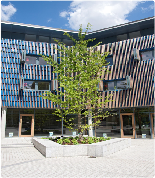
13.1 Promoting good design is fundamental to achieving high-quality, inclusive development and is an important consideration for new buildings and public and private spaces. It goes beyond aesthetic considerations, addressing issues such as connectivity between people and places and the integration of development into the natural, built and historic environment.
13.2 Harlow’s New Town historic environment, based on the design principles set out in the master plan prepared by Sir Frederick Gibberd, established the overall layout and character of the town. The dominant green spaces provide a sense of openness and tranquillity in an otherwise relatively densely populated urban area.
The policies contained within this chapter aim to conserve, protect and enhance the natural and built environment of Harlow, including its green spaces, biodiversity and overall landscape quality. The policies also aim to safeguard the environment from harmful development that may affect, for example, air quality, water quality or flood risk.
13.3 The district currently has ten Conservation Areas, designated for their special architectural or historic interest. The Conservation Area status aims to ensure the character and appearance of these areas is protected. There are also 168 listed buildings in Harlow which are preserved and enhanced through the policies in the Local Plan. The Council has also sought to identify buildings and structures which have not been identified nationally for listing but which contribute towards the district’s distinct character and historic environment.
13.4 This chapter and the policies contained within it will help deliver the Council’s Corporate Priorities, as follows:
13.5 This chapter and the policies contained within it will help deliver the following Local Plan Strategic Objectives:
PL1 Design Principles for Development
A high standard of urban and architectural design is expected for all development. Development must meet the following criteria:
13.6 This policy sets out the design criteria for all development in Harlow, taking into account the requirements of the adopted Harlow Design Guide SPD. It also ensures the design and layout of new development respects Sir Frederick Gibberd’s master plan for the New Town, which ensured the town was planned to be contained within the original landscape and to retain as many natural features as possible.
13.7 This policy is applicable to all development types in the district, whether they are for the provision of buildings and structures or the layout of places and spaces.
13.8 A Planning Statement and Design and Access Statement will be required for major developments and, where appropriate, may be required for other developments. They should demonstrate how the criteria in this policy and relevant national planning policies and guidance have been complied with.
13.9 For further guidance and explanation on the characteristics of high quality urban and architectural design and the methods to create safe and secure environments, applicants should refer to the adopted Harlow Design Guide SPD. This will be used to guide and assess future development across Harlow and will be a material consideration in the determination of planning applications. Applicants should also refer to the services and access chapter of the Essex Design Guide, which provides detailed highways design guidance.
PL2 Amenity Principles for Development
Development which preserves or enhances the level of amenity of existing and future occupants and neighbours in the local area will be supported.
In assessing the acceptability of development on amenity, the following criteria and the cumulative effects will be considered.
13.10 This policy aims to promote and protect high standards of amenity. This is a key element of sustainable growth and continued regeneration, and will assist in meeting the Council’s priority to ensure regeneration takes place in the district.
13.11 This policy also aims to avoid loss of privacy due to the proximity and design of development and will allow sufficient daylight and sunlight to penetrate into and between buildings. It also takes into account the need for development to provide access to amenity space and links with Harlow’s wider Green Infrastructure network.
13.12 For further guidance, applicants should refer to the adopted Harlow Design Guide Supplementary Planning Document (SPD). This is useful when considering the design and layout of new buildings, structures, places and spaces.
PL3 Sustainable Design, Construction and Energy Usage
New development will be expected to deliver high standards of sustainable design and construction and efficient energy usage, taking account of predicted changes to heating and cooling requirements as a result of climate change.
13.13 Local Plans should consider climate change, the effects of which are wide-ranging and can lead to increased drought, extreme weather events (including heatwaves, snow and storms) and surface water flooding. Such impacts could have a major negative impact on the local economy, people, infrastructure and environment.
13.14 This policy seeks to reduce the impact of new development on the environment and this should be read in conjunction with the Strategic policies set out the Local Plan which identify the most sustainable locations for growth and promote the use of sustainable modes of transport.
13.15 Many buildings in Harlow are a legacy of its New Town historic environment and were constructed using the methods and techniques of the time. Some of these buildings are now no longer fit for purpose and need replacement. The Council will ensure that new buildings are constructed in a sustainable manner and accord with current best practice.
13.16 This policy encourages applicants to consider the impact of their development and seek ways to address the effects, above and beyond those measures required by Building Regulations. The preferable amount by which the minimum Building Regulations standards should be exceeded is set out in the Implementation section of this policy, and is based on policy recommendations of the UK Green Building Council20 which were, in part, derived from the now-defunct Code for Sustainable Homes Level 4 standard.
13.17 This policy assists in the delivery of the Local Plan Strategic Vision, which states that, by 2033, new development will mitigate and adapt to the effects of climate change. It also reflects legislation enacted in 2019, which amends the Climate Change Act 2008 so that, in 2050, UK greenhouse gas emissions are at least 100% lower than the 1990 baseline, as opposed to the original Act which required a reduction of at least 80%.
13.18 The Building Regulations set out the minimum requirements for the conservation of fuel and power. Development will be encouraged to exceed the minimum standards required by Building Regulations. Where exceeded, the amount by which the minimum standards should be exceeded is preferably at least 19%. The Council supports development that follows the principles of sustainable construction, and encourages developers to deliver schemes which adopt a fabric-first approach to development and meet the performance and quality set by appropriate standards, such as Passivhaus, Home Quality Mark (HQM) and BREEAM UK New Construction 2018.
13.19 Development proposals must demonstrate how the reduction of energy consumption and carbon dioxide emissions is being considered. The wellbeing of building occupants must also be addressed within the design and layout, by minimising risks of overheating and providing adequate daylight and ventilation. These factors can be addressed by:
13.20 Where a low-carbon district heating scheme is proposed, the Council will expect the scheme to demonstrate that any proposed heating and cooling systems have been selected in line with the following order of preference:
13.21 A Sustainability Statement will be required for major development and may be required for other development, detailing the sustainability credentials of the proposed development. This should cover any use of on-site low carbon/renewable energy technology and how the design, massing, layout, construction of the building and use of Green Infrastructure contributes to reducing carbon dioxide (CO2) emissions. The Sustainability Statement should make clear how measures have been incorporated into the design of the development to ensure they are well integrated.
13.22 Where a Sustainability Statement is submitted, the developer will be required to provide evidence of the implementation of the target total carbon dioxide (CO2) reduction level, by using nationally recognised, independently audited schemes such as Energy Performance Certificates. The evidence should include a clear breakdown of the percentage of carbon savings delivered by building efficiency and the use of any low carbon or renewable energy technologies.
PL4 Green Belt
Development on land designated as Green Belt will be severely restricted to ensure it continues to fulfil the five purposes of the Green Belt. The essential characteristics of Green Belts are their openness and their permanence. Substantial weight will be given to any harm to the Green Belt when assessing planning applications.
Other development is inappropriate development in the Green Belt and will only be permitted in very special circumstances.
Such circumstances only exist if the potential harm to the Green Belt by reason of inappropriateness, and any other harm, is clearly outweighed by other considerations.
Development must not adversely affect the role or function of adjacent land which forms part of a Green Wedge or Green Finger.
13.23 The Green Belt is a national policy designation, the fundamental aim of which is to prevent unrestricted urban sprawl as well as a number of other purposes as set out in national planning policies.
13.24 Since the Ministry of Housing and Local Government Circular in 1955, which recommended that Local Planning Authorities should establish Green Belts, the Green Belt has had great importance attached to it by subsequent Governments.
As such, it is protected from inappropriate development through both national and local planning policies. The construction of new buildings and other development which does not meet the criteria of this policy would, therefore, not be supported, unless very special circumstances exist.
13.25 Harlow lies within the Metropolitan Green Belt which surrounds London and, although only a small amount of designated land lies within the district boundary, its protection is important to preserve the character and setting of the town.
13.26 The Green Belt links with the wide-ranging Green Infrastructure in the district, including the Green Wedges and Green Fingers. The Green Belt in Harlow also provides a physical link with the overall Green Belt and wider countryside in the surrounding Epping Forest and East Hertfordshire districts.
13.27 The purpose of this policy is to continue to protect the Green Belt in Harlow from inappropriate development, as such development would conflict with the Green Belt purposes and be harmful to the Green Belt.
13.28 As detailed in other Local Plan policies, Harlow’s Green Wedges and Green Fingers make a significant and important contribution to the district’s Green Infrastructure, by providing a number of roles and functions for the benefits of visitors, residents and wildlife.
13.29 One of the functions is to provide access to wider countryside and other open spaces and, therefore, most Green Belt land in Harlow adjoins, or is near to, land designated as Green Wedge or Green Finger. To assist with the protection of the Green Wedges and Green Fingers afforded by other Local Plan policies, this policy ensures that any development in the Green Belt does not adversely affect the roles and functions of adjoining or nearby Green Wedge or Green Finger land.
13.30 The purposes of the Green Belt are set out in national planning policies, as follows:
13.31 Whilst these purposes are not weighted in terms of significance, national planning policies recognise that the fundamental aim of the Green Belt is to provide permanently open land to prevent unrestricted urban sprawl.
13.32 Small-scale development can include householder applications, sports-related development, recreation, cemeteries and community uses.
13.33 For development relating to renewable energy, very special circumstances may include the wider environmental benefits associated with increased production of energy from renewable sources.
PL5 Green Wedges and Green Fingers
Development on land designated as Green Wedge or Green Finger must meet one or more of the following criteria:
13.34 Green Wedges and Fingers are fundamental to the character of Harlow.
Sir Frederick Gibberd’s master plan sought to preserve the form of the original landscape and the natural features that gave the district its distinctive character; consequently the green areas were generally kept free of buildings and as natural as possible.
13.35 The purpose of this policy is to continue to protect the Green Wedges and Green Fingers from encroachment and visual intrusion, while recognising there may be opportunities for some development within them, where the development benefits the wider community or improves the biodiversity and/or landscaping.
13.36 While the roles and functions of the Green Wedges and Green Fingers differ, these two types of open space are complementary and of equal importance; the main difference being their scale. Details of their roles and functions are set out in
Policy WE2.
13.37 Small-scale development can include householder applications, school or sports related development, recreation and community uses, waterway uses and facilities/services related to an existing use.
13.38 Applications for local transport infrastructure must demonstrate their requirement for a Green Wedge or Green Finger location. This would also include the provision of essential infrastructure identified in the Local Plan, or where the applicant can demonstrate that there is no other location within the district that could accommodate the proposed infrastructure.
PL6 Other Open Spaces
Development on Other Open Spaces must meet the following criteria:
13.39 Along with the preservation of Green Wedges and Green Fingers, the preservation of Other Open Spaces is fundamental to ensuring the original design of Sir Frederick Gibberd’s master plan for Harlow is respected, which planned the district to be interspersed with many open spaces to offset the provision of small private gardens.
13.40 Other Open Spaces can be of public value where they have a role or function which makes a positive contribution to the character of the area. Such spaces often provide opportunities for recreational uses and also provide landscaping and visual buffers.
13.41 The aim of this policy is to protect those Other Open Spaces which make a positive contribution, through their specific role or function, to the overall character and design of Harlow. For example, some Other Open Spaces offer amenity and informal recreational opportunities, and therefore contribute to the health and wellbeing of local residents by providing nearby spaces for outdoor and physical activity.
13.42 Other Open Spaces are defined as open spaces, both private and publically owned, which are not allocated as Green Belt, Green Wedge or Green Finger in the Local Plan. Other Open Spaces vary in nature and quality and can include:
13.43 An application for infill development, which would block the potential for comprehensive development, would not be supported. For example, where there are open spaces adjacent to each other, the development of one open space in isolation could prevent the opportunity to develop the open spaces as a whole.
PL7 Trees and Hedgerows
13.44 This policy aims to protect the trees and hedgerows in Harlow, which form an important part of the Green Infrastructure and landscaping in the district, fundamental to Harlow’s original design character. Trees and hedgerows provide wildlife habitats and natural visual and noise buffers, and assist in mitigating the effects of climate change, for example by providing shading and reducing the temperature of the local micro-climate.
13.45 Whilst over 300 trees in Harlow are already protected by Tree Preservation Orders, and many trees and hedgerows are found within protected areas such as Green Wedges, there are a number of significant trees and hedgerows found in Other Open Spaces and residential areas.
13.46 Many of the trees and hedgerows in the district are over 70 years old and, therefore, pre-date the development of the New Town, as Sir Frederick Gibberd’s master plan aimed to respect the existing natural landscape assets. There are over 250 veteran trees in Harlow and many of the existing trees are likely to become veteran and ancient specimens in the future. A number of hedges have historic importance, especially where they are found along original highways and old parish and farm boundaries. Hedgerows are also listed as being of principal importance in Section 41 of the Natural Environment and Rural Communities (NERC) Act (2006) (as amended).
13.47 When assessing the impacts of development on trees and/or hedges and measures to mitigate any impacts, an Arboricultural Impact Assessment, Arboricultural Method Statement and Biodiversity Assessment may need to be submitted to the Council.
13.48 When assessing the value and condition of existing trees and/or hedgerows, a survey may need to be submitted to the Council. The value that trees and/or hedges offer includes historic, cultural, ecological, economic and amenity value. The condition includes the health and structure of the trees and/or hedges.
13.49 Existing specific protections that trees and/or hedges may have include Tree Preservation Orders and other protections offered by Conservation Areas or the Hedgerow Regulations (1997).
13.50 The enhancement of the below-ground environment could be achieved through measures such as cellular confinement systems, Sustainable Drainage Systems (SuDS), soil mycorrhizal inoculations and porous surfacing.
13.51 The Council may also require a Management Plan to be submitted, which demonstrates how the future maintenance of new trees and hedges would be managed, in order to protect their long-term quality.
13.52 Where appropriate, the Council will consult with specialists to obtain advice on tree and hedgerow matters.
PL8 Green Infrastructure and Landscaping
Green Infrastructure and landscaping must be protected and enhanced as part of development.
Development must meet the following criteria:
13.53 Green Infrastructure is an important element of Harlow’s distinctive character, which Sir Frederick Gibberd developed within his original master plan to respect the existing natural environment and integrate it within the New Town to provide functional areas of green and open space which could be used and enjoyed by wildlife, visitors and residents.
13.54 The requirement of this policy is for new Green Infrastructure and landscaping to be sympathetically integrated into development to ensure the continuation of Sir Frederick Gibberd’s master plan and, therefore, contribute to enhancing and conserving the historic environment.
13.55 There are opportunities for development to create, protect and enhance existing Green Infrastructure and landscaping, to improve the natural environment, and create additional wildlife habitats and reinforce existing green links. This policy aims to protect existing Green Infrastructure in Harlow and ensure that new Green Infrastructure is well-planned and effectively managed in the future.
13.56 Green Infrastructure is multi-functional natural and man-made urban and rural green space, including parks, playing fields, woodlands, allotments and wildlife corridors, rivers, canals and other bodies of water. At a smaller-scale, it also includes measures to assist climate change mitigation, such as green roofs, green walls, rain gardens and ponds.
13.57 The adopted Harlow Design Guide Supplementary Planning Document (SPD) should be consulted for guidance on appropriate landscaping for development.
13.58 The Council may require a Management Plan to be submitted, which demonstrates how the future maintenance of the Green Infrastructure and landscaping would be managed, in order to protect its quality and functionality in the long-term, including, where appropriate, the protection and recovery of priority habitats and species.
PL9 Biodiversity and Geodiversity Assets
Development should contribute to and enhance biodiversity or geodiversity assets, to ensure a net gain in biodiversity.
The potential harm caused by development on these assets and their surroundings will be assessed based on the harm caused by the development. The greater the significance of the asset, the greater the weight that is given to the asset’s protection. Distinction will be made between the hierarchy of international, national and locally designated and non-designated sites so that the level of protection afforded is consistent with their status.
Development must meet the following criteria:
13.59 As a planned New Town, Harlow benefits from networks of open spaces which contribute to the biodiversity of the district, conserve habitats of local significance and provide opportunities for people to enjoy nature.
13.60 Helping to protect and enhance biodiversity is one of the fundamental aims of national planning policies and guidance, to achieve a net gain in biodiversity.
This policy aims to ensure the continued protection and enhancement of biodiversity and geodiversity assets in Harlow.
13.61 Designated biodiversity and geodiversity assets are allocated on the Policies Map. In Harlow, the highest order asset type is Sites of Special Scientific Interest, followed by locally designated sites (Local Wildlife Sites and Local Nature Reserves), ancient woodland, and aged or veteran trees found outside ancient woodland. There are, as yet, no designated geodiversity assets in Harlow.
13.62 The Council will seek to protect and enhance non-designated assets of biodiversity and geodiversity importance, identified in Evidence Base studies, to extend the geodiversity and the network of biodiversity and open spaces across the district.
13.63 If the richness of biodiversity evident at a non-designated asset increases sufficiently, it may become formally declared as a designated asset, such as a Local Wildlife Site or Local Nature Reserve. Information of any such declarations would be made available on the Council's website.
13.64 The Council may require assessments of biodiversity and geodiversity assets to be submitted, which identify the impacts of development and any necessary mitigation and/or compensatory measures, and consider the presence of invasive, non-native species and their management, including biosecurity measures and the eradication of invasive species. To ensure compliance with national biodiversity policy and legislation, applicants are advised to refer to the Essex Biodiversity Validation Checklist (or its successor), available on the Essex County Council website.
13.65 Biodiversity assets within development will require appropriate protection, enhancement and/or mitigation measures for the biodiversity assets.
Appropriate measures could include management agreements, planning conditions and/or obligations.
PL10 Pollution and Contamination
All development proposals must minimise and, where possible, reduce all forms of pollution and contamination. For air quality, the acceptability or otherwise of a proposal will be determined with reference to the relevant limit values or National Air Quality Objectives as they relate to human health or biodiversity.
In assessing the acceptability of development, the following criteria and the cumulative effects will be considered:
The location and type of development and its relationship to the surrounding built and natural environment will be taken into consideration when assessing the acceptability of the impacts.
Where it can be demonstrated that pollution and/or contamination is unavoidable, appropriate measures must mitigate the negative effects of the development.
Where adequate mitigation cannot be provided, development will not normally be permitted.
13.66 It is important that any potential conflicts arising from pollution or contamination are assessed in order to protect the built and natural environment, including safeguarding local amenity and the health and wellbeing of local residents.
13.67 Sir Frederick Gibberd’s master plan for Harlow separated residential uses from industrial uses, which were concentrated within a number of employment areas. Consequently the Council will consider whether new uses are compatible with existing uses within an area in order to minimise the risk of pollution and/or contamination.
13.68 Development in Harlow has historically been built at a high density. Where new development could have an impact on existing development due to potential pollution or contamination, the Council will give careful consideration to impacts on the amenities of the surrounding area.
13.69 In terms of air quality in Harlow, air quality monitoring has been undertaken and there are no areas where the air quality has led to the designation of Air Quality Management Areas. This policy aims to maintain this position in the district.
13.70 The Council will require a Preliminary Risk Assessment of land considered to be contaminated to be undertaken and submitted, which identify any existing pollution and/or contamination, and the impacts of the development and any necessary mitigation and/or compensatory measures.
13.71 For example, an assessment of light may need to take into consideration the detail of the angles of lights, lighting design, light spillage, luminance levels, height of light columns and proposed hours of use. Mitigation measures could include the use of baffles and appropriate building design to minimise impacts. The Council may also impose conditions to control and manage pollution and contamination levels. Further investigations, assessments, long-term maintenance regimes and validation reports may also be required if land is contaminated.
13.72 Where contaminated sites have the potential to mobilise contaminants, or where there is a high-risk development proposal within a vulnerable ground water area, mitigation measures must ensure the risks to groundwater are minimised.
PL11 Water Quality, Water Management, Flooding and Sustainable Drainage Systems
Flooding
All development proposals will be considered against national policies (including application of the sequential test and, if necessary, the exception test) and against the European Water Framework Directive (or any subsequent equivalent).
Development must follow a risk-based and sequential approach, so that it is located in the lowest flood risk area. If this cannot be achieved, the exception test must be applied and the appropriate mitigation measures must be undertaken.
Development must meet the following criteria:
Development within identified Critical Drainage Areas may, depending on the outcomes of a specific flood risk assessment, be required to contribute to funding for the delivery of appropriate flood alleviation schemes.
Where SuDS are required, the drainage scheme must meet the following criteria:
New development adjacent to water courses should seek to include restoration and deculverting. The culverting of water courses should be avoided. Where the applicant can demonstrate that deculverting or other river enhancements are unfeasible, a financial contribution will be sought to restore another section of the same watercourse.
New development adjacent to designated main rivers must provide and maintain an undeveloped buffer zone, of at least eight metres, to the watercourse. Such development must also include a long-term scheme to protect and enhance the conservation value of the watercourse.
13.73 Sir Frederick Gibberd’s master plan planned Harlow within the landscape, keeping the valleys free from development and building on the higher ground, therefore helping to prevent major flooding.
13.74 This policy will ensure that the quality of drinking water is maintained, avoiding harmful polluting developments which affect its quality. The requirement for development adjacent to designated main rivers to provide an undeveloped buffer zone will ensure the enhancement and protection of local biodiversity, provide space for flood water and provide access for maintenance. The necessity for a scheme to protect and enhance the conservation value of a watercourse, and to aim to improve water quality, is required by the Water Framework Directive and/or the Thames River Basin Management Plan.
13.75 This policy also sets out targets for water management. The Environment Agency’s report, Water Stressed areas – final classification (2013), states there is serious water stress for many parts of the east of England including Harlow, both now and in the future. Serious water stress is the result of a large population with high water demands but with limited water availability.
13.76 It is therefore appropriate to set a water use target of 110 litres per head per day for residential development, which is approximately 50 litres less than the current Harlow average and 15 litres less than the standard Building Regulations requirements. Developing a house with this target could save 79kg of CO2 and 15m3 of water per year per house.
13.77 This policy also aims to prevent the risk of flooding in the district. Flood risk is a combination of the probability and the potential consequences of flooding from all sources – including from rivers and the sea, directly from rainfall on the ground surface and rising groundwater, overwhelmed sewers and drainage systems, and from reservoirs, canals and lakes and other artificial sources.
13.78 Surface water flooding is also an important issue and this policy aims to prevent this through the use of SuDS in new developments. SuDS are designed to control surface water run off close to where it falls and mimic natural drainage as closely as possible. They provide opportunities to reduce the causes and impacts of flooding, remove pollutants from urban run-off at source through natural filtration and combine water management with green space to provide benefits for amenity, recreation and wildlife.
13.79 A number of Critical Drainage Areas have been identified based on the results of the Harlow Surface Water Management Plan. The risk of surface water flooding in these areas needs to be reduced and drainage improved.
13.80 The requirement that any proposed development in Flood Zone 3b must be ‘water compatible’ or ‘essential’ development is in accordance with national guidance and the Strategic Flood Risk Assessment.
13.81 Applications for developments involving high risk activities in Special Protection Zones (SPZs) or aquifers must be accompanied by a risk assessment to determine whether the development would pose a threat to water quality and what mitigation measures or management strategy is being put in place to deal with the risk. In terms of water quality, high risk activities include those involving hazardous substances such as pesticides, oils, petrol and diesel.
13.82 Meeting the water management target can be achieved by ensuring development makes use of efficient appliances such as efficient showerheads, spray taps and low-flush toilets, recycling grey water, and using natural filtration measures and facilities.
13.83 The Water Cycle Study emphasises the importance of non-residential development meeting a level of BREEAM compliance regarding water efficiency. The meeting of BREEAM 'Excellent' rating for water efficiency in non-residential buildings is, therefore, supported.
13.84 Harlow contains a significant number of older buildings which will not be as efficient with water use as modern buildings. Measures to retrofit such buildings to increase their energy efficiency are, therefore, encouraged.
13.85 National policies and guidance defines flood zones and the types of development which are considered appropriate and inappropriate. It also provides information on the sequential test for Flood Risk Zones and how to then apply an exception test.
13.86 Applicants may be required to submit a site-specific Flood Risk Assessment to the Council in order to assess the flood risk to and from the development site. Applicants should refer to the latest guidance from the Environment Agency and the Department for Environment, Food and Rural Affairs for the most up to date information on Flood Risk Assessment.
13.87 To demonstrate that a development will be protected over its lifetime, information must be submitted in the assessment of how users will access the development, how flood risk will be reduced, how any overland flood and flow routes are preserved and what flood defence infrastructure will be in place. Flood warning and evacuation procedures may also need to be put in place.
13.88 The risk of flooding can be avoided and reduced by:
13.89 In terms of surface water flooding, the general aim should be to discharge surface run off as high up the following hierarchy of drainage options as reasonably practicable:
13.90 It is expected that space is created for flooding to occur by restoring the functional floodplain, wherever possible, through a reduction of development footprint within Flood Zone 3b.
13.91 Water-compatible development and essential development are referred to in this policy. As defined by national guidance, water-compatible development includes flood control infrastructure, sewage transmission and pumping stations, navigation facilities and water-based recreation (excluding sleeping accommodation). Essential development includes essential transport infrastructure which has to cross the area at risk, wind turbines and essential utility infrastructure, such as power stations, which requires the location for operational reasons.
13.92 Methods of attenuation include attenuation ponds, filter strips and swales.
13.93 When considering whether a drainage system is appropriate for a development, the Council will consider the technical standards produced by DEFRA, design and constructions costs and advice from the relevant flood risk management bodies. When planning SuDS, developers need to ensure their design takes account of the construction, operation and maintenance requirements of both surface and subsurface components, allowing for any personnel, vehicle or machinery access required to undertake this work.
13.94 The Council will consult the statutory bodies on drainage systems where it is applicable to do so.
13.95 Developers should refer to the Council’s Strategic Flood Risk Assessment for further information and advice. Reference should also be made to the Harlow Surface Water Management Plan and the Essex SuDS Design Guide. The Essex SuDS Design Guide provides guidance on local standards for water quality and water quantity from developments and guidance on SuDS design. Developers should also consider national guidance on natural flood management techniques and working with natural processes, which seek to protect, restore and emulate the natural functions of catchments, floodplains and rivers.
13.96 All proposed development must engage the actions and measures as specified by the Thames River Basin Management Plan, where feasibly possible and reasonable. Developers should liaise with the Environment Agency on such actions and measures.
13.97 Appropriate arrangements for foul water must be identified where the local public sewer network does not have adequate capacity. Developers must demonstrate how any upgrades of the existing sewerage network, to alleviate capacity issues, would be delivered in advance of the development. New development must connect to mains foul drainage, but a foul drainage assessment may be required if non-mains foul drainage is proposed.
PL12 Heritage Assets and their Settings
Development that affects a heritage asset or its setting will be considered against national policies. Based on the effects caused by the development on the significance of the heritage asset, the greater the significance of the asset, the greater the weight that is given to the asset’s conservation. The level of impact caused to the significance of the heritage asset will be assessed on the following criteria:
Where development affects a heritage asset or its setting, a Heritage Statement must be submitted to conserve and enhance the asset and its setting.
Where proposals affect or are adjacent to sites of known or suspected archaeological interest a desk-based or field evaluation should be submitted.
Where the heritage asset is at risk and the development would conflict with other policies of the Local Plan, it must be demonstrated that the development represents the asset’s optimum viable use and is necessary to secure the future conservation of the asset and that any negative impacts are outweighed.
13.98 The purpose of this policy is to protect the significance of heritage assets. This also includes any buildings or structures within the curtilage or wider setting of a heritage asset and which contribute towards its significance.
13.99 National policies highlight the importance of these assets as irreplaceable resources. They are part of the historic environment which contributes strongly to the character and distinctiveness of places; bringing wider social, cultural, economic and environmental benefits to local communities and providing enjoyment to the wider public.
13.100 Harlow contains several Scheduled Monuments including a number of historic moats and burial mounds, earthwork remains of medieval villages, a barn, a chapel and remnants of Roman villas and temples. The district has a rich historical past and contains various archaeological remains, which were preserved throughout the development of the New Town.
13.101 Harlow contains one Historic Park and Garden recorded on the national statutory register of historic parks and gardens, the Gibberd Garden. This is to the east of the district and was previously owned, developed and maintained by Sir Frederick Gibberd. The gardens and the house are located within the Stort Valley to the east of Harlow.
13.102 Development which would conflict with other policies of the Local Plan may be considered appropriate where the ongoing conservation of a listed building or locally listed building is at risk, and in this instance it must be shown that this is the only way to conserve the asset by providing an income for the upkeep and repair. Such development will not be justified on the basis that it will generate increased revenue or property values.
13.103 Designated heritage assets include listed buildings, curtilages of listed buildings, conservation areas, Scheduled Monuments and Registered Parks and Gardens. Such assets, except Conservation Areas, are administered by Historic England.
Non-designated assets include Locally Listed Buildings, monuments, sites, places, areas or landscapes which a Local Authority deems to have special historic or architectural interest.
13.104 National policies and guidance outline the rationale behind the designation of heritage assets, with special architectural or historic interest being at the core of any designation decision. Proposals for enabling development would be assessed having regard to Historic England’s latest guidance on enabling development. National policies also set out the hierarchy of significance of historic assets.
13.105 The Council will consult with Historic England on development which would affect Grade II* or Grade I listed buildings or their settings, as well as other developments as indicated in national guidance. Other bodies, such as Essex County Council, may also be consulted to obtain specialist advice on heritage assets.
Listed and Locally Listed Buildings
13.106 Harlow has over 150 listed buildings. The Department for Culture, Media and Sport designates listed buildings and Scheduled Monuments. Locally listed buildings have also been identified as they contribute towards the district’s historic environment.
13.107 A national register of listed buildings is maintained by Historic England and available online. The Council maintains a register of locally listed buildings which is also available online. This may alter during the Local Plan period. Any updates to the list, including the removal or addition of buildings and structures, will be published on the Council’s website.
13.108 Where planning permission is required for alterations or additions to listed and locally listed buildings, a Heritage Statement should be submitted assessing how the proposal complements or mitigates any harm towards a building’s historic character and/or architectural interest. A Heritage Statement must also be submitted for Listed Building Consent applications. For proposals which affect a Grade I or II* listed building or structure, the Council will also seek advice from Historic England.
13.109 As well as assessing the effect that development would have on the physical features of a listed or locally listed building/structure, this policy will also assess the impact the proposal will have on the asset’s setting. The term ‘setting’ refers to the surroundings in which a building or structure is located, and may therefore be more extensive than its curtilage. Setting is often expressed by reference to visual considerations, although the way in which a building or structure is experienced in its setting is also influenced by other environmental factors such as noise, dust and vibration from other land uses, and by understanding the historic relationship between places.
13.110 When assessing applications for development which may affect the setting of a listed or locally listed building or structure, consideration will be given to the implications of cumulative change which may materially impact on the significance of the building or structure, its economic viability and its conservation.
Conservation Areas
13.111 The district’s ten Conservation Areas are allocated on the Policies Map and have been designated because of their special interest. This policy ensures that development in Conservation Areas respects the character, appearance and features which justify the special designation of that area. This is also applicable to development which affects the setting of a Conservation Area. The Council will encourage redevelopment and refurbishment that would enhance a Conservation Area and its setting.
13.112 The Council has completed character appraisals and management plans for several of the district’s Conservation Areas. This is part of an ongoing monitoring and review process. Supporting statements accompanying an application should set out how development proposals have considered these character appraisals and how they have accorded with management plans. The appraisals, plans and confirmed Article 4 Directions are available on the Council’s website.
Archaeology
13.113 A desk-based assessment, or where appropriate an archaeological field evaluation, must be submitted where proposals are on or adjacent to sites of known archaeological interest or sites believed to possess potential archaeological significance. Following the assessment, further investigation may be required.
13.114 Where the loss of the whole or a part of a heritage asset’s archaeological significance is justified, planning conditions will be attached to a planning permission to ensure that an adequate record is made of the significance of the heritage asset before it is lost.
PL13 Advertisements
The acceptability of proposals for advertisements will be assessed on the following criteria:
13.115 Advertisements can contribute significantly to the character of an area and, without proper management, can create clutter and an unattractive street scene in the built environment. However, advertising is an important way of promoting businesses and contributing to the vitality of the area. The intention of this policy is, therefore, to manage advertisements in a consistent manner, taking into consideration any impact on the amenity value of the area and the safety of the public.
13.116 This policy will apply to proposals which require the express consent of the Council. The Town and Country Planning (Control of Advertisements) Regulations 2007 sets out where express consent is required.
20 UK Green Building Council, 2018. Driving sustainability in new homes: a resource for local authorities.
< Previous | ^ Top | Next >