< Previous | Next >
11. POLICY MAPS
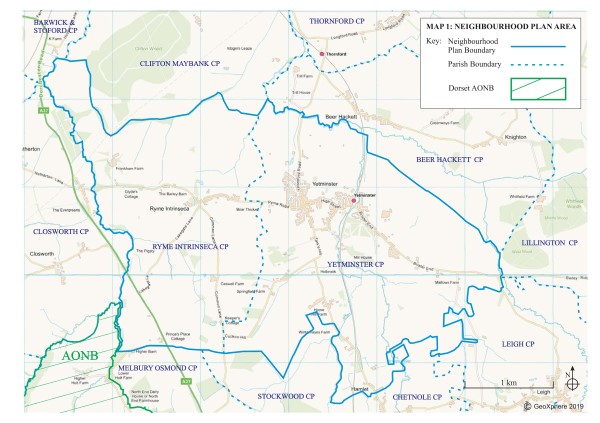
- Neighbourhood Plan Area
- Conservation Area and Listed Buildings
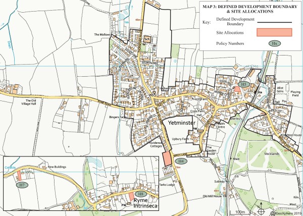
- Defined Development Boundary and Site Allocations
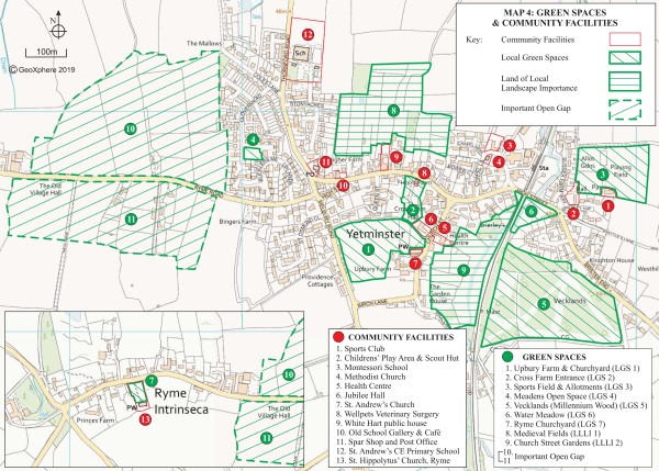
- Green Spaces and Community Facilities
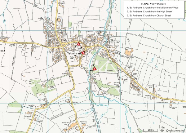
- Viewpoints
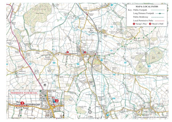
- Local Paths
- Areas of Ecological Value
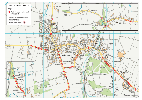
- Road Safety
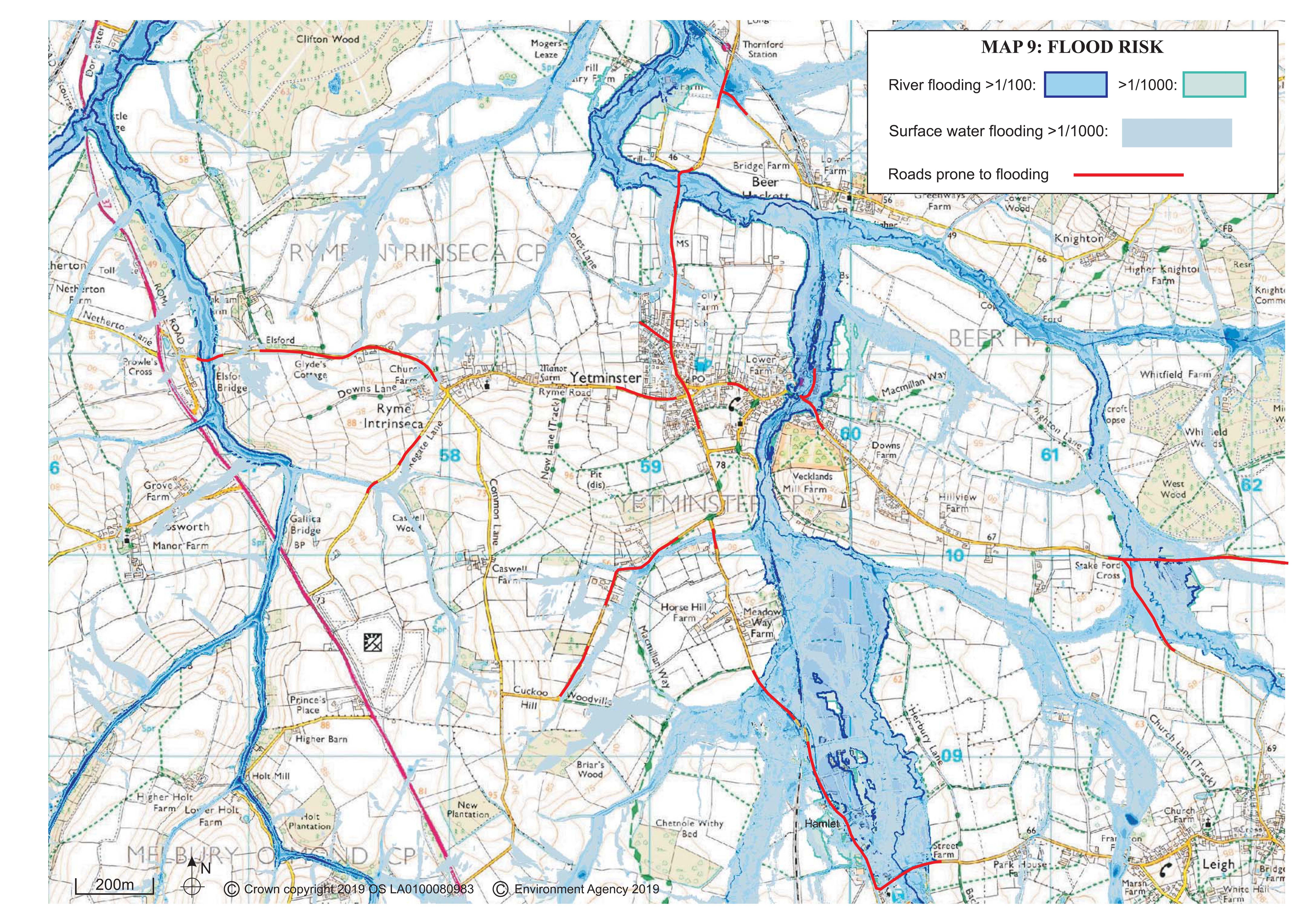
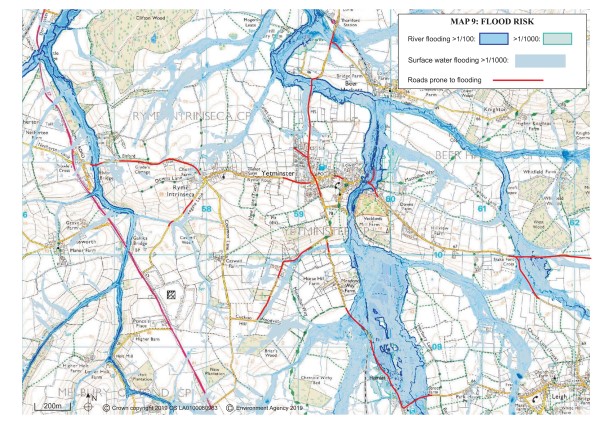
- Flood Risk


< Previous | ^ Top | Next >