
2018 to 2033
Upper Marshwood Vale Parish Council
Final Version, December 2019
1.1 The Upper Marshwood Vale stretches 9km west to east, from Marshwood close to the Devon county boundary to Stoke Abbott near the small town of Beaminster in Dorset.
1.2 The landscape is incredibly scenic. Most of the area lies within the nationally important Dorset Area of Outstanding National Beauty, and is described as a rolling lowland pastoral vale, enclosed by greensand ridges with associated hillforts.
‘a soft and enfolding landscape of rounded hills, hidden hamlets with cider orchards, ancient tiny lanes banked in spring with wild flowers – daffodils, primroses and bluebells, farms patterned with ancient field systems, woods and rows of hedgerow oaks. Buzzards, falcons and ravens dominate the air and badgers, deer and foxes criss-cross the hills below.’ – description from the 2010 Parish Plan
1.3 The area is also sparsely populated, with no major employment sites. As a result it is tranquil and enjoys some of the darkest night skies in Dorset.
1.4 Like many rural areas in the South West, the general population is ageing with fewer young adults and families in the parish. This has obvious implications for local services. Many people are self‐employed and work from home, helped by the fact that much of the area has benefited from superfast broadband, following a concerted campaign by local businesses and residents (although there are still some areas where infrastructure upgrades are needed).
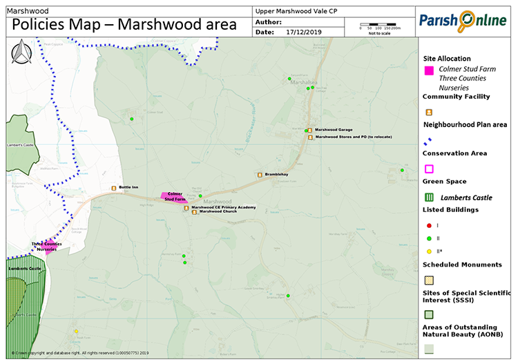
1.5 In early 2016 the first residents moved into the eight new affordable homes at Bramblehay, Marshwood. These were built as a result of local residents forming a Community Land Trust in 2012 – an example of how local action can make a real difference in our community.
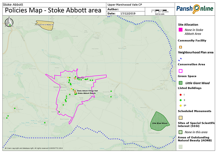
1.6 There are local services and facilities, including Marshwood CE Primary School, various public houses, churches and village halls (the latter in Stoke Abbott and Bettiscombe). These are all valued by the local community. The Marshwood Stores and Post Office closed in 2018, giving a timely reminder of how reliant we are on local people to run such local services.
Upper - implies the heights – and thus the depths – of our countryside, our geography, our geology of soft stone and hard rocks.
Marsh – this too tells us everything; over eons, the same farmers have worked their magic on the land with a welter of watercourses – many still hidden underground – to drain, tidy up and civilise our place and hence community into the all but hidden Upper Marshwood Vale we know and love today.
Wood – it is forest, trees and bushes that define and detail our villages, fields, byways and hamlets, once prolific and impassable now tamed by generations of farmers.
Vale – that is what defines us so well – a series of linked valleys topped by real hills with a rich history just a scratch beneath the surface.
1.8 The adopted 2015 Local Plan (which covers the whole of West Dorset, Weymouth and Portland) includes many general policies that seek to protect and enhance the area’s natural environment, its built heritage, and to achieve high quality and sustainability in design. Its policies focus new development towards the larger towns and villages. The largest settlements in our area - Marshwood and Stoke Abbott - fall under the minimum population threshold to feature in the Local Plan. As such, there is little expectation that this area should have much development, and the Local Plan does not allocate any land for development or define settlement boundaries within which development is encouraged. However it does allow Neighbourhood Plans to allocate sites for future development, or to define their own development boundaries, to help deliver some growth to meet local needs.
So what does this Neighbourhood Plan look to achieve in the period from 2018 to 2033?
1.9 In terms of housing – the vision is to allow some housing growth at a rate that reflects local needs and the rural nature of the area. Where possible, this should provide for younger people with children, as well as older people needing to downsize.
1.10 In terms of the local economy – the vision is to support home working, rural workshops and small-scale tourism to strengthen the local economy and provide further job opportunities.
1.11 In terms of community facilities – the vision is to support a range of community facilities that can be sustained given the sparsity of the local population. The initial focus for this will be on supporting a new local shop in Marshwood. Practical solutions that could improve the local school and church (in terms of better parking and outdoor play facilities) are also considered.
1.12In terms of environment and design – the vision is to protect the landscape and features which contribute to the area’s unique character, the enjoyment of the area in terms of countryside access and views, the general tranquillity of the area and its dark skies. As this is broadly covered by the Local Plan the focus here is on highlighting more local features that perhaps would otherwise be overlooked in planning decisions.