
1.1 A Neighbourhood Plan is a community-led framework for guiding the future development and growth of an area. The process, introduced by the Localism Act 2011, allows local communities to create policies which will shape the places where they live and work; allowing residents to influence the future of their parish, focusing on the issues that are important to them. It will be subject to examination by an Independent Examiner and a referendum vote by the residents of the parish. Once approved by residents, the Neighbourhood Plan will form part of the Local Development Plan: a statutory status giving it far more weight than previous local planning documents such as the Parish Plan.
1.2 The Parish Council decided to start work on a Neighbourhood Plan in 2017, with the area (based on the parish boundary) formally approved in the September of that year. The Stinsford Neighbourhood Plan Steering Group of volunteer residents was established in March 2018, reporting to the Parish Council. At a number of public events, and through a process of Residents and Business Questionnaires, consultations with Dorset Council and discussions with the MP for West Dorset, a Shared Vision for the parish was established, from which the community’s values, hopes and needs have been translated into a list of Objectives to support the Vision and, in turn, into Policies to carry those Objectives through.
 1.3 During 2018 the Local Plan Review ‘preferred options’ were published, and this included Policy DOR15, proposing a significant expansion north of Dorchester, in Stinsford parish. This was for 3,500 homes as well as employment land, a local centre and a range of community facilities such as schools and healthcare. There was considerable opposition to these proposals. STAND (Save The Area North of Dorchester) emerged as the vehicle for opposition to that development. Whilst acknowledging the strong feelings about this proposal, whether it goes ahead or not is a strategic decision which cannot be decided through a Neighbourhood Plan.
1.4 At the Stinsford Michaelmas Fayre in 2018, we asked the people of the parish and visitors to tell us about the words they associate with Stinsford. The word clouds show the feedback by scale, and told us much about the ‘Sense of Place’.

1.5 In 2019, two surveys were conducted: one for residents and one for businesses. Over half of the resident population (in terms of households) responded (56% of the 126 occupied properties). The survey highlighted the main concerns as traffic, the threat of over-development, and the lack of facilities. Just under half (20 of the 52 businesses that were known to be based in the parish) responded to the business survey. This survey showed a wide range of business size and activities, and that there were very few who considered that they would be relocating, but some were planning to enlarge their premises. All of the data, thoughts and opinions from these consultations has helped to inform the production of this Neighbourhood Plan. More details about these consultations are available in the Consultation Statement.
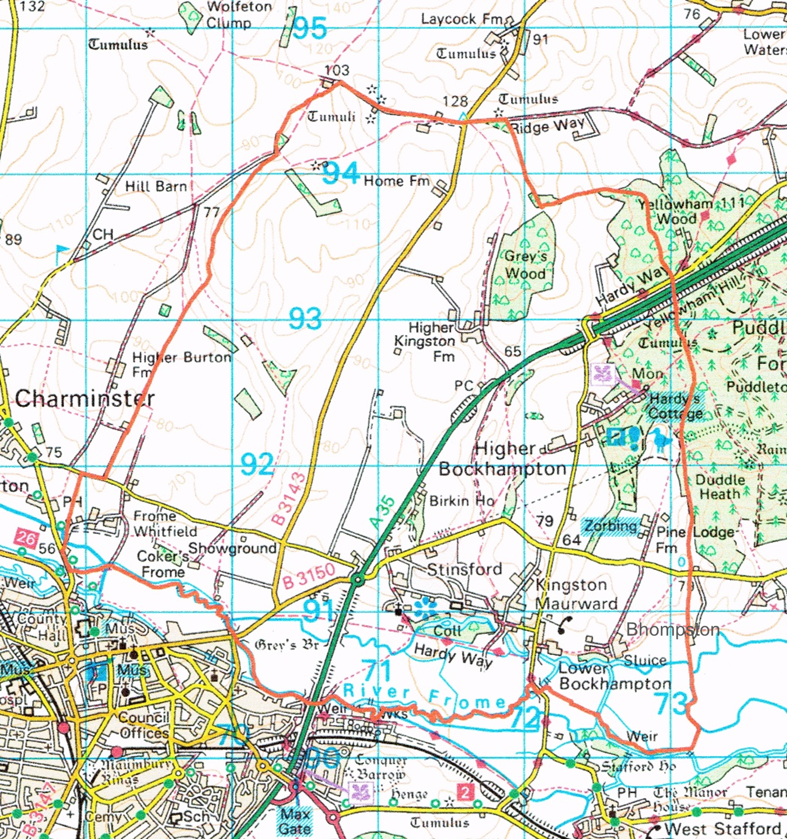
1.6 The Neighbourhood Plan relates to the parish of Stinsford. It covers an area of land to the north and east of Dorchester of 1,352 hectares (3,336 acres).
1.7 The parish boundary (and therefore the Neighbourhood Plan area) is marked by a red boundary on the map:
Figure 1. The Parish of Stinsford
1.8 The Plan Period that this Plan will cover is 2021 – 2038 (in line with the proposed Dorset Local Plan). However, it is likely that the Plan will be reviewed within the next 5 years, given the potential changes in the Local Plan and national planning policy.
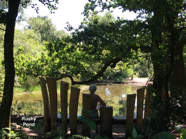
1.9 The northern parish boundary follows the route of the Ridgeway at Waterston, where nearby there are two tumuli. Here the land lies approximately 125 metres above sea level with far reaching views. The River Frome, running west to east at around 50 metres above sea level, marks the southern boundary of the parish, beyond which lies the county town of Dorchester, to the south-west. The western boundary follows long established field boundaries, passing Three Cornered Copse in the north down to join the River Frome below Frome Whitfield. The eastern boundary runs down from the Ridgeway to the northern edge of Grey’s Wood, through Yellowham Woods and the western fringe of Puddletown Forest, taking in Rushy Pond and Heedless William’s Pond, before continuing south to join the River Frome west of Duddle Farm.
1.10 From west to east the landscape changes from chalk downland to heathland formed on tertiary sands and clays. Some of the soils are amongst the best and most versatile agricultural land nationally.
1.11 Bridleways and footpaths cross the area offering far reaching views. The Hardy Way, a long distance circular walk of some 220 miles, enters the parish to the north of Higher Bockhampton and ends at Stinsford Church.
1.12 The parish has one major road running through it: the busy A35, part of the Highways England trunk road network. This connects from Bere Regis (where the road splits off to the A31 to connect up to Wimborne and on to the M27, or continues on to the Poole / Bournemouth conurbation) through to Stinsford, around the Dorchester bypass and on into Devon. This once followed the route of the Roman Road, a scheduled monument, which also runs through the parish from the Stinsford roundabout to Tincleton, and connected Dorchester (Durnovaria) with Badbury Rings (Vindocladia), near Wimborne.
1.13 The River Frome, from Greys Bridge flowing east, is a Site of Special Scientific Interest, important for its aquatic and bankside vegetation, invertebrates, fish and breeding riverside birds. The wider swathe of water meadows is also rich in wildlife, and contain the hatches once used in the ‘drowning’ of the meadows to encourage early growth. Significant mixed, ancient woodland occurs within Grey’s, Yellowham and Thorncombe Woods. Heathland and forest form part of the landscape before giving way to green pastures and the Frome valley.
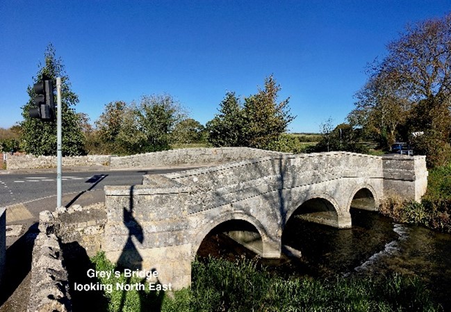
1.14 Amongst the important monuments in the parish today are Kingston Maurward Old Manor, Kingston Maurward House, and Stinsford Church. There are conservation areas in and around Stinsford, Lower Bockhampton and Higher Kingston, together with a wide variety of Listed Buildings. The road into the parish from the county town of Dorchester is over the scheduled monument of Grey’s Bridge, and the parkland around Kingston Maurward is of national importance as a designated Registered Park and Garden.
1.15 The parish is especially well known for being the birthplace and home of the novelist and poet Thomas Hardy (1840 – 1928), in the heart of Hardy’s fictional ‘Wessex’. The parish is considered to be his fictional ‘Mellstock’ and features in many of his works.
1.16 Within this rural setting live some 330 or so people. During the last 20 years, there has been very little new housing in the parish, other than a small number of barn and farm building conversions. This contrasts markedly with the scale of development that has happened at Dorchester, which adjoins the parish.
1.17 The main settlements within the parish are Stinsford and Lower Bockhampton, with smaller settlements at Higher Kingston, Bhompston, Higher Bockhampton and Frome Whitfield, most of which are mentioned in the Domesday Book. During term time, however, the parish is temporary home to up to 45 student boarders at Kingston Maurward College. The College, awarded an “Outstanding” assessment in its 2019 OFSTED Inspection, is one of only two centres in South West England specializing in teaching land-based skills, and attracts many hundreds of students to its courses each year. More recently Dorset Studio School has been set up (co-located with the college) and provides a similar land and environment focused education for secondary school age students. The College is also home to a popular Animal Park with a cafe and beautiful gardens and a small business centre. There are two other business parks in the parish, as well as holiday accommodation, cafés and an award-winning restaurant.
1.18 Neighbourhood Plans are required to have regard to national policy and guidance and be in general conformity with the strategic policies in the development plan for the local area (which in our case would be the West Dorset, Weymouth and Portland Local Plan that was adopted in October 2015, together with the Minerals Strategy, Mineral Sites Plan and the Waste Plan that deal with ‘county matters’ of minerals and waste development).
1.19 National planning policy sets out how plans should positively seek opportunities to meet the development needs of the area, and that they should be sufficiently flexible to adapt changes in the economy. There is a lot of guidance on how plans should help:
1.20 The Local Plan covers a wide area stretching from Tolpuddle to Lyme Regis, and from Portland up to Sherborne, and has considered the level of housing, employment and infrastructure needed up to 2031. It sets out the hierarchy of settlements, with the larger towns of Dorchester and Weymouth being the main locations for new development; down to rural settlements that may have some growth to meet their local needs, but where in general development will be strictly controlled. Major site allocations have been made at the towns.
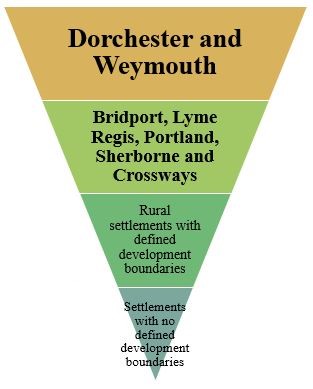
1.21 There were no site allocations made in Stinsford parish, and all of the settlements within our parish fall within this lowest tier of the settlement hierarchy (having no defined development boundaries). Therefore there is little expectation that they should change significantly unless there is a clear local need for development. Parts of Stinsford Parish are subject to minerals safeguarding, there is a safeguarded sewage treatment works site south of Stinsford (near Stinsford House), and other safeguarded areas relating to waste sites along St Georges Road in Dorchester, just south of the parish boundary.
1.22 The Inspector who examined the Local Plan noted that development proposals for Dorchester would fall short of meeting the anticipated needs towards the end of the plan period, and as a result asked for the plan to clearly state that options for meeting the future needs of Dorchester would be considered through an early review of the plan. This review started in 2018, with the Local Plan Review ‘Preferred Options’ consultation proposing a major expansion of the town to its north side, going north of the River Frome (so a lot of the development would be in Stinsford parish).
1.23 In June 2019 the newly formed Dorset Council took the decision to focus on the production of a Dorset-wide Local Plan. The first consultation on the options for development started in January 2021, and included proposals for the major expansion to the north of Dorchester, north of the River Frome to provide around 3,500 homes 10 ha of employment land, as well as new schools and open space (Policy DOR13). The plan also included a policy referring to the masterplanning of the development and expansion of Kingston Maurward College (Policy DOR11).
1.24 In August 2020 the Government announced its intention to make major reforms to the planning system, which would include a new zoning system (identifying growth and renewal areas for development, and protected areas where more stringent controls would apply) and streamlining the development management content of Local Plans, using nationally prescribed development management policies. This could significantly impact on the role and content of both the Local Plan and Neighbourhood Plans. It is clear that the Government continues to see an important role for Neighbourhood Plans in the new system, but at the time of drafting this document, the details about how the new system would work, and when it would come into play, are as yet unclear. Watch this space…
< Previous | ^ Top | Next >