< Previous | Next >
10. Allocations
Years 1-5 (2023-2027)
AS1/011 (Land at Former Bulldog Nurseries, Town Lane)
Site Information |
Site ID |
AS1/011 |
Site name/ address |
Land at former Bulldog Nurseries, Town Lane, Ashford, TW19 7BZ |
Site area (ha) |
0.3 |
Location |
Greenfield land Former Green Belt |
Ward |
Ashford North and Stanwell South |
Proposed Allocation |
Residential (C3): 24 units (approx.) |
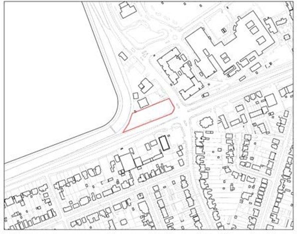
|
Site description & existing use |
This site comprises what remains of the former Bulldog Nurseries, a site extending from London Road (A30) in the south to the southern boundary of the Fire Station to the north. The site to the north is occupied by a 2.5 storey building comprising 10 flats with frontage parking and access via Town Lane.
The wider area is mixed in character with residential development immediately north and to the west across Town Lane. Some local commercial uses are located across London Road to the South. The site is adjacent to the Staines Reservoirs which have a number of international and
national biodiversity designations (SPA, Ramsar and SSSI). |
Site-specific requirements |
In addition to meeting the policies in the plan, any developer of this site will be required to provide the following:
- Shared amenity space for residents.
- Adequate flooding and drainage management programme to address surface water issues.
- 50% Affordable Housing [subject to viability testing]
- Through provision of landscaping and boundary planting provide net gains in biodiversity; This will need to be demonstrated through appropriate habitat/species surveys and implementation of management plans.
- Include measures to mitigate the impact of development on the local road network and take account of impacts on the strategic road network as identified through a site-specific Travel Plan and Transport Assessment.
- Provide or contribute to any infrastructure as set out in the IDP and/or identified at the application stage which is necessary to make the site acceptable in planning terms.
- Maximise the use of Climate Change measures and renewable energy sources, in accordance with Policy DS2 to make buildings zero carbon where possible.
|
Opportunities |
- High quality designed scheme to make a positive contribution to the wider area and to aid regeneration of the area.
- The proposed residential access could be configured to ensure that traffic uses do not exacerbate local highways issues. Movement of junction or widening of existing access could contribute to an improved access into the site.
- Cycleway widening along the A30/London Road.
|
Delivery Timeframe |
2023-2027 (years 1-5) |
AS2/006 (Land East of Desford Way)
Site Information |
Site ID |
AS2/006 |
Site name/ address |
Land East of Desford Way, Ashford, TW15 3FF |
Site area (ha) |
3.33 |
Location |
Greenfield land Former Green Belt |
Ward |
Ashford North and Stanwell South |
Proposed Allocation |
Travelling showpeople plots: 15 |
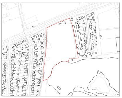
|
Site description & existing use |
The site is located on the edge of Ashford and is an undeveloped, grassed plot of land.
The site is bounded to the west by residential development, to the east by commercial uses, to the north by the A30 and to the south by lakes. The wider character is semi-urban with more
open uses to the south and north. |
Site-specific requirements |
- In addition to meeting the policies in the plan, any developer of this site will be required to provide the following:
- Make provision for 15 serviced travelling showpeople plots.
- The site is only available for the designated use of Travelling Showpeople plots and not for general residential provision (Use Class C3). In accordance with Policy H3, the loss of plots to other uses will be resisted unless it can be demonstrated that there is a surplus supply of Travelling Showpeople plots.
- The retention and enhancement of boundary planting should be used as an opportunity to provide net gains in biodiversity. This will need to be demonstrated through appropriate habitat/species surveys and implementation of management plans.
- Sufficient screening and boundary provision to separate the site from the lakes to the south for safety purposes and nature conservation.
- Strengthening of Green Belt boundaries to ensure the surrounding Green Belt performance is not compromised and retains a strategic function.
- Include measures to mitigate the impact of development on the local road network and take account of impacts on the strategic road network as identified through a site- specific Travel Plan and Transport Assessment.
- Provide or contribute to any infrastructure as set out in the IDP and/or identified at the application stage which is necessary to make the site acceptable in planning terms.
- Maximise the use of Climate Change measures and renewable energy sources, in accordance with policy DS2 to make buildings zero carbon where possible.
|
Opportunities |
- Development should contribute to the enhancement of public transport, walking and cycling infrastructure and links to local town centres and other destinations such as places of employment, services and leisure in order to minimise traffic generation and improve the connectivity.
|
Delivery Timeframe |
2023-2027 (years 1-5) |
AT1/002 (Land East of Ashford Sports Club, Woodthorpe Road)
Site Information |
Site ID |
AT1/002 |
Site name/ address |
Land East of Ashford Sports Club, Woodthorpe Road, Ashford, TW15 3JX |
Site area (ha) |
1.15 |
Location |
Greenfield land Former Green Belt |
Ward |
Ashford Town |
Proposed Allocation |
Residential (C3): 108 units (approx.) |
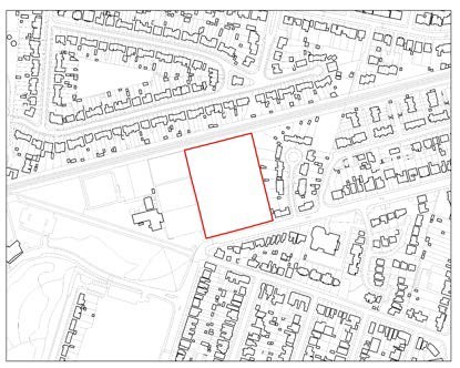
|
Site description & existing use |
The site is open land within a wider sports club facility. The site is surplus to requirements and does not fulfil an open space or recreation role. The site is not publicly accessible. The land to the west is occupied by tennis courts, playing pitches, ancillary buildings and hardstanding for parking associated with the sports club. To the east are residential properties in Ashford
Close and to the north is the railway line. Woodthorpe Road is located to the south. The wider area is largely urban in character. |
Site-specific requirements |
In addition to meeting the policies in the plan, any developer of this site will be required to provide the following:
- The proposals will be expected to contribute to the enhancement of the adjacent sports facilities at Ashford Sports Club.
- 50% Affordable Housing [subject to viability testing]
- The enhancement of boundary planting should be used as an opportunity to provide net gains in biodiversity. This will need to be demonstrated through appropriate habitat/species surveys and implementation of management plans.
- Strengthening of the adjacent Green Belt boundaries to retain its performance and strategic role.
- Include measures to mitigate the impact of development on the local road network and take account of impacts on the strategic road network as identified through a site- specific Travel Plan and Transport Assessment.
- Provide or contribute to any infrastructure as set out in the IDP and/or identified at the application stage which is necessary to make the site acceptable in planning terms.
- The site should be laid out to ensure that it does not impact upon the Esso Southampton to London Pipeline infrastructure on site.
- Maximise the use of Climate Change measures and renewable energy sources, in accordance with Policy DS2 to make buildings zero carbon where possible.
|
Opportunities |
- Development should contribute to the enhancement of public transport, walking and cycling infrastructure and links to local town centres and other destinations such as places of employment, services and leisure in order to minimise traffic generation and improve the connectivity.
- The site should accommodate a scheme of high-quality design that makes a positive contribution to the wider environment and character.
|
Delivery Timeframe |
Following the completion of the Esso Southampton to London Pipeline works (end of 2023 Q1)
2023-2027 (years 1-5) |
AT1/012 (Ashford Community Centre, Woodthorpe Road)
Site Information |
Site ID |
AT1/012 |
Site name/ address |
Ashford Community Centre, Woodthorpe Road, Ashford, TW15 3LF |
Site area (ha) |
0.47 |
Location |
Previously developed land Former Green Belt |
Ward |
Ashford Town |
Proposed Allocation |
Local Community F2(b): 300sqm Community Centre (approx.) Residential (C3): 32 units |
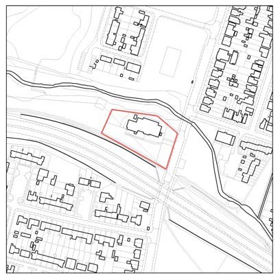
|
Site description & existing use |
The site is bounded by the A308 Staines By-Pass to the south and the River Ash to the north and is accessed from Woodthorpe Road. Woodthorpe Road is predominantly a residential area. Ashford Community Centre is located on the site. The site provides a community centre of 635 sqm, and 43 marked car parking spaces. The community centre was built in the 1950s and is at the end of its life. Most of the site is covered in hardstanding. |
Site-specific requirements |
In addition to meeting the policies in the plan, any developer of this site will be required to provide the following:
- Retention of the community centre use on site, to an equivalent or higher quality standard.
- 100% affordable housing (Council-owned) provision.
- The enhancement of boundary planting should be used as an opportunity to provide net gains in biodiversity. This will need to be demonstrated through appropriate habitat/species surveys and implementation of management plans.
- Strengthening of the adjacent Green Belt boundaries to retain its performance and strategic role.
- Include measures to mitigate the impact of development on the local road network and take account of impacts on the strategic road network as identified through a site- specific Travel Plan and Transport Assessment.
- Provide or contribute to any infrastructure as set out in the IDP and/or identified at the application stage which is necessary to make the site acceptable in planning terms.
- Maximise the use of Climate Change measures and renewable energy sources, in accordance with Policy DS2 to make buildings zero carbon where possible.
|
Opportunities |
- Development should contribute to the enhancement of public transport, walking and cycling infrastructure and links to local town centres and other destinations such as places of employment, services and leisure in order to minimise traffic generation and improve the connectivity.
- The site should accommodate a scheme of high-quality design that makes a positive contribution to the wider environment and character.
|
Delivery Timeframe |
2023-2027 (years 1-5) |
AT3/007 (Ashford multi-storey car park, Church Road)
Site Information |
Site ID |
AT3/007 |
Site name/ address |
Ashford multi-storey car park, Church Road, Ashford, TW15 2TY |
Site area (ha) |
0.2 |
Location |
Urban area
Previously developed land |
Ward |
Ashford Town |
Proposed Allocation |
Residential (C3): 55 units (approx.) Retail/community: 400 sqm (approx.) |
|
Site description & existing use |
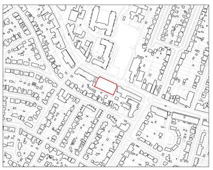
The site is currently occupied by a multi-storey car park fronting onto the Church Road. The site is located between a row of shops, backing onto residential properties to the rear along
Clarendon Road. Opposite the site is the Brooklands Development, formerly a college. |
Site-specific requirements |
In addition to meeting the policies in the plan, any developer of this site will be required to provide the following:
- A mixed-use development comprising residential development and ground floor retail/community uses to provide an active frontage.
- A well-designed scheme that has a positive relationship with nearby town centre uses and existing residential properties nearby.
- Sufficient parking re-provision to meet needs on site or in an appropriate nearby location.
- Include measures to mitigate the impact of development on the local road network and take account of impacts on the strategic road network as identified through a site- specific Travel Plan and Transport Assessment.
- Provide or contribute to any infrastructure as set out in the IDP and/or identified at the application stage which is necessary to make the site acceptable in planning terms.
- Maximise the use of Climate Change measures and renewable energy sources, in accordance with Policy DS2 to make buildings zero carbon where possible.
|
Opportunities |
- This rectangular plot lends itself to a well-designed scheme that makes a positive contribution to the wider street scene.
- Improvements for pedestrian access and public realm, linking the site to nearby services with active and sustainably travel options.
|
Delivery Timeframe |
2023-2027 (years 1-5) |
AT3/016 (23-31 (not 11-19) Woodthorpe Road)
Site Information |
Site ID |
AT3/016 |
Site name/ address |
23-31 (not 11-19) Woodthorpe Road, Ashford, TW15 2RP |
Site area (ha) |
0.24 |
Location |
Urban area
Previously developed land |
Ward |
Ashford Town |
Proposed Allocation |
Residential (C3): 120 units (approx.)
Ground floor office/retail (Class E): 1300 sqm (approx.) |
|
Site description & existing use |
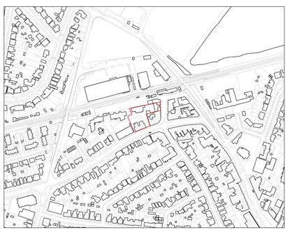
The site is an L shaped plot of land to the west of Station Approach with Woodthorpe Road to the south. The site comprises two parcels of land, made up of office, retail and
residential buildings. The wider area is urban in character with commercial and residential uses present. |
Site-specific requirements |
In addition to meeting the policies in the plan, any developer of this site will be required to provide the following:
- A mixed-use development comprising residential development and ground floor retail/office use to provide an active commercial frontage.
- A well-designed scheme that has a positive relationship with nearby town centre uses and residential properties.
- Include measures to mitigate the impact of development on the local road network and take account of impacts on the strategic road network as identified through a site- specific Travel Plan and Transport Assessment.
- Provide or contribute to any infrastructure as set out in the IDP and/or identified at the application stage which is necessary to make the site acceptable in planning terms.
- Maximise the use of Climate Change measures and renewable energy sources, in accordance with Policy DS2 to make buildings zero carbon where possible.
|
Opportunities |
- This L-shaped plot lends itself to a well-designed scheme that makes a positive contribution to the wider street scene.
- Improvements for pedestrian access and public realm, linking the site to nearby services with active and sustainably travel options.
|
Delivery Timeframe |
2023-2027 (years 1-5) |
HS1/002 (Land at Croysdale Avenue/ Hazelwood Drive)
Site Information |
Site ID |
HS1/002 |
Site name/ address |
Land at Croysdale Avenue/ Hazelwood Drive, Sunbury, TW16 6QN |
Site area (ha) |
1.68 |
Location |
Greenfield land Former Green Belt |
Ward |
Halliford and Sunbury West |
Proposed Allocation |
Residential (C3): 67 units (approx.) |
|
Site description & existing use |
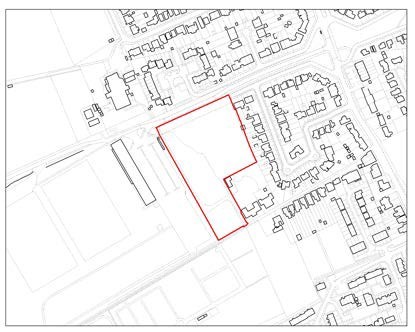
The site is currently vacant green area characterised by trees and bushes. Along Croysdale Avenue/Hazelwood Drive to the north there is a maintained green verge with dispersed trees.
To north and to the east are suburban residential areas. To the west is the London Irish Training grounds with its facility building and surface car park immediately adjacent to the site boundary.
A public footpath and public right of way (School Walk) run to the south of the site with Sunbury cemetery beyond. An access lane runs from Croysdale Avenue alongside the west boundary through the site and joins the public footpath to the south. |
Site-specific requirements |
In addition to meeting the policies in the plan, any developer of this site will be required to provide the following:
- A mixed development of dwellinghouses and apartments.
- Provide vehicle access to all new build dwellings from Hazelwood Drive.
- Improved pedestrian access through the site and to School House and the Scout building, including maintenance of public Rights of Way.
- Carry out appropriate engagement with nearby uses, to take account of the additional needs of residents in these buildings to understand the proposals.
- 50% Affordable Housing [subject to viability testing]
- Preservation of the tree belt along the site’s northern boundary.
- The enhancement of boundary planting should be used as an opportunity to provide net gains in biodiversity. This will need to be demonstrated through appropriate habitat/species surveys and implementation of management plans.
- Strengthening of the adjacent Green Belt boundaries to retain its performance and strategic role adjacent to the site.
- Include measures to mitigate the impact of development on the local road network and take account of impacts on the strategic road network as identified through a site- specific Travel Plan and Transport Assessment.
- Provide or contribute to any infrastructure as set out in the IDP and/or identified at the application stage which is necessary to make the site acceptable in planning terms.
- Maximise the use of Climate Change measures and renewable energy sources, in accordance with Policy DS2 to make buildings zero carbon where possible.
|
Opportunities |
- Development should contribute to the enhancement of public transport, walking and cycling infrastructure and links to local town centres and other destinations such as places of employment, services and leisure in order to minimise traffic generation and improve the connectivity.
- The site should accommodate a scheme of high-quality design that makes a positive contribution to the wider environment and character.
|
Delivery Timeframe |
2023-2027 (years 1-5) |
HS1/009 (Bugle Nurseries, Upper Halliford Road)
Site Information |
Site ID |
HS1/009 |
Site name/ address |
Bugle Nurseries, 171 Upper Halliford Road, Shepperton, TW17 8SN |
Site area (ha) |
4.83
2.28 (developable area for residential use |
Location |
Part previously developed land/part greenfield. Former Green Belt (Part A)
Retain in Green Belt (Part B) |
Ward |
Halliford and Sunbury West |
Proposed Allocation |
Residential (C3): 79 units (approx.) |
|
Site description & existing use |
The site is located to the west of Upper Halliford Road and comprises open fields with paddocks, old nursery structures and other buildings and hardstanding in commercial use, including parking and access. The site is part of the wider Bugle Nurseries site which extends to include a residential
bungalow to the north and additional open fields to the west.
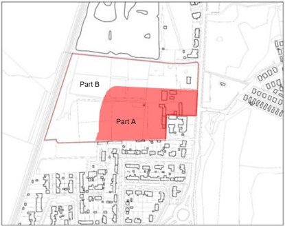
Part A is 2.28ha and has been identified for housing development and release from the Green Belt. Part B is 2.55ha and is identified for open space and is to be retained in the Green Belt to maintain the northern boundary.
Immediately to the south east of the site are residential properties positioned at right angles within Halliford Close, whose rear gardens adjoin the application site. Further to the west, the garages of properties at Bramble Close and allotments adjoin the application site to the south. Directly to the north of the site is a public footpath and the site of the former Bugle Public House which has been rebuilt as apartments. Further to the north are other dwellings fronting Upper Halliford Road, with open grass land behind and a large fishing lake to the north west of the site. A Tree Preservation Order is on a tree in the north-eastern corner of the wider Bugle Nurseries site however this is outside the allocation boundary. |
Site-specific requirements |
In addition to meeting the policies in the plan, any developer of this site will be required to provide the following:
- A mixed development of dwellinghouses and apartments on Part A.
- Provision of a publicly accessible open space on the remainder of the site (Part B).
- The creation and maintenance of a buffer along the northern boundary of the site to retain and enhance the Green Belt function. The buffer should be no less than 50 meters and remain open and free of development. This should be continuous with the public open space to the rear of the site.
- Provision of a pedestrian crossing adjacent to the site on Upper Halliford Road.
- 50% Affordable Housing [subject to viability testing].
- The enhancement of boundary planting should be used as an opportunity to provide net gains in biodiversity. This will need to be demonstrated through appropriate habitat/species surveys and implementation of management plans.
- Strengthening of the adjacent Green Belt boundaries to retain its performance and strategic role adjacent to the site.
- Remediation of the existing waste transfer use on site.
- Include measures to mitigate the impact of development on the local road network and take account of impacts on the strategic road network as identified through a site-specific Travel Plan and Transport Assessment.
- Provide or contribute to any infrastructure as set out in the IDP and/or identified at the application stage which is necessary to make the site acceptable in planning terms.
- Maximise the use of Climate Change measures and renewable energy sources, in accordance with Policy DS2 to make buildings zero carbon where possible.
|
Opportunities |
- Development should contribute to the enhancement of public transport, walking and cycling infrastructure and links to local town centres and other destinations such as places of employment, services and leisure in order to minimise traffic generation and improve the connectivity.
- The site should accommodate a scheme of high- quality design that makes a positive contribution to the wider environment and character.
|
Delivery Timeframe |
2023-2037 (years 1-5) |
HS1/012 (Land East of Upper Halliford, Nursery Road)
Site Information |
Site ID |
HS1/012 |
Site name/ address |
Land East of Upper Halliford, Nursery Road, Upper Halliford, TW16 6JW |
Site area (ha) |
1.61 |
Location |
Greenfield land Former Green Belt |
Ward |
Halliford and Sunbury West |
Proposed Allocation |
Residential (C3): 60 units (approx.) Open space provision |
|
Site description & existing use |
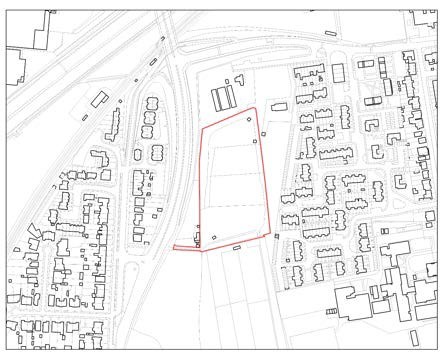
The site is rectangular in shape and is currently occupied by an open field used for equestrian grazing, with several structures on site associated with this use. The site is located
to the west of Upper Halliford Road, northeast of The Bishop Wand Secondary School and is bound by trees and hedging.
The land adjoins residential to the east, a vacant area to the
immediate south and housing further south and west. Upper Halliford Park is located further south west. |
Site-specific requirements |
In addition to meeting the policies in the plan, any developer of this site will be required to provide the following:
- The provision of a new vehicular and pedestrian access road through the site from Upper Halliford Road to the Bishop Wand School.
- Provide high-quality, well-designed, safe access/egress into and out of the site for pedestrians, cyclists and vehicles, including suitable junction improvements.
- Surrey County Council as the education provider support additional sixth form development, subject to the supply of specific types of provision. This is to be agreed with the Council as part of the application process.
- 50% Affordable Housing [subject to viability testing]
- The enhancement of boundary planting should be used as an opportunity to provide net gains in biodiversity. This will need to be demonstrated through appropriate habitat/species surveys and implementation of management plans.
- Maximise retention and safeguarding of existing trees and hedgerows.
- Strengthening of the adjacent Green Belt boundaries to retain its performance and strategic role adjacent to the site.
- Include measures to mitigate the impact of development on the local road network and take account of impacts on the strategic road network as identified through a site-specific Travel Plan and Transport Assessment.
- Provide or contribute to any infrastructure as set out in the IDP and/or identified at the application stage which is necessary to make the site acceptable in planning terms.
- Maximise the use of Climate Change measures and renewable energy sources, in accordance with Policy DS2 to make buildings zero carbon where possible.
|
Opportunities |
- Development should contribute to the enhancement of public transport, walking and cycling infrastructure and links to local town centres and other destinations such as places of employment, services and leisure in order to minimise traffic generation and improve the connectivity. Appropriate linkages with the Spelthorne Local Cycling and Walking Infrastructure Plan.
- The site should accommodate a scheme of high- quality design that makes a positive contribution to the wider environment and character.
|
Delivery Timeframe |
2023-2037 (years 1-5) |
HS2/004 (Land south of Nursery Road)
Site Information |
Site ID |
HS2/004 |
Site name/ address |
Land south of Nursery Road, Sunbury on Thames, TW18 6LX |
Site area (ha) |
0.66 |
Location |
Greenfield land Former Green Belt |
Ward |
Halliford and Sunbury West |
Proposed Allocation |
Residential (Use Class C3): 41 units (approx.) |
|
Site description & existing use |
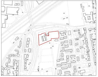
The site is located to the south of Nursery Road and east of the A244 (Upper Halliford Road). The site is rectangular in shape which slopes away from Nursery Road towards the south east corner of the site. It is currently vacant, although old structures associated with previous nursery use is located on site. A bungalow is enclosed within the centre of the site but outside its boundaries. The nearby A244 lifts above the railway line, with
the site at a lower level. Vegetation lines the road and site which limits views between the two. |
Site-specific requirements |
In addition to meeting the policies in the plan, any developer of this site will be required to provide the following:
- Improved pedestrian linkages to nearby community facilities and existing active travel routes, including the widening of the footway adjacent to the site.
- 50% Affordable Housing [subject to viability testing]
- The enhancement of boundary planting should be used as an opportunity to provide net gains in biodiversity. This will need to be demonstrated through appropriate habitat/species surveys and implementation of management plans.
- Include measures to mitigate the impact of development on the local road network and take account of impacts on the strategic road network as identified through a site- specific Travel Plan and Transport Assessment.
- Provide or contribute to any infrastructure as set out in the IDP and/or identified at the application stage which is necessary to make the site acceptable in planning terms.
- Maximise the use of Climate Change measures and renewable energy sources, in accordance with policy DS2
|
Opportunities |
- Development should contribute to the enhancement of public transport, walking and cycling infrastructure and links to local town centres and other destinations such as places of employment, services and leisure in order to minimise traffic generation and improve the connectivity. Appropriate linkages with the Spelthorne Local Cycling and Walking Infrastructure Plan.
- The site should accommodate a scheme of high-quality design that makes a positive contribution to the wider environment and character.
|
Delivery Timeframe |
2023-2027 (years 1-5) |
LS1/024 (Land at Staines Road West and Cedar Way)
Site Information |
Site ID |
LS1/024 |
Site name/ address |
Land at Staines Road West and Cedar Way, Sunbury, TW16 7BL |
Site area (ha) |
1.63 |
Location |
Greenfield Land Former Green Belt |
Ward |
Laleham and Shepperton Green |
Proposed Allocation |
Residential (C3): 77 units (approx.) |
|
Site description & existing use |
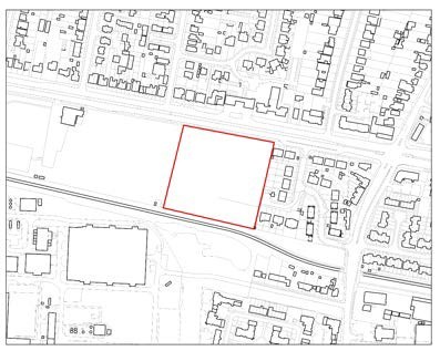
The site is located on the south side of Staines Road West and to the west of Cedar Way. Spelthorne Sports club is located immediately west of the site. The Staines Reservoirs Aqueduct runs immediately south of the site with the Thames Water treatment works further south. The site is currently free from
development and is occupied by paddocks and grazing land. |
Site-specific requirements |
In addition to meeting the policies in the plan, any developer of this site will be required to provide the following:
- A mix of dwellinghouses and apartments.
- Suitable junction improvements to enable safe access/egress into and out of the site.
- 50% Affordable Housing [subject to viability testing]
- The enhancement of boundary planting should be used as an opportunity to provide net gains in biodiversity. This will need to be demonstrated through appropriate habitat/species surveys and implementation of management plans.
- Strengthening of the adjacent Green Belt boundaries to retain its performance and strategic role adjacent to the site.
- Include measures to mitigate the impact of development on the local road network and take account of impacts on the strategic road network as identified through a site- specific Travel Plan and Transport Assessment.
- Provide or contribute to any infrastructure as set out in the IDP and/or identified at the application stage which is necessary to make the site acceptable in planning terms.
- Maximise the use of Climate Change measures and renewable energy sources, in accordance with Policy DS2 to make buildings zero carbon where possible.
|
Opportunities |
- Development should contribute to the enhancement of public transport, walking and cycling infrastructure and links to local town centres and other destinations such as places of employment, services and leisure in order to minimise traffic generation and improve the connectivity. Appropriate linkages with the Spelthorne Local Cycling and Walking Infrastructure Plan.
- The site should accommodate a scheme of high-quality design that makes a positive contribution to the wider environment and character.
|
Delivery Timeframe |
2023-2027 (years 1-5) |
SE1/005 (Benwell House, Green Street)
Site Information |
Site ID |
SE1/005 |
Site name/ address |
Benwell House, Green Street, Sunbury, TW16 6QF |
Site area (ha) |
0.7 |
Location |
Urban area
Previously developed land |
Ward |
Sunbury East |
Proposed Allocation |
Residential (C3): 39 Units (approx.) |
|
Site description & existing use |
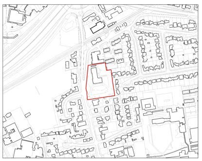
The site is currently occupied by a converted office to residential building, previously occupied by the Benwell House offices.
The surrounding area contains a mix of residential and commercial uses. A large number of semi-detached properties are present to the east, with flats to the north and south and some commercial units to the west. The proposed development site excludes the converted office building and includes the
undeveloped grounds. |
Site-specific requirements |
In addition to meeting the policies in the plan, any developer of this site will be required to provide the following:
- Maximise retention and safeguarding of existing mature trees, including those which are subject to a Tree Preservation Order, incorporating those features in a coherent landscaping strategy for the site.
- Include measures to mitigate the impact of development on the local road network and take account of impacts on the strategic road network as identified through a site- specific Travel Plan and Transport Assessment;
- Provide or contribute to any infrastructure as set out in the IDP and/or identified at the application stage which is necessary to make the site acceptable in planning terms.
- Maximise the use of Climate Change measures and renewable energy sources, in accordance with Policy DS2 to make buildings zero carbon where possible.
|
Opportunities |
- This plot lends itself to a well-designed scheme that makes a positive contribution to the wider street scene.
- Improvements for pedestrian access and public realm, linking the site to nearby services with active and sustainably travel options.
|
Delivery Timeframe |
2023-2027 (years 1-5) |
SE1/024 (Annandale House, Hanworth Road)
Site Information |
Site ID |
SE1/024 |
Site name/ address |
Annandale House, 1 Hanworth Road, Sunbury, TW16 5DJ |
Site area (ha) |
0.97 |
Location |
Urban area
Previously developed land |
Ward |
Sunbury East |
Proposed Allocation |
Residential (C3): 295 units (approx.)
Ground floor retail (Class E): 450 sqm (approx.) |
|
Site description & existing use |
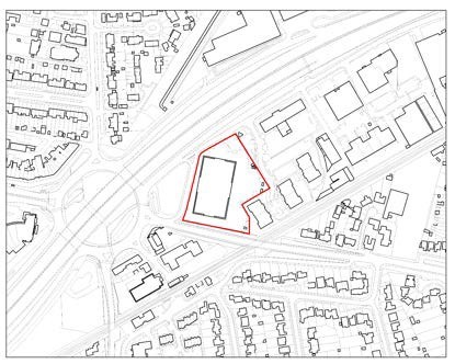
The site is located on the south side of Hanworth Road and is occupied by a two-storey office building and associated parking area. To the north of the site is the M3 motorway with Sunbury Cross roundabout to the west. To the east of the site is a hotel and three apartment buildings with commercial uses further east. The A308 runs to the south with the Shepperton rail line beyond. The site is located within the current Hanworth Road employment area. |
Site-specific requirements |
In addition to meeting the policies in the plan, any developer of this site will be required to provide the following:
- A mixed-use development comprising residential development and ground floor retail/Class E use to provide an active commercial frontage.
- A well-designed scheme that has a positive relationship with nearby town centre uses.
- Carry out an Air Quality Assessment and identify suitable mitigation to overcome any impacts.
- Include measures to mitigate the impact of development on the local road network and take account of impacts on the strategic road network as identified through a site- specific Travel Plan and Transport Assessment;
- Provide or contribute to any infrastructure as set out in the IDP and/or identified at the application stage which is necessary to make the site acceptable in planning terms.
- Maximise the use of Climate Change measures and renewable energy sources, in accordance with Policy DS2 to make buildings zero carbon where possible.
|
Opportunities |
- This plot in a prominent location at Sunbury Cross Roundabout lends itself to a well-designed scheme that makes a positive contribution to the wider street scene.
- Improvements for pedestrian access and public realm, linking the site to nearby services with active and sustainably travel options. Linkages with the Spelthorne Local Cycling and Walking Infrastructure Plan.
|
Delivery Timeframe |
2023-2027 (years 1-5) |
SN1/006 (Land to west of Long Lane and south of Blackburn Trading Estate)
Site Information |
Site ID |
SN1/006 |
Site name/ address |
Land to west of Long Lane and south of Blackburn Trading Estate, Stanwell, TW19 7AN |
Site area (ha) |
4.83 |
Location |
Greenfield land Former Green Belt |
Ward |
Stanwell North |
Proposed Allocation |
Residential (C3): 200 units Open space provision |
|
Site description & existing use |
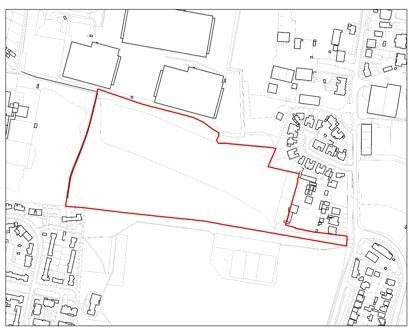
The site is currently undeveloped vacant land and is bounded by Blackburn Trading Estate to the north; hardstanding associated with van hire and storage area is located to the east; and recreation/school fields to the west and south beyond a mature belt of landscaping. The site is accessed via Long Lane. The
wider area is largely urban in character, with mixed industrial, and warehousing to the north and east and residential development west and further south. Heathrow Airport is situated further north of the site past Blackburn Trading Estate. |
Site-specific requirements |
In addition to meeting the policies in the plan, any developer of this site will be required to provide the following:
- A mix of dwellinghouses and flats
- Suitable junction improvements to enable safe access/egress into and out of the site.
- 50% Affordable Housing [subject to viability testing]
- The enhancement of boundary planting should be used as an opportunity to provide net gains in biodiversity. This will need to be demonstrated through appropriate habitat/species surveys and implementation of management plans.
- Strengthening of the adjacent Green Belt boundaries to retain its performance and strategic role adjacent to the site.
- Include measures to mitigate the impact of development on the local road network and take account of impacts on the strategic road network as identified through a site- specific Travel Plan and Transport Assessment.
- Provide or contribute to any infrastructure as set out in the IDP and/or identified at the application stage which is necessary to make the site acceptable in planning terms.
- Maximise the use of Climate Change measures and renewable energy sources, in accordance with Policy DS2 to make buildings zero carbon where possible.
|
Opportunities |
- Development should contribute to the enhancement of public transport, walking and cycling infrastructure and links to local town centres and other destinations such as places of employment, services and leisure in order to minimise traffic generation and improve the connectivity.
- The site should accommodate a scheme of high-quality design that makes a positive contribution to the wider environment and character.
|
Delivery Timeframe |
2023-2027 (years 1-5) |
ST1/037 (Thameside House, South Street)
Site Information |
Site ID |
ST1/037 |
Site name/ address |
Thameside House, South Street, Staines, TW18 4PR |
Site area (ha) |
1.26 |
Location |
Urban area
Previously developed land |
Ward |
Staines |
Proposed Allocation |
Residential (C3): 140 units (approx.)
Flexible Commercial (Class E): 3,200 sqm (approx.) |
|
Site description & existing use |
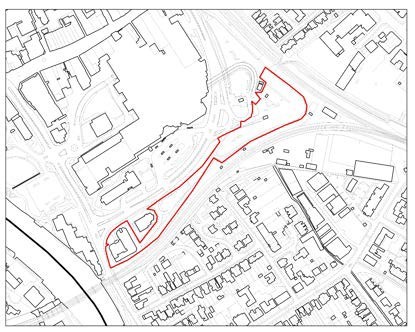
The site is occupied by Thameside House, located on the corner of South Street (A308) and Thames Street (B376) and extends along South Street to incorporate the underused surface carparking areas to the north of Thameside House. The site is located on the edge of the Town Centre and approximately
0.6km southwest of Staines Rail Station. |
Site-specific requirements |
In addition to meeting the policies in the plan, any developer of this site will be required to provide the following:
- A mixed-use development comprising residential development and flexible commercial uses.
- A well-designed scheme that has a positive relationship with nearby town centre uses.
- Include measures to mitigate the impact of development on the local road network and take account of impacts on the strategic road network as identified through a site- specific Travel Plan and Transport Assessment.
- Provide or contribute to any infrastructure as set out in the IDP and/or identified at the application stage which is necessary to make the site acceptable in planning terms.
- Maximise the use of Climate Change measures and renewable energy sources, in accordance with Policy DS2 to make buildings zero carbon where possible.
|
Opportunities |
- This plot at the edge of the town centre lends itself to a high-quality scheme that makes a positive contribution to the wider street scene.
- Improvements for pedestrian access and public realm, linking the site to nearby services with active and sustainably travel options.
|
Delivery Timeframe |
2023-2027 (years 1-5) |
ST1/043 (Land East of 355 London Road)
Site Information |
Site ID |
ST1/043 |
Site name/ address |
Land East of 355 London Road, Staines |
Site area (ha) |
0.27 |
Location |
Greenfield land Former Green Belt |
Ward |
Staines |
Proposed Allocation |
Gypsy and Traveller pitches: 3 |
|
Site description & existing use |
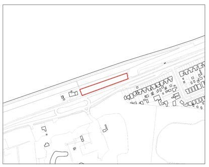
The site is publicly owned, undeveloped open greenfield land. It is located to the north of London Road (A30). The site is located within the Green Belt and the Colne Valley Park. In addition, the southern boundary of the land is identified as an area of High Archaeological Importance. The site is undeveloped open greenfield land. To the east is a further area of open land, with a commercial premises to the west. Opposite is Hengrove Farm
minerals site with housing to the southeast across the A30. |
Site-specific requirements |
In addition to meeting the policies in the plan, any developer of this site will be required to provide the following:
- Make provision for 3 serviced gypsy and traveller pitches.
- The site is only available for the designated use of Gypsy and Traveller pitches and not for general residential provision (Use Class C3). In accordance with Policy H3, the loss of pitches to other uses will be resisted unless it can be demonstrated that there is a surplus supply of traveller pitches.
- The retention and enhancement of boundary planting should be used as an opportunity to provide net gains in biodiversity. This will need to be demonstrated through appropriate habitat/species surveys and implementation of management plans.
- Strengthening of Green Belt boundaries to ensure the surrounding Green Belt performance is not compromised and retains a strategic function.
- Include measures to mitigate the impact of development on the local road network and take account of impacts on the strategic road network as identified through a site- specific Travel Plan and Transport Assessment.
- Provide or contribute to any infrastructure as set out in the IDP and/or identified at the application stage which is necessary to make the site acceptable in planning terms.
- Maximise the use of Climate Change measures and renewable energy sources, in accordance with Policy DS2 to make buildings zero carbon where possible.
|
Opportunities |
- Development should contribute to the enhancement of public transport, walking and cycling infrastructure and links to local town centres and other destinations such as places of employment, services and leisure in order to minimise traffic generation and improve the connectivity.
|
Delivery Timeframe |
2023-2027 (years 1-5) |
ST3/004 (Oast House, Kingston Road)
Site Information |
Site ID |
ST3/004 |
Site name/ address |
34-36 Kingston Road (Oast House) & Car Park, Staines, TW18 4LN |
Site area (ha) |
0.92 |
Location |
Urban area
Previously developed land |
Ward |
Staines |
Proposed Allocation |
Residential (C3): 180 units (approx.) Community/Healthcare use: 4500 sqm |
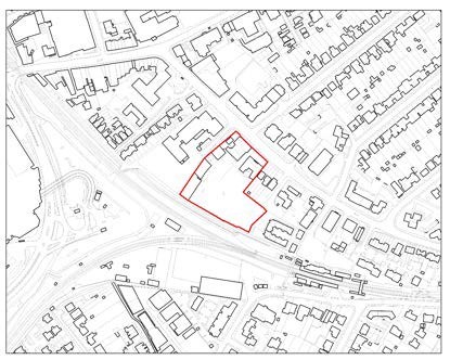
|
Site description & existing use |
The site is currently occupied by a mix of uses including Surrey County Council buildings, a Spelthorne Borough Council operated carpark and private buildings. The Surrey County Council buildings (adult learning centre at 34-36 and 36B) are vacant with part listed. A footpath runs to the south of the site with Staines Police Station to the west. Several semi-detached residential properties and garages are located to the northeast
along Kingston Road. The Staines rail line is located to the south with Staines station further to the southeast. |
|
The site can be accessed on foot via Station Path to the south or from Kingston Road to the north. The surrounding character is mixed commercial and residential. |
Site-specific requirements |
In addition to meeting the policies in the plan, any developer of this site will be required to provide the following:
- A mixed-use development comprising residential development and health/community uses.
- A well-designed scheme that has a positive relationship with nearby town centre uses and nearby residential properties
- Conserve and, where possible, enhance heritage assets and their setting, most notably the Grade II listed Oast House on site.
- Include measures to mitigate the impact of development on the local road network and take account of impacts on the strategic road network as identified through a site- specific Travel Plan and Transport Assessment.
- Provide or contribute to any infrastructure as set out in the IDP and/or identified at the application stage which is necessary to make the site acceptable in planning terms.
- Maximise the use of Climate Change measures and renewable energy sources, in accordance with Policy DS2 to make buildings zero carbon where possible.
|
Opportunities |
- This plot at the edge of the town centre lends itself to a high-quality scheme that makes a positive contribution to the wider street scene.
- Improvements for pedestrian access and public realm, linking the site to nearby services with active and sustainably travel options.
|
Delivery Timeframe |
2023-2027 (years 1-5) |
ST4/002 (Bridge Street Car Park, Hanover House & Sea Cadet Building, Bridge Street, Staines)
Site Information |
Site ID |
ST4/002 |
Site name/ address |
Bridge Street Car Park, Hanover House & Sea Cadet Building, Bridge Street, Staines |
Site area (ha) |
0.93 |
Location |
Urban area
Previously developed land |
Ward |
Staines |
Proposed Allocation |
Residential (C3): 158 units (approx.) Hotel (C1): 300 bed (approx.) |
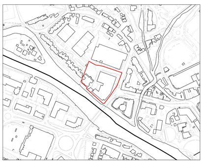
|
Site description & existing use |
The site lies within the urban area. It is occupied by Bridge Street Car Park and the former Staines and Egham Group Sea Cadets building which originates from the 1980s. It comprises two levels of parking, of which the first-floor deck is broadly level with the adjacent Staines Bridge approach Road. The Cadets building is two storeys, located to the west of the car park and
faces the River Thames. Hanover House is an office building located further west. It is two storeys in height with a traditional pitched roof design, with an area of hardstanding for parking to the rear.
To the west residential properties are present along Island Close. To the north are Bridge Close and the 3 storey Strata office building which was built in the 1980s and has recently been refurbished with a modern appearance. To the south is the River Thames and to the southeast is Staines Bridge, which is a Grade II listed building erected in 1832. Further east across Staines Bridge is Thames Edge Court which is a part 4-5 storey building that comprises a mixture of commercial units at ground levels and flats above. The site lies at the edge of Staines upon Thames Town Centre and is characterised by a mixture of residential and commercial properties. There are several trees
within the site and none of them are subject to a Tree Preservation Order. |
Site-specific requirements |
In addition to meeting the policies in the plan, any developer of this site will be required to provide the following:
- A mixed use residential and hotel scheme.
- A well-designed scheme that has a positive relationship with nearby town centre uses and the River Thames.
- Incorporate flood risk mitigation measures to alleviate the risk of fluvial and surface water flooding, in accordance with Policy E2.
- Conserve and, where possible, enhance Staines Conservation Area and the setting of nearby listed buildings.
- Include measures to mitigate the impact of development on the local road network and take account of impacts on the strategic road network as identified through a site- specific Travel Plan and Transport Assessment.
- Provide or contribute to any infrastructure as set out in the IDP and/or identified at the application stage which is necessary to make the site acceptable in planning terms.
- Maximise the use of Climate Change measures and renewable energy sources, in accordance with Policy DS2 to make buildings zero carbon where possible.
|
Opportunities |
- This plot at the edge of the town centre lends itself to a high-quality scheme that makes a positive contribution to the wider street scene.
- Improvements for pedestrian access and public realm, linking the site to nearby services with active and sustainably travel options.
|
Delivery Timeframe |
2023-2027 (years 1-5) |
ST4/019 (Former Debenhams Site, High Street)
Site Information |
Site ID |
ST4/019 |
Site name/ address |
35-45 High Street, Staines (Former Debenhams Site), TW18 4QU |
Site area (ha) |
0.24 |
Location |
Urban area
Previously developed land |
Ward |
Staines |
Proposed Allocation |
Residential (C3): 150 units (approx.) Commercial (Class E): 500 sqm (approx.) |
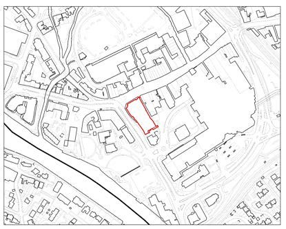
|
Site description & existing use |
The site is located to the south of the High Street and is on the corner where the road meets the A308/Thames Street. The site is located to the northwest of Elmsleigh Shopping Centre. The surrounding area is predominantly commercial as the site is located within the Borough’s primary shopping area. The site is
currently occupied by a four-storey department store, now vacant. The site is locally listed. |
Site-specific requirements |
In addition to meeting the policies in the plan, any developer of this site will be required to provide the following:
- A mixed residential and commercial development that provides an active frontage along the High Street.
- A well-designed scheme that has a positive relationship with the surrounding town centre uses.
- Include measures to mitigate the impact of development on the local road network and take account of impacts on the strategic road network as identified through a site- specific Travel Plan and Transport Assessment.
- Provide or contribute to any infrastructure as set out in the IDP and/or identified at the application stage which is necessary to make the site acceptable in planning terms.
- Maximise the use of Climate Change measures and renewable energy sources, in accordance with Policy DS2 to make buildings zero carbon where possible.
|
Opportunities |
- This plot within the town centre lends itself to a high- quality scheme that makes a positive contribution to the wider street scene.
- Provide positive benefits in terms of landscape and townscape character and local distinctiveness.
- Improvements for pedestrian access and public realm, linking the site to nearby services with active and sustainably travel options.
|
Delivery Timeframe |
2023-2027 (years 1-5) |
ST4/025 (Coppermill Road)
Site Information |
Site ID |
ST4/025 |
Site name/ address |
Coppermill Road, Wraysbury, TW19 5NU |
Site area (ha) |
0.92 |
Location |
Greenfield land Former Green Belt |
Ward |
Staines |
Proposed Allocation |
Residential (C3): 15 units (approx.) |
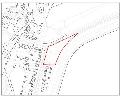
|
Site description & existing use |
The site is undeveloped greenfield land. It is located on the edge of Spelthorne and adjacent to linear residential development along Coppermill Road to the south. The nearby residential dwellings are within the Royal Borough of Windsor and Maidenhead and are designated Green Belt.
The site is bounded by the Wraysbury Reservoir to the east, residential to the south and west and Woodland to the north. |
Site-specific requirements |
In addition to meeting the policies in the plan, any developer of this site will be required to provide the following:
- Provision of 15 residential dwellinghouses (approx.)
- Improved pedestrian linkages to nearby community facilities and existing active travel routes, including the provision of crossing facilities along Coppermill Road.
- Liaise with the relevant service providers, including Royal Borough of Windsor and Maidenhead, to ensure that appropriate waste management is incorporated into proposals.
- The enhancement of boundary planting should be used as an opportunity to provide net gains in biodiversity. This will need to be demonstrated through appropriate habitat/species surveys and implementation of management plans.
- Strengthening of the adjacent Green Belt boundaries to retain its performance and strategic role beyond the site.
- Include measures to mitigate the impact of development on the local road network and take account of impacts on the strategic road network as identified through a site- specific Travel Plan and Transport Assessment.
- Provide or contribute to any infrastructure as set out in the IDP and/or identified at the application stage which is necessary to make the site acceptable in planning terms.
- Maximise the use of Climate Change measures and renewable energy sources, in accordance with Policy DS2 to make buildings zero carbon where possible.
|
Opportunities |
- Development should contribute to the enhancement of public transport, walking and cycling infrastructure and links to local town centres and other destinations such as places of employment, services and leisure in order to minimise traffic generation and improve the connectivity. Appropriate linkages with the Spelthorne Local Cycling and Walking Infrastructure Plan.
- The site should accommodate a scheme of high-quality design that makes a positive contribution to the wider environment and character.
|
Delivery Timeframe |
2023-2027 (years 1-5) |
ST4/026 (Communications House, South Street, Staines)
Site Information |
Site ID |
ST4/026 |
Site name/ address |
Communications House, South Street, Staines, TW18 4QE |
Site area (ha) |
0.25 |
Location |
Urban area
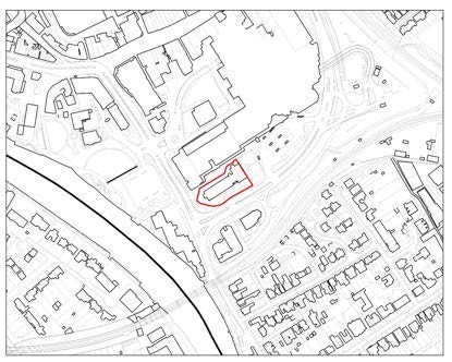
Previously developed land |
Ward |
Staines |
Proposed Allocation |
Residential (C3): 120 units (approx.) |
|
Site description & existing use |
Communications House lies on the junction of South Street and Thames Street, with access from South Street. The building is currently in office use and is part six and part five storeys. The site backs onto Friends Walk / the Elmsleigh Centre and is adjacent to Staines Bus Station.
To the west is the Thames Lodge hotel and to the south is Thameside House and the railway line with residential development beyond this. To the north of the site lies Staines town centre. |
Site-specific requirements |
In addition to meeting the policies in the plan, any developer of this site will be required to provide the following:
- A well-designed scheme that has a positive relationship with nearby town centre uses.
- Incorporate flood risk mitigation measures to alleviate the risk of fluvial and surface water flooding, in accordance with Policy E2.
- Include measures to mitigate the impact of development on the local road network and take account of impacts on the strategic road network as identified through a site-specific Travel Plan and Transport Assessment;
- Provide or contribute to any infrastructure as set out in the IDP and/or identified at the application stage which is necessary to make the site acceptable in planning terms.
- Maximise the use of Climate Change measures and renewable energy sources, in accordance with Policy DS2 to make buildings zero carbon where possible.
|
Opportunities |
- This plot within the town centre lends itself to a high quality scheme that makes a positive contribution to the wider street scene.
- Improvements for pedestrian access and public realm, linking the site to nearby services with active and sustainably travel options.
|
Delivery Timeframe |
2023-2027 (years 1-5) |
ST4/028 (William Hill / Vodafone/ Monsoon, High Street)
Site Information |
Site ID |
ST4/028 |
Site name/ address |
William Hill / Vodafone/ Monsoon, 91-93 High Street, Staines TW18 4PQ |
Site area (ha) |
0.11 |
Location |
Urban area
Previously developed land |
Ward |
Staines |
Proposed Allocation |
Residential (C3): 14 units (approx.)
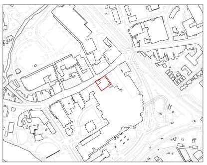
Commercial (Class E): 400 sqm (approx.) (retain existing) |
|
Site description & existing use |
The site is located on the High Street and is surrounded by a large variety of retail shops varying in height and in architecture. There are a series of larger scale developments that are planned for the local area particularly to the West and the South. The existing building at 91-93 High St is a Victorian/Edwardian Gothic style building that currently houses retail use. It rises to a maximum of three storeys. It is an attractive building which
contributes positively to the streetscape of the High Street and is locally listed.
The remainder of the site is occupied by a part of the Elmsleigh Shopping Centre, being two bays of the High St frontage to the east of the Shopping Centre frontage. |
Site-specific requirements |
In addition to meeting the policies in the plan, any developer of this site will be required to provide the following:
- A mixed residential and commercial development that provides an active frontage along the High Street. Retention of the existing retail use.
- A well-designed scheme that has a positive relationship with the surrounding town centre uses. Sensitive design that retains and enhances the locally listed features on site.
- Include measures to mitigate the impact of development on the local road network and take account of impacts on the strategic road network as identified through a site- specific Travel Plan and Transport Assessment.
- Provide or contribute to any infrastructure as set out in the IDP and/or identified at the application stage which is necessary to make the site acceptable in planning terms.
- Maximise the use of Climate Change measures and renewable energy sources, in accordance with Policy DS2 to make buildings zero carbon where possible.
|
Opportunities |
- This plot within the town centre lends itself to a high- quality scheme that makes a positive contribution to the wider street scene.
- Provide positive benefits in terms of landscape and townscape character and local distinctiveness.
- Improvements for pedestrian access and public realm, linking the site to nearby services with active and sustainably travel options.
|
Delivery Timeframe |
2023-2027 (years 1-5) |
Years 6-10 (2028-2032)
AE3/006 (158-166 Feltham Road)
Site Information |
Site ID |
AE3/006 |
Site name/ address |
158-166 Feltham Road, Ashford, TW15 1YQ |
Site area (ha) |
1.31 |
Location |
Urban area
Previously developed land |
Ward |
Ashford East |
Proposed Allocation |
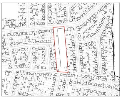
Housing (C3): 75 units (approx.) |
|
Site description & existing use |
The site is a long narrow site currently in use as warehousing. The site comprises 17 single storey brick business units known as Ashford Business Complex. There are quite substantial buildings on the site at present and it is bounded on three sides by residential properties. Access is through a primarily residential area. Feltham Road runs to the north of the site. |
Site-specific requirements |
In addition to meeting the policies in the plan, any developer of this site will be required to provide the following:
- A mix of houses and flats would contribute to the need for different types of housing in the Borough.
- Through provision of landscaping and boundary planting provide net gains in biodiversity; This will need to be demonstrated through appropriate habitat/species surveys and implementation of management plans.
- Include measures to mitigate the impact of development on the local road network and take account of impacts on the strategic road network as identified through a site- specific Travel Plan and Transport Assessment;
- Provide or contribute to any infrastructure as set out in the IDP and/or identified at the application stage which is necessary to make the site acceptable in planning terms.
- Maximise the use of Climate Change measures and renewable energy sources, in accordance with policy DS2.
|
Opportunities |
- This rectangular plot lends itself to a well-designed scheme that makes a positive contribution to the wider street scene.
- Improvements for pedestrian access and public realm, linking the site to nearby services with active and sustainably travel options.
|
Delivery Timeframe |
2028-2032 (years 6-10) |
AS1/001 (Tesco Extra, Town Lane)
Site Information |
Site ID |
AS1/001 |
Site name/ address |
Tesco Extra, Town Lane, Stanwell, TW15 8RW |
Site area (ha) |
3.98 |
Location |
Urban area
Previously developed land |
Ward |
Ashford North and Stanwell South |
Proposed Allocation |
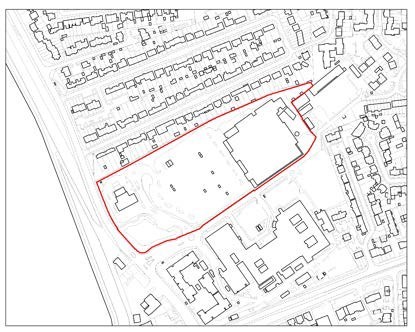
Retail: Retention of the existing superstore on site. Residential (C3): 350 units (approx.) |
|
Site description & existing use |
The site is currently occupied by a large Tesco superstore with adjoining car park and petrol station, located on land adjacent to Ashford Hospital. Residential dwellings lie to the north and east of the store, with the hospital buildings to the south and Town Lane and the Staines Reservoir bounding the western boundary. Access is via Town Lane. |
Site-specific requirements |
In addition to meeting the policies in the plan, any developer of this site will be required to provide the following:
- Retention of the existing superstore on site with adequate parking.
- Through provision of landscaping and boundary planting provide net gains in biodiversity; This will need to be demonstrated through appropriate habitat/species surveys and implementation of management plans.
- Include measures to mitigate the impact of development on the local road network and take account of impacts on the strategic road network as identified through a site- specific Travel Plan and Transport Assessment.
- Provide or contribute to any infrastructure as set out in the IDP and/or identified at the application stage which is necessary to make the site acceptable in planning terms.
- Maximise the use of Climate Change measures and renewable energy sources, in accordance with Policy DS2 to make buildings zero carbon where possible.
|
Opportunities |
- Roads within the site should be designed to provide safe and legible walking and cycling access. There should be clear delineation between commercial and residential development. Development should contribute to the enhancement of public transport, walking and cycling infrastructure and links to local town centres and other destinations such as places of employment, services and leisure in order to minimise traffic generation and improve the connectivity.
|
Delivery Timeframe |
2028-2032 (years 6-10) |
AS1/003 (Former Staines Fire Station, Town Lane)
Site Information |
Site ID |
AS1/003 |
Site name/ address |
Former Staines Fire Station, Town Lane, Stanwell, TW19 7JP |
Site area (ha) |
0.43 |
Location |
Urban area
Previously developed land |
Ward |
Ashford North and Stanwell South |
Proposed Allocation |
Residential (C3): 50 units (approx.) |
|
Site description & existing use |
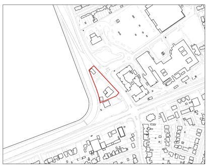
The site is occupied by the now disused Staines Fire Station which has been replaced by a new station facility at Fordbridge Road in Ashford. The site is occupied by a two-storey building with a double fire engine garage, parking area and training tower. The site is currently occupied by an ambulance ‘Make Ready Centre’ and is required operationally for the ambulance service. An alternative location for this use will therefore require
identification prior to the redevelopment of this site. The site is adjacent to the Staines Reservoirs which have a number of international and national biodiversity designations (SPA, Ramsar and SSSI). |
Site-specific requirements |
In addition to meeting the policies in the plan, any developer of this site will be required to provide the following:
- Identification of alternative location for the ambulance ‘Make Ready Centre’ prior to redevelopment.
- Through provision of landscaping and boundary planting provide net gains in biodiversity; This will need to be demonstrated through appropriate habitat/species surveys and implementation of management plans.
- Include measures to mitigate the impact of development on the local road network and take account of impacts on the strategic road network as identified through a site- specific Travel Plan and Transport Assessment.
- Provide or contribute to any infrastructure as set out in the IDP and/or identified at the application stage which is necessary to make the site acceptable in planning terms.
- Maximise the use of Climate Change measures and renewable energy sources, in accordance with Policy DS2 to make buildings zero carbon where possible.
|
Opportunities |
- Provide positive benefit in terms of landscape and townscape character and local distinctiveness and have regard to the identified landscape character areas.
|
Delivery Timeframe |
2028-2032 (years 6-10) |
HS1/012b (Land East of Upper Halliford Road)
Site Information |
Site ID |
HS1/012b |
Site name/ address |
Land East of Upper Halliford Road (Site B), Upper Halliford, TW16 6JL |
Site area (ha) |
2.34 |
Location |
Greenfield land Former Green Belt |
Ward |
Halliford and Sunbury West |
Proposed Allocation |
Sixth form college (Use Class F1)
Residential (Use Class C3): 20 units (approx.) |
|
Site description & existing use |
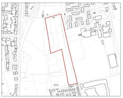
The site is linear in shape and is currently occupied by an open field, with several small structures on site. The site is located to the west of Upper Halliford Road, east of The Bishop Wand Secondary School and is bound by trees and hedging.
The land adjoins residential to the northeast, south and west across Upper Halliford Road. Upper Halliford Park is located further southwest. |
Site-specific requirements |
In addition to meeting the policies in the plan, any developer of this site will be required to provide the following:
- The provision of a new sixth form college supported by the provision of approximately 20 houses to enable the education development.
- The provision of a new vehicular and pedestrian access road through the site from Upper Halliford Road to the Bishop Wand School, alongside HS1/012.
- 50% Affordable Housing [subject to viability testing]
- The enhancement of boundary planting should be used as an opportunity to provide net gains in biodiversity. This will need to be demonstrated through appropriate habitat/species surveys and implementation of management plans.
- Strengthening of the adjacent Green Belt boundaries to retain its performance and strategic role beyond the site.
- Include measures to mitigate the impact of development on the local road network and take account of impacts on the strategic road network as identified through a site- specific Travel Plan and Transport Assessment.
- Provide or contribute to any infrastructure as set out in the IDP and/or identified at the application stage which is necessary to make the site acceptable in planning terms.
- Maximise the use of Climate Change measures and renewable energy sources, in accordance with Policy DS2 to make buildings zero carbon where possible.
|
Opportunities |
- Development should contribute to the enhancement of public transport, walking and cycling infrastructure and links to local town centres and other destinations such as places of employment, services and leisure in order to minimise traffic generation and improve the connectivity. Appropriate linkages with the Spelthorne Local Cycling and Walking Infrastructure Plan.
- The site should accommodate a scheme of high-quality design that makes a positive contribution to the wider environment and character.
|
Delivery Timeframe |
2028-2032 (years 6-10) |
RL1/011 (Land at Staines and Laleham Sports Club, Worple Road)
Site Information |
Site ID |
RL1/011 |
Site name/ address |
Land at Staines and Laleham Sports Club, Worple Road, Staines, TW18 1HR |
Site area (ha) |
6.03
1.59 (developable area for residential use) |
Location |
Greenfield land
Former Green Belt (Part A) Retain in Green Belt (Part B) |
Ward |
Riverside and Laleham |
Proposed Allocation |
Residential (C3): 52 units (approx.) Upgraded sports facilities (Class F2) |
|
Site description & existing use |
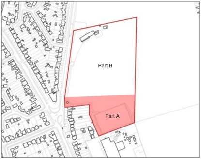
The site is part of the Staines and Laleham Sports club with access via Worple Road. The wider sports club measures
6.03 hectares. This comprises Part A (1.59 hectares) which is identified for housing and release from the Green Belt and Part B (4.44 hectares) which is identified for improved sports facilities and is to be retained in the Green Belt.
The site is currently occupied by a sports pitch and is to the south of the sports club area. It borders housing to the southwest and a garden centre to the south. Open greenfield land is present to the southeast. |
Site-specific requirements |
In addition to meeting the policies in the plan, any developer of this site will be required to provide the following:
- A mix of dwellinghouses and apartments on Part A.
- The provision of a new vehicular and pedestrian access to the site from Worple Road, with additional pedestrian crossings.
- The proposals will be expected to contribute to the enhancement of the adjacent sports facilities at Staines and Laleham Sports Association on Part B. This area will be retained in the Green Belt.
- Suitable junction improvements to enable safe access/egress into and out of the site.
- 50% Affordable Housing [subject to viability testing]
- The enhancement of boundary planting should be used as an opportunity to provide net gains in biodiversity. This will need to be demonstrated through appropriate habitat/species surveys and implementation of management plans.
- Strengthening of the adjacent Green Belt boundaries to retain its performance and strategic role adjacent to the site.
- Include measures to mitigate the impact of development on the local road network and take account of impacts on the strategic road network as identified through a site-specific Travel Plan and Transport Assessment.
- Provide or contribute to any infrastructure as set out in the IDP and/or identified at the application stage which is necessary to make the site acceptable in planning terms.
- Maximise the use of Climate Change measures and renewable energy sources, in accordance with Policy DS2 to make buildings zero carbon where possible.
|
Opportunities |
- Development should contribute to the enhancement of public transport, walking and cycling infrastructure and links to local town centres and other destinations such as places of employment, services and leisure in order to minimise traffic generation and improve the connectivity. Appropriate linkages with the Spelthorne Local Cycling and Walking Infrastructure Plan.
- The site should accommodate a scheme of high- quality design that makes a positive contribution to the wider environment and character.
|
Delivery Timeframe |
2028-2032 (years 6-10) |
SC1/006 (Tesco Extra, Escot Road)
Site Information |
Site ID |
SC1/006 |
Site name/ address |
Tesco Extra, Escot Road, Sunbury, TW16 7BB |
Site area (ha) |
3.75 |
Location |
Urban area
Previously developed land |
Ward |
Sunbury Common |
Proposed Allocation |
Retail: Retention of the existing superstore on site. Residential (C3): 225 units (approx.) |
|
Site description & existing use |
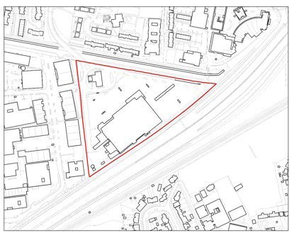
The site is triangular in shape and is occupied by a Tesco Extra supermarket with associated servicing area, a petrol filling station and large surface car park. The northern boundary of the site is formed by Staines Reservoir Aqueduct, beyond which is Sunbury Cross Shopping Centre and existing residential properties at Spelthorne Grove and Forest Drive. The M3 runs to
the south of the site with various industrial uses to the west. |
Site-specific requirements |
In addition to meeting the policies in the plan, any developer of this site will be required to provide the following:
- Retention of the existing superstore on site with appropriate parking.
- Through provision of landscaping and boundary planting provide net gains in biodiversity; This will need to be demonstrated through appropriate habitat/species surveys and implementation of management plans.
- Include measures to mitigate the impact of development on the local road network and take account of impacts on the strategic road network as identified through a site- specific Travel Plan and Transport Assessment.
- Provide or contribute to any infrastructure as set out in the IDP and/or identified at the application stage which is necessary to make the site acceptable in planning terms.
- Maximise the use of Climate Change measures and renewable energy sources, in accordance with Policy DS2 to make buildings zero carbon where possible.
|
Opportunities |
- Roads within the site should be designed to provide safe and legible walking and cycling access. There should be clear delineation between commercial and residential development. Development should contribute to the enhancement of public transport, walking and cycling infrastructure and links to local town centres and other destinations such as places of employment, services and leisure in order to minimise traffic generation and improve the connectivity.
|
Delivery Timeframe |
2028-2032 (years 6-10) |
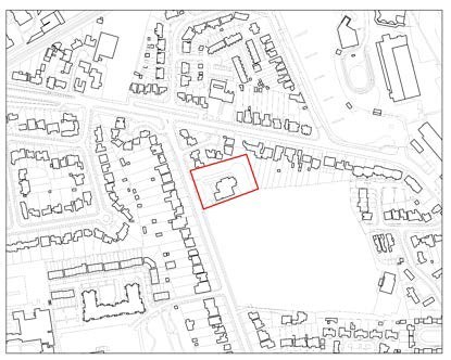
SE1/020 (Sunbury Adult Education Centre, The Avenue)
Site Information |
Site ID |
SE1/020 |
Site name/ address |
Sunbury Adult Education Centre, The Avenue, Sunbury-on- Thames, TW16 5DZ |
Site area (ha) |
0.43 |
Location |
Urban area
Previously developed land |
Ward |
Sunbury East |
Proposed Allocation |
Residential (C3): 30 units (Approx.) |
|
Site description & existing use |
The site is currently occupied by a 1-2 storey building in use for adult education purposes. A parking area is situated to the front and rear of the site with trees lining the west and east. The site is situated within the urban area of Sunbury. The site is accessed via The Avenue to the west. A sports ground is situated to the south of the site, with family dwelling houses to the north, west and east. |
Site-specific requirements |
In addition to meeting the policies in the plan, any developer of this site will be required to provide the following:
- A housing scheme subject to the existing use being re- provided off site in location accessible to the community, prior to redevelopment.
- Include measures to mitigate the impact of development on the local road network and take account of impacts on the strategic road network as identified through a site- specific Travel Plan and Transport Assessment.
- Provide or contribute to any infrastructure as set out in the IDP and/or identified at the application stage which is necessary to make the site acceptable in planning terms.
- Maximise the use of Climate Change measures and renewable energy sources, in accordance with Policy DS2 to make buildings zero carbon where possible.
|
Opportunities |
- This plot lends itself to a well-designed scheme that makes a positive contribution to the wider street scene.
- Improvements for pedestrian access and public realm, linking the site to nearby services with active and sustainably travel options.
|
Delivery Timeframe |
2028-2032 (years 6-10) |
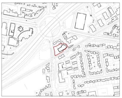
SE1/025 (Elmbrook House, Station Road)
Site Information |
Site ID |
SE1/025 |
Site name/ address |
Elmbrook House, 18-19 Station Road, Sunbury, TW16 6SU |
Site area (ha) |
0.25 |
Location |
Urban area
Previously developed land |
Ward |
Sunbury East |
Proposed Allocation |
Residential (C3): 50 Units (approx.) |
|
Site description & existing use |
The site is currently occupied by an office building and carpark. The site is within the urban area, adjacent to Sunbury Rail Station and other commercial uses occupy the wider area.
Further north is Sunbury Cross Roundabout, with Green Street to the southwest. |
Site-specific requirements |
In addition to meeting the policies in the plan, any developer of this site will be required to provide the following:
- A well-designed scheme that has a positive relationship with nearby town centre uses.
- Include measures to mitigate the impact of development on the local road network and take account of impacts on the strategic road network as identified through a site- specific Travel Plan and Transport Assessment.
- Provide or contribute to any infrastructure as set out in the IDP and/or identified at the application stage which is necessary to make the site acceptable in planning terms.
- Maximise the use of Climate Change measures and renewable energy sources, in accordance with Policy DS2 to make buildings zero carbon where possible.
|
Opportunities |
- This plot in a prominent location at Sunbury Cross Roundabout lends itself to a well-designed scheme that makes a positive contribution to the wider street scene.
- Improvements for pedestrian access and public realm, linking the site to nearby services with active and sustainably travel options. Linkages with the Spelthorne Local Cycling and Walking Infrastructure Plan.
|
Delivery Timeframe |
2028-2032 (years 6-10) |
SH1/010 (Shepperton Library, High Street)
Site Information |
Site ID |
SH1/010 |
Site name/ address |
Shepperton Library, High Street, Shepperton, TW17 9AU |
Site area (ha) |
0.14 |
Location |
Urban area
Previously developed land |
Ward |
Shepperton Town |
Proposed Allocation |
Residential (C3): 10 units (approx.)
Ground floor community use (Class F): 250sqm (approx.) or re-provision off site |
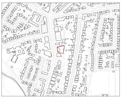
|
Site description & existing use |
The site is currently occupied by Shepperton Library, a single storey building set back from the road by a forecourt with a small amount of parking, and with a small, grassed area. The site fronts onto Shepperton High Street between the BP petrol filling station and a former bank premises. The surrounding area
largely commercial in character on the ground floor with residential uses on the upper storeys of buildings. |
Site-specific requirements |
In addition to meeting the policies in the plan, any developer of this site will be required to provide the following:
- A housing scheme subject to the existing use being re- provided off site in location accessible to the community, prior to redevelopment, or a mixed-use scheme incorporating ground floor community uses.
- A well-designed scheme that has a positive relationship with nearby town centre uses and residential properties.
- Include measures to mitigate the impact of development on the local road network and take account of impacts on the strategic road network as identified through a site- specific Travel Plan and Transport Assessment.
- Provide or contribute to any infrastructure as set out in the IDP and/or identified at the application stage which is necessary to make the site acceptable in planning terms.
- Maximise the use of Climate Change measures and renewable energy sources, in accordance with Policy DS2 to make buildings zero carbon where possible.
|
Opportunities |
- This plot lends itself to a well-designed scheme that makes a positive contribution to the wider street scene.
- Improvements for pedestrian access and public realm, linking the site to nearby services with active and sustainably travel options.
|
Delivery Timeframe |
2028-2032 (years 6-10) |
ST1/028 (Leacroft Centre, Leacroft, Staines)
Site Information |
Site ID |
ST1/028 |
Site name/ address |
Leacroft Centre, Leacroft, Staines, TW18 4PB |
Site area (ha) |
0.15 |
Location |
Urban area, previously developed land |
Ward |
Staines |
Proposed Allocation |
Residential (C3): 17 units (approx.)
Ground floor community units or re-provision off site |
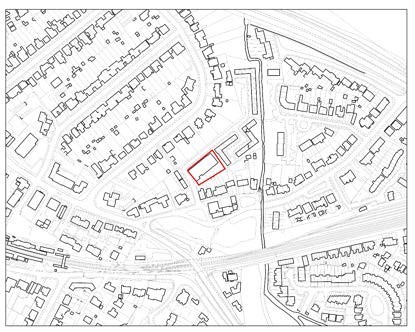
|
Site description & existing use |
The site is currently occupied by the Leacroft Youth Centre, a two-storey rectangular-shaped building. The building was formerly occupied by a drill hall and dates from the 1910s. The site lies on the corner of Leacroft and Raleigh Court. The surrounding area is largely residential in character with single storey and semi-detached dwellings neighbouring the site.
Further south of the site are a number of flatted 2-3 storey flatted developments. |
Site-specific requirements |
In addition to meeting the policies in the plan, any developer of this site will be required to provide the following:
- A housing scheme subject to the existing use being re- provided off site in a location accessible to the community, prior to redevelopment, or a mixed use scheme incorporating ground floor community uses.
- Include measures to mitigate the impact of development on the local road network and take account of impacts on the strategic road network as identified through a site- specific Travel Plan and Transport Assessment.
- Provide or contribute to any infrastructure as set out in the IDP and/or identified at the application stage which is necessary to make the site acceptable in planning terms.
- Maximise the use of Climate Change measures and renewable energy sources, in accordance with Policy DS2 to make buildings zero carbon where possible.
|
Opportunities |
- This plot lends itself to a well-designed scheme that makes a positive contribution to the wider street scene.
- Improvements for pedestrian access and public realm, linking the site to nearby services with active and sustainably travel options.
|
Delivery Timeframe |
2028-2032 (years 6-10) |
ST1/029 (Surrey County Council buildings, Burges Way, Staines)
Site Information |
Site ID |
ST1/029 |
Site name/ address |
Surrey County Council buildings, Burges Way, Staines, TW18 1YA |
Site area (ha) |
0.47 |
Location |
Urban area, previously developed land. |
Ward |
Staines |
Proposed Allocation |
Residential (C3): 30 units (approx.)
Ground floor community units or re-provision off site |
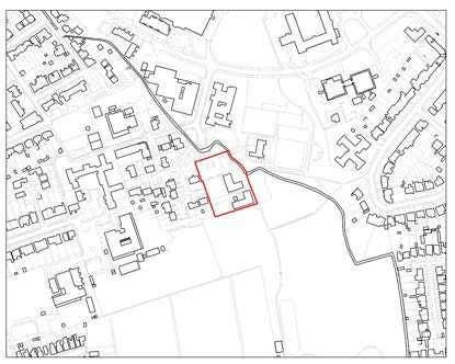
|
Site description & existing use |
The site is currently occupied by Surrey County Council health offices, a parking area to the front and a scout building to the south of the site. The surrounding uses within the Knowle Green estate are largely community focused and residential. The
buildings are all generally low-key in scale, with these being single storey. |
Site-specific requirements |
In addition to meeting the policies in the plan, any developer of this site will be required to provide the following:
- A housing scheme subject to the existing use being re- provided off site in a location accessible to the community, prior to redevelopment, or a mixed use scheme incorporating ground floor community uses.
- Appropriate flood risk mitigation measures to enable the safe introduction of residents.
- Include measures to mitigate the impact of development on the local road network and take account of impacts on the strategic road network as identified through a site- specific Travel Plan and Transport Assessment;
- Provide or contribute to any infrastructure as set out in the IDP and/or identified at the application stage which is necessary to make the site acceptable in planning terms.
- Maximise the use of Climate Change measures and renewable energy sources, in accordance with Policy DS2 to make buildings zero carbon where possible.
|
Opportunities |
- A well designed scheme that makes a positive contribution to the wider area.
- Improvements for pedestrian access and public realm, linking the site to nearby services with active and sustainably travel options.
- Opportunity to link development with ST1/030 to the north west to create a more holistic, high quality scheme.
|
Delivery Timeframe |
2028-2032 (years 6-10) |
ST1/030 (Fairways Day Centre, Knowle Green, Staines)
Site Information |
Site ID |
ST1/030 |
Site name/ address |
Fairways Day Centre, Knowle Green, Staines, TW18 1AJ |
Site area (ha) |
0.66 |
Location |
Urban area
Previously developed land |
Ward |
Staines |
Proposed Allocation |
Residential (C3): 30 units (approx.)
Ground floor community units or re-provision off site |
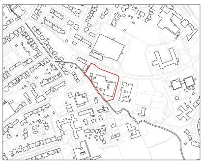
|
Site description & existing use |
The site is currently occupied by Surrey County Council health offices, a parking area to the front and a scout building to the south of the site. The surrounding uses within the Knowle Green estate are largely community focused and residential. The buildings are all generally low-key in scale, with these being
single storey. |
Site-specific requirements |
In addition to meeting the policies in the plan, any developer of this site will be required to provide the following:
- A housing scheme subject to the existing use being re- provided off site in a location accessible to the community, prior to redevelopment, or a mixed use scheme incorporating ground floor community uses.
- Appropriate flood risk mitigation measures to enable the safe introduction of residents.
- Include measures to mitigate the impact of development on the local road network and take account of impacts on the strategic road network as identified through a site- specific Travel Plan and Transport Assessment;
- Provide or contribute to any infrastructure as set out in the IDP and/or identified at the application stage which is necessary to make the site acceptable in planning terms.
|
Opportunities |
- A well designed scheme that makes a positive contribution to the wider area.
- Improvements for pedestrian access and public realm, linking the site to nearby services with active and sustainably travel options.
- Opportunity to link development with ST1/029 to the south east to create a more holistic, high quality scheme.
|
Delivery Timeframe |
2028-2032 (years 6-10) |
ST3/014 (Birch House/London Road, Fairfield Avenue, Staines)
Site Information |
Site ID |
ST3/014 |
Site name/ address |
Birch House/London Road, Fairfield Avenue, Staines, TW18 4AB |
Site area (ha) |
1.25 |
Location |
Urban area, previously developed land |
Ward |
Staines |
Proposed Allocation |
Residential (C3): 400 units (approx.) (net) Commercial (Class E): 1200 sqm (approx.) |
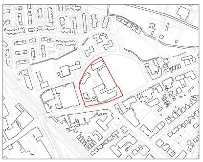
|
Site description & existing use |
The existing site currently consists of numerous retail and office buildings of various ages and a multi storey car park. These include One London Road and Birch House which are four and five storey office buildings with front onto London Road and Fairfield Avenue respectively.
Located within Staines-Upon-Thames, the site is situated in a densely built-up site, bounded by London Road to the south and
Fairfield Avenue to the north. Historically the site and the immediate area was predominantly a commercial area but the string of new residential developments has led to a much more residential area. |
Site-specific requirements |
In addition to meeting the policies in the plan, any developer of this site will be required to provide the following:
- A mixed residential and commercial development that provides an active street frontage.
- A well-designed scheme that has a positive relationship with nearby town centre uses.
- Include measures to mitigate the impact of development on the local road network and take account of impacts on the strategic road network as identified through a site- specific Travel Plan and Transport Assessment;
- Provide or contribute to any infrastructure as set out in the IDP and/or identified at the application stage which is necessary to make the site acceptable in planning terms.
- Maximise the use of Climate Change measures and renewable energy sources, in accordance with Policy DS2 to make buildings zero carbon where possible.
|
Opportunities |
- This plot within the town centre lends itself to a high- quality scheme that makes a positive contribution to the wider street scene.
- Provide positive benefits in terms of landscape and townscape character and local distinctiveness.
- Improvements for pedestrian access and public realm, linking the site to nearby services with active and sustainably travel options.
|
Delivery Timeframe |
2028-2032 (years 6-10) |
ST4/004 (96-104 Church Street, Staines)
Site Information |
Site ID |
ST4/004 |
Site name/ address |
96-104 Church Street, Staines, TW18 4QF |
Site area (ha) |
0.88 |
Location |
Urban area
Previously developed land |
Ward |
Staines |
Proposed Allocation |
Residential (C3): 100 units (approx.) |
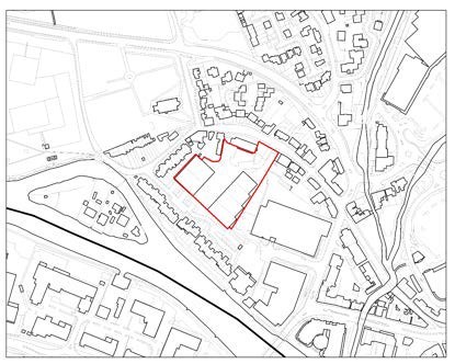
|
Site description & existing use |
The site is situated on southern side of Church Street within the urban area, to the west of Staines town centre. The site is some
0.89 hectares in area and currently consists of 6 warehouse buildings and an associated access road and hard standing along with parking spaces for the three-storey office block to the north of the site fronting Church Street which is locally listed, whilst the gate and railings are Grade II listed. There is access via Church Street between Magna House and No. 96-104. The
warehouse buildings are located towards the rear of the site. These buildings face into the site, with hard standing between.
The elevations of some of these buildings make up the boundary treatment with the adjacent residential developments. Church Street is within Staines Conservation Area and consists of properties, with varying ages and styles, however it is largely residential and 2-storeys in nature, with traditional pitched roofs. There are some commercial uses located further east. |
Site-specific requirements |
In addition to meeting the policies in the plan, any developer of this site will be required to provide the following:
- A well-designed scheme that has a positive relationship with nearby town centre uses and residential properties.
- Conserve and, where possible, enhance Staines Conservation Area and the setting of nearby listed buildings along Church Street.
- Include measures to mitigate the impact of development on the local road network and take account of impacts on the strategic road network as identified through a site- specific Travel Plan and Transport Assessment.
- Provide or contribute to any infrastructure as set out in the IDP and/or identified at the application stage which is necessary to make the site acceptable in planning terms.
- Maximise the use of Climate Change measures and renewable energy sources, in accordance with Policy DS2 to make buildings zero carbon where possible.
|
Opportunities |
- This plot at the edge of the town centre lends itself to a high-quality scheme that makes a positive contribution to the wider street scene.
- Improvements for pedestrian access and public realm, linking the site to nearby services with active and sustainably travel options.
|
Delivery Timeframe |
2028-2033 (years 6-10) |
ST4/010 (Riverside car park, Thames Street, Staines)
Site Information |
Site ID |
ST4/010 |
Site name/ address |
Riverside car park, Thames Street, Staines, TW18 4UD |
Site area (ha) |
0.25 |
Location |
Urban area
Previously developed land |
Ward |
Staines |
Proposed Allocation |
Residential (C3): 35 units (approx.)
Community Café/ Commercial (Class E): 150 sqm (approx.) Open space linking to Memorial Gardens |
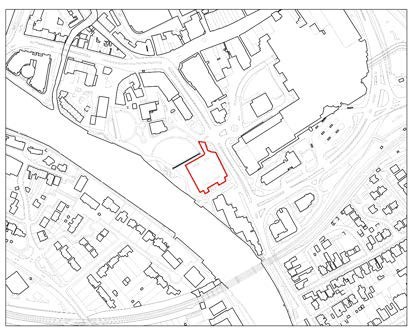
|
Site description & existing use |
The site is currently in use as a surface car park located to the east of Staines Town centre between the River Thames and A308. There is the large Memorial Gardens to the north, and a hotel to the south. To
the west is a public footpath that links with the Thames Path. |
Site-specific requirements |
In addition to meeting the policies in the plan, any developer of this site will be required to provide the following:
- A mixed residential and commercial development that provides an active frontage against the River Thames.
- Provision of open space, linking to Memorial Gardens to the northwest.
- A well-designed scheme that has a positive relationship with nearby town centre uses and the River Thames.
- Incorporate flood risk mitigation measures to alleviate the risk of fluvial and surface water flooding, in accordance with Policy E2.
- Sufficient parking re-provision to meet needs on site or in an appropriate nearby location.
- Include measures to mitigate the impact of development on the local road network and take account of impacts on the strategic road network as identified through a site-specific Travel Plan and Transport Assessment.
- Provide or contribute to any infrastructure as set out in the IDP and/or identified at the application stage which is necessary to make the site acceptable in planning terms.
- Maximise the use of Climate Change measures and renewable energy sources, in accordance with Policy DS2 to make buildings zero carbon where possible.
|
Opportunities |
- This plot within the town centre lends itself to a high-quality scheme that makes a positive contribution to the wider street scene.
- Provide positive benefits in terms of landscape and townscape character and local distinctiveness.
- Improvements for pedestrian access and public realm, linking the site to nearby services with active and sustainably travel options.
|
Delivery Timeframe |
2028-2032 (years 6-10) |
ST4/011 (Thames Lodge Hotel, Thames Street, Staines)
Site Information |
Site ID |
ST4/011 |
Site name/ address |
Thames Lodge Hotel, Thames Street, Staines, TW18 4SJ |
Site area (ha) |
0.36 |
Location |
Urban area
Previously developed land |
Ward |
Staines |
Proposed Allocation |
Residential (C3): 40 units (approx.) (net)
Café/ Commercial (Class E): 150 sqm (approx.) |
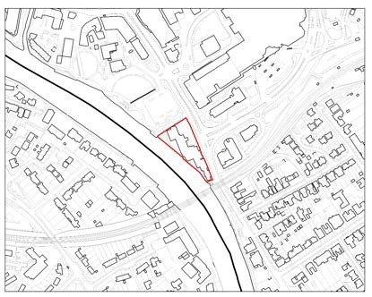
|
Site description & existing use |
The site is currently occupied by a hotel and a car park. The site backs onto the River Thames and is accessed via Thames Street. The site is occupied by a locally listed building. Offices sit to the east of the site across Laleham Road. The building is 2-3 storeys and is locally listed- 19th C building.
The character of the wider area is mixed with commercial uses dominating to the north with a carpark also present to the north west. To the south and east residential uses become more prominent further away from the Town Centre. A rail line is
present immediately south of the site. |
Site-specific requirements |
In addition to meeting the policies in the plan, any developer of this site will be required to provide the following:
- A mixed residential and commercial development that provides an active frontage against the River Thames.
- A well-designed scheme that has a positive relationship with nearby town centre uses, the River Thames and nearby residential properties.
- Reprovision of the Thames Path link.
- Incorporate flood risk mitigation measures to alleviate the risk of fluvial and surface water flooding, in accordance with Policy E2.
- Include measures to mitigate the impact of development on the local road network and take account of impacts on the strategic road network as identified through a site- specific Travel Plan and Transport Assessment.
- Provide or contribute to any infrastructure as set out in the IDP and/or identified at the application stage which is necessary to make the site acceptable in planning terms.
- Maximise the use of Climate Change measures and renewable energy sources, in accordance with Policy DS2 to make buildings zero carbon where possible.
|
Opportunities |
- This plot within the town centre lends itself to a high- quality scheme that makes a positive contribution to the wider street scene.
- Provide positive benefits in terms of landscape and townscape character and local distinctiveness.
- Improvements for pedestrian access and public realm, linking the site to nearby services with active and sustainably travel options.
|
Delivery Timeframe |
2028-2032 (years 6-10) |
ST4/023 (Two Rivers Retail Park Terrace, Mustard Mill Road, Staines)
Site Information |
Site ID |
ST4/023 |
Site name/ address |
Two Rivers Retail Park Terrace, Mustard Mill Road, Staines |
Site area (ha) |
2.29 |
Location |
Urban area, previously developed land |
Ward |
Staines |
Proposed Allocation |
Residential (C3): 750 units (approx.) Ground floor commercial/community use |
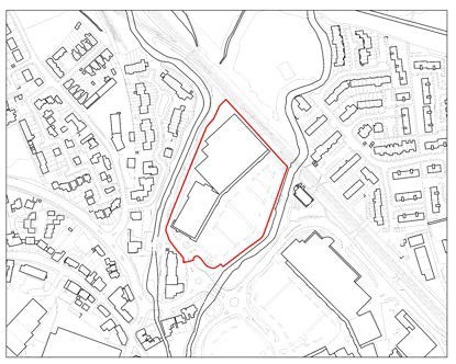
|
Site description & existing use |
The site is located to the west of the River Colne and the East of the River Wraysbury. The site is located to the northwest of Mustard Mill Road, comprising the Retail Park terrace with large retail units and a
surface carpark occupying the site. |
Site-specific requirements |
In addition to meeting the policies in the plan, any developer of this site will be required to provide the following:
- A mixed residential and commercial development that provides an active frontage against Mustard Mill Road.
- Provision of residential amenity space within the development site.
- Suitable reprovision of shoppers’ parking
- A well-designed scheme that has a positive relationship with nearby town centre uses and nearby residential properties.
- Include measures to mitigate the impact of development on the local road network and take account of impacts on the strategic road network as identified through a site-specific Travel Plan and Transport Assessment.
- Provide or contribute to any infrastructure as set out in the IDP and/or identified at the application stage which is necessary to make the site acceptable in planning terms.
- Maximise the use of Climate Change measures and renewable energy sources, in accordance with Policy DS2 to make buildings zero carbon where possible.
|
Opportunities |
- This plot within the town centre lends itself to a high-quality scheme that makes a positive contribution to the wider street scene.
- Provide positive benefits in terms of landscape and townscape character and local distinctiveness.
- Improvements for pedestrian access and public realm, linking the site to nearby services with active and sustainably travel options.
- Improvements to nearby open space.
|
Delivery Timeframe |
2028-2032 (years 6-10) |
ST4/024 (Frankie & Benny’s/Travelodge, Two Rivers, Hale Street, Staines)
Site Information |
Site ID |
ST4/024 |
Site name/ address |
Frankie & Benny’s/Travelodge, Two Rivers, Hale Street,
Staines, TW18 4UW |
Site area (ha) |
0.24 |
Location |
Urban area
Previously developed land |
Ward |
Staines |
Proposed Allocation |
Residential (C3): 55 units (approx.) |
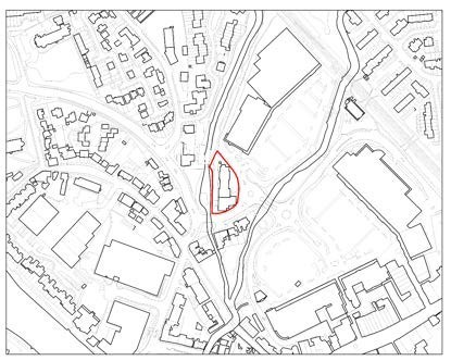
|
Site description & existing use |
The area is currently occupied by a restaurant and hotel use in Hale Street. The existing buildings were erected in the early 2000’s. The site is within Staines Town Centre.
To the north lies the Two River Retail Park Terrace, while to the south on the other side of the road are 16 – 24 Hale Street. To the east is the Two Rivers Shopping Centre, while to the west is
the Wraysbury River. The site is located with the Staines Conservation Area. |
Site-specific requirements |
In addition to meeting the policies in the plan, any developer of this site will be required to provide the following:
- A well-designed scheme that has a positive relationship with nearby town centre uses and residential properties.
- Include measures to mitigate the impact of development on the local road network and take account of impacts on the strategic road network as identified through a site- specific Travel Plan and Transport Assessment.
- Provide or contribute to any infrastructure as set out in the IDP and/or identified at the application stage which is necessary to make the site acceptable in planning terms.
- Maximise the use of Climate Change measures and renewable energy sources, in accordance with Policy DS2 to make buildings zero carbon where possible.
|
Opportunities |
- This plot at the edge of the town centre lends itself to a high-quality scheme that makes a positive contribution to the wider street scene.
- Improvements for pedestrian access and public realm, linking the site to nearby services with active and sustainably travel options.
|
Delivery Timeframe |
2028-2032 (years 6-10) |
Years 11-15 (2033-2037)
AS2/001 (Ashford Youth Club, Kenilworth Road)
Site Information |
Site ID |
AS2/001 |
Site name/ address |
Ashford Youth Club, Kenilworth Road, Ashford, TW15 3EL |
Site area (ha) |
0.25 |
Location |
Urban area
Previously developed land |
Ward |
Ashford North and Stanwell South |
Proposed Allocation |
Local Community F2(b): 500sqm Youth Centre (approx.) Residential (C3): 5 units (approx.) |
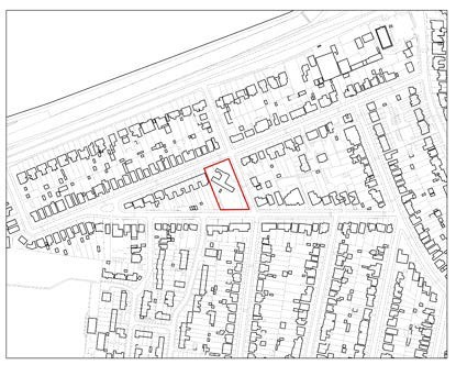
|
Site description & existing use |
The site is currently occupied by a youth club and is located within a predominantly residential area. The site is bounded to the north by Kenilworth Road and to the south by Cumberland Road. |
Site-specific requirements |
In addition to meeting the policies in the plan, any developer of this site will be required to provide the following:
- Retention of the youth club and associated open space on site, as part of a mixed use scheme, or relocation to a suitable alternative site.
- Provide or contribute to any infrastructure as set out in the IDP and/or identified at the application stage which is necessary to make the site acceptable in planning terms.
- Through provision of landscaping and boundary planting provide net gains in biodiversity; This will need to be demonstrated through appropriate habitat/species surveys and implementation of management plans.
- Maximise the use of Climate Change measures and renewable energy sources, in accordance with Policy DS2 to make buildings zero carbon where possible.
|
Opportunities |
- High-quality mixed-use scheme designed to make a positive contribution to the wider area and character.
|
Delivery Timeframe |
2033-2037 (years 11-15) |
AT3/009 (Ashford Telephone Exchange, Church Road)
Site Information |
Site ID |
AT3/009 |
Site name/ address |
Ashford Telephone Exchange, Church Road, Ashford, TW15 2TS |
Site area (ha) |
0.26 |
Location |
Urban area
Previously developed land |
Ward |
Ashford Town |
Proposed Allocation |
Residential (C3): 20 units (approx.) |
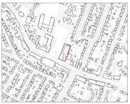
|
Site description & existing use |
The existing Telephone Exchange is located to the north of Church Road. The site is made up of three separate buildings with a parking area for approximately 10 vehicles to the side. The site is adjacent to former Brooklands College site and
Studholme Medical Centre and opposite the Co-op convenience store. |
Site-specific requirements |
In addition to meeting the policies in the plan, any developer of this site will be required to provide the following:
- Include measures to mitigate the impact of development on the local road network and take account of impacts on the strategic road network as identified through a site- specific Travel Plan and Transport Assessment.
- Provide or contribute to any infrastructure as set out in the IDP and/or identified at the application stage which is necessary to make the site acceptable in planning terms.
- Relocation of the existing use prior to development.
- Maximise the use of Climate Change measures and renewable energy sources, in accordance with Policy DS2 to make buildings zero carbon where possible.
|
Opportunities |
- This rectangular plot lends itself to a well-designed scheme that makes a positive contribution to the wider street scene.
- Improvements for pedestrian access and public realm, linking the site to nearby services with active and sustainably travel options.
|
Delivery Timeframe |
2033-2037 (years 11-15) |
SC1/013 (RMG Warehouse & Delivery Office, Staines Road West)
Site Information |
Site ID |
SC1/013 |
Site name/ address |
RMG Warehouse & Delivery Office, 47-49 Staines Road West, Sunbury, TW16 7AA |
Site area (ha) |
0.25 |
Location |
Urban area
Previously developed land |
Ward |
Sunbury Common |
Proposed Allocation |
Residential (C3): 22 units (approx.)
Ground floor office/retail (Class E): 500 sqm (approx.) |
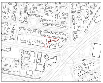
|
Site description & existing use |
The site is occupied by warehousing units accessed from Vicarage Road to the east. The site is L shaped, with a commercial unit fronting Staines Road West and The Parade. The surrounding area is largely commercial in character with commercial units present along The Parade and opposite at Sunbury Cross. Residential uses are also located in the wider area which is largely high density in character. |
Site-specific requirements |
In addition to meeting the policies in the plan, any developer of this site will be required to provide the following:
- Include measures to mitigate the impact of development on the local road network and take account of impacts on the strategic road network as identified through a site- specific Travel Plan and Transport Assessment;
- Provide or contribute to any infrastructure as set out in the IDP and/or identified at the application stage which is necessary to make the site acceptable in planning terms.
- Relocation of the existing use prior to development.
- Maximise the use of Climate Change measures and renewable energy sources, in accordance with Policy DS2 to make buildings zero carbon where possible.
|
Opportunities |
- This plot lends itself to a well-designed scheme that makes a positive contribution to the wider street scene.
- Improvements for pedestrian access and public realm, linking the site to nearby services with active and sustainably travel options.
|
Delivery Timeframe |
2033-2037 (years 11-15) |
SC1/019 (Sunbury Social Services Centre, Vicarage Road)
Site Information |
Site ID |
SC1/019 |
Site name/ address |
Sunbury Social Services Centre, 108 Vicarage Road, Sunbury, TW16 7QL |
Site area (ha) |
0.23 |
Location |
Urban area
Previously developed land |
Ward |
Sunbury Common |
Proposed Allocation |
Residential (C3): 11 units (approx.)
Ground floor community units or re-provision off site |
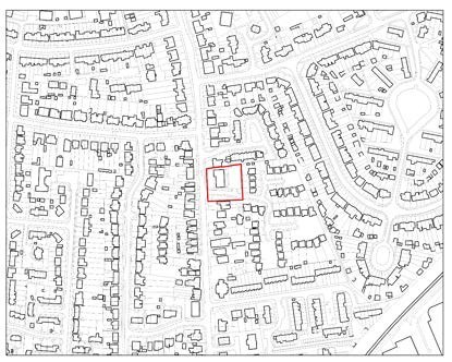
|
Site description & existing use |
The site is currently occupied by a single storey building with community uses present. To the rear of the site is a car parking area. The site is located on the corner of Vicarage Road and Wychwood Close. A mature tree is situated in the front of the site. The surrounding character is predominantly residential, with a few small-scale commercial uses to the south of the site.
Several small, flatted developments are present south along Vicarage Road. |
Site-specific requirements |
In addition to meeting the policies in the plan, any developer of this site will be required to provide the following:
- A housing scheme subject to the existing use being re- provided off site in location accessible to the community, prior to redevelopment, or a mixed use scheme incorporating ground floor community uses.
- Include measures to mitigate the impact of development on the local road network and take account of impacts on the strategic road network as identified through a site- specific Travel Plan and Transport Assessment.
- Provide or contribute to any infrastructure as set out in the IDP and/or identified at the application stage which is necessary to make the site acceptable in planning terms.
- Maximise the use of Climate Change measures and renewable energy sources, in accordance with Policy DS2 to make buildings zero carbon where possible.
|
Opportunities |
- This plot lends itself to a well-designed scheme that makes a positive contribution to the wider street scene.
- Improvements for pedestrian access and public realm, linking the site to nearby services with active and sustainably travel options.
|
Delivery Timeframe |
2033-2037 (years 11-15) |
SC1/021 (Land at Spelthorne Grove)
Site Information |
Site ID |
SC1/021 |
Site name/ address |
Land at Spelthorne Grove, Sunbury, TW16 7BZ |
Site area (ha) |
2.1 |
Location |
Urban area
Previously developed land |
Ward |
Sunbury Common |
Proposed Allocation |
Residential (C3): 250 net units (approx.)
Open space: Retention of existing or reprovision within the wider site. |
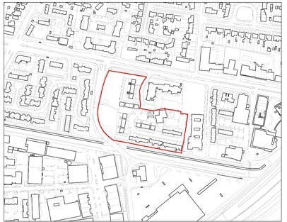
|
Site description & existing use |
The site is located to the south of Staines Road West and is occupied by a housing estate. The western part of the site comprises an open space and recreation area, with flatted development along the northern and central areas with houses along the southern boundary. Approximately 208 units currently occupy the site. To the west runs Escot Road which links to the Tesco Extra site to the south. The wider area is urban in character with residential and commercial uses the dominant
uses. |
Site-specific requirements |
In addition to meeting the policies in the plan, any developer of this site will be required to provide the following:
- Retention or re-provision of an open space/recreation area within the site to a better standard and improved location.
- Include measures to mitigate the impact of development on the local road network and take account of impacts on the strategic road network as identified through a site- specific Travel Plan and Transport Assessment.
- Provide or contribute to any infrastructure as set out in the IDP and/or identified at the application stage which is necessary to make the site acceptable in planning terms.
- A suitable decanting plan for the existing properties as to minimise the disruption for current residents.
- Maximise the use of Climate Change measures and renewable energy sources, in accordance with Policy DS2 to make buildings zero carbon where possible.
|
Opportunities |
- This plot lends itself to a well-designed scheme that makes a positive contribution to the wider street scene.
- Improvements for pedestrian access and public realm, linking the site to nearby services with active and sustainably travel options.
|
Delivery Timeframe |
2033-2037 (years 11-15) |
SE1/003 (Builder’s Yard, Staines Road East)
Site Information |
Site ID |
SE1/003 |
Site name/ address |
Builder’s Yard, 77 Staines Road East, TW16 5AD |
Site area (ha) |
0.75 |
Location |
Urban area, brownfield land. |
Ward |
Sunbury East |
Proposed Allocation |
Residential (C3): 75 units (approx.) |
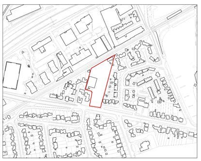
|
Site description & existing use |
The site is currently occupied by a builder’s yard and is accessed from Staines Road East. Buildings occupy the western part of the site with open storage and parking to the east. Trees line the site on both sides with the railway line to the north of the site.
The local area is predominantly residential in character with flats in front of the western part of the site. Houses sit across Staines
Road East with garden land immediately opposite. Properties neighbour the west and east of the site and the old police station sits to the southwest. A large number of mature trees are located around the site. |
Site-specific requirements |
In addition to meeting the policies in the plan, any developer of this site will be required to provide the following:
- Through provision of landscaping and boundary planting provide net gains in biodiversity; This will need to be demonstrated through appropriate habitat/species surveys and implementation of management plans.
- Include measures to mitigate the impact of development on the local road network and take account of impacts on the strategic road network as identified through a site- specific Travel Plan and Transport Assessment.
- Provide or contribute to any infrastructure as set out in the IDP and/or identified at the application stage which is necessary to make the site acceptable in planning terms.
- Maximise the use of Climate Change measures and renewable energy sources, in accordance with Policy DS2 to make buildings zero carbon where possible.
|
Opportunities |
- This plot lends itself to a well-designed scheme that makes a positive contribution to the wider street scene.
- Improvements for pedestrian access and public realm, linking the site to nearby services with active and sustainably travel options.
|
Delivery Timeframe |
2033-2037 (years 11-15) |
SE1/008 (Telephone Exchange, Green Street)
Site Information |
Site ID |
SE1/008 |
Site name/ address |
Telephone Exchange, Green Street, Sunbury, TW16 6QJ |
Site area (ha) |
0.25 |
Location |
Urban area
Previously developed land |
Ward |
Sunbury East |
Proposed Allocation |
Residential (C3): 14 units (approx.) |
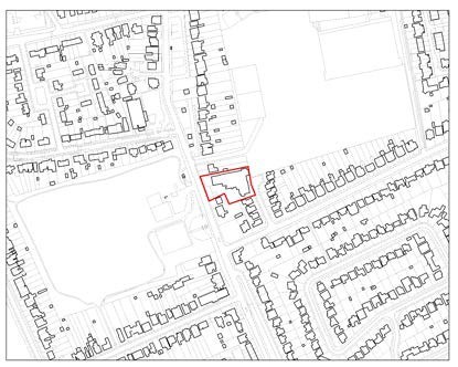
|
Site description & existing use |
The site is currently occupied by the BT Telephone Exchange. It is a 2-storey detached building, with an older property fronting the site and mid-20th century additions to the rear and east. The surrounding area is largely residential in character, with properties detached or semi-detached dwellings. St Paul’s College sits to the east of the site whilst Cedars Recreation Ground is to the west. |
Site-specific requirements |
In addition to meeting the policies in the plan, any developer of this site will be required to provide the following:
- Include measures to mitigate the impact of development on the local road network and take account of impacts on the strategic road network as identified through a site- specific Travel Plan and Transport Assessment;
- Provide or contribute to any infrastructure as set out in the IDP and/or identified at the application stage which is necessary to make the site acceptable in planning terms.
- Relocation of the existing use prior to development.
- Maximise the use of Climate Change measures and renewable energy sources, in accordance with Policy DS2 to make buildings zero carbon where possible.
|
Opportunities |
- This rectangular plot lends itself to a well-designed scheme that makes a positive contribution to the wider street scene.
- Improvements for pedestrian access and public realm, linking the site to nearby services with active and sustainably travel options.
|
Delivery Timeframe |
2033-2037 (years 11-15) |
SH1/015 (Shepperton Youth Centre, Shepperton Court Drive)
Site Information |
Site ID |
SH1/015 |
Site name/ address |
Shepperton Youth Centre, Shepperton Court Drive, Shepperton, TW17 8EJ |
Site area (ha) |
0.31 |
Location |
Urban area, previously developed land |
Ward |
Shepperton Town |
Proposed Allocation |
Local Community F2(b): 700sqm Youth Centre (approx.) and associated outdoor space
Residential (C3): 24 units (approx.) |
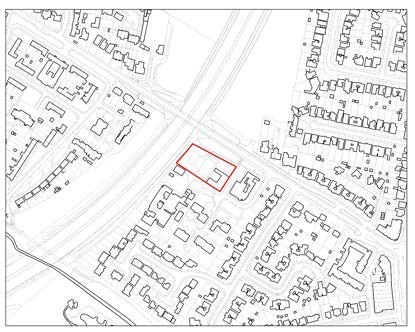
|
Site description & existing use |
The site is located to the south of the B376, with the M3 to the north and Shepperton Health centre immediately southeast.
Manor Mead school is situated to the southwest and residential development at Shepperton Court is located to the south of the
site. The surrounding character is mixed in nature, with various community and residential uses neighbouring the site. |
Site-specific requirements |
In addition to meeting the policies in the plan, any developer of this site will be required to provide the following:
- Retention of the youth club and associated open space on site (including the basketball court and skatepark), as part of a mixed-use scheme, or relocation to a suitable alternative site in a location accessible to the community.
- Provide or contribute to any infrastructure as set out in the IDP and/or identified at the application stage which is necessary to make the site acceptable in planning terms.
- Through provision of landscaping and boundary planting provide net gains in biodiversity; This will need to be demonstrated through appropriate habitat/species surveys and implementation of management plans.
- Maximise the use of Climate Change measures and renewable energy sources, in accordance with Policy DS2 to make buildings zero carbon where possible.
|
Opportunities |
- High-quality mixed-use scheme designed to make a positive contribution to the wider area and character.
- Improvements for pedestrian access and public realm, linking the site to nearby services with active and sustainably travel options.
|
Delivery Timeframe |
2033-2037 (years 11-15) |
SH2/003 (Shepperton Delivery Office, High Street)
Site Information |
Site ID |
SH2/003 |
Site name/ address |
Shepperton Delivery Office, 47 High Street, Shepperton, TW17 9AA |
Site area (ha) |
0.17 |
Location |
Urban area
Previously developed land |
Ward |
Shepperton Town |
Proposed Allocation |
Residential (C3): 10 units (approx.)
Ground floor Retail (Class E): 400sqm (approx.) |
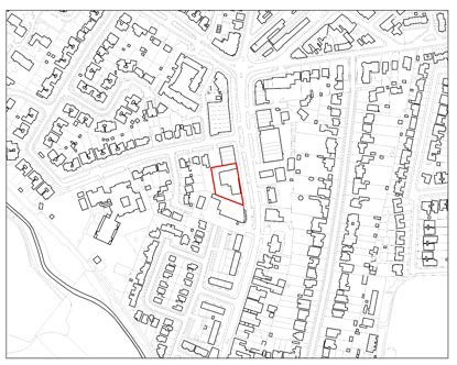
|
Site description & existing use |
The site is occupied by a Royal Mail delivery office and two retail units, with a single storey building fronting the High Street and a two-storey building set back. An area of hardstanding used for parking is located on the western part of the site. The surrounding area is largely commercial in character, with retail uses located adjacent along the High Street at ground floor level. Residential uses are largely present on the upper floors. A petrol filling station is located opposite the site. |
Site-specific requirements |
In addition to meeting the policies in the plan, any developer of this site will be required to provide the following:
- A mixed-use scheme comprising ground floor retail use (Class E) and residential units above on upper floors.
- A well-designed scheme that has a positive relationship with nearby town centre uses and residential properties.
- Include measures to mitigate the impact of development on the local road network and take account of impacts on the strategic road network as identified through a site- specific Travel Plan and Transport Assessment.
- Provide or contribute to any infrastructure as set out in the IDP and/or identified at the application stage which is necessary to make the site acceptable in planning terms.
- Maximise the use of Climate Change measures and renewable energy sources, in accordance with Policy DS2 to make buildings zero carbon where possible.
|
Opportunities |
- This plot lends itself to a well-designed scheme that makes a positive contribution to the wider street scene.
- Improvements for pedestrian access and public realm, linking the site to nearby services with active and sustainably travel options.
|
Delivery Timeframe |
2033-2037 (years 11-15) |
SN1/005 (Land at Northumberland Close)
Site Information |
Site ID |
SN1/005 |
Site name/ address |
Land at Northumberland Close, Stanwell, TW19 7LN |
Site area (ha) |
1.75 |
Location |
Greenfield land Former Green Belt |
Ward |
Stanwell North |
Proposed Allocation |
Residential (C3): 80 units (approx.) |
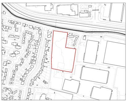
|
Site description & existing use |
The site is currently undeveloped and is situated on the western side of Northumberland Close. Trees line the north and west of the site. The site is surrounded by development on three sides, with residential development to the west, commercial uses to the east and Heathrow Airport further north past Bedfont Road and
Longford River. There is a small area of housing adjoining the site called Cleveland Park. |
Site-specific requirements |
In addition to meeting the policies in the plan, any developer of this site will be required to provide the following:
- A high-quality residential scheme.
- Adequate screening of the site against the adjacent commercial uses.
- 50% Affordable Housing [subject to viability testing]
- Through provision of landscaping and boundary planting provide net gains in biodiversity; This will need to be demonstrated through appropriate habitat/species surveys and implementation of management plans.
- Include measures to mitigate the impact of development on the local road network and take account of impacts on the strategic road network as identified through a site- specific Travel Plan and Transport Assessment.
- Provide or contribute to any infrastructure as set out in the IDP and/or identified at the application stage which is necessary to make the site acceptable in planning terms.
- Maximise the use of Climate Change measures and renewable energy sources, in accordance with Policy DS2 to make buildings zero carbon where possible.
|
Opportunities |
- Improved pedestrian linkages to Long Lane Recreation Ground.
- High quality designed scheme to make a positive contribution to the wider area and to aid regeneration of the area.
- The proposed residential access could be configured to ensure that traffic uses do not exacerbate local highways issues. Movement of junction or widening of existing access could contribute to an improved access into the site.
|
Delivery Timeframe |
2033-2037 (years 11-15) |
SN1/012 (Stanwell Bedsits, De Havilland Way)
Site Information |
Site ID |
SN1/012 |
Site name/ address |
Stanwell Bedsits, De Havilland Way, Stanwell, TW19 7DE |
Site area (ha) |
2.19 |
Location |
Urban area, previously developed land. |
Ward |
Stanwell North |
Proposed Allocation |
Residential (C3): 175 units (net) |
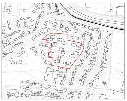
|
Site description & existing use |
The site comprises a number of blocks of flats incorporating one and two bed units. It is bounded by Whitley Close, Westland Close, De Havilland Way and Douglas Road and is within an area which has a strong residential character close to Stanwell
Village. To the extreme north of the site is Heathrow Airport with an area of open space lying to the southwest of the site. |
Site-specific requirements |
In addition to meeting the policies in the plan, any developer of this site will be required to provide the following:
- Holistic redevelopment of the site to provide a new high quality housing scheme.
- Include measures to mitigate the impact of development on the local road network and take account of impacts on the strategic road network as identified through a site- specific Travel Plan and Transport Assessment.
- Provide or contribute to any infrastructure as set out in the IDP and/or identified at the application stage which is necessary to make the site acceptable in planning terms.
- A suitable decanting plan for the existing properties as to minimise the disruption for current residents.
- Maximise the use of Climate Change measures and renewable energy sources, in accordance with Policy DS2 to make buildings zero carbon where possible.
|
Opportunities |
- This plot lends itself to a well-designed scheme that makes a positive contribution to the wider street scene.
- Improvements for pedestrian access and public realm, linking the site to nearby services with active and sustainably travel options.
- Active frontages at the boundary edges.
- Enhanced permeability of the site with the opportunity for new pedestrian routes.
- Sensitive design that draws on the Stanwell conservation area character.
- Stepped heights away from the centre of the site, to minimise impact on surrounding homes.
|
Delivery Timeframe |
2033-2037 (years 11-15) |
ST1/031 (Thameside Arts Centre, Wyatt Road)
Site Information |
Site ID |
ST1/031 |
Site name/ address |
Thameside Arts Centre, Wyatt Road, Staines, TW18 2AY |
Site area (ha) |
0.26 |
Location |
Urban area
Previously developed land |
Ward |
Staines |
Proposed Allocation |
Residential (C3): 19 units (approx.)
Ground floor community units or re-provision off site |
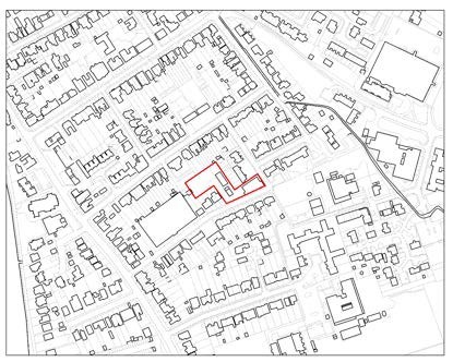
|
Site description & existing use |
The site is occupied by Thameside Centre which currently operates as a training centre and hot-desking space. A car park and cadets building also occupy the site. The building is late Victorian, dating from 1896, and ranges from 1 to 3 storeys equivalent in height. The building is locally listed. The predominant use is in the wider area is largely residential, with both flats and family dwelling houses present. A disused tinworks site is present to the south along Langley Road with community uses to the east. |
Site-specific requirements |
In addition to meeting the policies in the plan, any developer of this site will be required to provide the following:
- A housing scheme subject to the existing use being re- provided off site in a location accessible to the community, prior to redevelopment, or a mixed-use scheme incorporating ground floor community uses.
- Include measures to mitigate the impact of development on the local road network and take account of impacts on the strategic road network as identified through a site- specific Travel Plan and Transport Assessment.
- Provide or contribute to any infrastructure as set out in the IDP and/or identified at the application stage which is necessary to make the site acceptable in planning terms.
- Maximise the use of Climate Change measures and renewable energy sources, in accordance with Policy DS2 to make buildings zero carbon where possible.
|
Opportunities |
- This plot lends itself to a well-designed scheme that makes a positive contribution to the wider street scene.
- Improvements for pedestrian access and public realm, linking the site to nearby services with active and sustainably travel options.
|
Delivery Timeframe |
2033-2037 (years 11-15) |
ST2/006 (Builders Yard, Gresham Road)
Site Information |
Site ID |
ST2/006 |
Site name/ address |
Builders Yard, Gresham Road, Staines, TW18 2BE |
Site area (ha) |
1.36 |
Location |
Urban area
Previously developed land |
Ward |
Staines |
Proposed Allocation |
Residential (C3): 343 units (approx.) |
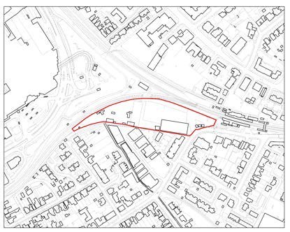
|
Site description & existing use |
The site houses an existing builder’s yard, with a large warehouse fronting onto Gresham Road. The site has a small amount of residential development to the south, mixed with commercial units. The train line bunds the northern and western boundaries with some residential properties and a large church
to the east on Gresham Road. The site is on the periphery of Staines Town Centre with retail uses to the northwest. |
Site-specific requirements |
In addition to meeting the policies in the plan, any developer of this site will be required to provide the following:
- A well-designed scheme that has a positive relationship with nearby town centre uses and residential properties.
- Include measures to mitigate the impact of development on the local road network and take account of impacts on the strategic road network as identified through a site- specific Travel Plan and Transport Assessment;
- Provide or contribute to any infrastructure as set out in the IDP and/or identified at the application stage which is necessary to make the site acceptable in planning terms.
- Maximise the use of Climate Change measures and renewable energy sources, in accordance with Policy DS2 to make buildings zero carbon where possible.
|
Opportunities |
- This plot at the edge of the town centre lends itself to a high-quality scheme that makes a positive contribution to the wider street scene.
- Improvements for pedestrian access and public realm, linking the site to nearby services with active and sustainably travel options.
|
Delivery Timeframe |
2033-2037 (years 11-15) |
ST3/012 (Staines Telephone Exchange, Fairfield Avenue)
Site Information |
Site ID |
ST3/012 |
Site name/ address |
Staines Telephone Exchange, Fairfield Avenue, TW18 4AB |
Site area (ha) |
0.59 |
Location |
Urban area
Previously developed land |
Ward |
Staines |
Proposed Allocation |
Residential (C3): 180 units (approx.) |
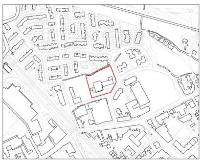
|
Site description & existing use |
The site is currently occupied by Telephone Exchange buildings ranging from 3 to 12 storeys in height. A large area of hardstanding is also present on the northern part of the site.
The surrounding area is urban in character with a mix of residential and commercial uses present. The Renshaw Estate is located west, with residential development to the south of the site. Further residential development is located north and east of
the site with offices present to the southeast. |
Site-specific requirements |
In addition to meeting the policies in the plan, any developer of this site will be required to provide the following:
- A well-designed scheme that has a positive relationship with nearby town centre uses and residential properties.
- Include measures to mitigate the impact of development on the local road network and take account of impacts on the strategic road network as identified through a site- specific Travel Plan and Transport Assessment.
- Provide or contribute to any infrastructure as set out in the IDP and/or identified at the application stage which is necessary to make the site acceptable in planning terms.
- Maximise the use of Climate Change measures and renewable energy sources, in accordance with Policy DS2 to make buildings zero carbon where possible.
|
Opportunities |
- This plot at the edge of the town centre lends itself to a high-quality scheme that makes a positive contribution to the wider street scene.
- Improvements for pedestrian access and public realm, linking the site to nearby services with active and sustainably travel options.
|
Delivery Timeframe |
2033-2037 (years 11-15) |
ST4/009 (Elmsleigh Centre and Adjoining Land, South Street)
Site Information |
Site ID |
ST4/009 |
Site name/ address |
Elmsleigh Centre and Adjoining Land, South Street, Staines, TW18 4QF |
Site area (ha) |
5.15 |
Location |
Urban area
Previously developed land |
Ward |
Staines |
Proposed Allocation |
Residential (C3): 850 units (approx.) Retail/Commercial town centre uses (Class E) |
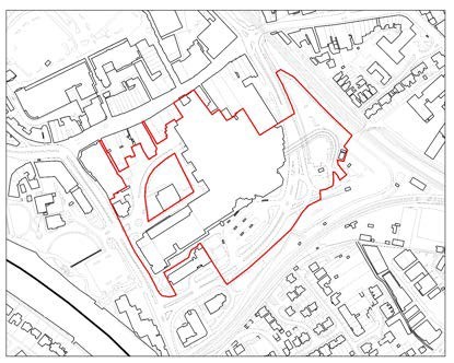
|
Site description & existing use |
The site is located to the south of the High Street with the A308/Thames Street wrapping around the west, south and east of the site. The site is currently occupied by the Elmsleigh shopping centre, Staines bus station, multi-storey car parks and service areas. A surface car park is present to the east with
retail units to the north and the Two Rivers Shopping Centre further north.
The surrounding area is predominantly commercial as the site is located within the Borough’s primary shopping area. |
Site-specific requirements |
In addition to meeting the policies in the plan, any developer of this site will be required to provide the following:
- A mixed residential and commercial development that provides an active street frontage.
- If required, reconfigure the existing bus station or relocate to a suitable town centre location to ensure the continuity of bus services within Staines.
- A well-designed scheme that has a positive relationship with nearby town centre uses.
- Retention of the museum, library and community centre on site, or relocation to a suitable alternative town centre location.
- Include measures to mitigate the impact of development on the local road network and take account of impacts on the strategic road network as identified through a site- specific Travel Plan and Transport Assessment.
- Provide or contribute to any infrastructure as set out in the IDP and/or identified at the application stage which is necessary to make the site acceptable in planning terms.
- Maximise the use of Climate Change measures and renewable energy sources, in accordance with Policy DS2 to make buildings zero carbon where possible.
|
Opportunities |
- This plot within the town centre lends itself to a high- quality scheme that makes a positive contribution to the wider street scene.
- Provide positive benefits in terms of landscape and townscape character and local distinctiveness.
- Improvements for pedestrian access and public realm, linking the site to nearby services with active and sustainably travel options.
|
Delivery Timeframe |
2033-2037 (years 11-15) |
< Previous | ^ Top | Next >
