
7.1.1 The WNP Vision survey confirmed that traffic management (congestion, provision for cyclists, parking) is of the highest priority if not the greatest single issue within and around the Area. The combination of regional through traffic and large visitor numbers give Windsor a particular problem with congestion and air quality on many main roads in the NP Area at particular times.
7.1.2 However, most highways, traffic infrastructure and bus and train operational initiatives are outside the main scope of NPs (whose focus is what should be given planning permission), except indirectly insofar as they are concerned with land use.
7.1.3 Likewise, Park and Ride initiatives are impossible to progress within the WNP area as there are no suitable sites beyond those at LEGOLAND and Home Park, which are already in use33. Also, although traffic congestion from through traffic between the M3 and M4 and M25 is a huge issue, alternative north/south routes to bypass Windsor would have to be outside the WNP area.
7.1.4 There is also a lot of subjective opinion around the issue, and we have sought to establish the factual evidence to inform the WNP. The Traffic Report in our Evidence Base File explains the detailed WNP research findings.
7.1.5 Therefore, we have considered other small initiatives which can help to improve the way people get around the area and make sustainable transport choices though increased footpath and cycle provision. The WNP seeks to improve conditions for walking, enhance the pedestrian experience and boost the provision and improvement of cycle infrastructure.
7.1.6 In respect of traffic congestion, Section 11 of the WNP also highlights a number of projects that will be pursued.
Cycling and Walking
OBJECTIVE 3 Encourage sustainable34 modes of transportation
CONTEXT
7.1.7 Footways line most of the Borough’s urban streets and so pedestrians are well provided for, although pedestrian crossings and dropped kerbs at junctions and crossroads for those using wheels are not always where they are most convenient.
7.1.8 Windsor’s relatively flat townscape makes cycling a good way for residents and commuters and schoolchildren to get around. There is clearly growing demand for better cycling infrastructure, and National and local Planning Policy35 encourages improvements to cycling and cycling infrastructure.
7.1.9 However, it is not easy to find space in the narrow streets which are often lined with cars, and cyclists and pedestrians frequently have to share paths. Existing cycle paths do not always follow a direct route between town and suburbs. Cycle paths peter out. Local neighbourhood shopping centres make little provision for cyclists. Cycling is often not seen as safe, and many children told us it was unsafe to cycle to school. Many residents dislike sharing footways with cyclists (especially the elderly and those with physical disabilities).
7.1.10 The Royal Windsor Way and Imperial Road through-route, as well as Goslar Way, effectively cut the NP Area into separate parts and the underpasses are unappealing and present a barrier to the safe passage of cyclists and pedestrians across the Area. In the long-term it would benefit the town and particularly the residents to the west, to address this barrier, although it is recognised that there would be significant cost involved.
7.1.11 National Cycle Route 4 crosses into the town from the Great Park to the river but is relatively unknown and follows a South-North route from the Great Park, along Bulkeley Avenue, York Avenue and through the underpass to Vansittart Road, to cross the Thames via Royal Windsor Way. It is relatively poorly connected to other local cycle paths and the signage doesn’t really give a sense of the whole system.
7.1.12 The special environmental and ownership status of much of Windsor Great Park limit the potential for additional cycle routes through it. New cycle paths towards Ascot and Bracknell have not been possible for these reasons.
7.1.13 Public Rights of Way (PROW) There are a range of different Rights of Way throughout the area and these are protected by National and Local policy. The Countryside and Rights of Way Act 2000 places a duty on all local highway authorities to publish and review a Rights of Way Improvement Plan for their area. The current RBWM plan is set out under cover of the “Public Rights of Way Management and Improvement Plan 2016-2026”. This plan lists three routes for additional rights of way within the WNP area. There are some paths within the area used by the public which are as yet not on the PROW list and which provide small links and cut-throughs for walkers and cyclists. Their loss would damage the way people are able to move around the town. Expected changes to PROW Legislation in the next decade may put existing PROWs at risk.
POLICIES - Cycling & Walking
CW. 01
All public rights of way within the WNP area must be retained, or alternatives provided that offer equivalent or better functionality. Improvements to the pedestrian and cycle network, including the creation of more safe linkages, will be supported.
REASONED JUSTIFICATION
7.1.14 This policy supports the maintenance of existing foot paths and consideration of new official Public Rights of Way (PROWs) around Windsor, including where there are some existing paths used at present but which are not currently designated as official PROWs. Occasionally small but important link paths are threatened by adjacent developments or attempts by nearby residents to change their boundaries. Recognition of these important paths will help to protect them from encroachment.
7.1.15 We would also support new paths south of the river were this possibility to arise on the Windsor Racecourse site.
7.1.16 Expected changes in PROW legislation 36 will potentially transform the position around existing rights of way. On 1st Jan 2026 the government intends to close the definitive maps to the claim of historic paths which existed before 1949 [section 53 of the Countryside and Rights Of Way Act 2000 (CROW Act)] with the aim of providing certainty to landowners about what highways exist on their land. The result may be that existing rights of way will be lost to the community, particularly within housing estates. Most estate footpaths, even those later than 1949 are taken for granted and do not appear on Definitive Maps. They remain unrecorded as Rights of Way. RBWM has also lost most of their historic records on this. The Windsor Neighbourhood Forum hopes to see all existing such links protected.
7.1.17 The existing RBWM Public Rights of Way Map 5 dated 1st January 2016 does not record either the E-W Clewer Fields footpath, (although the intersecting N-S link is included as Route 15) or the Hatch Lane to Longbourn footpath. We wish to see both of these footpaths recorded and retained.
7.1.18 The WNP supports all practical opportunities to improve pedestrian crossings/underpasses, footpaths and/or cycle routes at the following key locations:
7.1.19 WNP wants to encourage linkages between green areas and new pedestrian and cycle paths can help this. We wish to see new pedestrian and cycle routes incorporated within new developments where appropriate.
7.1.20 The Windsor Neighbourhood Forum supports improvements and new routes at specific sites, some of which have already been under consideration by RBWM, although we recognise that at many sites there are no easy solutions.
7.1.21 The Cycling Action Plan 2018-2028 has been produced by the CAP Task and Finish Group on behalf of the RBWM Cycle Forum. It was approved by the Highways, Transport and Environment Overview and Scrutiny Panel prior to adoption by Cabinet on 31st January 2019. The WNP supports its aims, strategies and priority schemes. Windsor Neighbourhood Forum would like to see developers ensure it is taken into account in the design of new housing and business areas and associated infrastructure.
7.1.22 The roundabout at the junction of the Royal Windsor Way/Clarence Road/Imperial Road is a major barrier for cyclists and pedestrians between the west and centre of town. The roundabout is dangerous for cyclists, with a cluster of 4 cycle accidents around this roundabout in the last five years37. The tunnels are also a barrier as they are narrow, badly lit, and unappealing, there are no footpaths at ground level. Cyclists and pedestrians have to share the space, and cyclists have to dismount, and all are forced underground. Many school children use it and many people avoid having to use it, particularly in the dark.
7.1.23 The only current cycle paths from Dedworth Road and the western suburbs towards the centre are via Green Lane/Vansittart Road or to the north of Clewer Village via the tunnel past the Leisure Centre and along the river. These cycle routes use quiet links to National Cycle Route 4 which goes along Vansittart Road and south of the river but are very indirect to get to the town centre.
7.1.24 The Goslar Way dual carriageway is also a barrier for pedestrians and somewhat unappealing and dangerous, and any practical improvements to this tunnel will be supported.
7.1.25 Crossing the Goslar Way dual carriageway near Alma Road can be challenging on foot. A pedestrian crossing is not feasible as the 40mph speed limit exceeds the 30mph limit required for a pedestrian crossing. Pedestrians will need to use the Vansittart Road underpass for the foreseeable future.
7.1.26 Crossing improvements of the Long Walk at the Albert Road are already being considered by RBWM in conjunction with the Crown Estate.
OBJECTIVE 3 Encourage sustainable modes of transportation
Context
7.2.1 Car parking is the most frequently mentioned issue in our consultations. It is a problem for residents, business owners and employees. National38 and Borough39 policies allow parking policies which consider local conditions.
7.2.2 There is a high level of car ownership in Windsor especially in suburban areas where there is less access to public transport and a large proportion of visitors to Windsor travel by car.
7.2.3 There are not enough official car parks in the Town Centre area and its environs for all of the users. Park and Rides (Centrica, LEGOLAND) have limitations in size and location, and a 400 space P&R at Windsor Racecourse has not been taken forward yet and the planning permission has lapsed. Commuter and visitor cars compete with residents for on and off-street parking spaces in both Neighbourhood Plan Areas. Residents parking schemes have spread to provide parking near homes. The approval of a Residents Parking Scheme tends to push the problem outwards across the area and causes extra problems for business related parking.
7.2.4 In residential areas the parking problem is becoming worse as population and residential densities increase, particularly where existing properties are subdivided into Houses in Multiple Occupation, and new ones built without sufficient provision, leading to an increase in the number of cars without a commensurate increase in the number of car parking spaces, as well as pressure on amenity land and neighbourhood parking disputes. Front gardens are often converted into parking spaces with detrimental effects on the appearance and character of the area and loss of greenery.
7.2.5 Dropped kerbs allow front gardens to be used for parking, and although this may be more convenient for the householder concerned, it often leads to the loss of on street communal parking spaces and some damage to the character of the area. In/out driveways particularly can result in the loss of more street parking spaces. These often diminish the quality of the street scene, especially if done badly. However, it is a trade-off between having places for people to live and enough space to park.
7.2.6 There is some hope that new technology such as Uber and Car Club schemes and provision of alternative transport modes (cycling, buses trains) will reduce the need for individuals to keep cars, although the need will continue for the foreseeable future particularly in suburban areas which are further from transport nodes.
7.2.7 The adopted Borough Wide Design Guide includes guidance on Parking Design.
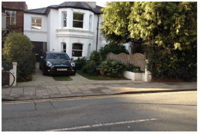
Photo 11 Dropped kerb and sympathetic parking design
POLICIES - Parking
PAR. 01
New residential development should respect local character and provide for safe parking, having regard to the WNP parking design standards and, where relevant, Area Design Guides (as set out in Appendix 2).
PAR 02
The provision of increased car parking capacity at existing car parks will be supported, subject to development respecting local character, residential amenity and highway safety.
7.2.8 PAR.01 Is a parking Design policy based on Building for Life principles, and seeks to encourage best practice and ensure that parking with dwellings is designed to be useable.
7.2.9 All new developments should provide enough spaces for residents and visitors, including disabled, and anticipate parking demand, taking into account location availability and frequency of public transport and car ownership locally. Sometimes developments have provided insufficient spaces which are not well designed or practical to use, which increases the impact of developments on the amenity of nearby residents as it increases the need to park nearby. The use of design solutions is suggested in research such as “Space to Park”40.
7.2.10 Some recent conversions have been allowed with NO parking provided or insufficient parking for the number of occupants on the assumption that the occupiers will use public transport. It is the Windsor Neighbourhood Forum view that this exacerbates the parking problem as the assumption that people living in the town centre will not use cars is not realistic at present. This is borne out by research which demonstrates that providing insufficient parking spaces in suburban estates doesn’t result in people using public transport instead.
7.2.11 Where existing parking problems exist, then conversion of garages into habitable rooms increases the pressure on parking spaces nearby, and this is something the Windsor Neighbourhood Forum wishes to discourage unless it can be demonstrated that there are adequate spaces nearby.
7.2.12 Windsor Neighbourhood Forum will seek to discourage the use of dropped kerbs where they result in the loss of an on-street space and there is no net gain of parking spaces. They often involve parking dominating the front garden, and loss of on street parking spaces, and are damaging to the look of an area, unless they are well designed and landscaped. Our Parking Design Guide (Appendix 2 part C) shows good practice in the design and landscaping of front garden parking and the Windsor Neighbourhood Forum will encourage applicants to use this.
7.2.13 PAR.02 This policy is designed to increase the supply of car park spaces. For example, the two hospitals in Windsor might be able to expand parking for public use subject to design and landscaping considerations.
7.2.14 The Crown Estate has some proposals to alter car parking arrangements on the edge of the Great Park near Queen Anne’s Gate. We support additional car parking subject to satisfactory design and landscaping consideration as this would help improve access to the park and could be considered as Very Special Circumstances which outweigh the harm to the Green Belt.
33 RBWM has recently stopped funding the Centrica P&R which is likely to cease to exist. The potential Windsor Racecourse 400 space Park and Ride is still in the emerging BLP Infrastructure Plan, although we understand that the planning permission which was renewed in 2013 will now have lapsed.
34 Sustainable transport is transport that minimizes harmful effects on the environment and the depletion of natural resources, such as walking, cycling, and fuel-efficient public transport, and hence can be sustained in the long term.
35 NPPF Ch 9 Paragraph 104 (provide for high quality walking and cycling networks), and Para 110c (minimise the scope for conflict between pedestrians, cyclists, vehicles).
36 Deregulation Act 2015
37 Source of road accident statistics -crashmap.co.uk
38 NPPF Para 105 &106
39 Emerging BLP Policy IF2
40 "Space to Park" by David Rudlin and John Sampson with help from Susanne Gallenz and Sangeetha Banner of URBED (Urbanism, Environment and Design). The report has been produced as part of the Space to Park research project. First Published: November 2013 ISBN: 978-0-9573
< Previous | ^ Top | Next >