< Previous | Next >
12 Ponders End Waterfront
12.1 Introduction
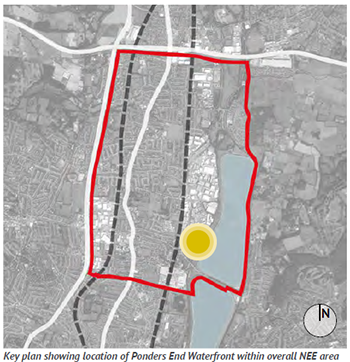
12.1.1 Ponders End Waterfront is a hidden gem: it is one of the most historic parts of the NEE area, has access to the Lee Valley Navigation and access to the Lee Valley Regional Park. However, it is difficult to get to and - with the exception of the Navigation pub - there are few attractions for local people or visitors from the wider area It has the potential to connect the wider NEE area with the River Lee Navigation and the open spaces of the Lee Valley Regional Park.
12.1.2 The Council’s Core Strategy defines the Ponders End Place Shaping Priority Area, of which the Ponders End Waterfront area forms a part. Core Strategy Policy 41 sets out planning policy for the area and includes the following objective in relation to Ponders End Waterfront:
- Columbia Wharf and the southern part of Brimsdown at Ponders End Waterfront area identified as sites that could accommodate housing as part of mixed-use developments;
- An attractive public realm, designed to promote community safety ... and good links to the Lee Valley Regional Park;
- Requires high quality new development that complements the heritage assets and historic environment of Ponders End, such as ... Ponders End Flour Mill; and
- Seeks a new mixed-use, employment, leisure and residential community at Ponders End Waterfront of exceptional quality, including sites at the southern part of Brimsdown and Columbia Wharf, helping to reconnect the Ponders End Community with its waterfront and contributing to the chain of attractions along the Lee Valley Regional Park.
12.1.3 The Council submitted a bid for All London Green Grid BIG Green funding of a number of projects at Ponders End Waterfront in 2013. These projects include:
- a nature reserve at South Meadow;
- new paddle-sports facilities;
- a heritage community orchard;
- a mini city farm; and
- pedestrian and cycle connections linking Ponders End to the waterfront.
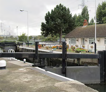
The lock at Ponders End Waterfront
London Plan |
Policy 2.14: Areas for Regeneration
Policy 7.4 Local Character
Policy 7.4 Public Realm
Policy 7.8: Heritage Assets and Archaeology |
Upper Lee Valley Opportunity Area Planning Framework (July 2013) |
Objective 1
Objective 7
Chapter 8 |
Core Strategy (Adopted Nov 2010) |
Policy 30: Maintaining and improving the quality of the built environment
Policy 31: Built and landscape heritage
Policy 40: North East Enfield
Policy 41: Ponders End |
Adopted Development Management Document (November 2014) |
Policy DMD37: Achieving high quality and design-led development
Policy DMD39: Design of business premises
Policy DMD40: Ground floor frontages
Policy DMD44: Preserving and enhancing heritage assets |
Other Sources |
National Planning Policy Framework
National Planning Policy Guidance
Lee Valley Regional Park Development Framework - Area 4 and 5 Proposals
Ponders End Framework for Growth, (Studio Egret West) 2009
Ponders End Planning Briefs - Feasibility Report (Savills), 2009
Level 2 Strategic Flood Risk Assessment, 2013
Ponders End Flour Mills Conservation Area Character Appraisal (Drury McPherson), 2013 Aerial view |
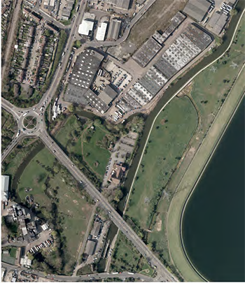
Aerial view of Ponders End Waterfront
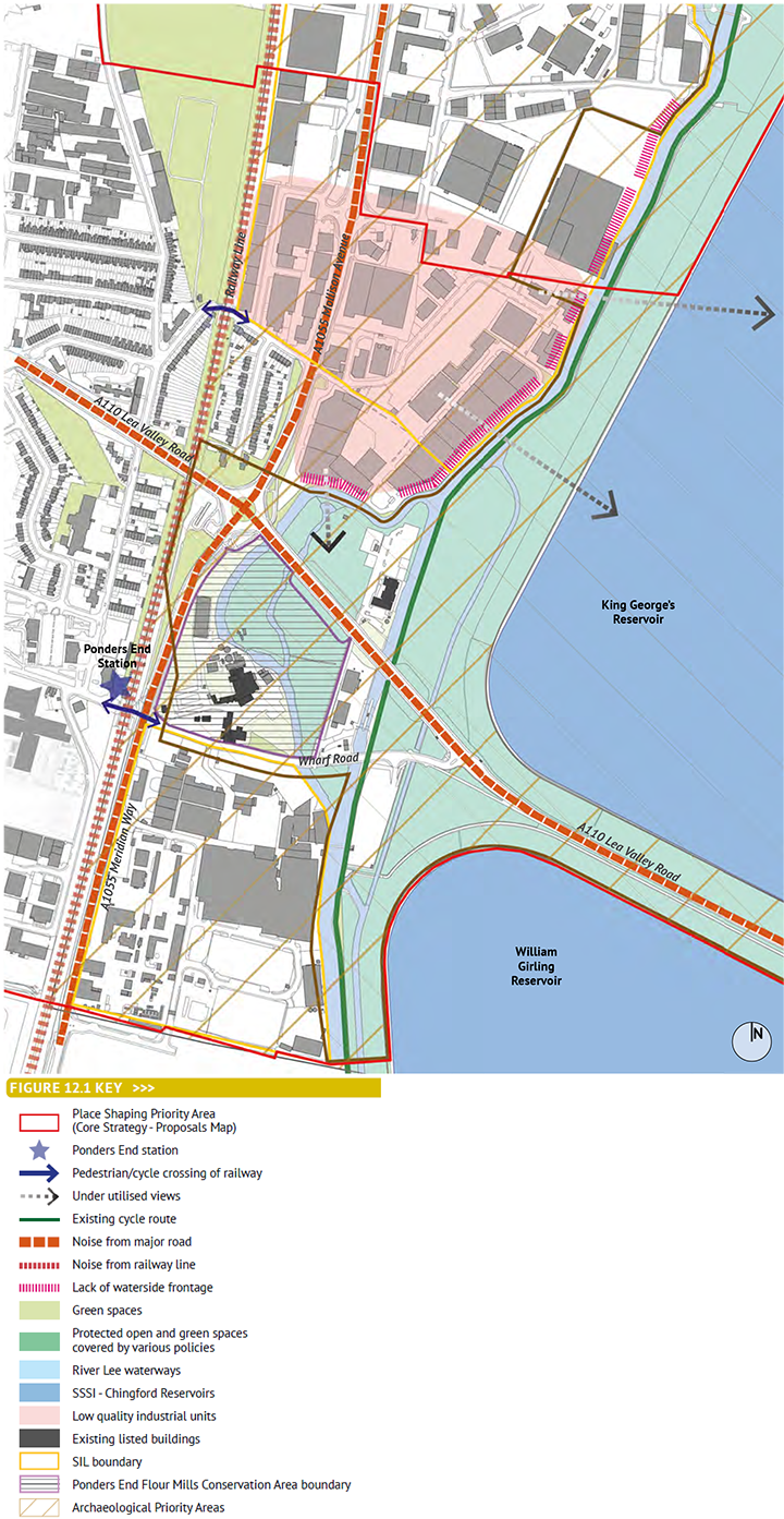
12.1.4 Figure 12.1 overleaf sets out the key issues that must be taken into consideration is any plans for the future:
- the heart of the area is the Ponders End Flour Mills Conservation Area, which encompasses the operational G.R.Wright and Sons Limited’s Flour Mill and the open space and water meadows next to the River Lea. There is no public access to the Conservation Area, and the Mill will remain in private use for the forseeable future;
- much of the open space is designated as a site of Metropolitan Importance for Nature Conservation, and should therefore be retained and enhanced;
- there are two main opportunities for pedestrian access from the wider NEE area: via the footbridge at Ponders End Station and the footbridge at Duck Lees Lane. However, the route via Duck Lees Lane involves crossing the very busy and unfriendly Mollison Avenue and there is no link across the waterway to the green space;
- vehicular access to the southern part of the area is via the major Lee Valley Road and then Wharf Road. This is rather a confusing approach from the west, as it involves doubling back. However, the Lee Valley Road is elevated and so there is no way or providing more direct access for cars;
- vehicular access to the north part of the site (which is often referred to as Southern Brimsdown) is off Mollison Avenue at East Duck Lees Lane. This is a left-in, left-out junction only and so is somewhat restricted. A further vehicular access may be possible from Jeffreys Road to the north; and
- whilst some of the industrial buildings within Southern Brimsdown are of good quality, the majority are low quality and run-down. This partly reflects the aspirations of the landowner to redevelop the site. These industrial buildings are located close to the water’s edge. Although there is a road next to the water’s edge, this is not currently publicly accessible. The Council has developed a strategy to require pedestrian and cycle access along the water’s edge when sites come forward for redevelopment.
12.1.5 In addition to these issues, the area is subject to flooding and has a number of flood defences in place. The Council has produced a Level 2 Strategic Flood Risk Assessment for the area, and this has been used to inform AAP policy.
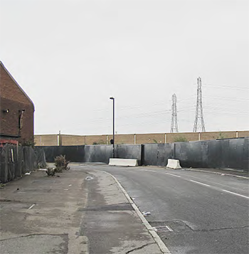 Wharf Road |
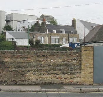 G.R.Wright and Sons Limited's Flour Mills |
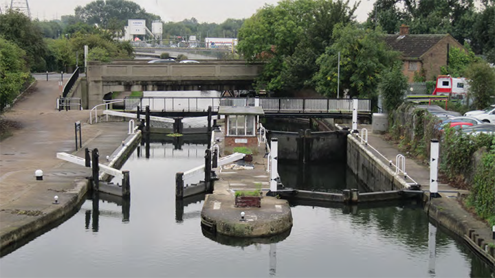
The lock at Ponders End Waterfront
Figure 12.1: Ponders End Waterfront- Key Issues
Policy 12.1: Ponders End Waterfront
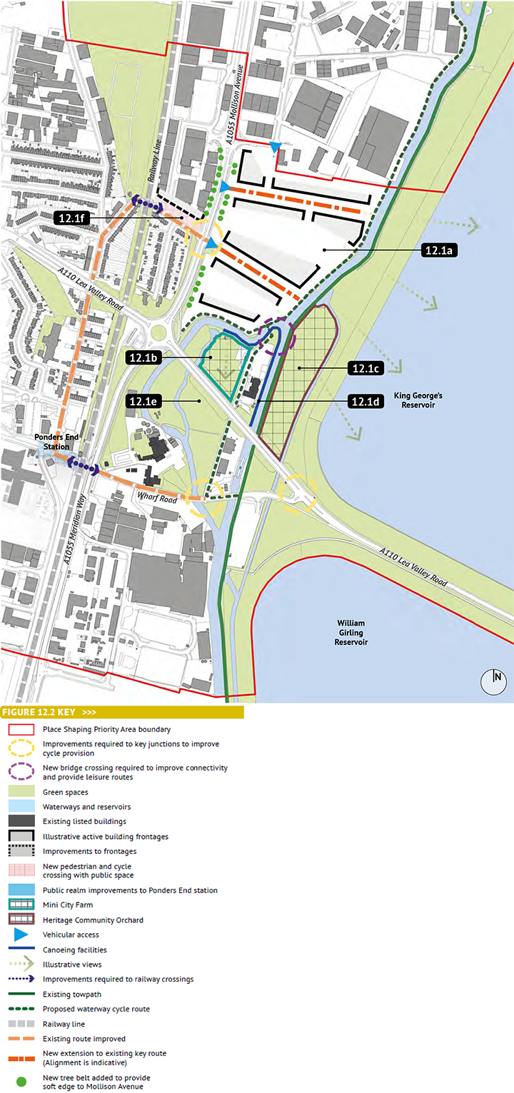
This is a major opportunity for employment-led mixed-use development that connects the waterfront back to the wider NEE area, creating a distinctive place and a valuable leisure resource for local people. Key principles include:
- redevelop the area for an employment-led mix of uses in high quality new buildings that collectively respond to the historic character of the area and waterfront setting to enhance this distinctive new quarter within the NEE area;
- seek opportunities to enhance the Ponders End Flour Mills Conservation Area and the setting of listed buildings;
- ensure that, where possible, having regard to viability and operational requirements, active building frontages overlook the waterways and streets and spaces within the development;
- provide a pedestrian / cycle route along the waterways;
- create views through the development to the water and to the reservoir embankments beyond;
- improve the crossing of the railway line at Duck Lees Lane. Any redevelopment of the area immediately to the north of this access should include positive building frontages onto the route and - where possible - allow more space for the crossing point. Provide an improved crossing across Mollison Avenue to connect with Duck Lees Lane;
- ensure that the principles set out in Policy 4.9 involving improvements to Wharf Road are incorporated into any proposals;
- create a clear pedestrian / cycle ‘circuit’ that connects the two railway crossings, the waterside walks, Alma Road and South Street together;
- ensure that the redevelopment of South Brimsdown allows for future connections to the north, especially for pedestrians and cyclists;
- create a nature reserve at South Meadow to enhance the biodiversity of the area. Provide public access for learning and leisure purposes;
- incorporate mooring facilities;
- create a heritage community orchard;
- create a mini city farm;
- provide new paddle-sport facilities; and
- refurbish a room in the Navigation Inn to provide a classroom facility to host visiting school groups and be available for rent by community groups such as the Ponders End Sea Cadets.
Any proposals must not have any indirect adverse effect on the ecological interest of the LVRP (e.g. through light pollution, water quality/level issues, increased recreational disturbance to sensitive areas, disturbance during construction) so as to avoid effects on the European site within the LVRP. |
12.1a |
Redevelopment of South Brimsdown |
12.1b |
Mini City Farm |
12.1c |
Heritage Community Orchard |
12.1d |
Canoeing Facility |
12.1e |
Nature Reserve at South Meadow |
12.1f |
Improved crossing at Duck Lees Lanev |
Figure 12.2: Ponders End Waterfront- Policy Principles
< Previous | ^ Top | Next >


