
2.1 The Neighbourhood Plan area (map 1) is in west Dorset and includes the villages of Yetminster and Ryme Intrinseca, and part of Hamlet. Sherborne is about six miles north-east, Yeovil six miles north-west and Dorchester 15 miles south. Open countryside round the villages is punctuated by scattered woods and the valley of the River Wriggle with its feeder streams. In the east and south, higher ridges provide attractive views. A network of footpaths and other rights of way is used by local walkers and visitors.
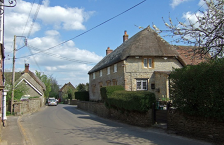
2.2 Each settlement in the plan area has a distinctive local character dating back to Saxon times. The smallest is Hamlet which is a group of houses straddling the boundary between the parishes of Yetminster and Chetnole. Ryme Intrinseca is the smaller of the two main villages with a population of about 120 people. The village name derives in part from its situation on the slope of a rima or ridge or, perhaps, from its proximity to the county boundary. 9
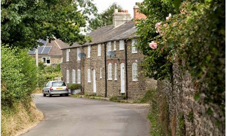
Hamlet
Ryme Intrinseca
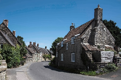
2.3 Yetminster, the main village in the plan area, was recorded in the Domesday Book as having over 100 inhabitants. There are many farmhouses and other fine houses mainly dating from the 16th, 17th and 18th centuries. A Conservation Area centred on the High Street was initially defined in 1970 in recognition of the area’s historic importance and was extended in 2009 and again in 2010.
Yetminster
2.4 The arrival of the railway in the 1850s led to further limited growth in the village as new markets opened up for the local dairy industry. This commercial use of the railway declined and then ceased after the Second World War, although passenger services remain.
2.5 There was little further development in the area until the early 1970s. Over the following twenty years or so about 100 more houses were built on the outskirts of Yetminster and a small number in Ryme Intrinseca. There was a further period of development between 1995 and 2015 and by the time of 2011 census there were 555 dwellings in the Neighbourhood Plan area. A further 21 dwellings were completed between 2011 - 2017. ONS data mid-year estimates suggest that the population of the Neighbourhood Plan area was about 1,260 persons in 2017.
2.6 Yetminster village is recognised as one of the larger and more sustainable villages in West Dorset and retained its Defined Development Boundary10 in the adopted Local Plan, because of its population size and the level of services and facilities. These include a primary school, pre-school, shops (one of which includes a post office), public house, health centre and railway station, serving a wide rural area. This designation, together with the lack of a 5-year land supply within the local plan area, led the Local Planning Authority to grant planning permission in 2016 for an additional 87 dwellings on a site off Thornford Road, Yetminster. A subsequent reserved matters application reduced this to 85 dwellings.
9 Dorset Place-Names, their origins and meanings (1991).
10 See paragraph 7.14 for more information on changes to the boundary proposed through this plan.
< Previous | ^ Top | Next >