< Previous
Appendix 1 – key statistics about this area
Population demographics (2011 Census):
- 584 usual residents, living in 262 households. The average household size is 2.1 persons, and the average house size is 3 bedrooms (both fairly typical)
- Sparse population (an average population density of 0.2 persons per hectare, compared to 0.9 persons per hectare in West Dorset and 3.7 persons per hectare across England and Wales)
- Ageing population (average age 56 years compared to West Dorset average of 49 years, and 30% aged 65 + years compared to West Dorset average of 26%) – but this does not notably skew health conditions (20% of the population are affected by health conditions that limit their day to day activities (which is fairly typical)).
- A comparatively high level of vacant homes (total dwelling number was 340, giving a vacancy rate of 23% - particularly high in Stoke Abbott and Pilsdon parishes, compared to 10% for West Dorset)
- More limited access to rented accommodation (79% homes are owner occupied compared to West Dorset average: 70%)
- High degree of car dependency - most households have one if not two cars (55% of households have 2 or more cars compared to West Dorset average of 39%)
- Good level of economic activity, particularly self-employed (45% economically active are self-employed compared to West Dorset average of 22%, only 1.7% unemployed compared to 3.4% in West Dorset)
Environmental Constraints:
- Almost the entire Neighbourhood Plan area lies within the Dorset AONB (Area of Outstanding Natural Beauty) – a nationally designated landscape, varying from the clay vale of the Marshwood Vale to the south, wooded hills of the Axe Valley Hills to the north and west, and undulating river valley of the Brit Valley to the east.
- Lambert’s Castle SSSI is a nationally important wildlife site in the west of the Neighbourhood Plan area. The site features a prominent landmark consisting of a flat-topped hill with an Iron Age hill fort from which it takes its name. Together with its flanks and adjacent lower slopes, which extend into Devon, this site comprises a range of grasslands and open heath, which are now both rare and threatened nationwide, with some scrub and secondary woodland.
- Four scheduled monuments – at Lambert’s Castle, Pilsdon Pen, Marshwood Castle and Waddon Hill (the latter two are on private land). Also visible is Lewesdon Hill fort (in the adjoining Broadwindsor parish).
- Some 88 Listed Buildings and structures, including the Church of St Mary (Pilsdon), and the Parish Church of St Mary (Stoke Abbott), both Grade I Listed.
- Stoke Abbott has been designated as a Conservation Area, for which a Conservation Area Appraisal was prepared in 2007.
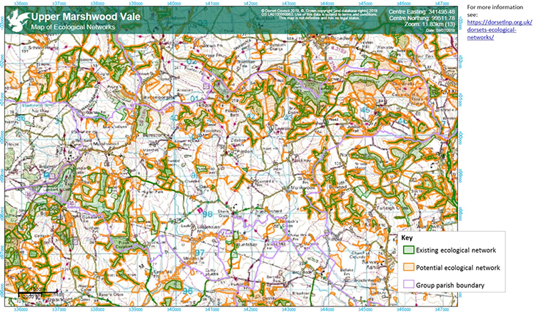
Appendix 2 – Existing and Potential Ecological Networks
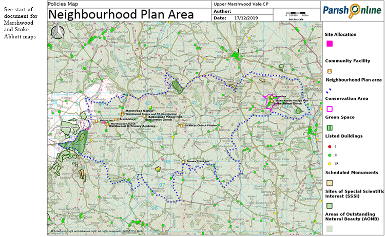
Policies Map – Entire Neighbourhood Plan Area
< Previous | ^ Top
