
5.1 The Local Plan for West Dorset, Weymouth and Portland does not identify a specific housing development figure for the Neighbourhood Plan area, nor does it specify a target for individual settlements in the area. Its strategic allocations provide the main development opportunities, and these are located at the main towns such as Beaminster, Bridport and Lyme Regis. It also anticipates that the larger villages where the majority of services are located (ie those with defined development boundaries, such as at Broadwindsor) will also provide a considerable supply of smaller sites through redevelopment and infill opportunities.
5.2 The Local Plan makes clear that Neighbourhood Development Plans can be used to help bring forward new development, and may allocate additional sites, or extend an existing (or add a new) development boundary to help deliver this growth. It also includes policies to ensure that where new homes are built, these provide a mix of housing types and sizes. The proposed mix is based on district-level housing need information, but this may be varied if justified by local circumstances.
5.3 Our research into the level of housing need suggested that if an average of between 4 to 5 dwellings were built each year over the Plan Period, this would be an appropriate level of housing growth for the Neighbourhood Plan area. Through the household survey it was established that most local residents would be prepared to support this level of growth if the type and mix of housing was suitable. Support was also indicated for small as opposed to large sites. Houses for sale on the open market and sites for private rental were not generally supported, however, adaptable, shared ownership and housing association homes, small (1 or 2 bedroom) starter homes suitable for first time buyers (what constitutes a starter home is defined in more detail in legislation1), small (2 or 3 bedroom) family homes and small (1 or 2 bedroom) homes for 'final purchase' downsizing, all attracted support. This mirrored the findings from the Census data and market research, which flagged up the ageing population profile and ‘over-provision’ of larger detached properties available on the open market.
5.4 Our research into local employment needs was based on a business survey in late 2016 (to which 52 local businesses responded), a review of Census data and feedback from the household questionnaire. This showed that although farming occupies the largest part of this Area of Outstanding Natural Beauty and still accounts for a significant proportion of local employment, the biggest employers are in construction and light engineering. Horn Park Quarry, between Broadwindsor and Beaminster, is the main business park in the area and considered to be a key employment site. Most (71%) of businesses in the Parish are people working from home, and where people do employ staff, about half of these live locally within the Neighbourhood Plan area. There is also a significant amount of synergy between local businesses, with about half of the businesses in the Parish buying goods or services from each other.
5.5 Only 5% of businesses said that they would be likely to look for new, improved or expanded premises during the next 5 years. The key requirement (mentioned by two thirds of respondents) was for faster broadband and a much better mobile signal, with many indicating that this was essential to their survival.
5.6 From the household survey, the consensus view was that the Neighbourhood Plan should seek to protect existing employment sites, encourage home working, support conversions of existing buildings to employment. There were more mixed views over whether further land should be allocated for employment, with a 44:56 split for and against.
5.7 As with housing, the Local Plan for West Dorset, Weymouth and Portland does not identify a specific employment development figure for the Neighbourhood Plan area. The strategy set out in the Local Plan is to ensure that there is a continuing supply of land and premises suitable for employment uses, of a type and scale appropriate to the characteristics of the local area. It anticipates that new sites will mainly be needed in the towns, but also includes flexible policies to allow development to come forward on other suitable sites, including:
5.8 All of this research points towards a figure of about 4 to 5 dwellings on average each year over the 14 years of the Plan Period to 2031, but is less clear-cut on the need for further employment if the existing stock is maintained. The housing figure is not in itself a definitive requirement nor a limit for growth in the local area. It is a starting point for determining the need and benefit of making site allocations and changes to the defined development boundaries through this Neighbourhood Plan.
5.9 Housing types should be focused on delivering smaller and more affordable housing, and homes specifically designed for residents with more limited mobility. Affordable housing would include affordable housing for rent (at levels substantially below the open market level); discounted market sales housing (with the discount retained for future eligible households); and other forms of affordable home ownership (including, for example, shared ownership). More affordable open market housing options would include self-build plots and smaller properties that would have a comparatively low open market value. Homes that meet the higher optional building regulation standards for accessibility (Category 2 accessible and adaptable dwellings and Category 3: wheelchair user dwellings) would clearly meet the needs of residents with more limited mobility.
5.10 There is no apparent need for larger, detached properties other than to provide specifically for home-working. The only circumstance where this may be readily justified is in the case of large barn conversions– although even in such situations thought should be given to whether the barn could be subdivided to create more flexible accommodation – such as the possibility to split into two units or allow for home working or annexed accommodation.
5.11 Support for new employment is broadly in line with the policies contained in the Local Plan, that focuses on the retention and potential extension of existing sites, and the potential for new sites within or on the edge of an existing settlement. Given the rural nature of the Neighbourhood Plan area, the latter is to be applied to all the settlements listed in section 2, provided that such sites are small-scale in nature so as not to significantly impact on the characteristics of those settlements.
Policy BGNP9. Meeting the area’s housing needs
The amount of housing growth supported over the Plan Period will be an average of 4 to 5 dwellings per annum, from:
Affordable housing for local needs should be provided on all housing sites of 6 or more dwellings as 35% of the total dwelling floorspace. Sites providing a higher level of affordable housing and starter homes than required will be supported. The type and size of affordable homes should reflect the current local need as evidenced in the affordable housing register. Financial contributions equivalent to any shortfall will be required on completion of the open market units. Legal agreements will be sought with the developers and providers of affordable housing to ensure that the housing remains affordable in perpetuity.
The type and size of open market housing should primarily provide two and three bedroom homes, starter homes and homes specifically designed for residents with more limited mobility. Larger homes (with the equivalent space for four or more bedrooms) will require special justification and should be designed to allow for potential future subdivision (as two dwellings / annexed accommodation or workspace / studio) unless it can be demonstrated that this would not be practicable.
Policy BGNP10. Meeting the area’s employment needs
There should be no net loss of employment land. This should be achieved through:5.12 In all cases, further detailed consideration of the impact of development on the local area, such as flood risk, heritage assets, traffic impacts etc will be required at planning application stage.
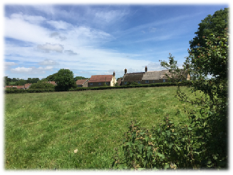
5.13 The distribution of housing and population has historically been spread between the various larger and smaller settlements and rural area. Estimates from Census data suggest about 40% of the population is based in or around Broadwindsor, about 25% in or around Drimpton, with the remaining population in the smaller settlements and scattered farmsteads, including places like Blackdown, Seaborough and Littlewindsor.
5.14 The Local Plan identifies Beaminster, Bridport, Chickerell, Crossways, Dorchester, Lyme Regis, the settlements on Portland, Sherborne and Weymouth as the most sustainable locations for further development. There are no Local Plan site allocations within the Neighbourhood Plan area. The Local Plan identifies Broadwindsor (being the largest settlement in the Neighbourhood Plan area, with the most facilities) as the main focus for new development in this area, and on this basis it has defined a development boundary for this settlement within which new housing is in principle acceptable. It would follow that most, if not all, new housing and employment should be located at this village. However, as explained in more detail below, this distribution was not in practice deliverable due to the lack of available and suitable sites in and around Broadwindsor, and as a result this plan also allocates sites at Drimpton and Netherhay.
Through the options consultation we asked local residents about whether some development should take place at some of the smaller settlements. Whilst there was no clear consensus view, the option of avoiding development at the smallest settlements which have no facilities was broadly supported.
5.15 Following a call for available sites in April 2017, potential sites were submitted by the landowners. There were far more sites put forward for the Drimpton area and more remote locations than in or around Broadwindsor. All the sites were assessed against a range of sustainability criteria and technical checks with the District and County Councils and the AONB team regarding landscape, heritage, highways, flooding, and land contamination.
5.16 The results of the initial technical and sustainability checks were shared with the landowners, and a number of sites that performed poorly were voluntarily withdrawn from the process at that stage. The strategic environmental assessment of the remaining site options did not suggest that there would be significant harm arising from any one site, with the possible exception of site 7 (Land east of Netherhay Lane, between Drimpton and Netherhay) and site 14 (Land at Axe Mill Industrial Estate, Netherhay) where the assessment identified the potential loss of a sizeable area of Grade 2 farmland. Sites 09 (Land south of the Mill House, Kittwhistle) and 15 (Land at Beck’s Field, Netherhay) were also noted as performing poorly with a number of topic areas, where possible (though not significant) harm was identified.
5.17 The results of the assessments were then subject to consultation with local residents , through road show exhibitions, held in Blackdown, Drimpton and Broadwindsor, resulting in the return of 175 feedback forms. The general consensus through the consultation was that six of the proposed sites were acceptable and likely to be supported by local parishioners. There was no clear consensus on three of the options, and clear opposition to the remaining three sites.
5.18 Three sites have been identified at Broadwindsor to accommodate housing growth.
5.19 The largest site put forward in Broadwindsor was land south of Fullers (site 01). An outline planning application (ref WD/D/17/000800) was submitted for this site in April 2017 (at the same time as the call for sites). The application was initially for up to 32 dwellings, but subsequently reduced to up to 22 dwellings. There were a considerable number of objections to the plans, most notably regarding the impact on the Dorset AONB and highway network / site access.
5.20 Despite the continued concerns raised by the AONB landscape officer (who advised that a further reduction in density should be made to allow further landscaping within the site), the case officer and committee considered that the site was large enough to accommodate appropriate landscaping and that any adverse impacts would not outweigh the benefits of allowing the application at that time. The application was therefore approved on 14 December 2018 (prior to this Neighbourhood Plan’s examination) following the completion of a legal agreement to secure the affordable housing and the provision and maintenance / management of the surface water drainage and landscaping areas.
5.21 Due to the various concerns, the Neighbourhood Plan had assessed the capacity for the development of the site to be considerably less (at up to 10 dwellings on the area closest to the road) than the outline planning application proposed. With the planning permission having been granted, the Examiner recommended that, in the interests of accuracy, the policy itself and the supporting text should be amended accordingly.
5.22 As comparatively few sites were put forward for consideration in and around Broadwindsor, an additional policy has been included that would allow other small-scale sites to be considered for a mix of open market and affordable homes. The Local Plan policy would also allow employment and community uses to be considered on land adjoining the settlement.
5.23 The largest site put forward in Drimpton was the field off Netherhay Lane (site 7). Part of the field, the south west corner (site 7a), had been identified by the Broadwindsor Group Parish Community Land Trust as their preferred site for an affordable housing development (in late 2016). They require about 1.5 acres to build 15 homes (1-bed, 2-bed, 3-bed), mainly for rent but also 1 or 2 as shared ownership, reflecting the requirements of families currently on the Affordable Housing List. A planning application has been submitted for this development.
5.24 Two smaller housing sites have also been included – one on the eastern side of Drimpton the other at the nearby hamlet of Netherhay. Altogether, these three sites meet the level of growth considered to be appropriate to a settlement of this size, and no further housing sites are needed in this general location.
5.25 One other site was put forward for employment and housing (Axe Mill), but as it is more removed from the settlement and less suited for housing, it is has been allocated for employment. This would complement the existing Horn Park Quarry business site on the eastern side of the plan area. No other employment sites were offered through the call for sites.
5.26 Although a number of sites were put forward by landowners, these were all some distance from the larger and more sustainable settlements, and the advice received from the Local Planning Authority was that greenfield sites in these locations would not accord with the Local Plan strategy.
5.27 The potential for the conversion of an existing rural building however was a possible option, and an assessment of one such example at Horn Ash (which had been submitted as part of the call for sites) was tested. As a result, the ‘in principle’ acceptability of such conversions has been considered and a general policy covering this type of development has been included in the Plan.
Table 5. Potential sites for inclusion - outcomes
| Site reference | Suggested amount | Public support | Neighbourhood Plan | ||
| Sites at or close to Broadwindsor village (including Hursey) | |||||
| 01 | Land south of Fullers | up to 22 houses | Marginal | Allocated | |
| 03 | Land at Manor Farm | up to 5 houses, inc replacement | YES | Allocated | |
| 06 | North of Hillside, Drimpton Road | up to 5 houses on lower ground | YES | Allocated (part) | |
 total potential: up to 32* homes plus infill & exception sites total potential: up to 32* homes plus infill & exception sites |
|||||
| Sites at or close to Drimpton village (including Greenham, Netherhay and Sandpit) | |||||
| 05 | Land at Brent Paddock, Netherhay | up to 2 houses | YES | Allocated (part) | |
| 07a | Land E of Netherhay Lane (S end) | up to 15 units (all affordable) | YES | Allocated (part) | |
| 12 | East of Manor Farm, Bridport Rd | up to 10 houses | Marginal | Allocated | |
| 14 | Land at Axe Mill, Netherhay | employment only | YES | Allocated | |
| total potential: up to 27 homes, including the CLT site |
|||||
| Sites in the wider rural area and smaller rural hamlets | |||||
| 08 | Barn rear of Ashleigh, Horn Ash | (conversion) | YES | general policy | |
| total potential: rural conversions |
|||||
| Overall potential: up to 59 homes plus windfall |
|||||
| Sites assessed but excluded as unsuitable for development | |||||
| 07b | Land E of Netherhay Lane (N end), Netherhay | Little public support, adverse heritage impacts | |||
| 11 | Land west of Netherhay Lane, Drimpton | Little public support, adverse landscape impacts | |||
| 15 | Land at Beck’s Field, Netherhay | Little public support, adverse heritage impacts | |||
| 09 | Land S of Mill House, Kittwhistle | Marginal support, isolated and landscape impacts | |||
5.28 The distribution is considered deliverable, and broadly in conformity with the strategy as set out in the Local Plan.
5.29 The following site allocations and the associated policy criteria have taken account of the potential environmental impacts and how such harm can be avoided or mitigated.
5.30 The strategic environmental assessment that accompanied the drafting of this plan focused on minimising harm to biodiversity, landscape, heritage, soils, minimising flood risk, and directing development towards locations which were safe and accessible. Where mitigation can provide multiple benefits, such as the planting of trees within catchments to reduce surface water runoff and strengthen local landscape character, create wildlife and recreational areas, this is to be encouraged.
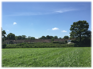
5.31 The site comprises the roadside portions of two relatively flat agricultural fields on the southern edge of Broadwindsor village. The allocated area that has outline planning permission extends to about 0.86ha. The fields begin to slope downwards further away from the road, and adjoin residential areas to the north and east. The site fronts onto the B3162. The existing access to the south is inadequate, with poor visibility, and therefore a new access will need to be created closer to the village. There would be scope to improve pedestrian safety along this stretch of road through a suitable traffic calming scheme or other measures.
Heritage, Landscape and Local Features
5.32 This is a potentially prominent site within the Dorset AONB, visible from lower slopes of Lewesdon Hill and wider footpath network to the south-west. Careful consideration of density, landscaping and design will be needed. The hedges along the field boundaries are quite ecologically diverse and if affected by the proposed development would require an assessment under the Hedgerow Regulations Act (1997). Where hazel is present this can provide suitable habitat for the dormouse. They are likely to be worthy of retention and enhancement.
Flood Risk, Contamination and other matters
5.33 No major risks identified, however nearby springs suggest that ground water may be high, and the sloping nature of site could result in run-off increasing flood risk to properties down-stream from surface water run-off. There are domestic-scale pylons along the road frontage. An 8” water main crosses through the southern section of the site before heading north-west – and will need to be taken into account (or diverted) in the detailed design. The site is also partly within Minerals Safeguarding Area, and therefore extraction of this minerals resource in advance of the site’s development should be considered.
Policy BGNP11. Site 1: Land south of Fullers, opposite Redlands Lane, Broadwindsor
Land south of Fullers, opposite Redlands Lane, as shown on the Policies Map, is allocated for up to 22 dwellings, including affordable housing, subject to all of the following requirements:
Site Description and Access
5.34 A small site of about 0.2ha that comprises existing outbuildings and garden / orchard area of Manor Farm, on the northern edge of Broadwindsor village accessed from Common Water Lane. The site slopes down from the east and adjoins Common Water Lane.
5.35 Vehicular access is from Common Water Lane, which is a narrow rural lane with no pavements. There should be scope to improve access and incorporate adequate on-site parking and vehicle turning space within the site. There are limited options for safe pedestrian access.
Heritage, Landscape and Local Features
5.36 The site lies within the Dorset AONB and partly within the Broadwindsor Conservation Area. It is intimate and busy in character, opening out to wider countryside to east. Potentially visible in distant views from higher ground to the south. There is an Area Tree Preservation Order over the land immediately to the south. The hedgebank bordering Common Water Lane is likely to be an old hedgerow and would need to be assessed under the Hedgerow Regulations (1997). Manor Farm to the west is considered a Locally Important Building as a mid C19 stone and slate, coped gables, replacement windows, of group value with converted barns, and Broadwindsor House to the south-east is Grade II Listed, and the context of these buildings will need to be respected. The Conservation Area Appraisal notes key view / vista from the eastern extremities of the Conservation Area along Common Water Lane and the B3163 towards the hills behind Beaminster. The stone boundary wall bordering Common Water Lane is also worthy of retention.
Flood Risk, Contamination and other matters
5.37 No major risks identified. The sloping nature of site could result in run-off. Although water mains reinforcement is unlikely to be necessary, the development will need internal pumping to provide satisfactory water pressure levels (with associated development cost implications). There is also potential for over-looking / loss of privacy that can be avoided through sensitive design.
Policy BGNP12. Site 3: Land at Manor Farm, Common Water Lane, Broadwindsor
Land at Manor Farm, Common Water Lane, as shown on the Policies Map, is allocated for up to 5 dwellings (including the redevelopment of outbuildings), subject to all of the following requirements:Site Description and Access
5.38 Sloping agricultural land rising up from the road, on the western edge of Broadwindsor heading towards Drimpton. The site allocation extends to about 0.2ha of the field. There is an existing vehicular access onto the B3162, but the visibility splay can become obscured by the roadside hedge and there are no pavements at this point along the B3162.
Heritage, Landscape and Local Features
5.39 This is a potentially prominent and open site within the Dorset AONB, with the higher ground likely to be visible in distant views from Lewesdon Hill and Pilsdon Pen, whereas the area closest to the road is much less prominent and partly screened by the strong hedgerows. The area of grassland is semi-improved and species-poor. The road bank hedge is shaded somewhat by mature trees. The eastern hedge on the higher ground could well qualify as an Important Hedgerow under the Act. Where hazel is present this can provide suitable habitat for the dormouse. No heritage or other features were noted that could be impacted by the development.
Flood Risk, Contamination and other matters
5.40 No major risks identified. The sloping nature of site could result in run-off. The existing water mains network servicing Broadwindsor will need to be extended to serve this development.
Policy BGNP13. Site 6: Land North of Hillside, Drimpton Road, Broadwindsor
Land North of Hillside, Drimpton Road, as shown on the Policies Map, is allocated for up to 5 dwellings, subject to all of the following requirements:
Land adjoining the defined development boundary
5.41 It is clear from the call for sites that there were only limited options put forward in and around Broadwindsor village. It is feasible that other sites may come forward during the lifetime of the plan that could continue to meet local needs in what is the area’s largest village, that are not unduly constrained by environmental designations or other factors.
5.42 The Local Plan allows for rural exception sites to be promoted, but the requirement for 100% affordable housing may be prohibitive, and a slightly more flexible approach is therefore suggested to encourage landowners to consider offering their sites to help meet these local needs in this particular location (in and around Broadwindsor village).
5.43 This policy extends to land around the hamlet of Hursey, which has a very close relationship with Broadwindsor village. A defined development boundary was suggested as a possible option for Hursey, but has not been adopted due to the complex nature and relationship between the dwellings and garden areas. Instead reference is made to the ‘built-up area’ which should be interpreted as areas where buildings are situated and the curtilages associated with those buildings, extending as far along the lane as Moorlands (where Spillers Lane exit joins the track). Closely related means visible from buildings within the built-up area, and not separated by an undeveloped area in which more than two houses could subsequently be built.
5.44 Any open market housing allowed as part of this exception site policy should comply with the dwelling requirements (which in themselves are aimed at providing more affordable forms of open market housing).
Policy BGNP14. Small-scale exception sites adjoining Broadwindsor and Hursey
Small-scale exception sites for affordable housing with a limited element of open market housing will be supported, provided that all of the following requirements are met:
Site Description and Access
5.45 About 0.8ha of a gently sloping, large agricultural field, forming part of the gap between Drimpton and Netherhay. Netherhay and the Crewkerne Road lies to the north, the Little Axe tributary runs to the east (with part of Drimpton’s residential area beyond), and to the south the site backs onto residential properties off the B3162. The site is accessed from Netherhay Lane which runs up its western boundary, with agricultural fields beyond. There are no pavements at this point, the lane is not heavily trafficked and is currently part of a local bus route. Public rights of way cross the field, linking south to Chard Road, west to Netherhay Lane and north to Axe Lane.
Heritage, Landscape and Local Features
5.46 An open, calm landscape character within the Dorset AONB with moderate visibility and having views to surrounding hills. The road hedge which alongside Netherhay Lane has a large bank (and on the road side this supports a varied flora) although the hedgerow itself is patchy with only small sections with shrubs. As part of any Biodiversity Mitigation Plan the hedge should be replanted with native species to enhance this important ecological and landscape feature. There are several mature trees along this boundary. There is a small section of intact hedge in the south of the site which will need to be assessed under the Hedgerow Regulations (1997). Where hazel is present this can provide suitable habitat for the dormouse.
5.47 There are two Listed buildings visible from the site: Grade II Listed Netherhay Methodist church to the north that faces onto the site; and a Grade II Listed c17 Old Netherhay Farmhouse that lies to the north-east. Development in proximity to these buildings could harm their setting and would need careful consideration. The field also separates Drimpton and Netherhay and a significant gap should be maintained between the two settlements.
Flood Risk, Contamination and other matters
5.48 The area near the Little Axe (outside the proposed site allocation) is prone to water-logging and is part of a mapped flood risk area. The field slopes down towards the Little Axe, so the flood risk area does not extend over much of the field – however consideration will be needed to avoid increased surface-water run-off impacting on properties down-stream. There is no local water mains available, and network reinforcement may be necessary.
Policy BGNP15. Site 7a: Land East of Netherhay Lane, adjoining Drimpton
Land east of Netherhay Lane, adjoining Drimpton, as shown on the Policies Map, is allocated for a rural affordable housing exception site, subject to all of the following requirements:
Site Description and Access
5.49 A broadly flat meadow of about 0.5ha, with residential to either side, farmland to rear, where linear development continues along the Bridport Road (B3162) heading out of Drimpton towards Sandpit. There are no pavements at this point, the road width is relatively narrow, and the existing field access has poor visibility. However there is potential to create a new access and also to provide a safe pedestrian route along this stretch of road.
Heritage, Landscape and Local Features
5.50 An open, exposed and unusually regular shaped field with a hedgerow boundary to the roadside, but just post and wire fence to south. The site is within the Dorset AONB with moderate to high visibility from Blackdown Hill to the south-east and Pilsdon Pen to the south, and therefore careful consideration will need to be given to the scale and form of dwellings and landscaping along the southern boundary. No notable heritage assets likely to be affected. The grassland is semi-improved but herbs form a significant percentage of the sward although no Dorset Notable Grassland plant species were recorded. The hedgerow along the frontage is species-rich and qualifies as a priority habitat under the UK Biodiversity Action Plan.
Flood Risk, Contamination and other matters
5.51 No major risks identified. However there is anecdotal evidence of localised surface water flooding impacting on adjoining land, and therefore run-off from the site should be considered in detailed design so as to not exacerbate this. It is likely that infiltration / soakaways will be needed to manage drainage and surface-water run-off given the apparent lack of any receiving system to drain into.
Policy BGNP16. Site 12: Land East of Manor Farm, Bridport Road, Drimpton
Land East of Manor Farm, Bridport Road, Drimpton, as shown on the Policies Map, is allocated for up to 10 dwellings, including affordable housing, subject to all of the following requirements:
Site Description and Access
5.52 A small, level paddock between residential developments on the northern edge of Netherhay hamlet where linear development continues northwards along the eastern side of Axe Lane. The roadside area allocated extends to just over 0.1ha. There is potential to either share the existing vehicular access or create a new access onto this road. There are no pavements at this point, but the lane is not heavily trafficked.
Heritage, Landscape and Local Features
5.53 A low-lying site of modest character within the Dorset AONB with limited visibility - mainly from hills to north. Hedgerow boundaries along the roadside and to the north side of the site, are on distinct banks and also host occasional mature trees. There is an active badger sett in the roadside hedge, and suitable habitat does exist for nesting birds. The hedgerows may qualify as important and if they are to be affected by the proposed development will need to be assessed under the regulations. As well as disturbing the badger sett, the creation of a new vehicular access could also impact on the tree root protection area, and therefore access to the site may need to rely on sharing the existing access. The Netherhay Methodist chapel to the south is Grade II Listed - however its setting is unlikely to be affected given intervening development and provided the building height does not exceed the existing house on Brent Paddock.
Flood Risk, Contamination and other matters
5.54 No major risks identified. It is likely that infiltration / soakaways will be needed to manage drainage and surface-water run-off.
Policy BGNP17. Site 5: Land at Brent Paddock, Netherhay
Land at Brent Paddock, Netherhay, as shown on the Policies Map, is allocated for up to 2 dwellings, subject to all of the following requirements:Site Description and Access
5.55 A flat agricultural parcel of land extending to some 1.75ha, within a rural setting but also adjoining the existing industrial units at Axe Mill. The existing vehicular access has been previously widened to accommodate employment uses, but the earlier planning consent for a larger industrial estate lapsed.
Heritage, Landscape and Local Features
5.56 Two regular shaped fields within the Dorset AONB with moderate visibility from hills to north and east. Along the southern boundary is a mature hedgerow on a large bank and supports a wide variety of woody trees and shrubs, and suitable habitat does exist for nesting birds and the dormouse. The roadside hedges appear less diverse, but due to their age all of the hedgerows will need to be assessed under the Hedgerow Regulations Act (1997). No notable heritage assets likely to be affected.
Flood Risk, Contamination and other matters
5.57 No major risks identified. It is likely that infiltration / soakaways will be needed to manage drainage and surface-water run-off given the apparent lack of any receiving system to drain into.
Policy BGNP18. Site 14: Land at Axe Mill, Netherhay
Land Land at Axe Mill, Netherhay, as shown on the Policies Map, is allocated for employment, subject to all of the following requirements:
Rural conversions
5.58 The adopted Local Plan allows open market housing to be provided through the re-use of existing rural buildings. This is subject to a number of conditions, including that the existing building must be of permanent and substantial construction, and would not need to be substantially rebuilt or extended; the proposed form, bulk and design will make a positive contribution to the local character; the building was in existence in 2011; and the building either:
5.59 Although in many parts of the country there are now permitted development rights for converting farm buildings into new homes, these do not apply within the AONB or where the building no longer forms part of a working farm. The example put forward through the call for sites (a barn at Horn Ash within the curtilage of someone’s home) could therefore only have come forward if it were not sold off separately from the main house, which potentially prohibits perfectly suitable barns from being converted to residential use. As such, the restriction that away from the main settlements, such buildings need to be tied to the wider holding, is proposed to be lifted. The inclusion of a clause used in the permitted development rights (that the location should be neither impractical nor undesirable) has been adopted to ensure a consistent approach is taken to avoid locations that would be particularly detrimental, such as hill-top locations with no road access or utility services, or adjacent to unneighbourly uses such as a silage store or general industrial estate.
5.60 This policy applies across the Neighbourhood Plan area
Policy BGNP19. Rural Conversions
The adaptation and re-use of rural buildings for open market housing will be supported, provided that all of the following criteria are met:
5.61 The Local Plan also allows the provision of rural worker’s dwellings, where a need is justified for that person to be located on site. There is no need to duplicate that policy in this Neighbourhood Plan.
1 Broadly speaking, a Starter Home is expected to be priced below the average price paid by a first time buyer, and should have restrictions imposed in terms of sale price and eligibility (in terms of age and income).
< Previous | ^ Top | Next >