
3.1 The planning policy context and the community engagement work already undertaken have raised a number of issues for the Neighbourhood Plan to address:
3.2 These issues have been debated and the conclusions have informed the land use policies of this Pre Submission version of the Plan. These proposals for planning policies are set out in the next section.
3.3 Land use policies are used to determine planning applications made for development proposals. They can establish the principles for retaining or changing the use of land in settlements and in the countryside. They can also set out the conditions against which development proposals will be judged in terms of their design, access etc.
3.4 The purpose of these policies is to either encourage planning applications to be made for things the local community wants to see happen or to discourage applications for developments that they do not want to happen. Policies must be clearly written so they can be easily applied when considering planning applications.
3.5 The Plan deliberately avoids repeating existing national or local planning policies. The proposed policies therefore focus on a relatively small number of key development issues in the area.
3.6 Set out below are the proposed policies of the Plan. Each policy has a number and title and the policy itself is written in bold within a text box for ease of reference. There is also a short statement explaining the intention of the policy. The Policies Maps are contained at the end of the Neighbourhood Plan. Where a policy refers to a specific site or area, then it is shown on the main Policies Map and/or an inset map.
Development proposals should:
Development must not increase flood risk elsewhere. The inclusion of Sustainable Drainage Systems as part of a new development will be supported.
3.7 Policy ENV1 recognises the importance of preserving the valuable natural assets of the area for the long-term benefits of future generations.
3.8 Policy ENV2 recognises the high cost of climate change with particular regard to circumstances created in the Plan area by the extensive flood plain designations in Hurley and Waltham St Lawrence from the River Thames and the Loddon, in addition to high levels of groundwater and poor access to drainage that has caused considerable flooding events in the recent past.
Development proposals for a single housing scheme at each of the Recognised Settlements in Hurley Parish will be supported, provided each scheme:
3.9 Policy HUR1 guides future development in Hurley Parish. The policy indicates the general types of locations and circumstances that may be appropriate for new housing, which is consistent with the 2003 Local Plan Policy GB3.
3.10 Policy HUR1 is intended to be more permissive of certain types of housing development schemes in the Green Belt than Policy GB3 in order to deliver specific housing outcomes for Hurley Parish. The local community there is increasingly concerned that the consequence of Green Belt policy is a lack of available smaller homes in each of its Recognised Settlements to enable older residents to downsize. The Parish Council therefore considers there is a ‘very special circumstance’ to allow each settlement to accommodate one housing scheme within or adjoining its present boundary, in line with NPPF paragraph 87. According to Census 2011, 63.5% of people in Hurley live in households of two people or fewer.
3.11 The NPPF paragraph 89 identifies ‘limited infilling’ within Green Belt villages and ‘limited affordable housing to meet local community needs’ as being exceptions to inappropriate development in the Green Belt. By confining its support to one scheme in each settlement in the plan period and to each scheme being for no more than five dwellings on land of no more than 0.25 Ha in a location that does not undermine the permanent open character of the Green Belt, the policy has paid full regard to national policy in this respect. Although not confined to the planning definition of affordable housing, the policy has a very similar intent in addressing a local housing need.
Community Action:
Hurley Parish Council will seek to work with third parties, with the aim of ensuring that proposals related to Star Works in Wokingham demonstrate that their impacts on Hurley’s highway network are satisfactorily mitigated.
3.12 Star Works is located within neighbouring Wokingham Borough Council, but the road access is via Star Lane in Knowl Hill, which lies within the Neighbourhood Area. In addition, the majority of the site is in minerals and waste use, which is ‘excluded development’ that cannot be controlled by a Neighbourhood Plan policy, but there are other business uses on the site. Hurley Parish Council would like to ensure that any future proposals for additional business uses on the site take into account the cumulative impact of noise and heavy goods traffic movements on Star Lane and the local community at Knowl Hill..
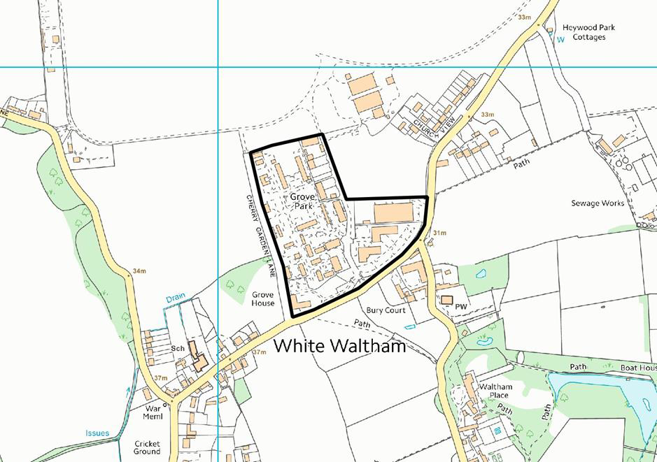
Policy WW1 – Housing at Grove Park
Proposals for the redevelopment of Grove Park, to provide housing, will be supported, subject to:
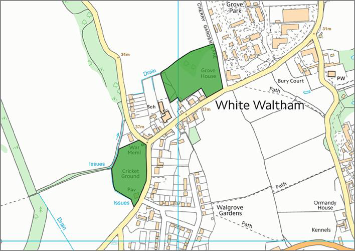
3.13 Grove Park is an established business park. The policy seeks to guide how such a scheme could be made satisfactory by setting out its key development principles. The site occupies a prominent position in the landscape; the relationship between new housing and existing businesses is sensitive; and Waltham Road is a busy road in peak hours. All require careful consideration in the design of future proposals.
Policy WW1 Grove Park
Proposals for the redevelopment of land at Smithfield Road, to provide housing, will be supported, subject to dwellings not being more than two storeys in height; maintaining a set back from Smithfield Road no less than that of neighbouring dwellings to the east; the provision of off-road parking spaces within the site; and the satisfactory resolution of any ground contamination issues.
3.14 The Smithfield Road site is currently in a single builders merchant yard use. Although that use has not formally been determined as ‘unneighbourly’ - and there is no proposal to force its relocation - the policy seeks to send a market signal to the land owner that a housing redevelopment scheme is acceptable in principle for the proper planning of the area.
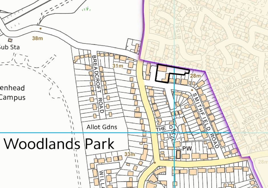
Map Policy WW2 Smithfield Road
Proposals for development on the White Waltham Airfield, as shown on the Policies Map, will only be supported if they are ancillary to the established airfield use, conserve heritage assets and are appropriate in the Green Belt.
3.15 Policy WW3 addresses the future use of the Airfield. This use covers a large area of the Green Belt in the parish and adjoins part of Woodlands Park. It is a popular airfield with a series of buildings located on its edge, all serving a purpose directly associated with its use, e.g. navigation, servicing, storage. Some airfield development is deemed permitted by the GPDO 2015 but other proposals may require planning consent, which this policy supports provided they remain ancillary to its primary purpose.
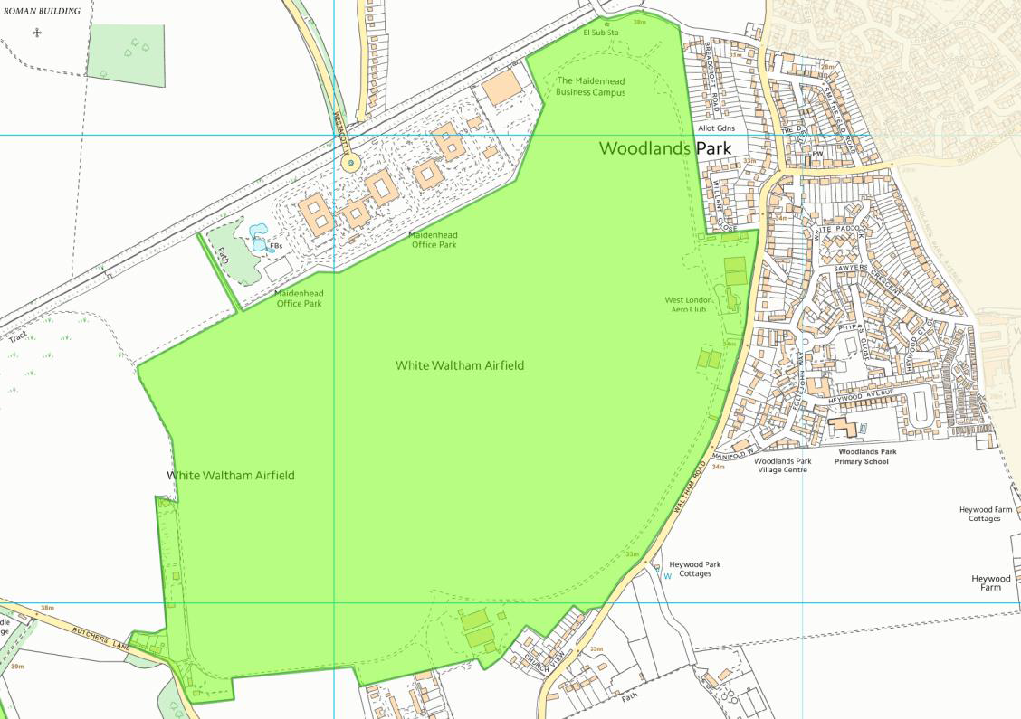
Map Policy WW3: White Waltham Airfield
General Policies: Gen Policies apply to all of the HWNP
Proposals for small-scale affordable housing development that is within or well related to an existing settlement will be supported, provided:
The initial and future occupation of all affordable homes will be controlled by means of a Planning Obligation to ensure that each home remains as affordable housing for people with a local connection in perpetuity, whereby a local connection is defined by people with a demonstrable connection to the village thus:
Cross subsidy through the provision of open market housing on the scheme shall be allowed only where it ensures the delivery of the affordable housing and shall comprise small homes of 2 and 3 bedroom market dwellings necessary to ensure the delivery of affordable housing as part of the same development proposal, to be demonstrated by a viability appraisal of the full scheme.
3.16 This is a policy that allows for small schemes of only affordable housing adjoining the Recognised Settlements in the Green Belt. It indicates the general types of locations and the very special circumstances that may be appropriate for such sites, which is consistent with 2003 Local Plan Policy h2.
3.17 The Neighbourhood Plan area recognises that given the particularly high price of housing in the area, and the lack of development of smaller homes for starters and downsizing, local residents are being priced out of the market. There is a confirmed need for affordable homes for local people identified in Housing Need Surveys conducted by the Rural Housing Enabler for Berkshire based at the Community Council for Berkshire across the 3 parished areas of the Neighbourhood Development Plan area.
3.18 Affordable Housing is defined by the NPPF as: “Social rented, affordable rented and intermediate housing, provided to eligible households whose needs are not met by the market. Eligibility is determined with regard to local incomes and local house prices.”
3.19 Need may include existing residents of the parish or from adjoining parishes who require separate accommodation or are currently living in accommodation unsuited to their needs.
3.20 The policy seeks to permit in exceptional circumstances development within, adjacent to, or well related to existing settlement. This policy seeks to prevent development in the open countryside but where a proposal is outside the settlement boundary, ‘Well-related’ in this case means according to what has been determined acceptable by the Parish Council through public consultation.
3.21 This policy seeks to limit the size of any rural exception development based upon impact to the Green Belt and rural character of the HWNP as well as with regards to feedback from the vast majority of residents in the HWNP consultation that would find this threshold acceptable.
3.22 This policy is consistent with the National Planning Policy Framework that allows for limited open market development on rural exception sites, but seeks to clarify that this is only acceptable where the open market development is necessary to make the affordable units deliverable. With the high land values in this area it is unlikely a scheme will require more than 25% of open market units on the development.
| Land Registry Average Sold House Values April 2015 – March 2016 | |||
|---|---|---|---|
| HWNP Area | BWM | England | |
All homes sold |
£594,000 | £424,877 |
£185,304 |
Semi detached properties only |
£462,000 | £398,616 |
£175,130 |
Lower Quartile average price |
£276,000 | * |
* |
3.23 This policy further seeks to set out the legal framework for the control of occupancy of the affordable homes on any rural exception development in the HWNP.
Policy Gen 2: Quality Design
Development proposals, including alterations to existing buildings, will be supported within the context of all other policies, providing their scale, density, massing, height, landscape design, layout and materials, and new ground surfaces, reflect the architectural and historic character and scale of the buildings and landscape of the respective Parishes. Innovative design solutions that enhance the appearance of the street scene will be supported.
3.24 This is a design policy that requires all planning applications to respond to the common design characteristics of the area and specifically to the adopted Conservation Area Appraisals for proposals located within or adjoining one of the Conservation Areas in the area, in line with Borough Local Plan Policy HOU8 and 2003 Local Plan Policies DG1 and H10.
Policy Gen 3: Areas of Special Character
The Neighbourhood Plan designates the following areas as Areas of Special Character, as shown on the Policies Map:
Hurley Parish:
Shottesbrooke Parish:
White Waltham Parish:
Development proposals in a designated area should have regard to the desire to conserve and enhance the characteristics that define that area, as set out in the Neighbourhood Plan Areas of Special Character Study.
3.25 This policy designates Areas of Special Character in the HWNP area for the purpose of managing development proposals in those settlements to ensure their essential characteristics are maintained.
3.26 The design guidance for each Area, and the definition of their local architectural and historic character that justifies their designation, is contained in the Areas of Special Character Study in the evidence base.
Policy Gen 4: Local Employment Sites
With the exception of land at Grove Park (see Policy WW 1), proposals that result in the loss of an existing employment or business use, will be resisted, unless it can be demonstrated that its continued use is no longer viable.
Policy Gen 5: Community Facilities
Development proposals to provide new community facilities, or that will sustain or extend the following existing community facilities, will be supported:
Hurley Parish sites:
Waltham St Lawrence Parish sites:
White Waltham Parish sites:
Proposals that will result in the loss, or significant reduction in the scale, of a community facility identified in this policy will be resisted, unless suitable alternative facilities are provided, or the existing community facility is demonstrated to be unviable in its current use.
This policy identifies those built community facilities that will be protected from a change of use that will result in a loss of their community value. Some may already have protection from demolition given they are designated heritage assets, but this policy seeks to ensure their community value is sustained. Further, it encourages proposals to enable the facilities to remain viable community assets, in line with 2003 Local Plan Policy CF1.
3.27 Further, it encourages proposals to enable the facilities to remain viable community assets, in line with 2003 Local Plan Policy CF1. However, this cannot be at any cost, and so the policy confines proposals to those that are the minimum to maintain the viability of the facilities and that will not undermine the character of the Green Belt or harm local amenities.
Policy Gen 6: Education
Proposals to extend an existing education facility to provide for additional educational uses and/or to establish a nursery school/play group, will be supported, provided:
Proposals that will result in the loss, or significant reduction in the scale, of an existing educational facility will be resisted, unless suitable alternative facilities are provided.
3.28 This is a policy that protects and supports the extension of existing education sites – the six primary schools and nursery schools in the parishes – to ensure they remain of a high standard and popular with local families and students respectively, subject to measures on parking and amenity for example, and is in line with 2003 Local Plan Policy CF1. The neighbourhood area is very rural and there is therefore a special value in retaining these facilities as part of the social fabric of the local communities.
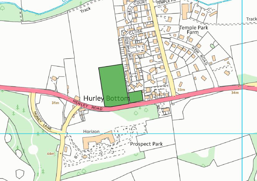
Policy Gen 7: Local Green Spaces
The Neighbourhood Plan designates Local Green Spaces in the following locations, as shown on the accompanying plans and further defined in the Appendix Local Green Spaces:
Hurley Parish sites:
Waltham St Lawrence Parish sites:
White Waltham Parish sites:
New development in a Local Green Space is ruled out other than in very special circumstances.
3.29 This is a policy that designates Local Green Spaces to protect them from development for the plan period and beyond, as provided for by National Planning Policy Framework. To qualify as such, each site meets the criteria set out in paragraph 77 of the NPPF as set out in Local Green Space Study in the evidence base.
Local Green Space Plans:
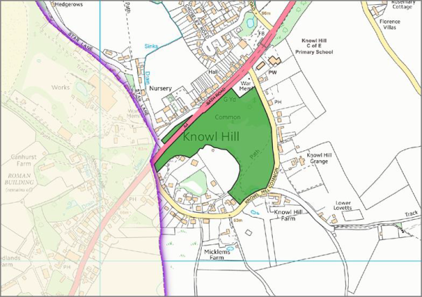
Map: Knowl Hill Common and Land North of A4
Map: Hurley Village Greens
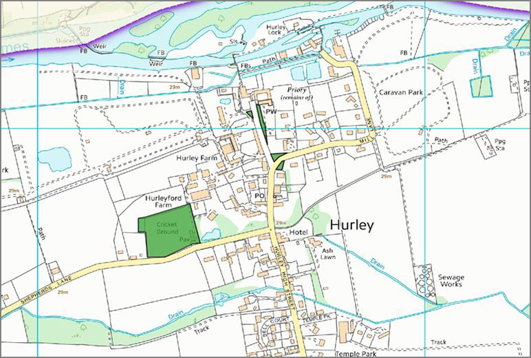
Map: Hurley football pitch, Cricket Ground and playground
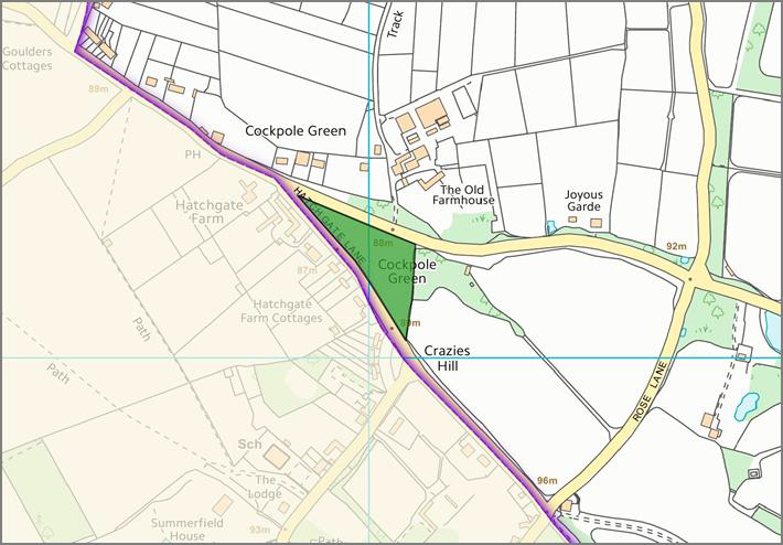
Map: Cockpole Green village green
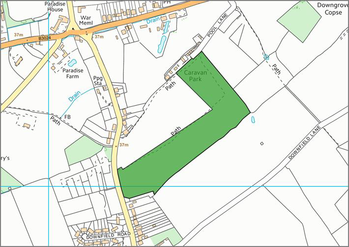
Map: Waltham St Lawrence Land adjacent to Pool Lane
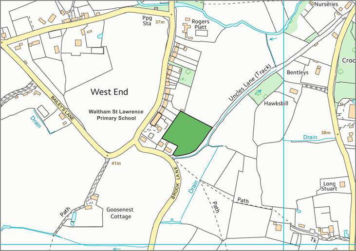
Map: WSL West End, land behind Primary School
Map: Waltham St Lawrence Land behind Bell Inn
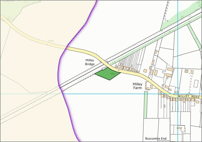
Map: Waltham St Lawrence land by Milley Bridge
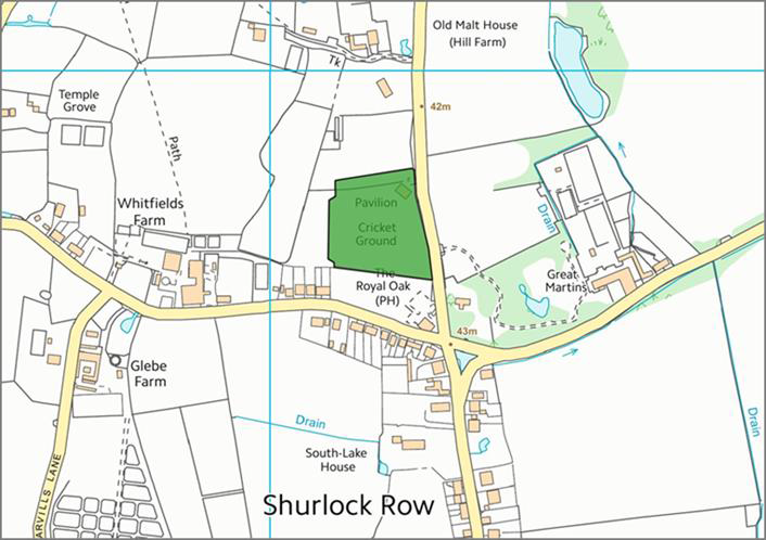
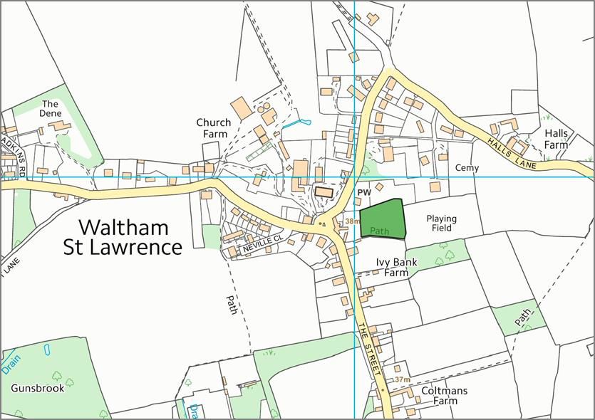
Map: Waltham St Lawrence land at Yeo Memorial Ground, Shurlock Row
Map: White Waltham Cricket Ground and Waltham Grove Park
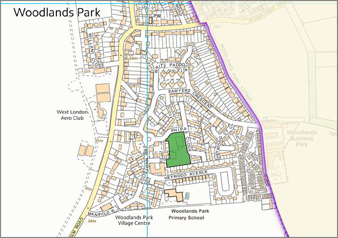
Map: WW Phipps Close Play Area
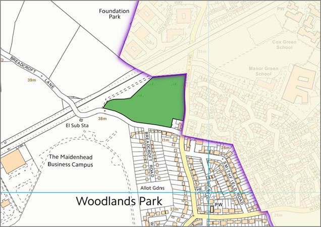
Map: WW land off Breadcroft Lane
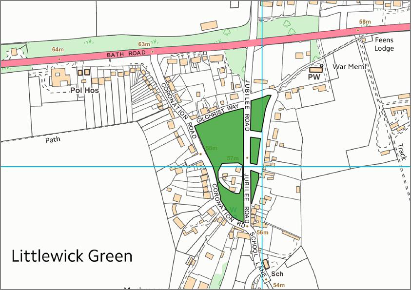
Map: WW Littlewick Green: Village green/ Cricket ground and Littlewick Common
Policy T1: Accessibility and Highways Safety
Development proposals requiring access must demonstrate safe and suitable access; and development proposals that would have severe residual cumulative impacts on highway safety will be refused.
3.30 Within the HWNP area, transport safety and traffic issues are one of the greatest concerns, particularly given the proximity to the M4, the A404M and Maidenhead Railway Station. These all represent one of the biggest commuter zones in the country. The impact of future development, in addition to the opening of the Crossrail link at Maidenhead, is likely to be significant but cannot be measured at this time.
Policy T2: Goods Vehicle Traffic
Development generating additional HGV/LGV traffic movements should ensure that any harm arising from noise and dust is satisfactorily mitigated.
3.31 Evidence from the consultations indicates that there are particular areas in the HWNP that are detrimentally impacted by noise and congestion from current levels of HGV/LGV traffic. These include Woodlands Park and Knowl Hill at Star Lane.
< Previous | ^ Top | Next >