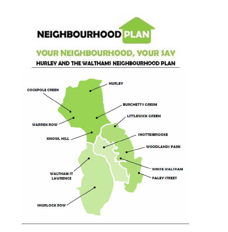
Knowl Hill Common:
Knowl Hill Common is a local beauty spot comprising a hill from the top of which can be viewed the countryside for miles around. It is a tranquil and very pleasant site much enjoyed by families for games and picnics, dog walkers and horse riders. It backs onto beech woods covered with bluebells and other wild flowers in the spring and provides a natural barrier against the noise and traffic of the A4. It is a recreation amenity for the surrounding houses as well as the wider village and others. The adjoining wood and pond, which is thought to be a horse pond, support wildlife including deer, ducks and moorhens.
Land North A4 Knowl Hill Opposite Knowl Hill Common
Located between the A4 and the original London to Bath Road the green enables parking for walkers and local businesses. This small parcel of green provides a popular local meeting point for walkers and cyclists who make use of National Cycle Network route 4 and woodland footpath up Bowsey Hill. Commonly known as the 7 Stars, the location is a landmark identified on pathfinder maps of the area. It was until recently the location of a popular pub that is now closed down, and due to be converted into housing. The green also represents an important green focal point marking the entrance of the Knowl Village that sets the character of the village. The green prevents development on the north side of the A4 from becoming strip-like in appearance and acts as a green buffer zone between the residential and commercial buildings and the A4. It defines the village to traffic passing through and has historic significance in that it is reputedly a place where hangings of highwaymen were carried out (once known as Hangman’s Common) and also where prize fighting took place.
Hurley Village Greens: adjacent to Village Shop SL6 5NB and Mill Lane SL6 5ND
The Village Greens, in the heart of the village of Hurley, are the main feature of the northern end of the village. They are surrounded by ancient buildings including the Church; ancient Tithe Barn (now Tythecote Manor); a second flint and chalk tithe barn; village shop and other old houses. The four Greens are part of the Waste of the Manor of Hurley and are now owned by the villagers through the Village Association, with one portion owned by the Hurley Church. These attractive Greens are all surrounded by posts and chains, making this the most picturesque part of the whole village.
Hurley Cricket Field, Shepherds Lane, Hurley
Managed under licence from local landowner. Important open space to the west of the village centre. Many young children are coached here and play in colts teams in local leagues.
Hurley Playground, Henley Rd, Hurley and Shepherds Close Hurley
Only playground in Hurley. Used by many children from the Shepherds Close area and elsewhere in the village. An important source of recreation for many houses with small gardens.
Hurley Football Field, Henley Rd, Hurley
Adjacent to playground. Managed under annual licence from local farmer. Used by some villagers on a regular basis in local area football leagues.
Cockpole Village Green, Cockpole Green (Hurley)
Cockpole Green is a small hamlet of some 40 houses, some 25 of which are situated in the Parish of Hurley. Approximately half of these properties are adjacent or overlooking a very attractive open area of rough grassland common and trees. The Common is often used for village events and is otherwise available to residents and visitors alike for air, exercise and recreation. The hamlet has several old properties which have been sympathetically renovated and many have open farmland. It is separately identified to the village of Crazies Hill which has a common boundary, the only pub, school and hall but is situated in the Wokingham Borough.
Land Adjacent to Pool Lane, Waltham St Lawrence – This 13 acres, less 1 acre earmarked by RBWM for a possible extension to the Pool Lane authorised gypsy/traveller site, is still owned by the Borough and originally intended as a ‘Jubilee Wood’ under the auspices of the Woodland Trust with car parking, walkways and seating proposed. This project appears now to have been abandoned which leaves the site potentially available as a community facility of which we have short supply.
Land Behind Primary School, West End – Owned and run by Trustees, this 3 acre site lies behind and adjacent to the village school in West End and is available for the school and all parishioners to use as a community facility for informal activities and the occasional village fete.
Land Behind Bell Inn, Waltham St Lawrence – This area directly behind the pub is owned by charity trustees and leased to the tenants who can allow it to be used for village functions; further down the street are the parish allotments.
Land By Milley Bridge, Waltham St Lawrence – A small one acre site at the extreme north western part of our parish set aside as a football play area. It is owned by the Haines Hill Estate and leased to the parish on an annual renewable basis.
Land At Yeo Memorial Cricket Ground, Shurlock Row – Previously sited within the grounds of Great Martins at Shurlock Row this 3 acre site is formerly designated as a parish cricket ground and benefits from a purpose built pavilion (also available for functions use). The land at Oak Meadow was funded by a former resident and the Waltham St Lawrence Cricket Club goes back to 1846.
White Waltham
White Waltham Cricket Ground – This is a major contributor to the attractiveness of the village, lying on its western edge and also on the parish boundary. On its N.E. periphery is the First World War Memorial monument. It should be protected as a sports and leisure amenity and an open space between administrative and community areas it must be protected.
Waltham Grove Park, White Waltham – This well maintained parkland which was leased to the parish council by the Shottesbrooke estate is not only a leisure, walking and fitness amenity but separates the village centre from the adjacent business park and newly allocated housing development site. As such, its protection as an open green space and civic amenity is vital.
Phipps Close Play Area, Woodlands Park – Leased from the Royal Borough by the parish council, which provides and maintains the play equipment and security installations, this open space is central to relieving and contrasting the intense housing development of the locality and provides essential leisure activity for young children.
Land at Breadcroft Lane, Woodlands Park – A natural and historical boundary between the two parishes of White Waltham and Cox Green, and a semi-rural gap between the villages of White Waltham and Cox Green. The individual communities benefit from this natural green space that protects the biodiversity of the area. Also, to lose this green space would add to the environmental pressure of the established Network Rail siding, including possible Crossrail expansion of the railway track alongside this parcel of land.
Village Green and Cricket Ground, Littlewick Green – Central to the picturesque village, and overlooked by the majority of properties in the village, the northern cricket ground, the smaller southern area, and the eastern meadow all constitute the major part of village character and openness. Owned and maintained by the parish council and entered by village green/common land statutes and byelaws, it retains protected status.