
9.1 In terms of trying to positively influence future patterns of movement into and around Datchet, the Neighbourhood Plan seeks to focus on making improvements for pedestrians and cyclists in order to encourage more walking and cycling from the residential areas. Linking residential areas into the network of walkways and safer cycling routes is vital to encourage more walking and cycling and less use of the private car. Such improvements have a range of benefits including:
9.2 This is particularly important given air pollution monitoring undertaken by RBWM. In Datchet three locations were monitored - outside the Bridge Café on The Green, on the High Street and on Queens Road. The maximum annual mean reading permissible for nitrogen dioxide (NO2) in England is 40 micrograms per cubic metre (µg/m3) and the annual mean reading outside Bridge Café on The Green was 43.0µg/m3. However, after the result was distance corrected to the nearest exposure26 the figure was adjusted to 37.5µg/m3. The RBWM 2020 Air Quality Annual Status Report committed to continuing monitoring of this and other locations in Datchet, with reporting then updated in 2021. What is clear is that air quality in this location - frequently used by pedestrians, café customers, and residents in the flat above - is very close to being beyond legally acceptable limits, posing a significant risk to health.
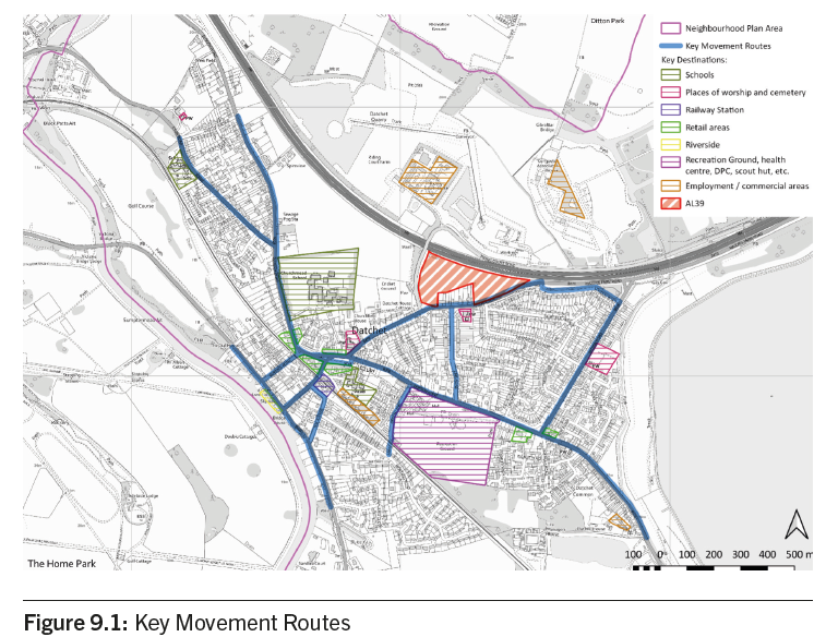
9.3 To help address this, the Neighbourhood Plan seeks to improve access to safe and high-quality walking and cycling routes. A series of Key Movement Routes have been identified where improvements will have the greatest potential to increase levels of walking and cycling and at the same time reduce pollution and improve road safety for pedestrians and cyclists. Figure 9.1 shows the Key Movement Routes and how they link up the important, regular destinations that residents make regular local journeys to, where appropriate traffic calming and improvements to enhance pedestrian and cyclist priority will be supported.
9.4 The Parish Council will promote enhancements to Key Movement Routes. Suggested improvements are listed and described in Appendix A.
POLICY DAT12: KEY MOVEMENT ROUTES
A. The development of segregated cycle and pedestrian routes that provide for suitable access by disabled users, those with sensory impairments and users of mobility scooters, will be supported.
B. The protection and/or enhancement of the positive features of Key Movement Routes, including the protection and maintaining of existing trees and the provision of new trees, hedging, verges and/or pollution-mitigating planting, will be supported.
C. Development should not result in harm to highway safety or to the accessibility of Key Movement Routes.
9.5 Recent residential developments of flats and houses have not included bicycle parking and storage as standard. To encourage cycling, the development of new housing will be expected to include provision for cycle parking and for thoughtfully designed secure storage allowing for easy access.
9.6 The provision of public cycle parking in retail or commercial development applications is considered a high priority and will be encouraged and supported. There is currently no public bicycle parking in the village (except rails and lockable storage boxes at the railway station platform). RBWM’s Cycling Action Plan 2018-202827 listed places where public bicycle parking might be introduced: in the Village Centre (The Green), at the Library (Horton Road), and at the Village Hall (Allen Way), with high deliverability and low cost. RBWM also considers these to be low priority but in the DNP Getting Around survey, there was support for public cycle parking particularly near commercial areas and amenities, e.g. in and around the village centre, at the car parks (Horton Road and The Avenue), near Tesco, near the village hall/health centre/Recreation Ground.
POLICY DAT13: PROVISION FOR CYCLE STORAGE AND PARKING
A. The development of new dwellings should provide for secure cycle parking and storage.
B. Proposals to improve cycle parking along the Key Movement Routes and, in particular, at the following locations, will be strongly supported:
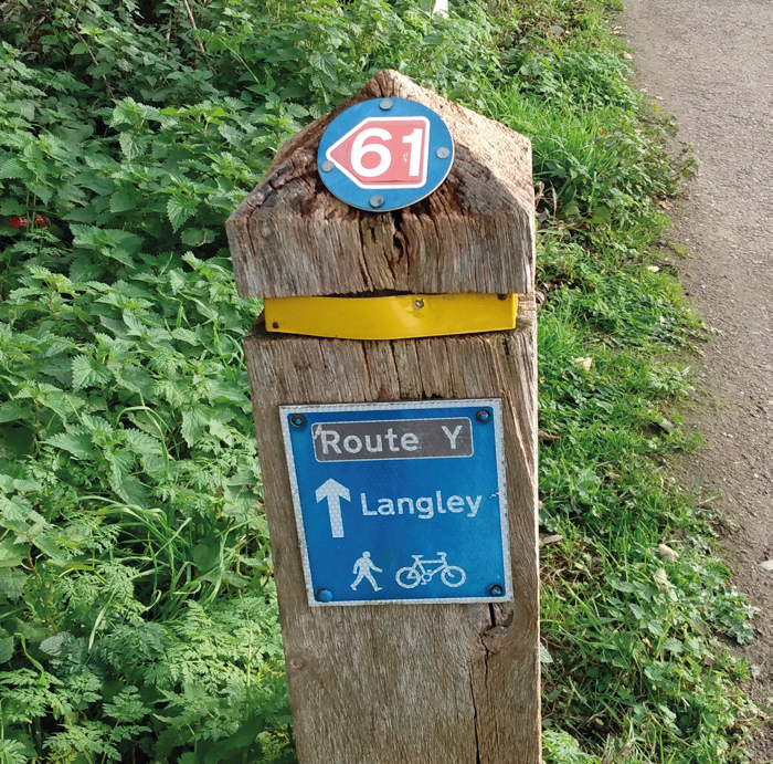
NCN 61 cycle route sign, north Datchet
26 An annual mean result obtained at a certain distance from the frontage of the building (In this case the Bridge Café) needs to be corrected as the pollutant concentration falls with the distance from the kerb.
27 https://www.rbwm.gov.uk/home/transport-and-streets/cycling/cycling-action-plan.
< Previous | ^ Top | Next >