
2.1 Datchet’s development has been shaped by its situation at a crossing of the Thames opposite Windsor Castle. Throughout Tudor and Stuart times, it was attractive to royal courtiers, civil servants and London merchants, who occupied the Riding Court and Southlea estates as well as houses in the village centre. From 1742, the Montagu and Buccleuch families owned both Ditton Park and Datchet Manor. The names of streets and buildings echo the historic association with these families.
2.2 In the 1850s the railway line cut through the centre of the village creating two level crossings. From the 1870s, demand for housing led to agricultural land being sold off and substantial houses were built on The Avenue, Montagu Road, Buccleuch Road, Eton Road, Windsor Road and Southlea Road, and terraces of small houses on Green Lane. When the need for land overcame the fear of floods, development extended along Slough Road and Whites Lane.
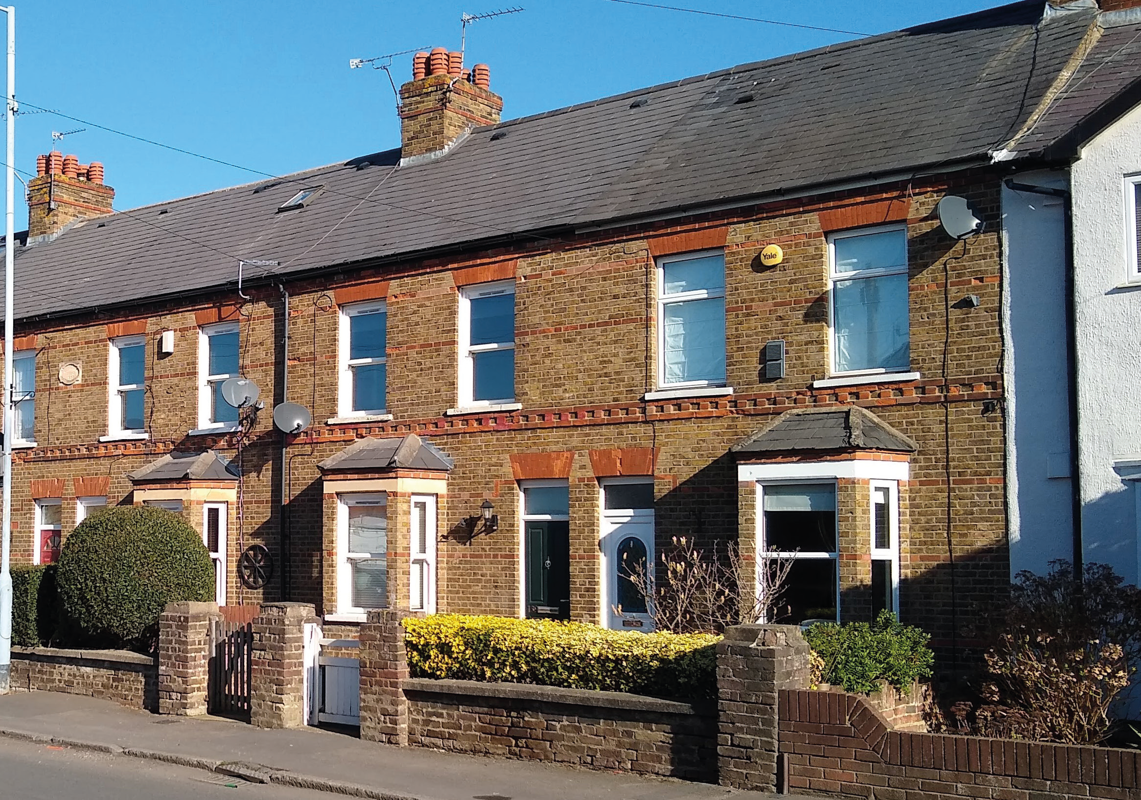
2.3 Expansion brought with it employment opportunities in the building trades and provision of services. Housing for these families was built at the eastern end of Datchet which became a separate and thriving community known as Datchet Common. It included parts of Horton Road, Ditton Road, New Road, Penn Road and Workhouse Road (now Holmlea Road).
2.4 In the 20th century, the growing need for more housing was met in three chief ways: by converting large old houses into flats; by infilling the extensive grounds of older houses; and by developing agricultural land.
2.5 Before WWI, 28 cottages with allotments were built on Ditton Road as part of the Garden City and Garden Suburb movement. In the 1930s, the private roads of Leigh Park and Lawn Close were created in the extensive grounds of older houses between London Road and Horton Road. (It wasn’t until 1956 that Link Road was built, opening up a through-route.) Other development around this time included houses to the north of London Road and behind the church; a row of substantial houses with long front gardens on Slough Road; and, new for Datchet, bungalows on Castle Avenue. Before WWII, development began on agricultural land to the north of the village, creating Montrose Avenue and Fairfield Avenue. The remaining space was later used for council housing, extending into Montrose Way and Fairfield Close.
2.6 As the century progressed, developers continued to seek out plots of land. A row of bungalows was built in the grounds of Datchet House. In 1958, a much-needed secondary school was built on Slough Road, on the extensive site of a Victorian house, Churchmead. On Montagu Road, the short cul-de-sacs of The Paddock, Saffron Close and Elm Croft were created behind the 19th-century houses. Queensmead, off Queens Road, was built on a field at the rear of the High Street. Around The Green, the maisonettes in Hall Court replaced a late Victorian house called The Hall, and three-storey townhouses were built in Priory Way near the tall Victorian villas, now flats, Ormonde and Mordenholt.
2.7 In the 1960s and 70s, there were also two major infrastructure projects which altered the landscape dramatically: the M4, separating Ditton Park and Riding Court Farm from the rest of the village, and the Queen Mother Reservoir. Both created a physical barrier to the expansion of the village which was also contained by the railway, the river and the Green Belt. A few miles away, expansion at London Airport, renamed Heathrow, was gathering pace.
2.8 The 1970 Buckinghamshire Plan resulted in new housing for more than 1700 people over the following decades, at Penn Road, New Road, Green Lane, Beaulieu Close, Montagu Road (Lombardy Park), and around Holmlea Road, Cobb Close, Holmlea Walk and Marshfield, adjoining previous local authority development at Talbot Place. This included both private and socially-rented housing intended to provide for population growth and replace some of the run-down housing. In addition, the Recreation Ground was extended to include the Sabatini Land fronting Horton Road, opening up a view of the whole space as a focal point of the village. A railway footbridge linked Montagu Road and the Recreation Ground; and Manor House Lane, behind the railway station, was recommended for housing and business development.
2.9 Although not part of the Plan, Mill Place Caravan Site was built to house some of Datchet’s gypsy and traveller community. It opened in 1970 and the site was enlarged in the 1980s.
2.10 The topic of traffic congestion was as prevalent then as it is now. The Buckinghamshire Plan proposed eastern and western by-pass routes and the site of Holmwood, a Victorian house at the corner of Slough Road and Eton Road, was reserved for the western arm. In the end, nothing happened so the plot was released for housing and Ruscombe Gardens was built there in the 1980s. This had been preceded by the development, in the same area, of Gables Close on the site of another old house, The Gables, and was followed by a development of neo-Georgian houses at Eton Close. A few years later, as planning regulations on the floodplain tightened, Agars Place was built to exacting requirements and raised above ground level in a backfill plot off Castle Avenue.
2.11 In recent years, tighter flood-zone regulations have resulted in some redevelopment plans for housing at brownfield sites being turned down. Although permitted development continues, a lack of suitable, available land has meant that development of new housing has slowed. There have been some backfill cul-de-sac developments including four sympathetically-designed detached houses at Ellesmere Close off Eton Road; eight social-housing units on Jubilee Way at the rear of Montrose Avenue; three terraced houses off Montrose Avenue; and three detached houses set back off London Road. On the outskirts of the built settlement, the former site of Datchet Mead Hotel has been redeveloped with Regency-style blocks of flats on Slough Road and houses in Burlington Mews, Datchet’s only gated development. The Borough Local Plan proposes the allocation of a Green Belt site north of London Road for approximately 80 homes.
“Fluvial and groundwater flooding remain a serious threat with a large proportion of the village lying in flood zones 2 and 3”.
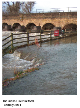
2.12 The village is also affected by a number of national infrastructure projects. In 2002 the Jubilee River flood-relief channel from Taplow to Datchet was completed, providing protection against flooding for settlements upstream of Datchet. More recently, a new River Thames Scheme flood-relief channel from Datchet to Teddington has been designed but funds are currently not available to build the first section from Datchet to Runnymede. Work on the other sections is proceeding with the possibility of reinstating a Datchet section at a later date. Meanwhile, fluvial and groundwater flooding remain a serious threat with a large proportion of the village lying in flood zones 2 and 3. In 2013, the removal at Southlea of a section of one of the historic bunds protecting Datchet increased this threat.
2.13 For some years, Heathrow Airport has been seeking to increase capacity with a third runway sited closer to Datchet, potentially adding to the already high levels of aircraft noise and pollution in the village. The M4 is currently being widened and bridges rebuilt as part of the Smart Motorway programme.
2.14 As in so many other communities, housing development and the burden of traffic have suburbanised Datchet but the heritage buildings and attractive green spaces in the heart of the village, its tree-lined roadside verges and well-planted private gardens mean that it still manages to retain its green and leafy character as a historic Thameside village.
2.15 In recent times there have been significant archaeological discoveries in Datchet including a pre-historic settlement at Southlea, a Neolithic causewayed enclosure at Riding Court, and a Bronze Age settlement at The Myrke.
2.16 Unless stated otherwise, the profile of the community has come from the 2011 Census.
2.17 In 2011, the population of Datchet was estimated to be 4,913 people. This represented an increase of 267 people since the 2001 Census, a 5.7% increase. It has a high proportion (compared with RBWM and the South East region) of young adults of working age (25–44 years old). Despite this, the most common type of household is a single person of retirement age (20%).
2.18 The majority of housing stock (60%) is detached or semi-detached but Datchet has a well-balanced profile of occupancy, i.e. houses are neither under-occupied (with spare bedrooms) nor over-crowded.
2.19 Over the ten-year period from March 2010 to February 2020, average house prices in the Datchet area increased by 129%, from £216,635 to £496,4002. This compares with an average increase of 51% to £443,368 across Berkshire as a whole.
2.20 Over the three-year period 2016/17 to 2018/19, a gross total of 63 housing completions was made in the parish of Datchet. This amounts to a net addition of 3 dwellings3. Since April 2019, a further 28 dwellings have been granted planning permission with some sites having been completed.
2.21 Windsor and Maidenhead is an affluent borough falling within the 10% least-deprived areas in England but it contains pockets of relative deprivation. The ward of Datchet, Horton and Wraysbury is the fourth most-deprived in RBWM4, with income deprivation affecting children in Datchet more than older people5. Nearly one in six dwellings in Datchet is socially-rented, sheltered or leased from affordable housing provider Abri, formerly Radian.
2.22 The population of working age has high levels of economic activity (mainly being in full-time employment) and high average levels of qualification. A significantly higher number of people leave Datchet each day to work than come to work in Datchet.
2.23 Levels of car ownership are broadly in line with those in RBWM, although the proportion of people that commute to work by car (nearly 50% of all residents aged 16–74) is high. The presence of the train station also means that train commuting — mainly to Central London — is proportionately high, although only at 9% of all residents aged 16–74.
2.24 Datchet is situated on the north bank of the River Thames opposite Windsor Castle and the Home Park. The geography of Datchet is dominated by the flood plain of the River Thames. The land is low-lying with an estimated 80–85 percent of Datchet designated as Flood Zones 2 and 3, forming the main constraint to development. This has helped to preserve the open space which gives Datchet its characteristic ‘greenness’. The M4 motorway cuts through the north of the parish.
2.25 To the south, the landscape is more rural and unified, with large fields traditionally farmed for cereals and pasture. The area is rich in archaeological finds and historic features such as field systems and hedgerows have been retained. It was proposed that Channel 1 of the River Thames Alleviation Scheme would traverse the area but this project stalled in 2020 due to lack of funds.
2.26 To the east, the 30m-high embankment of the Queen Mother Reservoir is visible above the built development, and to the west, the open landscape of meadow grassland and woodland along the river is the least changed. The outstanding views across to the rural Home Park and Windsor Castle are little altered since the early 17th century.
2.27 The Green Belt surrounds the settlement and washes over some buildings. There are three Local Wildlife Sites at Datchet Common and Gravel Pits, Upton Court Wetlands and the Queen Mother Reservoir. The section of the Jubilee River in Datchet has been highlighted as a Biodiversity Opportunity Area by the Thames Valley Environmental Records Centre.
2.28 Major water bodies include the River Thames, Jubilee River (flood relief scheme), Datchet Common Brook and the Myrke Stream (statutory main rivers), Queen Mother Reservoir (included in the Colne Valley Regional Park), and the lakes (former gravel pits) in the south-east of the parish which are currently used commercially as an aqua park and fishing lakes. Ditton Park has a moat and numerous small lakes. There is a site at Riding Court currently being used for gravel extraction. The proposed restoration scheme involves the creation of an amenity lake6.
2.29 Datchet’s heritage assets are greatly appreciated by residents and contribute to its special character. There is a rich variety of architecture, from late medieval small timber-framed halls through to the symmetrical red-brick Georgian style and to enormous Victorian mansions. There are 38 Grade II listed structures, many of which are in the central Conservation Area designated in 1995.
2.30 RBWM’s Landscape Character Assessment lists ‘generous grass verges to roadways’ as a key characteristic of the village. Tree-lined roads and avenues of trees are also a pleasing characteristic of the built environment.
2.31 Datchet is situated in a picturesque part of the Royal Borough and local people enjoy having easy access to the wider countryside. Within the settlement, green space is highly valued. Public spaces include Datchet Riverside Garden with river views, picnic area and limited mooring; The Green at the heart of the village; Datchet Recreation Ground, a park with tennis courts, football pitches, basketball court, green gym, and young and older children’s play areas; Willowfields parkland with shrubs and trees; The Land at Mill Place, an area of rough grass and shrubs.
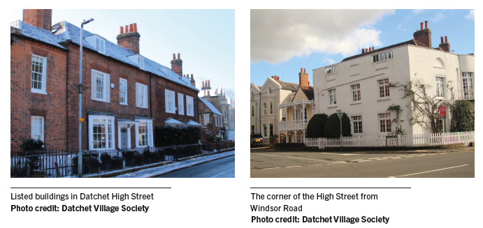
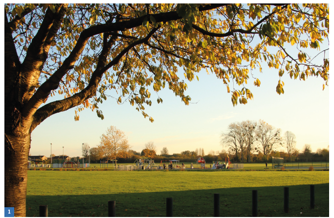
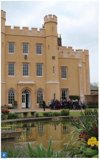
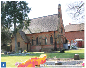
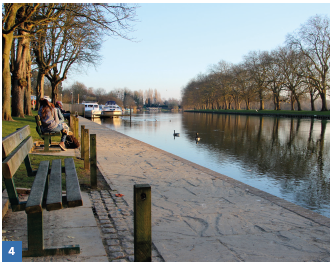
Photo credit: Datchet Village Society
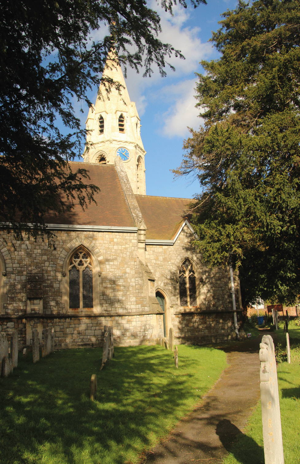
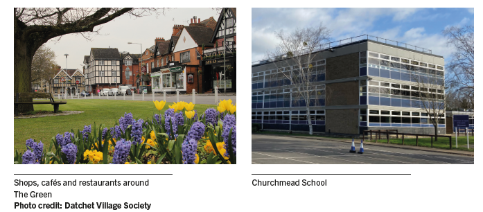
2.32 The community is served by a range of facilities and local services. The main centre is clustered around The Green, with the traditional church, pub and small shops. There is an additional smaller centre, with supermarket, fast-food outlets and restaurant, to the east of the village. There are also commercial areas and light-industrial units at Riding Court, Ditton Park (Botanica), Portland Business Centre, and Horton Road.
2.33 There are several pre-schools and play groups, as well as two primary schools and a secondary school: Datchet St Mary’s Church of England Primary Academy (3–11 years, 210 pupils and 30 nursery pupils); Eton End School (Independent, 3–11 years, 201 pupils); Churchmead Church of England School (11–18 years, 420 pupils). Not all village children can find places at the primary schools in Datchet and have to travel out of the village. At secondary level, there are two systems serving the area, Grammar/Secondary School and Middle/Upper School. Many secondary school children travel outside the village for their education while 83% of Churchmead’s pupils come from areas outside the Borough.
2.34 Datchet’s development has been shaped by transport. It lies at the intersection of several busy B-roads, close to two road bridges across the Thames. The London-to-Windsor railway cuts through the centre with level crossings on both roads to the river. The M4, connecting Datchet with the wider motorway network, slices through the north of the parish. Heathrow Airport is six miles away.
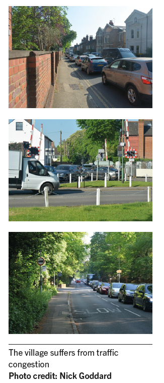
2.35 High levels of traffic cut through the heart of the Conservation Area and clog the approach routes. Historic narrow roads and junctions leading into and out of The Green are barely wide enough to accommodate two-way traffic. Larger vehicles, especially buses, coaches and lorries, mount the pavement or have difficulty negotiating the small roundabouts. Congestion is further exacerbated by the two level crossings which close up to four times an hour resulting in long tail-backs. Many Victorian houses do not have off-street parking which means that traditional front gardens and historic garden boundaries are often lost to create parking spaces. There are also direct physical impacts to important historic structures, for example, damage to a significant Grade II listed Georgian wall on London Road, as a result of vibration from HGVs7.
2.36 There are significant flows of workers both into and out of the village. A high proportion of residents (2,259) travel out of Datchet to work, nearly 50% doing so by car. This is well above the average for Windsor and Maidenhead and for the South East. The number arriving in Datchet each day to work is 1,1348. The major commuting destinations for Datchet workers are Central London, Slough and Windsor9
2.37 Over one-third (36.1%) of Datchet workers commute less than 3 miles. Many of these journeys could readily be made by bicycle but cycling accounts for less than 3% of journeys to work by Borough residents (excluding those who work mainly at/from home), while walking accounts for less than 10% of commuting journeys10
2.38 The school run also contributes to traffic congestion. There are school places for approximately 850–900 children in the parish; four-fifths of children attending the secondary school live outside the parish. Local children also travel to schools outside the parish, in neighbouring Wraysbury, Langley, Slough, Windsor and beyond.
2.39 There are very few cycle paths in Datchet. Most are shared-use and connectivity between them is poor. A section of National Cycle Network (NCN) Route 61 lies to the north of the Parish. RBWM’s Cycling Action Plan, Appendix 4, identifies key issues: cycle links to and from the village centre are poor; there is no direct cycle link to Windsor; there is significant peak hour traffic congestion in the centre of the village; NCN 61 and the route through Ditton Park are predominantly leisure routes, mostly unlit and therefore unsuited to commuting in winter/after dark; the cycle route alongside B470 Majors Farm Road is partially obstructed by an earth embankment and is also unlit for much of its length; a lack of available highway land is a key constraint to providing more cycle routes; the bridges over the River Thames are key pinch points; The Green has protected status; there is no public cycle parking anywhere within the village.
2.40 The volume of traffic has resulted in a layout where cars predominate, taking priority at the expense of pedestrians and cyclists. Traffic management is of great concern to residents; in Neighbourhood Plan consultations, traffic issues are one of the most frequently-raised topics even though a Neighbourhood Plan is very limited in what it can do about traffic.
2.41 Datchet’s railway station is on the line between Windsor & Eton Riverside and London Waterloo. The half-hourly service is sufficiently frequent to be well used by commuters whose destinations are served by that route. The station also has a car park. The proportion of residents who travel by train, 9%, is above the average for Windsor and Maidenhead and for the South East.
2.42 Slough, a major local shopping and employment centre, is a transport hub with fast train services, a large bus and coach station, and a number of car parks. It is difficult to reach by public transport from Datchet. The rail journey involves two trains and a change of station in Windsor. There is no direct bus service.
2.43 Very few buses serve Datchet. The service from Heathrow Airport via Datchet to Slough and Windsor ceased following the withdrawal of funding by Heathrow Airport. A park and ride bus from Datchet to Windsor runs three times a day off-peak Monday to Friday.
2.44 There are no direct connections by bus or train to local towns and villages such as Old Windsor, Horton, Langley, Colnbrook, Eton Wick, Burnham, Taplow, Maidenhead.
2.45 The Neighbourhood Plan seeks to address, as far as is possible, the challenges that face the community of Datchet parish, however, a Neighbourhood Plan must have regard to national policy; it can’t promote less development than the Borough Local Plan and its scope is framed by the flood zones, Green Belt and Conservation Area. This means that it cannot do anything about aviation, trains, pollution, traffic or flood schemes — topics which are frequently raised in public consultations — but it can consider issues which are part of RBWM’s planning process. It can also identify issues of a non-planning nature as separate projects or ‘non-policy actions’ (see Section 10).
2.46 The National Planning Policy Framework makes clear that the Government attaches great importance to Green Belts and these should only be altered in exceptional circumstances as part of the review of a local plan. Due to the restrictions of the Green Belt, and current lack of brownfield sites which are not in the flood zone, it is expected that most development is going to come forward in the form of infill development within the settlement boundary.
2.47 The issues were identified in various community consultations (2017–2021) and are summarised below:
“The Neighbourhood Plan cannot do anything about aviation, trains, pollution, traffic or flood schemes but it can consider issues which are part of RBWM’s planning process.”
2 Source:www.home.co.uk.
3 Source:RBWM Authority Monitoring Reports
4 Source: 2019 JSNA ward profile
5 https://rbwm.moderngov.co.uk/documents/s26845/JSNA%20Report.pdf.
6 http://www.cemexcommunities.co.uk/datchet.aspx.
7 Source:RBWM Local Transport Plan 2012-2026
8 Source: 2011 Census
9 Source:https://commute.datashine.org.uk.
10 Source: 2011 Census
< Previous | ^ Top | Next >