
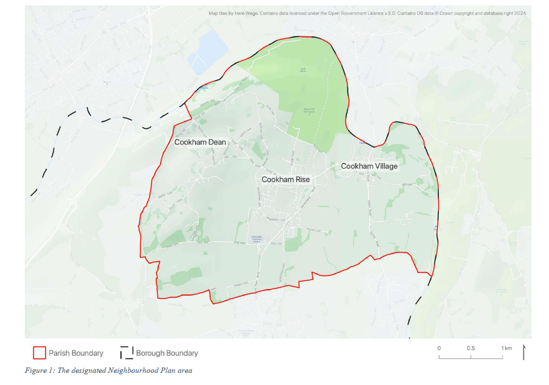
1.1 This is the submission version of the Neighbourhood Plan for Cookham Parish. It covers the entire Parish Council area, as illustrated in Figure 1. It sets out the local community’s aspirations for the Plan area over the period to 2038 and establishes policies in relation to land use and development. These are policies that will influence future planning applications and decisions in the area. But the Neighbourhood Plan is much more than this. It represents the community’s manifesto for the Parish, bringing together more than just traditional planning matters and presents, in the Appendix, a series of wider projects and aspirations that will help deliver change and improvement in the area.
1.2 The purpose of neighbourhood planning is to give local people and businesses a much greater say in how the places they live and work should change and develop over time. Neighbourhood planning is designed to give local people a very real voice in shaping the look and feel of an area.
1.3 Cookham Parish was formally designated as an area for neighbourhood planning purposes on 25 June 2020. The Cookham Neighbourhood Plan Working Party has surveyed, spoken to and listened to members of the community, and has used the issues, and opportunities, raised during that process to help inform production of the policies and projects now presented in this Neighbourhood Plan.
1.4 Cookham Parish is located alongside the River Thames in the north-easternmost corner of Berkshire. The Parish includes three settlements: Cookham Village – the original settlement; Cookham Dean – the most rural settlement in the parish; and Cookham Rise – the area around the railway station.
1.5 The Parish is bordered in the north and east by the River Thames with a band of Green Belt separating it from the town of Maidenhead to the south. Cookham Village is located on the river in the eastern part of the Parish, with Cookham Rise located more centrally and Cookham Dean, which is more sprawling, found on the western side.
1.6 The north and eastern boundary of the Parish is formed by the River Thames. This forms an important backdrop to the setting of the Parish, with riverside meadows and paths in regular use for recreational purposes. Likewise, this part of the Thames is regularly used for leisure purposes, including canoes, sailing and rowing boats.
1.7 Following this introduction the draft Neighbourhood Plan comprises eight further sections. These are:
1.8 For the avoidance of doubt, within sections 4 – 8, each topic area includes some introductory and explanatory text, followed by a policy box as indicated below:
The Neighbourhood Plan sets out land use planning policies that form part of the development plan for the Neighbourhood Area. The development plan is at the heart of the planning system, with a requirement set out in law that planning decisions must be taken in line with it unless material considerations indicate otherwise. The policies of this Neighbourhood Plan are all contained in coral shaded policy boxes, like this one.
< Previous | ^ Top | Next >