
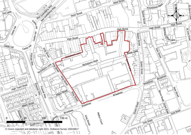
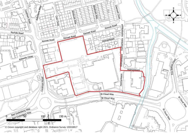
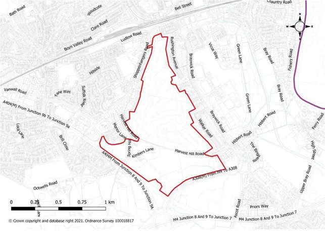
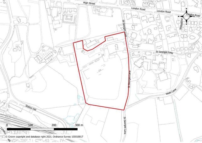
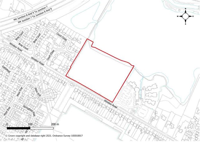
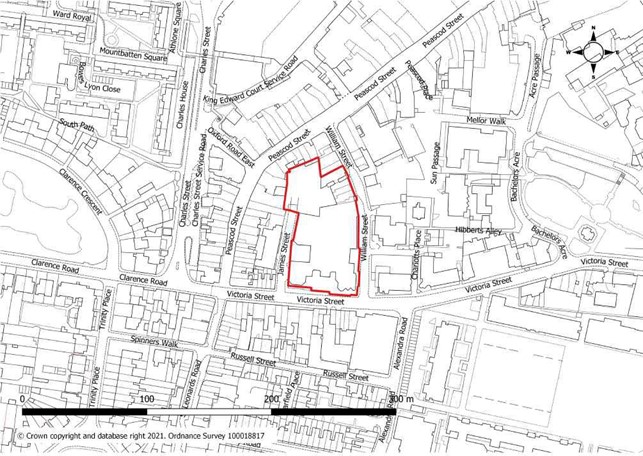
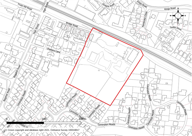
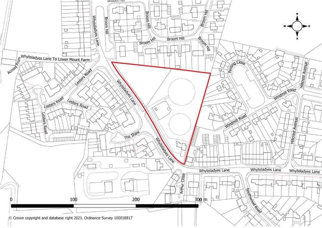
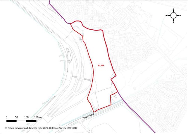
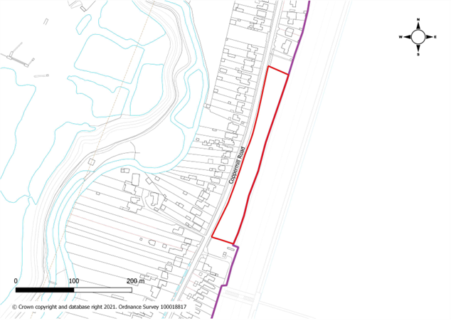
Allocation |
|
Site Area |
|
Site Specific Requirements Development of the site will be required to:
|
|
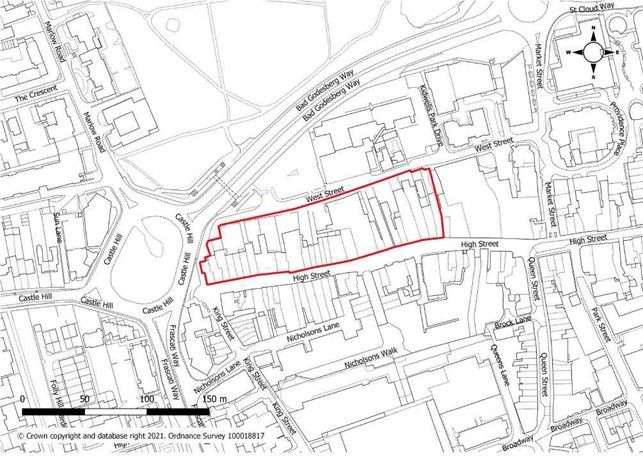
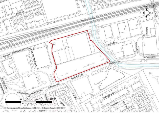
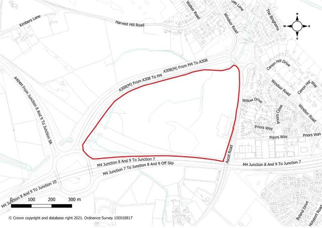
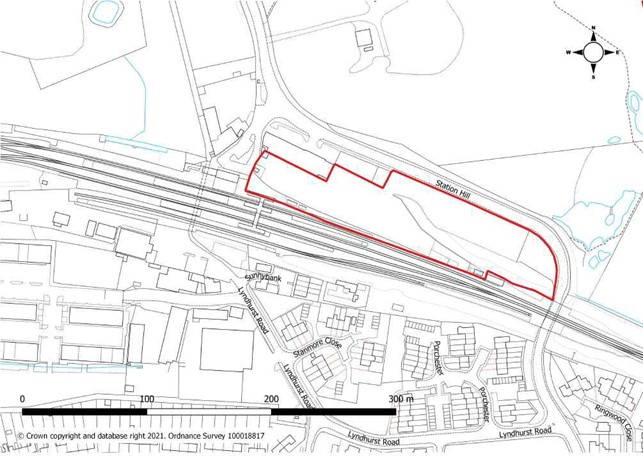
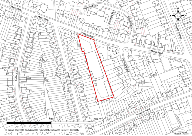
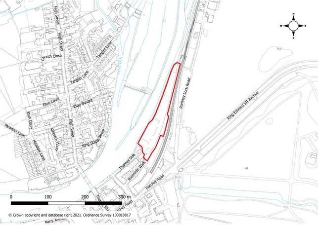
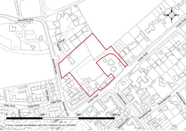
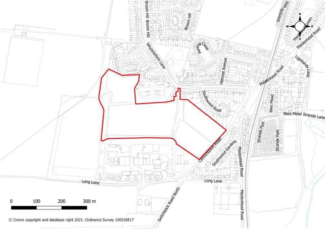
Allocation |
|
Site Area |
|
Site Specific Requirements Development of the site will be required to:
|
|
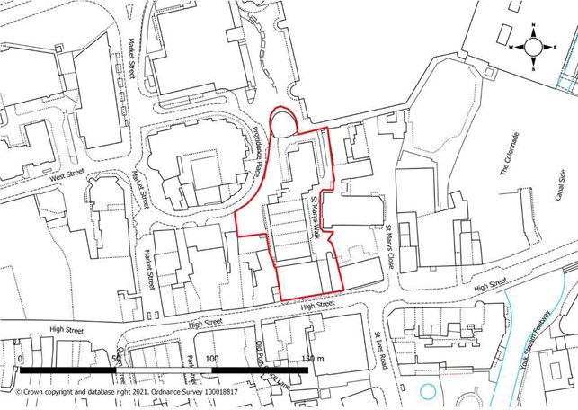
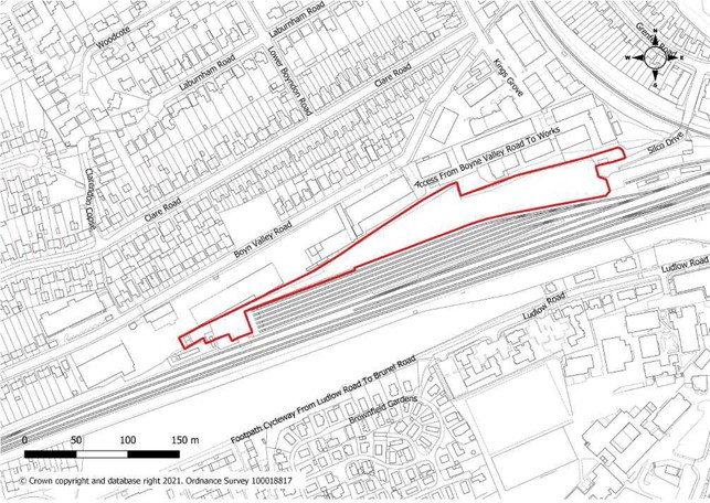
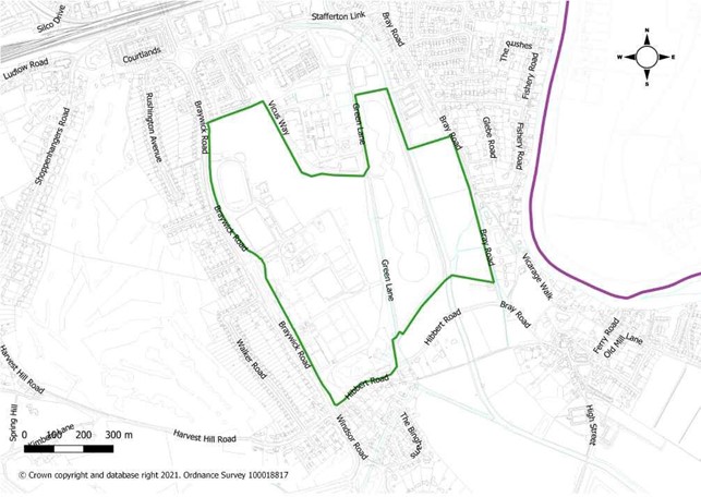
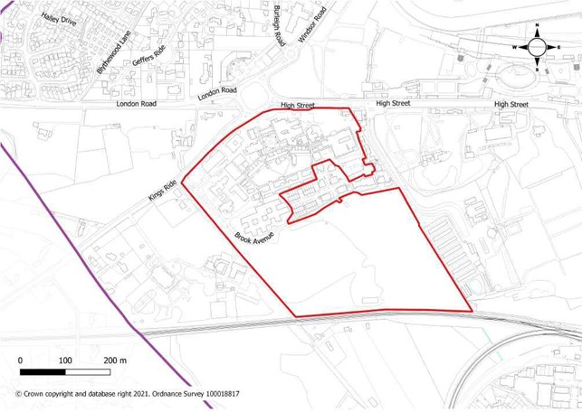
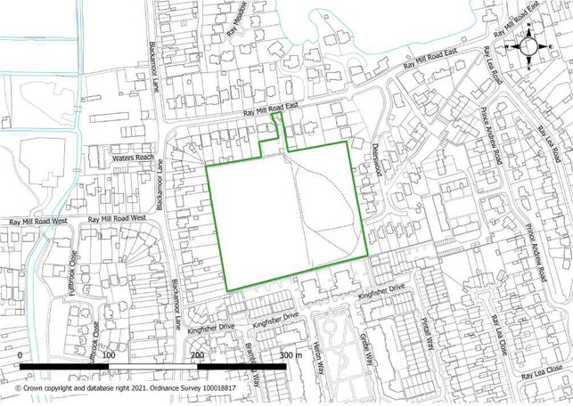
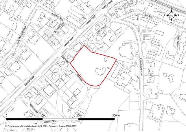
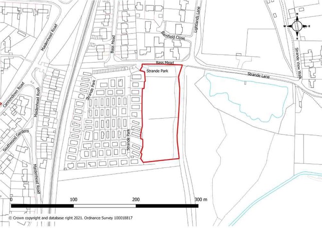
Allocation |
|
Site Area |
|
Site Specific Requirements Development of the site will be required to:
|
|
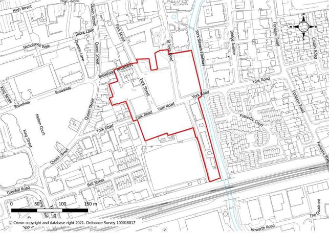
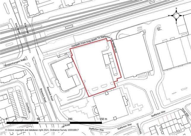
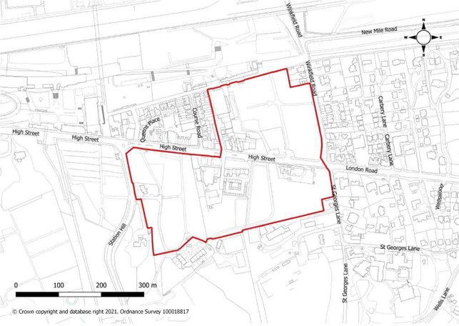
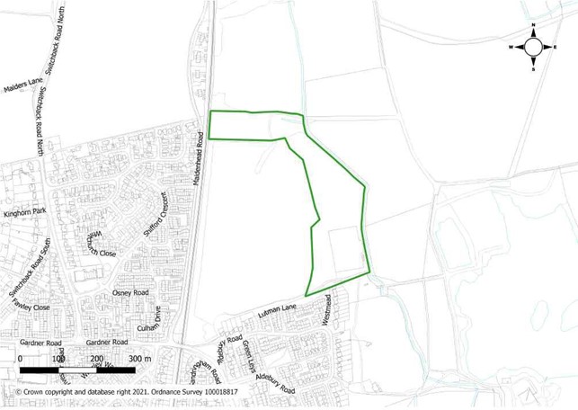
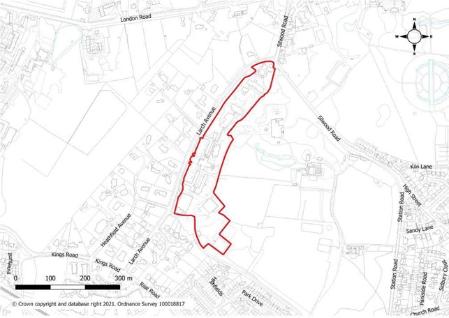
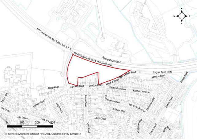
Allocation |
|
Site Area |
|
Site Specific Requirements Development of the site will be required to:
|
|
Allocation |
|
Site Area |
|
Site Specific Requirements Development of the site will be required to:
|
|
Allocation |
|
Site Area |
|
Site Specific Requirements Development of the site will be required to:
|
|
Allocation |
|
Site Area |
|
Site Specific Requirements Development of the site will be required to:
|
|
Allocation |
|
Site Area |
|
Site Specific Requirements Development of the site will be required to:
|
|
Allocation |
|
Site Area |
|
Site Specific Requirements Development of the site will be required to:
|
|
Allocation |
|
Site Area |
|
Site Specific Requirements Development of the site will be required to:
|
|
Allocation |
|
Site Area |
|
Site Specific Requirements Development of the site will be required to:
|
|
Allocation |
|
Site Area |
|
Site Specific Requirements Development of the site will be required to:
|
|
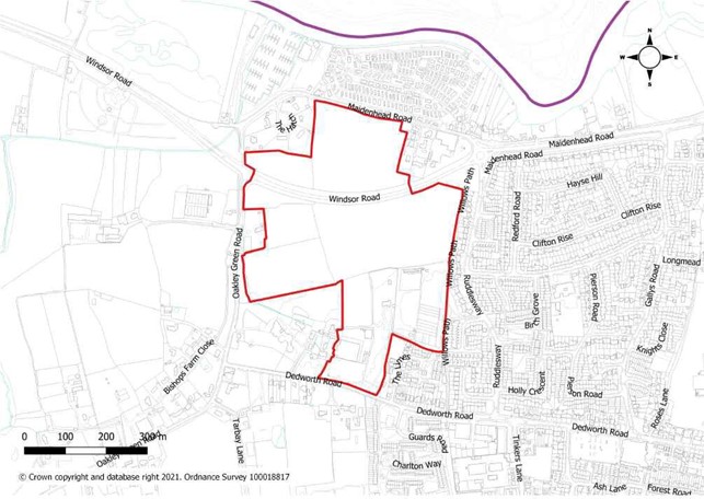
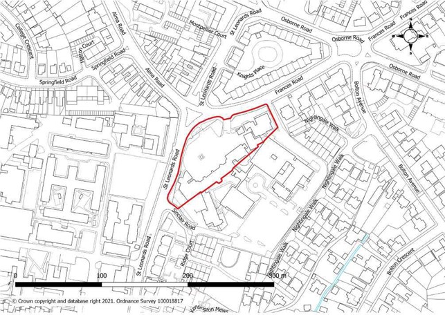
Allocation |
|
Site Area |
|
Site Specific Requirements Development of the site will be required to: In addition to the requirements set out in other policies in this plan, particularly those in Policy QP1b: Placemaking Principles for South West Maidenhead Strategic Area, the development of the site will be required to:
|
|
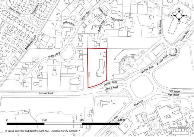
Allocation |
|
Site Area |
|
Site Specific Requirements Development of the site will be required to:
|
|
Allocation |
|
Site Area |
|
Site Specific Requirements Development of the site will be required to:
|
|
Allocation |
|
Site Area |
|
Site Specific Requirements Development of the site will be required to:
|
|
Allocation |
|
Site Area |
|
Site Specific Requirements Development of the site will be required to:
|
|
Allocation |
|
Site Area |
|
Site Specific Requirements Development of the site will be required to:
|
|
Allocation |
|
Site Area |
|
Site Specific Requirements Development of the site will be required to:
|
|
Allocation |
|
Site Area |
|
Site Specific Requirements Development of the site will be required to:
|
|
Allocation |
|
Site Area |
|
Site Specific Requirements Development of the site will be required to:
|
|
Allocation |
|
Site Area |
|
Site Specific Requirements Development of the site will be required to:
|
|
Allocation |
|
Site Area |
|
Site Specific Requirements Development of the site will be required to:
|
|
Allocation |
|
Site Area |
|
Site Specific Requirements Development of the site will be required to:
|
|
Allocation |
|
Site Area |
|
Site Specific Requirements Development of the site will be required to:
|
|
Allocation |
|
Site Area |
|
Site Specific Requirements Development of the site will be required to:
|
|
Allocation |
|
Site Area |
|
Site Specific Requirements Development of the site will be required to:
|
|
Allocation |
|
Site Area |
|
Site Specific Requirements Development of the site will be required to:
|
|
Allocation |
|
Site Area |
|
Site Specific Requirements Development of the site will be required to:
|
|
Allocation |
|
Site Area |
|
Site Specific Requirements Development of the site will be required to:
|
|
Allocation |
|
Site Area |
|
Site Specific Requirements Development of the site will be required to:
|
|
Allocation |
|
Site Area |
|
Site Specific Requirements Development of the site will be required to:
|
|
Allocation |
|
Site Area |
|
Site Specific Requirements Development of the site will be required to:
|
|
Allocation |
|
Site Area |
|
Site Specific Requirements Development of the site will be required to:
|
|
Allocation |
|
Site Area |
|
Site Specific Requirements Development of the site will be required to:
|
|
Allocation |
|
Site Area |
|
Site Specific Requirements Development of the site will be required to:
|
|
Allocation |
|
Site Area |
|
Site Specific Requirements Development of the site will be required to:
|
|
Allocation |
|
Site Area |
|
Site Specific Requirements Development of the site will be required to:
|
|
Allocation |
|
Site Area |
|
Site Specific Requirements Development of the site will be required to:
|
|
Allocation |
|
Site Area |
|
Site Specific Requirements Development of the site will be required to:
|
|
Allocation |
|
Site Area |
|
Site Specific Requirements Development of the site will be required to:
|
|
Allocation |
|
Site Area |
|
Site Specific Requirements Development of the site will be required to:
|
|
< Previous | ^ Top | Next >