
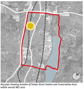
15.1.1 Turkey Street Station serves the local residents of the housing areas that surround it. Unless you are a resident, you are unlikely to use Turkey Street Station. It is, all the same, an important destination and as such it needs to be easy to find. At the moment it is easy to miss, being tucked away to one side of Turkey Street.
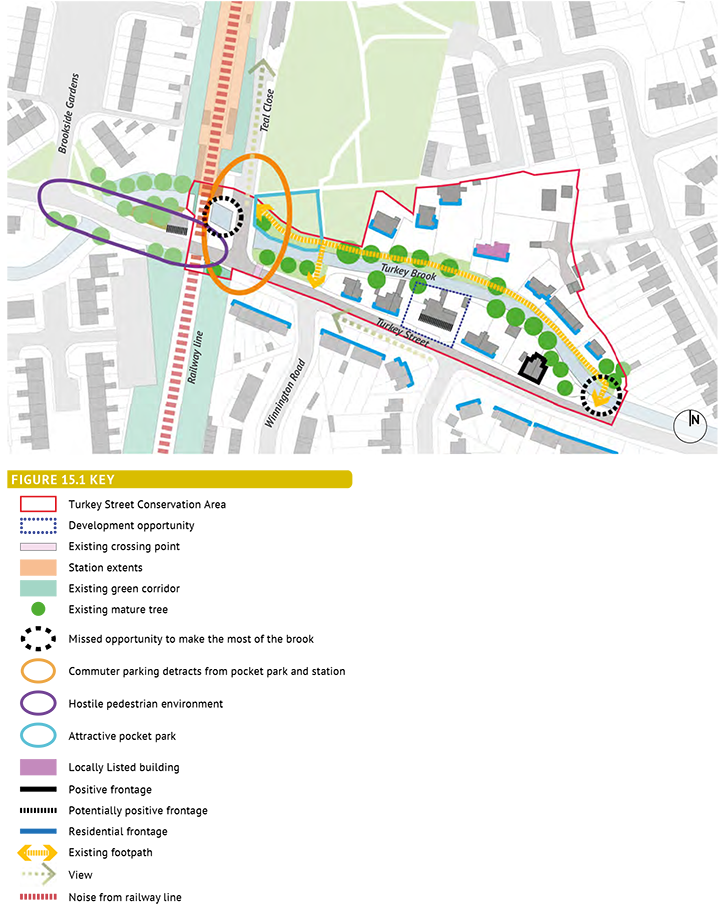
15.1.2 The station is included within the Turkey Street Conservation Area. The Conservation Area was designated in 1972 to recognise its character as a small, semi-rural enclave in a suburban area. There are no listed buildings. The area is very small, and includes just 18 houses and The Turkey public house. There are some plans for the redevelopment of the pub. The Conservation Area is best experienced from the footpath that connects Teal Close to Turkey Street, where the character is at its most semi-rural. Approaching the area from the east, the footbridge connecting to this oath across Turkey Brook is not easy to spot.
15.1.3 Turkey Brook is important not only to the character of the Conservation Area, but is a strong feature across the northern part of the NEE area. There is an opportunity to make more of it, especially next to the station where a high wall and vegetation hide it from view.
15.1.4 Improvements have been made to the entrance to the open space on Teal Close, creating a high quality and distinctive pocket park. This contrasts with the rather bland character of the flat grassland to the north.
15.1.5 Teal Close itself is dominated by parked cars which appear to belong to commuters. This detracts from the area and the entrance to the pocket park in particular.
15.1.6 Turkey Street narrows where it crosses over the railway line, resulting in very narrow pavements. Coupled with railings and high walls, this results in a cramped environment for pedestrians and limited on-road space for cyclists. There is little to indicate that one is approaching the station.
Policy Context for Chapter 15: Turkey Street Station and Conservation Area |
|
London Plan |
Policy 7.4 Local Character Policy 7.4 Public Realm Policy 7.8: Heritage Assets and Archaeology |
Upper Lee Valley Opportunity Area Planning Framework (July 2013) |
Objective 7
|
Core Strategy (Adopted Nov 2010) |
Policy 30: Maintaining and improving the quality of the built environment Policy 31: Built and landscape heritage Policy 40: North East Enfield |
Adopted Development Management Document (November 2014) |
Policy DMD37: Achieving high quality and design-led development Policy DMD44: Preserving and enhancing heritage assets |
Other Sources |
National Planning Policy Framework National Planning Policy Guidance Turkey Street Conservation Area Character Appraisal (Drury McPherson), 2013 Cycle Routes in Enfield, Oct 2013 |
Figure 15.1: Turkey Street Station And Conservation Area - Key Issues
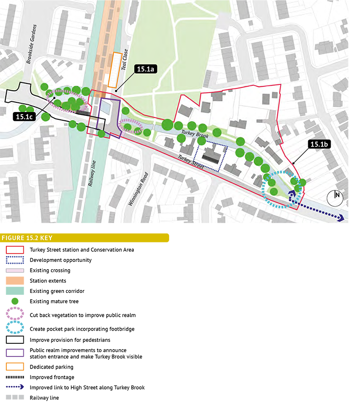
Policy 15.1: Turkey Street Station and Conservation Area Develop a comprehensive street design scheme which - through public realm enhancements - helps to enhance local distinctiveness and contribute to an improved sense of security whilst still providing for traffic movements. This scheme should include:
|
Project Ref |
Description |
15.1a |
Public realm enhancement to announce the station entrance |
15.1b |
Create a pocket park |
15.1c |
Improve pedestrian and cycle provision |
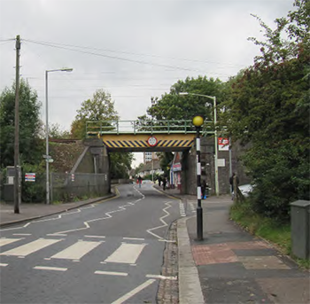 View towards the Station from the east |
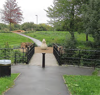 The attractive pocket park on Teal Close |
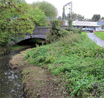 Turkey Brook is an important feature within the area and there is an opportunity to make more of it |
Figure 15.2: Turkey Street Station And Conservation Area - Policy Principles
< Previous | ^ Top | Next >