
Introduction
4.1.1 This chapter sets out the planning policies to deliver the transport objectives set out earlier in the document. These policies support the importance of accessibility to employment, shopping and services to residents, customers, and the supply chain for businesses. They mitigate impacts on quality of life, and the economic and social well-being of the Borough. Public transport, cars, cycling, and walking are often used in combination to make journeys.
4.1.2 Planning Practice Guidance (PPG) highlights the importance of promoting access for the whole community, whether able-bodied or disabled. The National Planning Policy Framework (NPPF) advises that local authorities should consider opportunities for people to live healthy lifestyles including planning for an environment that helps promote active travel and physical activity. Good quality infrastructure encourages walking, cycling and the use of public transport which makes it easier for people to choose more active travel which supports individual health choices and helps prevent weight related illnesses, including diabetes and cardiovascular disease.
4.1.3 Bromley’s transport networks are related to the distribution of the population, with better access and choice in the more densely populated areas, with access to public transport more limited in the rural areas. As an Outer London Borough, a number of destinations will be in rural areas. The rural nature of much of the south and east of the Borough means that public transport is limited, the availability of basic local facilities is more important. The north west of the Borough, lying closest to Central London, and the Borough’s main town centres have good transport links outside the Borough via the rail network, and westwards towards Croydon via Tramlink.
4.1.4 The main transport pressures in the Borough are:
| Policy 30 Parking The Council will normally require off-street parking spaces to be provided in new residential development in accordance with Table 1 set out below: Table 1: Residential Parking Standards Bromley Residential Parking Standards (per unit)
For development where servicing problems may arise, the Council will normally require off-street/rear servicing facilities. |
Supporting Text
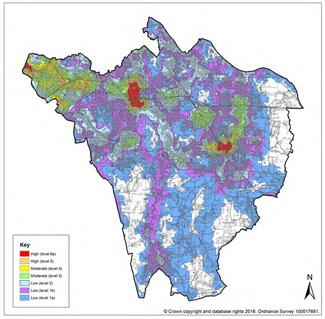
4.1.5 Bromley has one of the highest car ownership levels in London (1.2 per household, Census 2011) and an average public transport accessibility level (PTAL) score of 2.7 (Transport for London, 2010), and parking standards in Table 1 reflect these local circumstances. Minimum levels of parking for residential development are required in order to ensure new developments do not generate additional intrusive or obstructive on-street parking as a result of inadequate on-site provision.
4.1.6 The ‘Bromley standards’ in Table 1 are in line with the London Plan (paragraphs 6.42i-k) which allows Outer London boroughs greater parking provision in new residential developments in areas which have Public Transport Accessibility Levels (PTALs) of 0 – 1 and parts of 2*, subject to the particular characteristics of the development and the actual level of public transport accessibility and provision.
4.1.7 These standards reflect the factors in the National Planning Policy Framework (NPPF) which encourage local planning authorities to develop their own standards taking into account:
4.1.8 The use of the minimum standards in Table 1 uses the flexibility provided by the London Plan to ensure that, as far as possible, parking at new developments is sufficient.
4.1.9 For reference Appendix 10.5 sets out the published London Plan residential parking standards.
Development Type and PTAL matrix
| Development type (Use Class) | Public Transport Accessibility Level | ||
| High | Moderate | Low | |
| Level 5 and 6 |
Level 3 and 4 |
Level 1 and 2 |
|
| Large regional (> 4000 sqm): Class A1 (retail) | x | x | |
| Small to Medium urban: Class A1 (retail) / Class A3 (Restaurants & Cafes) / Class A4 (Public houses) and Class A5 (Takeaways) | x | x | x |
| Large regional (>4000sq.m): Class A2 (financial & professional services) / Class B1 (business) / Class D2 (leisure) | x | x | |
| Small to Medium urban: Class A2 / Class B1/ Class D2 | x | x | x |
| Class B2 (industrial) / Class B8 (storage & | x | x | |
| Class D1 (Schools / Further Education / other Class D1) | x | x | x |
| Class C1 (Hotels / Guest Houses) and Class C2 (Residential Institutions) | x | x | x |
| Class 3 (Residential Development) | x | x | x |
x= Type and scale of development in this location acceptable in principle
| Policy 31 Relieving Congestion Any new development likely to be a significant generator of travel:
|
Supporting Text
4.1.10 Development proposals that are likely to have significant transport implications will be assessed for their impact on all modes of travel. The assessment should reflect the scale and likely impact of the development and propose appropriate measures to improve access by public transport, walking, and cycling in order to reduce the need for car based trips and parking.
4.1.11 The National Planning Policy Framework (NPPF) supports the promotion and facilitation of sustainable transport. It notes the need for the transport system to be balanced in favour of sustainable transport modes and to give priority to pedestrians and cyclists. New developments should take up opportunities for sustainable transport to reduce the need for major transport infrastructure.
4.1.12 Plans and decisions should also ensure developments that generate a significant movement are located where the need to travel will be minimised and the use of sustainable transport modes maximised. However, in some cases it may be necessary to strike a balance between need and availability of suitable sites. Development for town centre uses will be required to take a sequential test where appropriate (see Policy 91 Proposals for Main Town Centre Uses).
4.1.13 Proposals should be assessed for access to the site by all modes of transport, taking into account journey times, public transport frequency, quality, safety and access for disabled people. The Council will require Transport Assessments for large residential development that may have a significant traffic impact on existing residential areas.
4.1.14 Traffic management measures will be required to be in place through encouraging appropriate measures within development proposals, primarily through the levels of parking provision, appropriate contributions to public transport, fostering alternative methods of travel and the provision of Travel Plans.
4.1.15 A Travel Plan will normally be required to ensure that methods of reducing the number of visits by car are thoroughly explored and implemented. Travel Plans should set objectives for reducing car usage, increased walking, cycling and public transport use, improvements in safety features, environmentally friendly freight movement and delivery services. These will usually be made binding by attaching conditions on the relevant planning permission or through a Section 106 agreement. However, a development proposal will not in itself be made acceptable by the provision of a Travel Plan.
4.1.16 The Council also maintains a list of traffic congestion “pinch points” on the road network as a means of identifying potential traffic schemes to reduce congestion. Subsequently allowing new development close to these locations could further exacerbate the conditions and potentially be contrary to the broader transport policies of the Council.
4.1.17 All Transport Assessments, Travel Plans, Construction Logistics and Servicing Plans should be developed in line with TfL guidelines.
| Policy 32 Road Safety The Council will consider the potential impact of any development on road safety and will ensure that it is not significantly adversely affected. |
Supporting Text
4.1.18 Road safety considerations need to influence design of any development. Where a proposal may have a detrimental effect on the safety of all users, measures to remove that potential risk should be agreed with the Council. Where a proposal is situated in a location with an existing road safety problem, the applicant would be expected to fund any necessary mitigation to resolve the difficulty as far as possible within the development and/or contributing to broader off-site solutions.
| Policy 33 Access for All The Council will:
|
Supporting Text
4.1.19 The policy is designed to promote ease of access to all parts of the Borough and all new development. Consideration will be given to the needs of wheelchair users in design of all road alterations. Dropped kerbs at road junctions, for example, do much to enable ease of movement. The design of pedestrian areas, extensions to footways, fully accessible bus stops, installation of street furniture, landscaping schemes and other alterations will take the needs of people with disabilities into account. The Council recognises the differing needs of both physical and sensory disabilities.
4.1.20 New development can make significant improvements to facilitate safe and convenient direct cycle routes and implement secure cycle parking facilities, with the Mayor’s Cycling Vision for London an agreed approach for developers to take. It also requires similar implementation of walking routes. Contributions towards Mayoral cycle route programmes may be sought.
| Policy 34 Highway Infrastructure Provision In determining planning applications, The Council will:
|
Supporting Text
4.1.21 When planning permission is required, the need for a crossover and any detail considerations will be assessed. Applications need to be in compliance with the Council's Vehicle Crossing Guidelines.
| Policy 35 Transport Investment Priorities The Council will work with and lobby partner agencies including Transport for London (TfL), Network Rail, and Department for Transport (DfT) to secure investment in transport infrastructure for the benefits of the Borough, such as increasing capacity, reducing congestion, and making improvements to public transport. This is critical to the development of the Borough. In particular, improvements in public transport connectivity to Canary Wharf and East London through the extension of the Docklands Light Railway to Bromley Town Centre and commitments to a dedicated off-road cycle route along the A21. Where appropriate, developments may be expected to contribute towards the cost of implementation of the strategic transport schemes either through the Community Infrastructure Levy (CIL) or S106 Agreements. |
Supporting Text
4.1.22 Investment in public transport is primarily through the DfT, TfL, and Network Rail. The Council will promote the needs of the Borough to secure investment to help deliver its transport objectives, and, wherever possible, facilitate improvements to public transport, cycling, and walking.
4.1.23 The publication of the Rail Prospectus by the DfT in January 2016 which intends to transfer outer suburban rail services from the DfT to TfL has the potential to benefit the Borough by way of a number of services being incorporated into the London Overground network with all the associated quality enhancements that symbolise the brand.
4.1.24 The Council continues to lobby for improved public transport connectivity with Canary Wharf, principally to provide access to this growing employment centre. To date, feasibility proposals have been worked up jointly between TfL and the Council but funding has yet to be identified for any investment in light rail extensions. As the London Overground network success continues, the feasibility of extending from New Cross Gate to Bromley North is currently being explored.
| Policy 36 Safeguarding Land for Transport Improvements The Council will safeguard sites and routes which support the delivery of key infrastructure which will bring benefits to the Borough and for the following transport improvement schemes to tackle existing congestion issues and facilitate new development:
|
Supporting Text
4.1.25 The Council will ensure provision of sufficient land for the provision of an expanded transport system through the safeguarding of existing land used for transport or support functions and identifying and safeguarding sites, land and route alignments to implement transport proposals that have a reasonable prospect of provision. Until demonstration by TfL of a sound business case taking into account the detriment to existing national rail services to Hayes, the Council will not support safeguarding of land for any extension of the London Underground.
4.1.26 The London Plan (policy 6.2) encourages improvements to the public transport system including the enhancement of the Docklands Light Railway and Tramlink along with extensions of the London Underground and Overground.
4.1.27 Transport for London and the Council are exploring the potential of significant junction improvements at the ‘Keston Mark’ junction – the A232 Croydon Road and the A233 Westerham Road and Oakley Road. Significant delays are experienced by all road users on all four arms of this important junction, including buses which are often forced to curtail part of their route when they fall significantly behind schedule. This situation could, potentially, be further exacerbated with an increase in road traffic associated with Biggin Hill Airport and the proposed economic growth at the Biggin Hill Strategic Outer London Development Centre (SOLDC).
< Previous | ^ Top | Next >